- National Register of Historic Places listings in Lycoming County, Pennsylvania
-
 Location of Lycoming County in Pennsylvania
This is a list of the National Register of Historic Places listings in Lycoming County, Pennsylvania.
This is intended to be a complete list of the properties and districts on the National Register of Historic Places in Lycoming County, Pennsylvania, United States. The locations of National Register properties and districts for which the latitude and longitude coordinates are included below, may be seen in a Google map.[1]
There are 19 properties and districts listed on the National Register in the county.
-
- This National Park Service list is complete through NPS recent listings posted November 10, 2011.[2]
Current listings
[3] Landmark name[4] Image Date listed Location City or Town Summary 1 Archeological Site 36 LY 37 
April 14, 1982 Coextensive with Canfield Island
41°14′32″N 76°57′11″W / 41.24222°N 76.95306°W[5]Loyalsock Township 2 Bridge in Brown Township 
June 22, 1988 Legislative Route 41022 over Pine Creek
41°29′43″N 77°29′51″W / 41.49528°N 77.4975°WBrown Township 3 Bridge in Lewis Township 
June 22, 1988 Legislative Route 41051 over Lycoming Creek
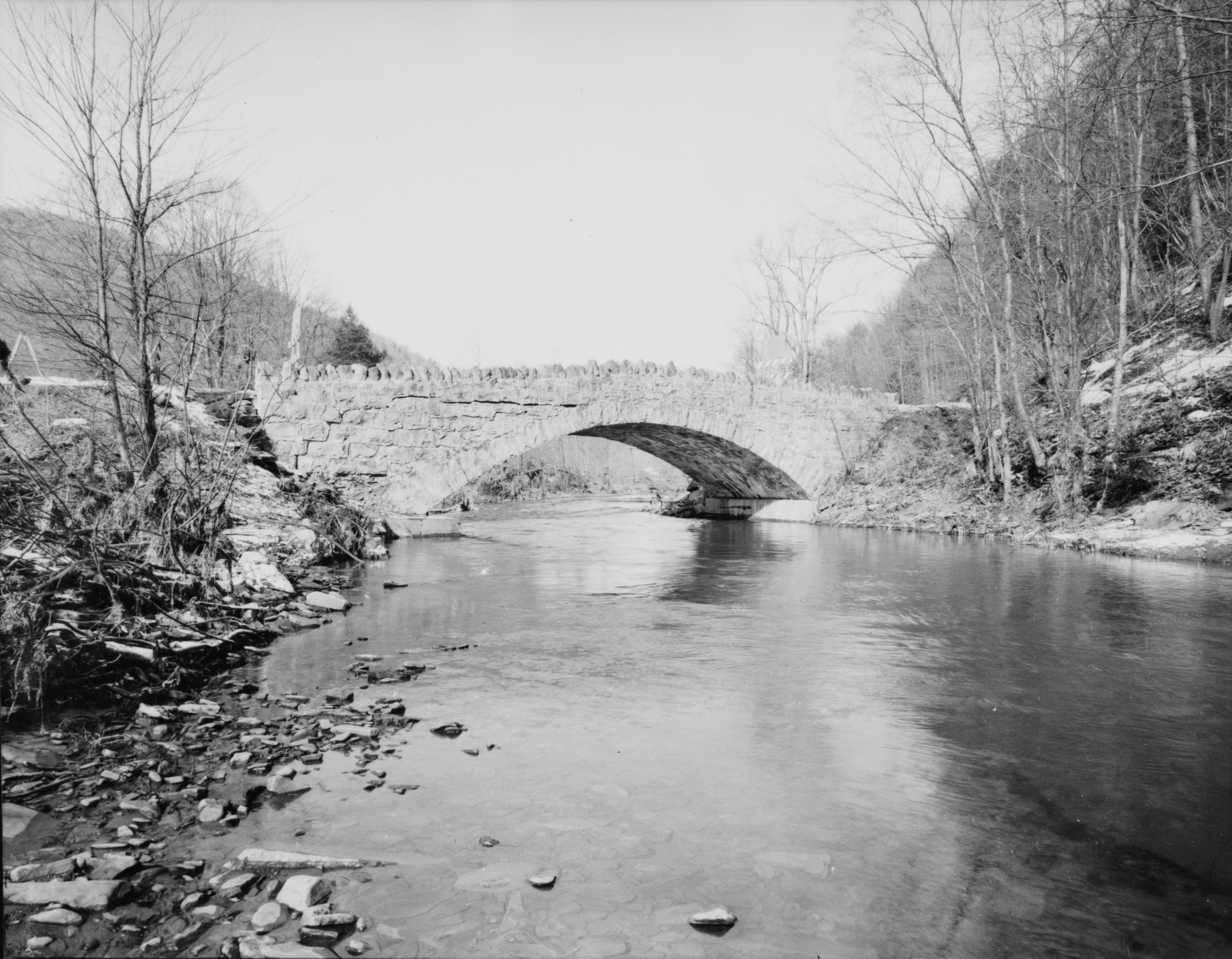
41°26′54″N 76°58′52″W / 41.44833°N 76.98111°WLewis Township 4 Bridge in Porter Township 
June 22, 1988 Legislative Route 41017 over Pine Creek
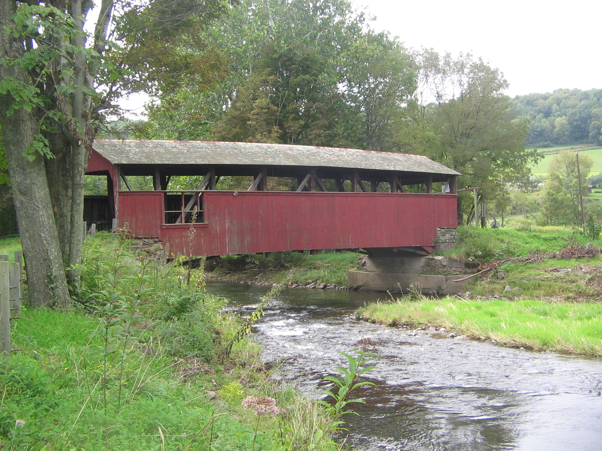
41°10′51″N 77°16′43″W / 41.18083°N 77.27861°WPorter Township 5 Buttonwood Covered Bridge 
July 24, 1980 Southwest of Liberty on Township 816
41°30′35″N 77°7′50″W / 41.50972°N 77.13056°WJackson Township 6 Cogan House Covered Bridge 
July 24, 1980 Southeast of White Pine on Township 784
41°23′53″N 77°12′4″W / 41.39806°N 77.20111°WCogan House Township 7 English Center Suspension Bridge 
December 14, 1978 Over Pine Creek at English Center
41°26′5″N 77°17′21″W / 41.43472°N 77.28917°WPine Township 8 Hart Building 
September 7, 1984 26–30 West 3rd Street
41°14′27″N 77°0′8″W / 41.24083°N 77.00222°WWilliamsport 9 Peter Herdic House 
November 21, 1978 407 4th Street
41°14′23″N 77°0′33″W / 41.23972°N 77.00917°WWilliamsport 10 Houseknecht Farm 
August 7, 2007 812 J. Houseknecht Road
41°10′41″N 76°38′53″W / 41.17806°N 76.64806°WMoreland Township 11 Jersey Shore Historic District 
March 31, 1975 Irregular shape roughly bounded by Lawshe Run, West Branch Susquehanna River, southern borough bundaries, and Tomb Avenue
41°12′4″N 77°15′18″W / 41.20111°N 77.255°WJersey Shore 12 Lairdsville Covered Bridge 
July 24, 1980 West of Lairdsville on Township 664
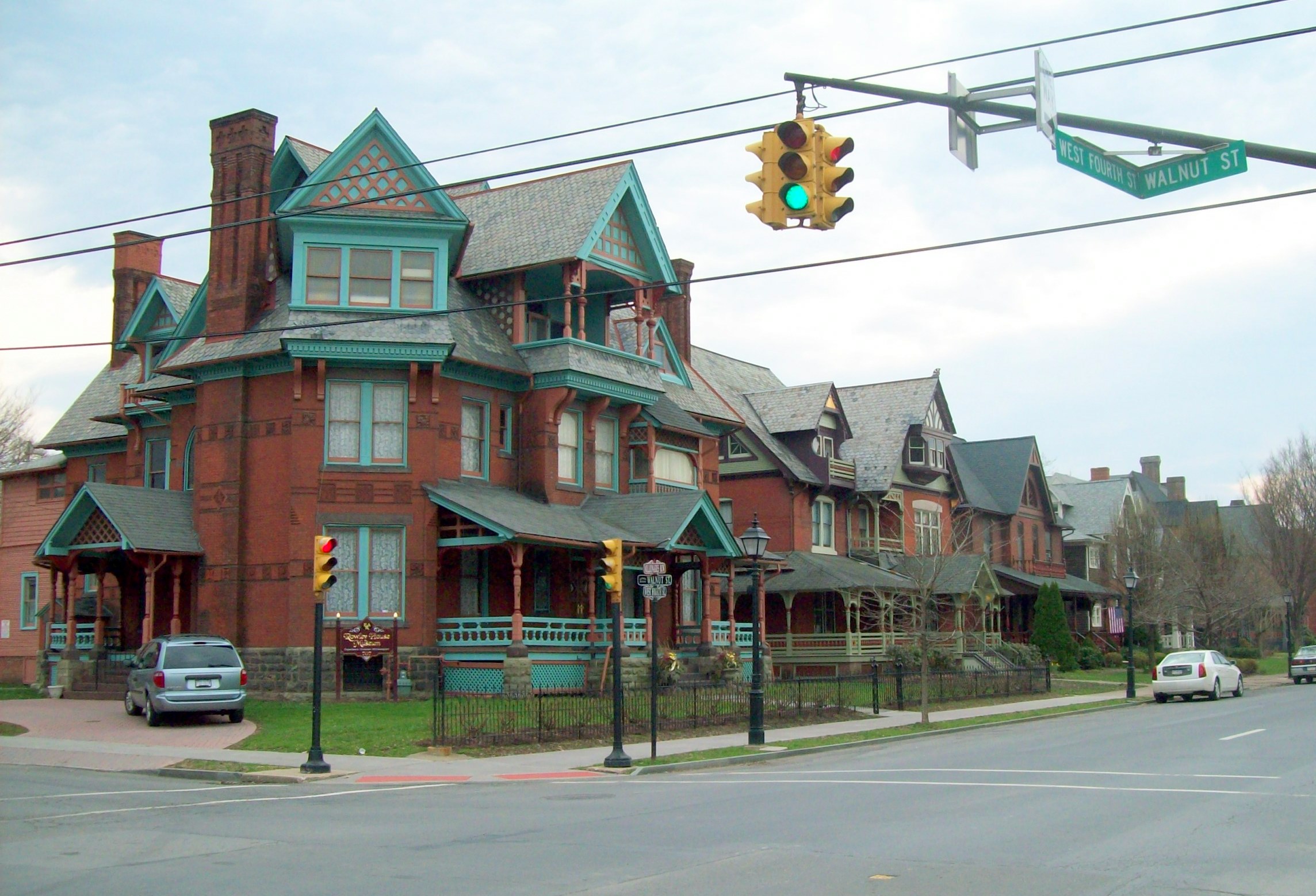
41°12′26″N 76°38′10″W / 41.20722°N 76.63611°WMoreland Township 13 Millionaire's Row Historic District 
January 24, 1985 Roughly bounded by Nichols Place, Elmira and West 3rd Streets, and 7th Avenue
41°14′20″N 77°0′59″W / 41.23889°N 77.01639°WWilliamsport 14 Muncy Historic District 
July 3, 1980 Roughly bounded by Ridell Lane, Sherman, Washington and Mechanic Streets
41°12′13″N 76°47′7″W / 41.20361°N 76.78528°WMuncy 15 Reading-Halls Station Bridge 
January 17, 1980 Northwest of Muncy off U.S. Route 220
41°14′9″N 76°49′58″W / 41.23583°N 76.83278°WMuncy Township 16 St. James Episcopal Church 
November 20, 1979 215 South Main Street
41°12′5″N 76°47′9″W / 41.20139°N 76.78583°WMuncy 17 U.S. Post Office 
March 16, 1972 West 4th Street between Government Place and West Street
41°14′24″N 77°0′23″W / 41.24°N 77.00639°WWilliamsport 18 Williamsport Armory 
November 14, 1991 1300 Penn Street
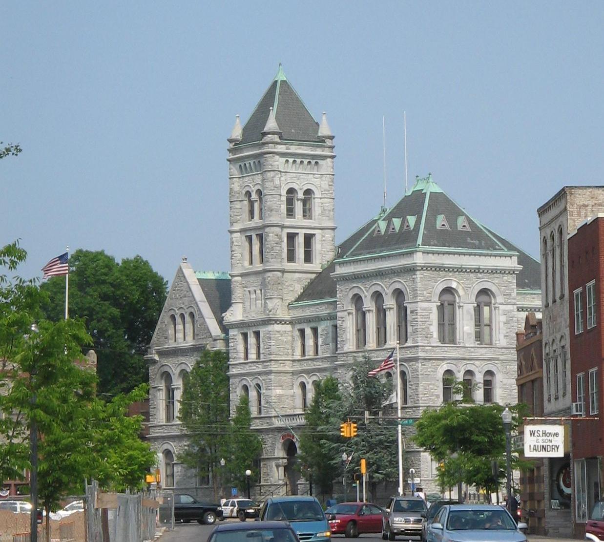
41°15′15″N 76°59′34″W / 41.25417°N 76.99278°WWilliamsport 19 Williamsport City Hall 
November 7, 1976 Pine Street
41°14′33″N 77°0′15″W / 41.2425°N 77.00417°WWilliamsport Former listing
[3] Landmark name[4] Image Date delisted Location City or Town Summary 1 Bridge in Plunketts Creek Township 
July 22, 2002 Legislative Route 41053 over Plunketts Creek
41°24′32″N 76°48′10″W / 41.40889°N 76.80278°WPlunketts Creek Township Damaged in a flood on January 21, 1996 and eventually demolished. See also
- List of National Historic Landmarks in Pennsylvania
- National Register of Historic Places listings in Pennsylvania
- List of Pennsylvania state historical markers in Lycoming County
References
- ^ The latitude and longitude information provided in this table was derived originally from the National Register Information System, which has been found to be fairly accurate for about 99% of listings. For about 1% of NRIS original coordinates, experience has shown that one or both coordinates are typos or otherwise extremely far off; some corrections may have been made. A more subtle problem causes many locations to be off by up to 150 yards, depending on location in the country: most NRIS coordinates were derived from tracing out latitude and longitudes off of USGS topographical quadrant maps created under the North American Datum of 1927, which differs from the current, highly accurate WGS84 GPS system used by Google maps. Chicago is about right, but NRIS longitudes in Washington are higher by about 4.5 seconds, and are lower by about 2.0 seconds in Maine. Latitudes differ by about 1.0 second in Florida. Some locations in this table may have been corrected to current GPS standards.
- ^ "National Register of Historic Places: Weekly List Actions". National Park Service, United States Department of the Interior. Retrieved on November 10, 2011.
- ^ a b Numbers represent an ordering by significant words. Various colorings, defined here, differentiate National Historic Landmark sites and National Register of Historic Places Districts from other NRHP buildings, structures, sites or objects.
- ^ a b "NPS Focus". National Register of Historic Places. National Park Service. http://nrhp.focus.nps.gov. Retrieved November 20, 2009.
- ^ Location derived from its NRHP nomination form; the NRIS lists the site as "Address Restricted"
Municipalities and communities of Lycoming County, Pennsylvania City 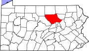
Boroughs Townships Anthony | Armstrong | Bastress | Brady | Brown | Cascade | Clinton | Cogan House | Cummings | Eldred | Fairfield | Franklin | Gamble | Hepburn | Jackson | Jordan | Lewis | Limestone | Loyalsock | Lycoming | McHenry | McIntyre | McNett | Mifflin | Mill Creek | Moreland | Muncy Creek | Muncy | Nippenose | Old Lycoming | Penn | Piatt | Pine | Plunketts Creek | Porter | Shrewsbury | Susquehanna | Upper Fairfield | Washington | Watson | Wolf | Woodward
CDPs Faxon | Garden View | Kenmar | Oval | Rauchtown‡
Unincorporated
communitiesGhost town Footnotes ‡This populated place also has portions in an adjacent county
Categories:- Lycoming County, Pennsylvania
- National Register of Historic Places in Pennsylvania by county
-


Wikimedia Foundation. 2010.