- National Register of Historic Places listings in Union County, Pennsylvania
-
 Location of Union County in Pennsylvania
This is a list of the National Register of Historic Places listings in Union County, Pennsylvania.
This is intended to be a complete list of the properties and districts on the National Register of Historic Places in Union County, Pennsylvania, United States. The locations of National Register properties and districts for which the latitude and longitude coordinates are included below, may be seen in a Google map.[1]
There are 19 properties and districts listed on the National Register in the county.
-
- This National Park Service list is complete through NPS recent listings posted November 10, 2011.[2]
Current listings
[3] Landmark name[4] Image Date listed Location City or Town Summary 1 Allenwood River Bridge 
June 22, 1988 Legislative Route 460 over the West Branch of the Susquehanna River at Allenwood
41°6′28″N 76°53′25″W / 41.10778°N 76.89028°WGregg Township Extends into Delaware Township in Northumberland County 2 Buffalo Presbyterian Church January 30, 1976 West of Lewisburg on Pennsylvania Route 192
40°57′47″N 76°58′4″W / 40.96306°N 76.96778°WBuffalo Township 3 Chamberlin Iron Front Building 
May 14, 1979 434 Market Street
40°57′48″N 76°53′15″W / 40.96333°N 76.8875°WLewisburg 4 Factory Bridge February 8, 1980 1 mile (1.6 km) west of White Deer on Township 629
41°4′25″N 76°54′12″W / 41.07361°N 76.90333°WWhite Deer Township 5 Benjamin Griffey House September 13, 1978 West of Allenwood on Pennsylvania Route 44
41°7′18″N 76°57′56″W / 41.12167°N 76.96556°WGregg Township 6 Halfway Lake Dam 
May 11, 1987 16 miles (26 km) west of Lewisburg on Pennsylvania Route 191
40°59′24″N 77°11′23″W / 40.99°N 77.18972°WHartley Township 7 Hassenplug Bridge 
February 8, 1980 North 4th Street
40°55′25″N 77°3′0″W / 40.92361°N 77.05°WMifflinburg 8 Hayes Bridge 
February 8, 1980 West of Mifflinburg on Township 376
40°55′34″N 77°5′32″W / 40.92611°N 77.09222°WWest Buffalo Township 9 William A. Heiss House and Buggy Shop August 6, 1979 523 Green Street
40°54′53″N 77°2′55″W / 40.91472°N 77.04861°WMifflinburg 10 Lewisburg Armory 
November 14, 1991 U.S. Route 15 south of its junction with Pennsylvania Route 45
40°56′47″N 76°52′49″W / 40.94639°N 76.88028°WEast Buffalo Township 11 Lewisburg Historic District 
July 28, 2004 Roughly bounded by U.S. Route 15, Beck Street, the Susquehanna River, and the borough boundary
40°57′51″N 76°53′4″W / 40.96417°N 76.88444°WLewisburg 12 Mifflinburg Historic District April 10, 1980 Pennsylvania Route 45
40°54′59″N 77°2′58″W / 40.91639°N 77.04944°WMifflinburg 13 Millmont Red Bridge February 8, 1980 Southwest of Millmont on Legislative Route 59005
40°52′41″N 77°9′21″W / 40.87806°N 77.15583°WHartley Township 14 New Berlin Presbyterian Church October 26, 1972 Vine and High Streets
40°52′46″N 76°59′13″W / 40.87944°N 76.98694°WNew Berlin 15 Old Union County Courthouse November 9, 1972 Market and Vine Streets
40°52′43″N 76°59′12″W / 40.87861°N 76.98667°WNew Berlin 16 Packwood House-American Hotel 
September 20, 1978 10 Market Street
40°57′59″N 76°52′57″W / 40.96639°N 76.8825°WLewisburg 17 Reading Railroad Freight Station 
January 22, 1992 Junction of South 5th and St. Louis Streets
40°57′48″N 76°53′15″W / 40.96333°N 76.8875°WLewisburg 18 Slifer House 
June 18, 1975 North of Lewisburg off U.S. Route 15 on Pennsylvania Route 59024
40°58′33″N 76°52′59″W / 40.97583°N 76.88306°WKelly Township 19 Watsontown River Bridge 
June 22, 1988 Legislative Route 240 spur over the West Branch of the Susquehanna River
41°4′51″N 76°51′55″W / 41.08083°N 76.86528°WWhite Deer Township Extends into Watsontown in Northumberland County See also
- List of National Historic Landmarks in Pennsylvania
- National Register of Historic Places listings in Pennsylvania
- List of Pennsylvania state historical markers in Union County
References
- ^ The latitude and longitude information provided in this table was derived originally from the National Register Information System, which has been found to be fairly accurate for about 99% of listings. For about 1% of NRIS original coordinates, experience has shown that one or both coordinates are typos or otherwise extremely far off; some corrections may have been made. A more subtle problem causes many locations to be off by up to 150 yards, depending on location in the country: most NRIS coordinates were derived from tracing out latitude and longitudes off of USGS topographical quadrant maps created under North American Datum of 1927, which differs from the current, highly accurate GPS system used by Google maps. Chicago is about right, but NRIS longitudes in Washington are higher by about 4.5 seconds, and are lower by about 2.0 seconds in Maine. Latitudes differ by about 1.0 second in Florida. Some locations in this table may have been corrected to current GPS standards.
- ^ "National Register of Historic Places: Weekly List Actions". National Park Service, United States Department of the Interior. Retrieved on November 10, 2011.
- ^ Numbers represent an ordering by significant words. Various colorings, defined here, differentiate National Historic Landmark sites and National Register of Historic Places Districts from other NRHP buildings, structures, sites or objects.
- ^ "NPS Focus". National Register of Historic Places. National Park Service. http://nrhp.focus.nps.gov. Retrieved November 20, 2009.
Municipalities and communities of Union County, Pennsylvania County seat: Lewisburg Boroughs 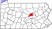
Townships CDP Unincorporated
communityCategories:- Union County, Pennsylvania
- National Register of Historic Places in Pennsylvania by county
-


Wikimedia Foundation. 2010.