- National Register of Historic Places listings in Elk County, Pennsylvania
-
 Location of Elk County in Pennsylvania
This is a list of the National Register of Historic Places listings in Elk County, Pennsylvania.
This is intended to be a complete list of the properties and districts on the National Register of Historic Places in Elk County, Pennsylvania, United States. The locations of National Register properties and districts for which the latitude and longitude coordinates are included below, may be seen in a Google map.[1]
There are 10 properties and districts listed on the National Register in the county.
-
- This National Park Service list is complete through NPS recent listings posted November 10, 2011.[2]
Current listings
[3] Landmark name Image Date listed Location City or town Summary 1 Bonifels 
December 14, 1978 West of Ridgway off Laurel Mill Road
41°25′11″N 78°45′17″W / 41.41972°N 78.75472°WRidgway Township 2 Decker's Chapel 
November 12, 1998 Junction of Earth Road and Pennsylvania Route 255
41°24′2.8″N 78°33′38.5″W / 41.400778°N 78.560694°WSt. Marys 3 O.B. Grant House 
April 5, 2004 610 West Main Street
41°25′17″N 78°44′57″W / 41.42139°N 78.74917°WRidgway 4 Johnsonburg Commercial Historic District 
October 28, 1999 Roughly along Center, Bridge, and Market Streets
41°29′20″N 78°40′31″W / 41.48889°N 78.67528°WJohnsonburg 5 Lake City School 
June 10, 2008 27586 Lake City Road in Lake City
41°21′54″N 78°53′6.75″W / 41.365°N 78.8852083°WSpring Creek Township 6 Ridgway Armory 
December 22, 1989 72 North Broad Street
41°25′24″N 78°43′48″W / 41.42333°N 78.73°WRidgway 7 Ridgway Historic District 
January 22, 2003 Roughly bounded by the borough limits, the Clarion River, Erie Alley, and Gallagher Run
41°25′12″N 78°43′40″W / 41.42°N 78.72778°WRidgway 8 St. Marys Historic District 
November 25, 1998 Roughly bounded by Walburga, St. Michael, Fourth, John, and Mill Streets
41°25′43″N 78°33′49″W / 41.42861°N 78.56361°WSt. Marys 9 Swedish Lutheran Parsonage 
February 24, 2005 230 Kane Street in Wilcox
41°34′34″N 78°41′14″W / 41.57611°N 78.68722°WJones Township 10 John E. Weidenboerner House 
July 24, 1992 20 North St. Michael Street
41°25′45″N 78°33′43.3″W / 41.42917°N 78.562028°WSt. Marys See also
- List of National Historic Landmarks in Pennsylvania
- National Register of Historic Places listings in Pennsylvania
- List of Pennsylvania state historical markers in Elk County
References
- ^ The latitude and longitude information provided in this table was derived originally from the National Register Information System, which has been found to be fairly accurate for about 99% of listings. For about 1% of NRIS original coordinates, experience has shown that one or both coordinates are typos or otherwise extremely far off; some corrections may have been made. A more subtle problem causes many locations to be off by up to 150 yards, depending on location in the country: most NRIS coordinates were derived from tracing out latitude and longitudes off of USGS topographical quadrant maps created under North American Datum of 1927, which differs from the current, highly accurate GPS system used by Google maps. Chicago is about right, but NRIS longitudes in Washington are higher by about 4.5 seconds, and are lower by about 2.0 seconds in Maine. Latitudes differ by about 1.0 second in Florida. Some locations in this table may have been corrected to current GPS standards.
- ^ "National Register of Historic Places: Weekly List Actions". National Park Service, United States Department of the Interior. Retrieved on November 10, 2011.
- ^ Numbers represent an ordering by significant words. Various colorings, defined here, differentiate National Historic Landmark sites and National Register of Historic Places Districts from other NRHP buildings, structures, sites or objects.
Municipalities and communities of Elk County, Pennsylvania County seat: Ridgway City 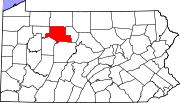
Boroughs Townships Benezette | Fox | Highland | Horton | Jay | Jones | Millstone | Ridgway | Spring Creek
Unincorporated
communitiesCategories:- Elk County, Pennsylvania
- National Register of Historic Places in Pennsylvania by county
-


Wikimedia Foundation. 2010.