- National Register of Historic Places listings in Franklin County, Pennsylvania
-
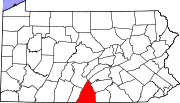
 Location of Franklin County in Pennsylvania
This is a list of the National Register of Historic Places listings in Franklin County, Pennsylvania.
This is intended to be a complete list of the properties and districts on the National Register of Historic Places in Franklin County, Pennsylvania, United States. The locations of National Register properties and districts for which the latitude and longitude coordinates are included below, may be seen in a Google map.[1]
There are 61 properties and districts listed on the National Register in the county.
-
- This National Park Service list is complete through NPS recent listings posted November 10, 2011.[2]
Current listings
[3] Landmark name Image Date listed Location City or town Summary 1 Angle Farm November 20, 1979 Southeast of Mercersburg
39°45′53″N 77°51′10″W / 39.764722°N 77.852778°WMontgomery Township 2 Borough Hall of the Borough of Waynesboro December 2, 1980 57 East Main Street
39°45′18″N 77°34′36″W / 39.755°N 77.576667°WWaynesboro 3 Bridge between Guilford and Hamilton Townships June 22, 1988 Legislative Route 28033 over Conococheague Creek near Social Island
39°53′09″N 77°42′48″W / 39.885833°N 77.713333°WGuilford and Hamilton Townships 4 Bridge in Metal Township 
June 22, 1988 Legislative Route 45 Spur east over West Branch Conococheague Creek, near Willow Hill
40°07′13″N 77°46′39″W / 40.120278°N 77.7775°WMetal Township 5 Brotherton Farm March 30, 1979 Southwest of Chambersburg on Falling Spring Road
39°54′43″N 77°36′58″W / 39.911944°N 77.616111°WGuilford Township 6 John Brown House 
March 5, 1970 225 East King Street
39°56′20″N 77°39′34″W / 39.938889°N 77.659444°WChambersburg 7 Jeremiah Burns Farm August 15, 2002 10988 Fish and Game Road
39°45′58″N 77°31′47″W / 39.76624°N 77.52985°WWashington Township 8 Carrick Furnace September 6, 1991 Pennsylvania Route 75 north of Metal
40°01′08″N 77°52′36″W / 40.018889°N 77.876667°WMetal Township 9 Chambersburg and Bedford Turnpike Road Company Toll House 
January 3, 1978 West of St. Thomas on U.S. Route 30
39°54′47″N 77°48′50″W / 39.913056°N 77.813889°WSt. Thomas Township 10 Chambersburg Historic District 
August 26, 1982 U.S. Routes 11 and 30
39°55′44″N 77°39′41″W / 39.928889°N 77.661389°WChambersburg 11 Church Hill Farm December 2, 1980 Northeast of Mercersburg at 8941 Kings Lane
39°50′21″N 77°51′11″W / 39.839167°N 77.853056°WPeters Township 12 Coldbrook Farm 
March 28, 1996 955 Spring Lane
39°56′07″N 77°38′32″W / 39.935278°N 77.642222°WChambersburg 13 Corker Hill March 18, 2003 1237 Garver Lane, Scotland
39°58′27″N 77°34′51″W / 39.974167°N 77.580833°WGreene Township 14 Culbertson-Harbison Farm June 27, 1980 South of Nyesville on Nyesville Road
40°01′02″N 77°37′44″W / 40.017222°N 77.628889°WGreene Township 15 Widow Donaldson Place 
November 5, 1987 177 Bear Valley Road near Fort Loudon
39°54′48″N 77°53′45″W / 39.913333°N 77.895833°WPeters Township 16 Findlay Farm April 21, 1983 6801 Findlay Road near Lamasters
39°49′50″N 77°51′55″W / 39.830556°N 77.865278°WPeters Township 17 James Finley House November 19, 1974 Building No. 505, Letterkenny Army Depot
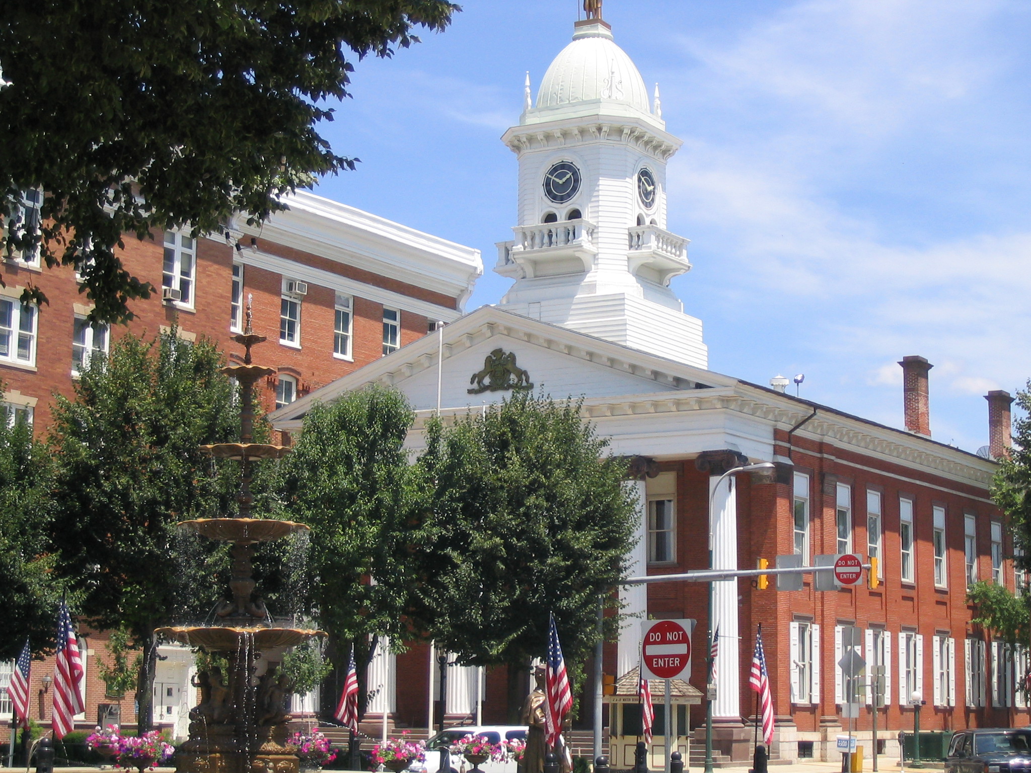
39°59′56″N 77°38′19″W / 39.998889°N 77.638611°WGreene Township 18 Franklin County Courthouse 
January 18, 1974 1 North Main Street, on Memorial Sq.
39°56′15″N 77°39′40″W / 39.9375°N 77.661111°WChambersburg 19 Franklin County Jail 
January 21, 1970 Northwestern corner of King and 2nd Streets
39°56′20″N 77°39′35″W / 39.938889°N 77.659722°WChambersburg 20 Franklin Furnace Historic District September 6, 1991 Roughly bounded by Circle Drive and Cinder Street, near Edenville
39°57′32″N 77°49′21″W / 39.958889°N 77.8225°WSt. Thomas Township 21 Gass House April 11, 1977 East of Chambersburg off U.S. Route 30
39°55′46″N 77°37′46″W / 39.929444°N 77.629444°WGuilford Township 22 Greencastle Historic District December 24, 1992 Roughly bounded by Washington, Pennsylvania Route 2002, Jefferson, Mifflin, Chambers, Grant and Allison, and Baltimore north to Spring Grove
39°47′20″N 77°43′30″W / 39.788889°N 77.725°WGreencastle 23 Alexander Hamilton House 
June 27, 1980 45 East Main Street
39°45′18″N 77°34′35″W / 39.755°N 77.576389°WWaynesboro 24 Handycraft Farmstead August 22, 2002 11071 Country Club Road
39°45′49″N 77°32′03″W / 39.763611°N 77.534167°WWashington Township 25 Harbaugh's Reformed Church March 20, 2002 14301 and 14269 Harbaugh Church Road
39°43′16″N 77°32′02″W / 39.721111°N 77.533889°WWashington Township 26 Hays Bridge Historic District July 31, 1978 East of Mercersburg on Pennsylvania Routes 331 and 328
39°47′19″N 77°51′15″W / 39.788611°N 77.854167°WMontgomery Township 27 Horse Valley Bridge June 22, 1988 Legislative Route 28093 over Conodoguinet Creek near Upper Strasburg
40°03′57″N 77°45′34″W / 40.065833°N 77.759444°WLetterkenny Township 28 Robert Kennedy Memorial Presbyterian Church June 6, 2009 11799 Mercersburg Road
39°45′51″N 77°51′09″W / 39.764167°N 77.8525°WMontgomery Township 29 Lane House January 13, 1972 14 North Main Street
39°49′44″N 77°54′17″W / 39.828889°N 77.904722°WMercersburg 30 Mansfield April 26, 1979 Southeast of Mercersburg
39°47′34″N 77°51′44″W / 39.792778°N 77.862222°WMontgomery Township 31 Martin's Mill Covered Bridge February 15, 1974 Southwest of Greencastle over Conococheague Creek
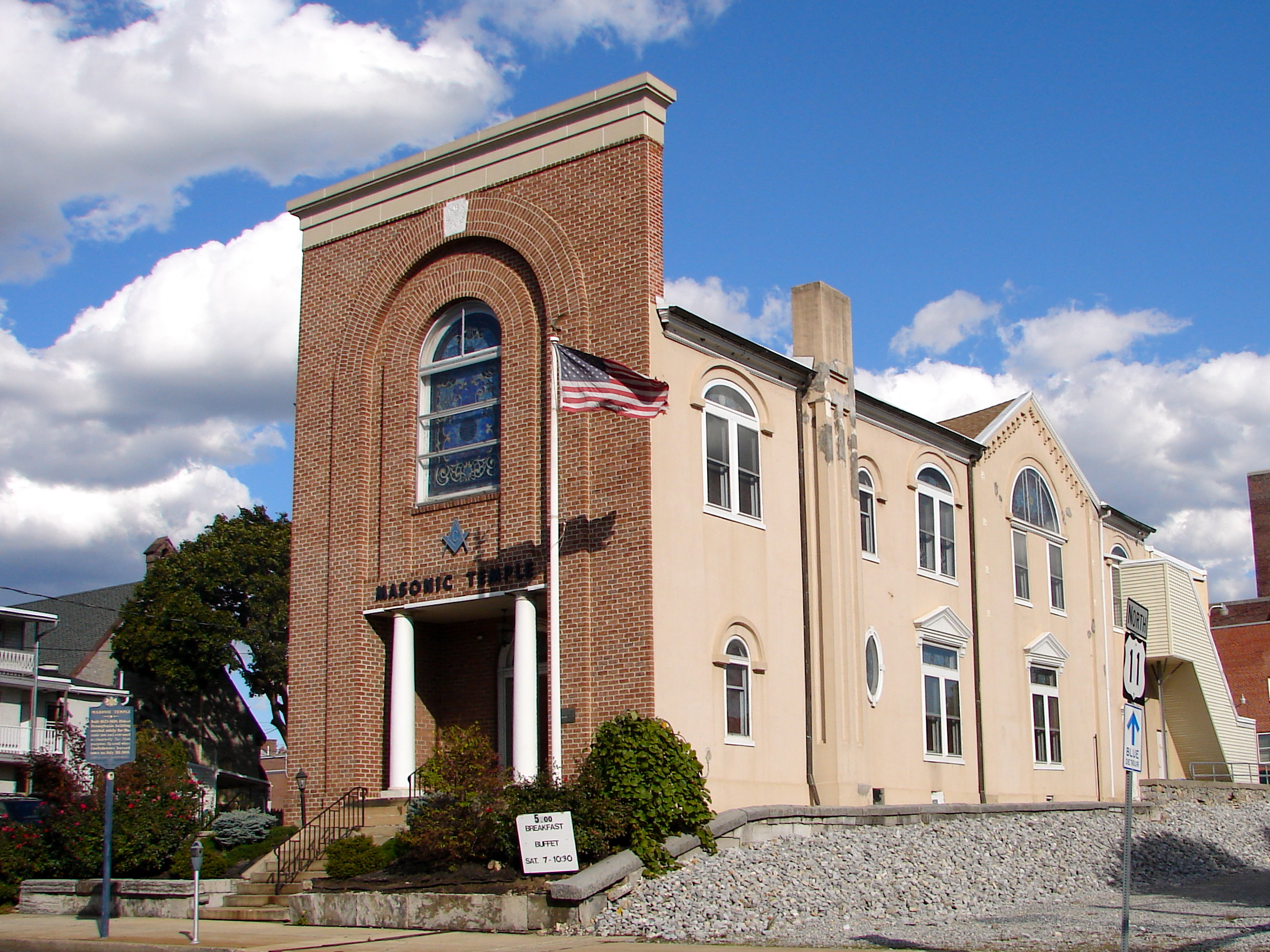
39°45′53″N 77°46′33″W / 39.764722°N 77.775833°WAntrim Township 32 Masonic Temple 
June 18, 1976 74 South 2nd Street
39°56′08″N 77°39′35″W / 39.935556°N 77.659722°WChambersburg 33 McClay's Twin Bridge (East) 
June 22, 1988 Legislative Route 28010 over a tributary of Conodoguinet Creek, near Middle Spring
40°05′54″N 77°34′15″W / 40.098333°N 77.570833°WLurgan and Southampton Townships 34 McClay's Twin Bridge (West) 
June 22, 1988 Legislative Route 28010 over Conodoguinet Creek, near Middle Spring
40°05′53″N 77°34′12″W / 40.098056°N 77.57°WLurgan Township 35 McCoy-Shoemaker Farm June 27, 1980 Southwest of Upton on Pennsylvania Route 995
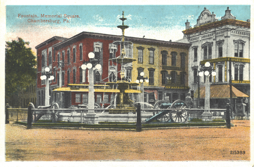
39°47′57″N 77°49′20″W / 39.799167°N 77.822222°WPeters Township 36 Memorial Fountain and Statue 
May 19, 1978 Memorial Square
39°56′15″N 77°39′43″W / 39.9375°N 77.661944°WChambersburg 37 Mercersburg Academy June 21, 1984 Pennsylvania Route 16
39°49′34″N 77°53′54″W / 39.826111°N 77.898333°WMercersburg 38 Mercersburg Historic District December 13, 1978 Main and Seminary Streets
39°49′38″N 77°54′12″W / 39.827222°N 77.903333°WMercersburg 39 Millmont Farm April 27, 1979 East of Mercersburg at the junction of Pennsylvania Routes 16 and 416
39°48′16″N 77°52′24″W / 39.804444°N 77.873333°WMontgomery Township 40 Mitchell-Shook House September 17, 1980 Leitersburg Street
39°46′48″N 77°43′26″W / 39.78°N 77.723889°WGreencastle 41 Monterey Historic District April 22, 1976 Off Pennsylvania Route 16 near Blue Ridge Summit
39°44′10″N 77°28′09″W / 39.736111°N 77.469167°WWashington Township 42 Mt. Pleasant Iron Works House December 31, 1974 About 4 miles (6.4 km) north of Fort Loudon on Pennsylvania Route 75
39°57′53″N 77°53′58″W / 39.964722°N 77.899444°WMetal Township 43 Old Brown's Mill School March 7, 1973 Off U.S. Route 11 near Kauffman
39°49′50″N 77°42′08″W / 39.830556°N 77.702222°WAntrim Township 44 Joseph J. Oller House June 28, 1996 138 West Main Street
39°45′26″N 77°34′53″W / 39.757222°N 77.581389°WWaynesboro 45 Red Run Lodge February 16, 1996 Buchanan Trail East (Pennsylvania Route 16) near Rouzerville
39°44′13″N 77°31′03″W / 39.736944°N 77.5175°WWashington Township 46 Rock Hill Farm July 28, 1999 12995 and 12755 Bain Road near Mercersburg
39°45′07″N 77°52′08″W / 39.751944°N 77.868889°WMontgomery Township 47 Rocky Spring Presbyterian Church May 13, 1994 Rocky Spring Road, approximately 0.5 miles (0.80 km) northwest of Funk Road
39°59′19″N 77°40′35″W / 39.988611°N 77.676389°WLetterkenny Township 48 Royer-Nicodemus House and Farm August 28, 1976 1010 East Main Street
39°44′35″N 77°33′44″W / 39.743056°N 77.562222°WWaynesboro 49 Skinner Tavern July 27, 2005 13361 Upper Strasburg Road
40°04′07″N 77°45′53″W / 40.068611°N 77.764722°WLetterkenny Township 50 Spring Grove Farm and Distillery August 10, 1979 Northwest of Greencastle on Williamsport Pike
39°45′33″N 77°45′31″W / 39.759167°N 77.758611°WAntrim Township 51 Springdale Mills September 18, 1975 Southeast of Waynesboro off Pennsylvania Route 16 on Amsterdam Road
39°44′05″N 77°32′56″W / 39.734722°N 77.548889°WWashington Township 52 Stover-Winger Farm August 24, 1979 Leitersburg Road near Greencastle
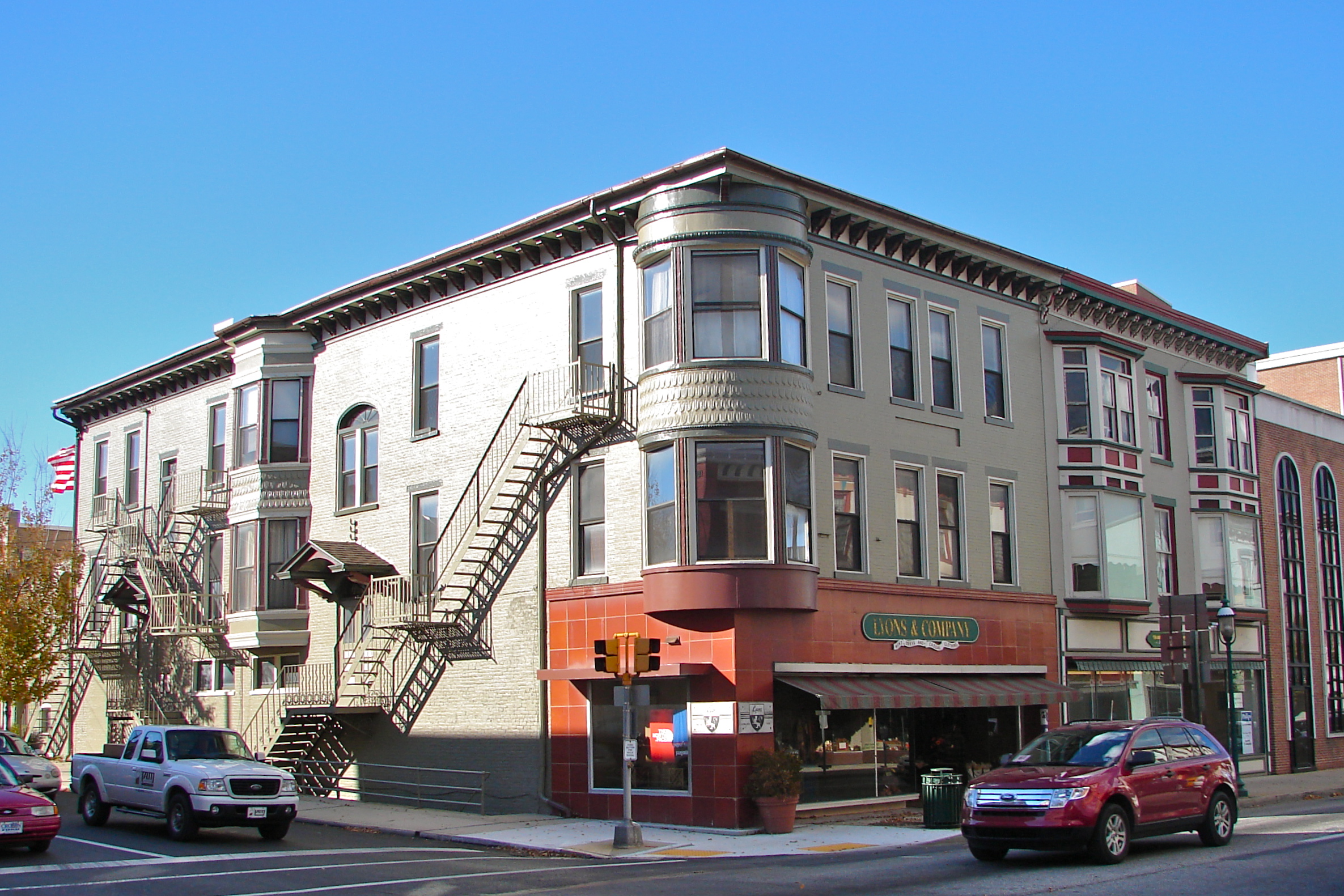
39°46′44″N 77°43′12″W / 39.778889°N 77.72°WAntrim Township 53 Townhouse Row 
December 18, 1978 57–85 North Main Street
39°56′19″N 77°39′43″W / 39.938611°N 77.661944°WChambersburg 54 Waynesboro Armory December 22, 1989 North Grant Street near Waynesboro
39°45′56″N 77°34′45″W / 39.765556°N 77.579167°WWashington Township 55 Welty's Mill Bridge January 6, 1983 South of Waynesboro on Pennsylvania Route 997
39°44′16″N 77°34′20″W / 39.737778°N 77.572222°WWashington Township 56 White House Inn February 27, 1986 10111 Lincoln Way West
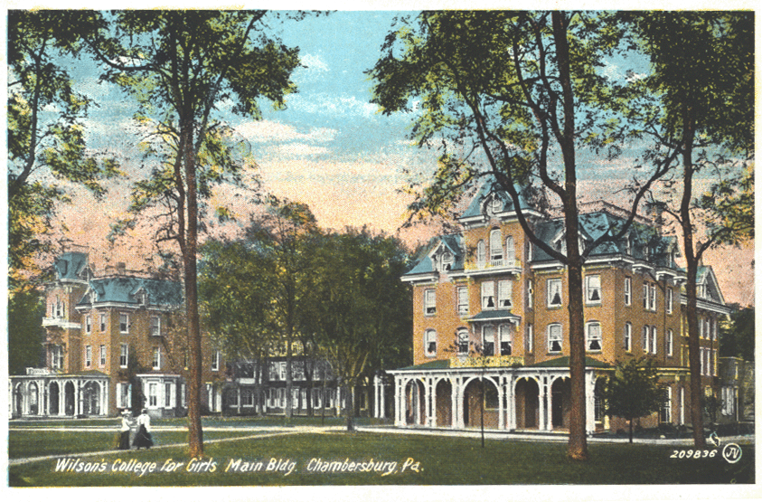
39°54′12″N 77°51′15″W / 39.903333°N 77.854167°WPeters Township 57 Wilson College 
July 21, 1995 1015 Philadelphia Avenue
39°57′02″N 77°39′20″W / 39.950556°N 77.655556°WChambersburg 58 Woodland September 20, 1973 Southwest of St. Thomas on Pennsylvania Route 416
39°53′38″N 77°50′12″W / 39.893889°N 77.836667°WSt. Thomas Township 59 Col. John Work House November 20, 1979 Southeast of Mercersburg
39°47′48″N 77°56′27″W / 39.796667°N 77.940833°WMontgomery Township 60 Yeakle's Mill Bridge 
November 14, 1988 Legislative Route 28042 over Little Cove Creek
39°44′06″N 78°02′15″W / 39.735°N 78.0375°WWarren Township 61 Zion Reformed Church 
December 17, 1979 South Main and West Liberty Streets
39°55′58″N 77°39′48″W / 39.932778°N 77.663333°WChambersburg See also
- List of National Historic Landmarks in Pennsylvania
- National Register of Historic Places listings in Pennsylvania
- List of Pennsylvania state historical markers in Franklin County
References
- ^ The latitude and longitude information provided in this table was derived originally from the National Register Information System, which has been found to be fairly accurate for about 99% of listings. For about 1% of NRIS original coordinates, experience has shown that one or both coordinates are typos or otherwise extremely far off; some corrections may have been made. A more subtle problem causes many locations to be off by up to 150 yards, depending on location in the country: most NRIS coordinates were derived from tracing out latitude and longitudes off of USGS topographical quadrant maps created under the North American Datum of 1927, which differs from the current, highly accurate WGS84 GPS system used by Google maps. Chicago is about right, but NRIS longitudes in Washington are higher by about 4.5 seconds, and are lower by about 2.0 seconds in Maine. Latitudes differ by about 1.0 second in Florida. Some locations in this table may have been corrected to current GPS standards.
- ^ "National Register of Historic Places: Weekly List Actions". National Park Service, United States Department of the Interior. Retrieved on November 10, 2011.
- ^ Numbers represent an ordering by significant words. Various colorings, defined here, differentiate National Historic Landmark sites and National Register of Historic Places Districts from other NRHP buildings, structures, sites or objects.
Municipalities and communities of Franklin County, Pennsylvania Boroughs Chambersburg | Greencastle | Mercersburg | Mont Alto | Orrstown | Shippensburg‡ | Waynesboro
Townships Antrim | Fannett | Greene | Guilford | Hamilton | Letterkenny | Lurgan | Metal | Montgomery | Peters | Quincy | Southampton | St. Thomas | Warren | Washington
CDPs Unincorporated
communitiesBlue Ridge Summit | Cove Gap | Johnston | Marion | Old Forge | Roxbury | Scotland | State Line
Footnotes ‡This populated place also has portions in an adjacent county or counties
Categories:- Franklin County, Pennsylvania
- National Register of Historic Places in Pennsylvania by county
-


Wikimedia Foundation. 2010.