- National Register of Historic Places listings in Cambria County, Pennsylvania
-
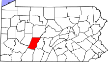 Location of Cambria County in Pennsylvania
This is a list of the National Register of Historic Places listings in Cambria County, Pennsylvania.
This is intended to be a complete list of the properties and districts on National Register of Historic Places in the Cambria County, Pennsylvania. The locations of National Register properties and districts for which the latitude and longitude coordinates are included below, may be seen in a Google map.[1]
There are 30 properties and districts listed on the National Register in the county. Two sites are further designated as National Historic Landmarks and another is designated as a National Memorial.
-
- This National Park Service list is complete through NPS recent listings posted November 10, 2011.[2]
Current listings
[3] Landmark name Image Date listed Location City or town Summary 1 Allegheny Portage Railroad National Historic Site 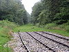
October 15, 1966 U.S. Route 22
40°24′47″N 78°27′37″W / 40.41306°N 78.46028°WConemaugh and Cresson Townships Extends into Allegheny Township in Blair County 2 Berwind-White Mine 40 Historic District 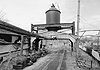
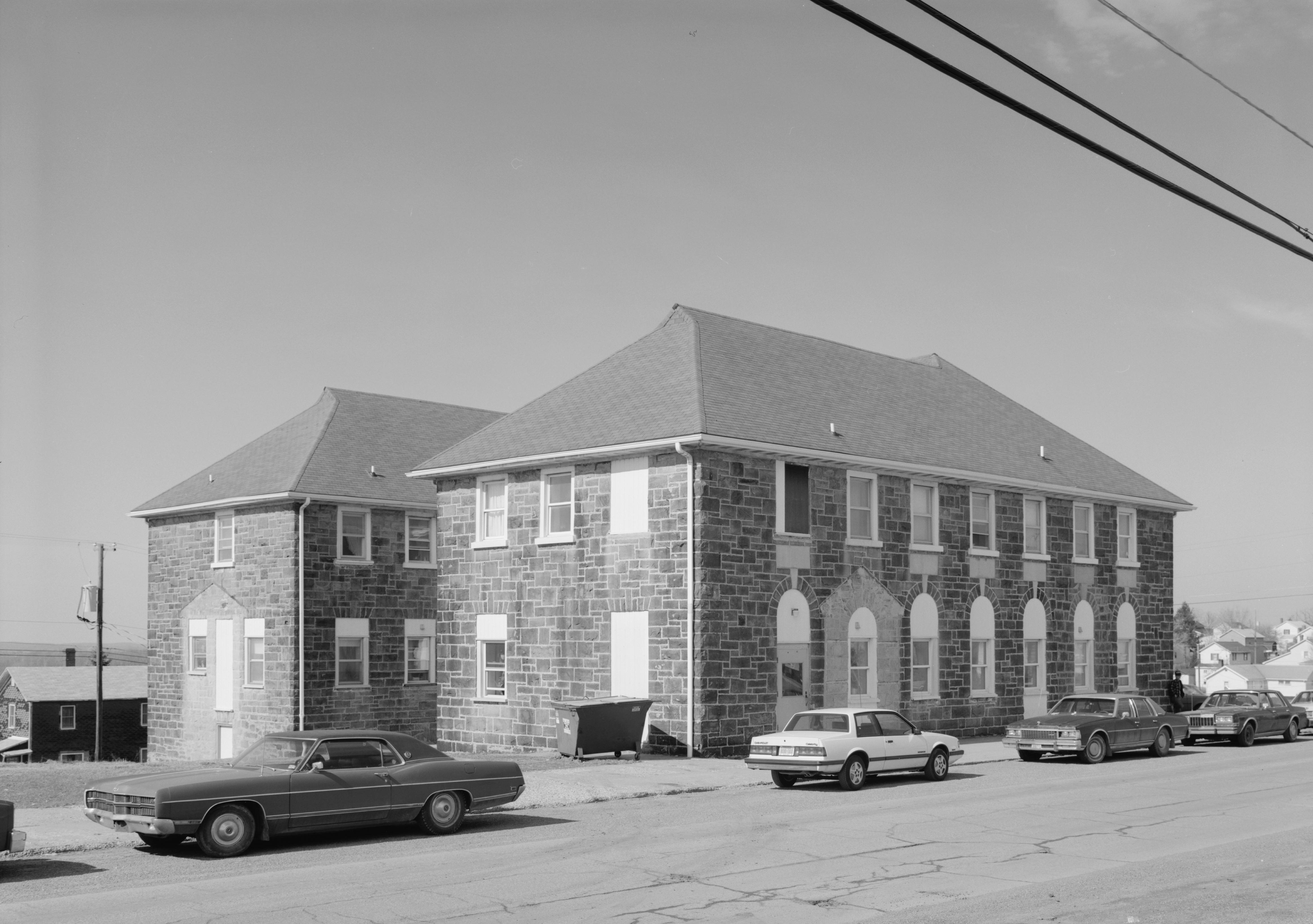
April 28, 1992 Roughly bounded by the boney pile, the Eureka No. 40 mine site, the Scalp Level borough line, and the Berwind-White Farmstead
40°15′13″N 78°50′21″W / 40.253611°N 78.839167°WScalp Level 3 Bridge in Johnstown City 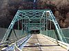
June 22, 1988 State Route 3022 spur over the Stonycreek River
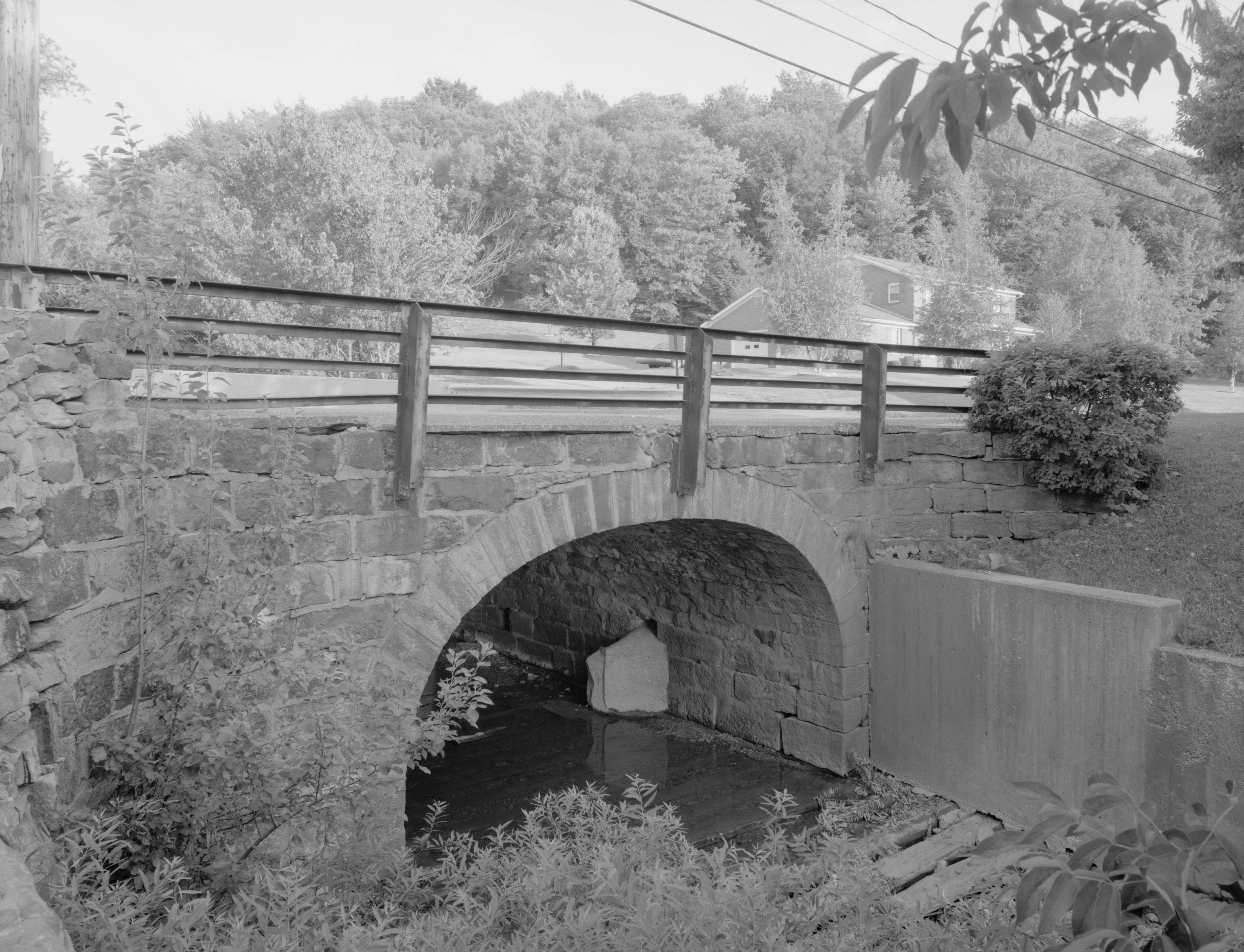
40°19′36″N 78°55′39″W / 40.326667°N 78.9275°WJohnstown 4 Bridge in Portage Township 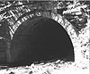
June 22, 1988 Pennsylvania Route 53 over Bens Creek
40°24′08″N 78°38′22″W / 40.402222°N 78.639444°WPortage Township 5 A.W. Buck House May 12, 1995 615 North Center Street
40°29′22″N 78°43′31″W / 40.489444°N 78.725278°WEbensburg 6 Cambria City Historic District November 14, 1991 Roughly bounded by Broad Street, Tenth Avenue, and the Conemaugh River
40°20′27″N 78°55′46″W / 40.340833°N 78.929444°WJohnstown 7 Cambria County Courthouse 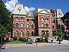
June 30, 1980 Center Street
40°29′01″N 78°43′29″W / 40.483611°N 78.724722°WEbensburg 8 Cambria County Jail June 30, 1980 North Center and Sample Streets
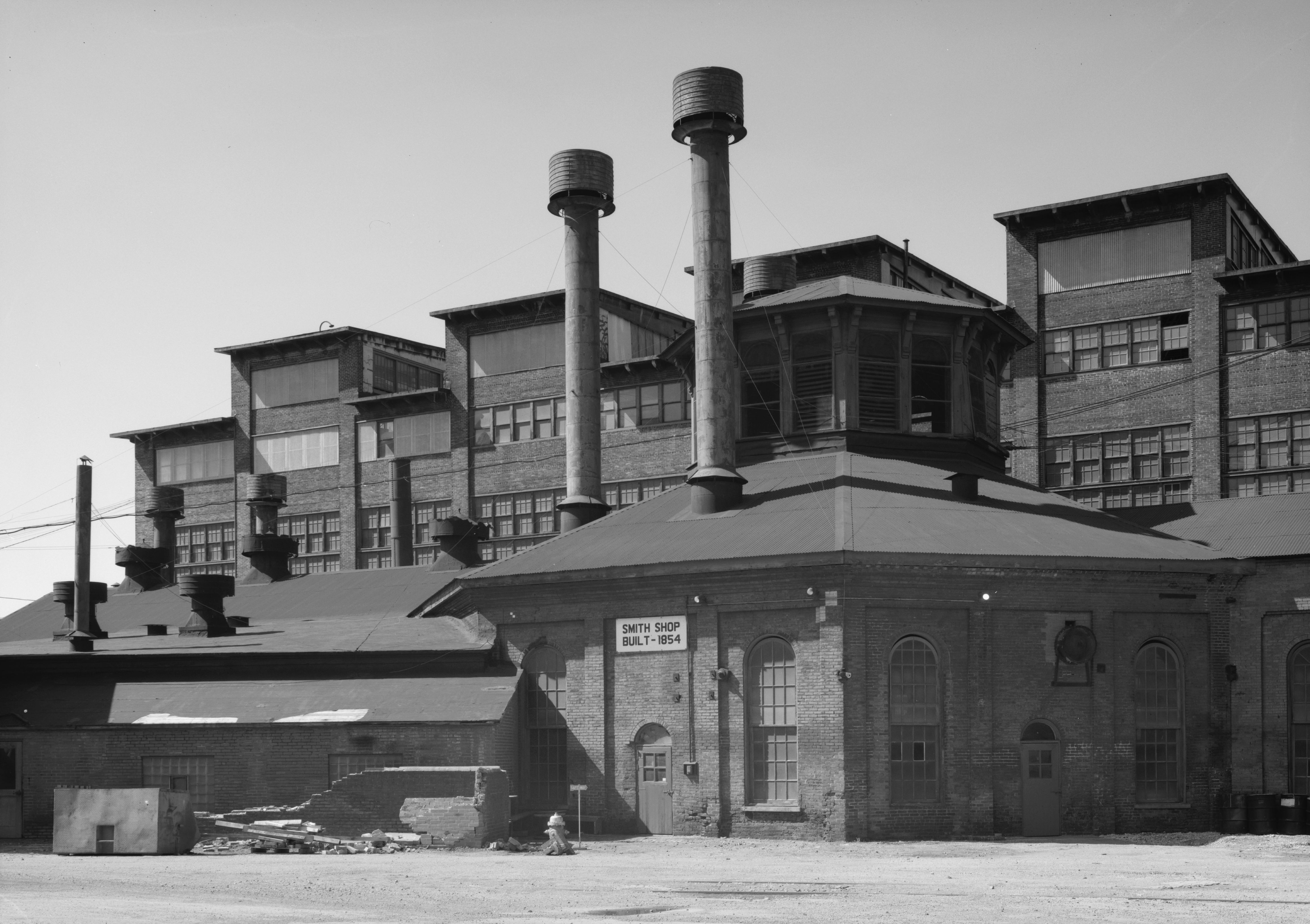
40°29′11″N 78°43′34″W / 40.486389°N 78.726111°WEbensburg 9 Cambria Iron Company 
June 22, 1989 Along the Conemaugh River in the vicinity of Johnstown
40°19′42″N 78°55′13″W / 40.328264°N 78.920278°WJohnstown 10 Cambria Public Library Building June 19, 1972 304 Washington Street
40°19′40″N 78°55′15″W / 40.327778°N 78.920833°WJohnstown 11 Colver Historic District 
June 3, 1994 Roughly bounded by Ninth Avenue, the Ebensburg Coal Company Power Building, and Bakerville, in Colver
40°32′36″N 78°47′46″W / 40.543333°N 78.796111°WBarr, Blacklick, and Cambria Townships 12 Downtown Johnstown Historic District August 7, 1992 Bounded by Washington, Clinton, Bedford, Vine, Market, Locust, and Walnut Streets
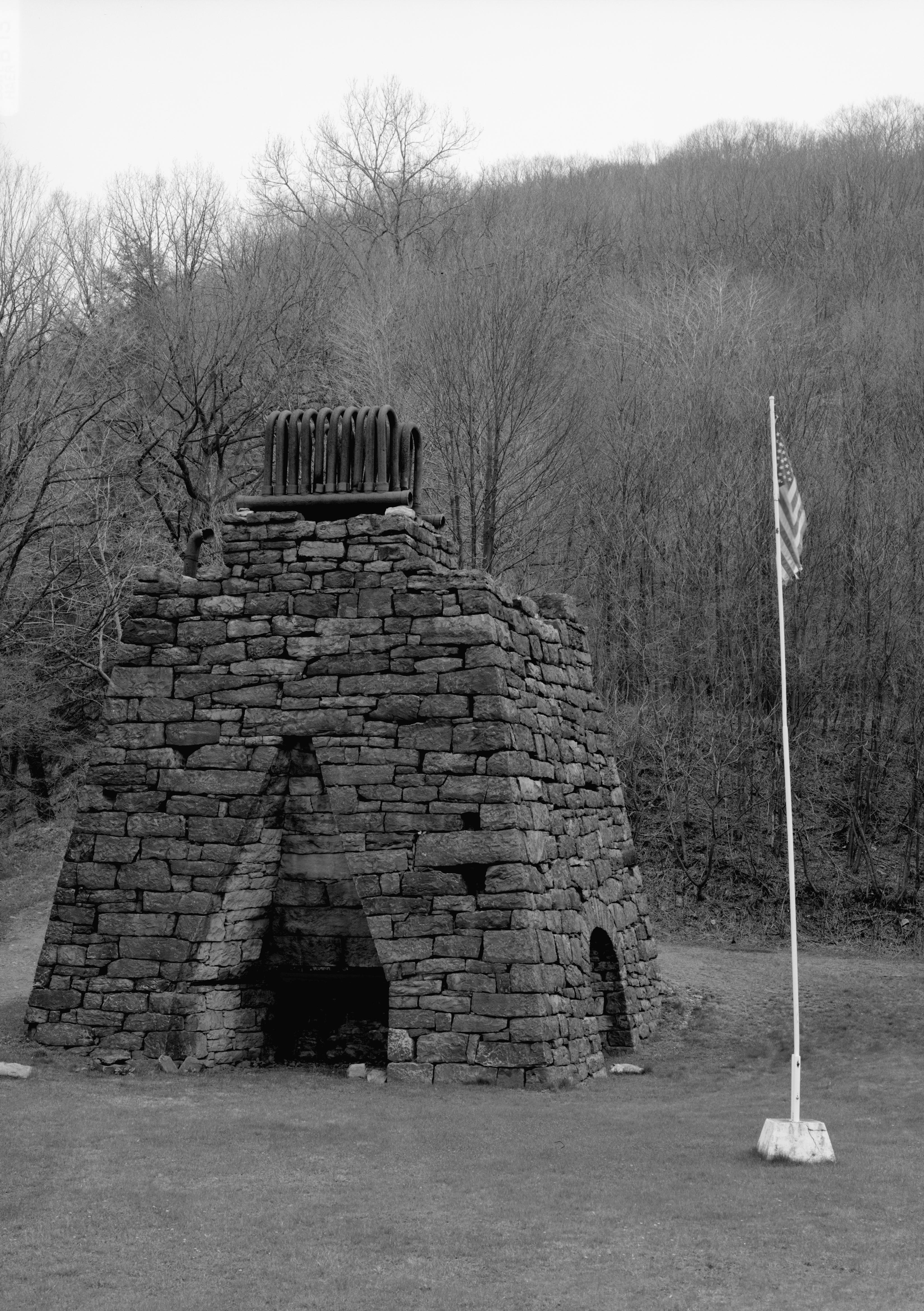
40°19′30″N 78°55′07″W / 40.325°N 78.918611°WJohnstown 13 Eliza Furnace 
September 6, 1991 Lower Main Street
40°29′03″N 78°55′20″W / 40.484167°N 78.922222°WVintondale Extends into Indiana County 14 Grand Army of the Republic Hall April 17, 1980 132 Park Place
40°19′34″N 78°55′07″W / 40.326111°N 78.918611°WJohnstown 15 Johnstown Flood National Memorial October 15, 1966 Junction of U.S. Route 219 and Pennsylvania Route 869, northeast of Johnstown
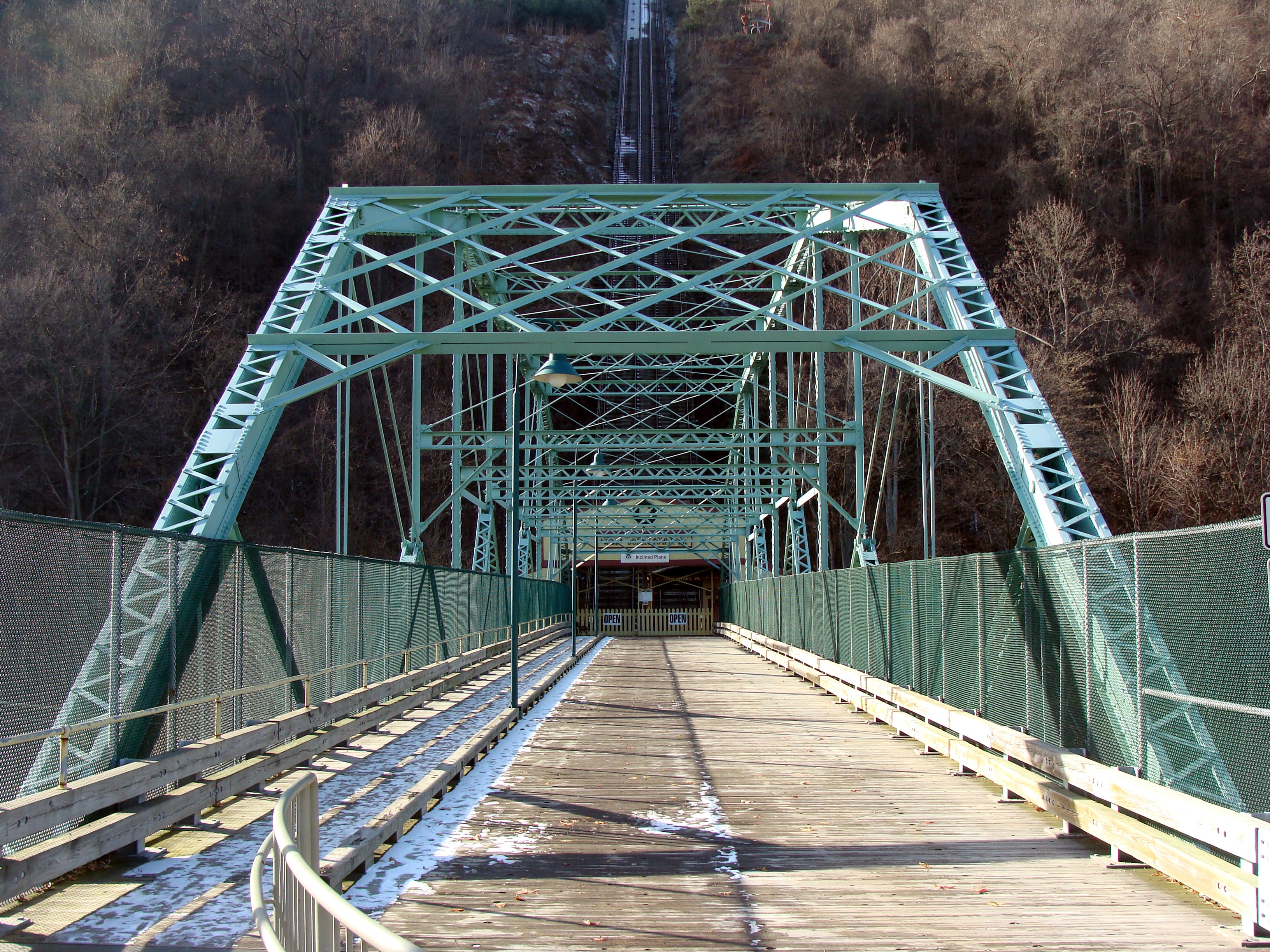
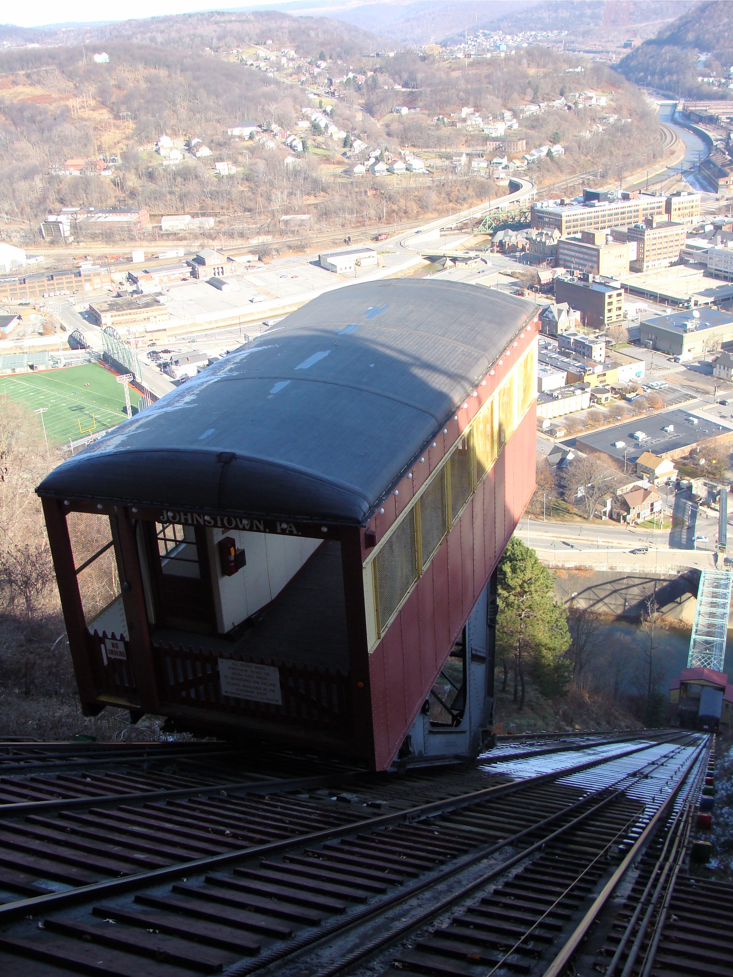
40°20′30″N 78°46′48″W / 40.34167°N 78.78°WAdams Township 16 Johnstown Inclined Railway 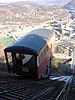
June 18, 1973 Between Johns Street and Edgehill Drive
40°19′32″N 78°55′43″W / 40.325556°N 78.928611°WJohnstown 17 Benjamin F. Jones Cottage February 24, 1995 Third Street
40°27′27″N 78°35′30″W / 40.4575°N 78.591667°WCresson Township 18 Lilly Bridge 
June 22, 1988 Pennsylvania Route 53 over Burgoon Run
40°25′25″N 78°37′03″W / 40.423611°N 78.6175°WLilly 19 Minersville Historic District April 27, 1995 Roughly along Connelly Avenue, Honan Avenue, Garvey Place, and Iron Street
40°20′39″N 78°55′44″W / 40.344167°N 78.928889°WJohnstown and West Taylor Township 20 Moxham Historic District March 12, 1999 Roughly bounded by Dupont Street, Linden Avenue, Village Street, and Park and Coleman Avenues
40°17′52″N 78°54′30″W / 40.297778°N 78.908333°WJohnstown 21 Nathan's Department Store August 10, 1979 426–432 Main St.
40°19′31″N 78°55′08″W / 40.325278°N 78.918889°WJohnstown 22 Philip Noon House August 23, 1984 114 East High Street
40°29′05″N 78°43′29″W / 40.484722°N 78.724722°WEbensburg 23 Old Conemaugh Borough Historic District November 7, 1995 Roughly bounded by Railroad, Adams, and Steel Streets, and Church Avenue
40°19′37″N 78°54′39″W / 40.326944°N 78.910833°WJohnstown 24 Patton Historic District June 28, 1996 Roughly bounded by 5th, Beech, 6th, and Palmer Avenues and Terra Cotta Street
40°38′10″N 78°39′04″W / 40.636111°N 78.651111°WPatton 25 Portage Historic District July 21, 1995 Roughly bounded by North Railroad Avenue, Prospect Street, Johnson Avenue, and Vine Street
40°23′07″N 78°40′23″W / 40.385278°N 78.673056°WPortage 26 Revloc Historic District May 11, 1995 Roughly bounded by Highland Avenue, Fourth Street, Penn Avenue, and Eighth Street in Revloc
40°29′27″N 78°45′52″W / 40.490833°N 78.764444°WCambria Township 27 South Fork Fishing and Hunting Club Historic District July 31, 1986 Roughly bounded by Fortieth, Main, and Lake Streets
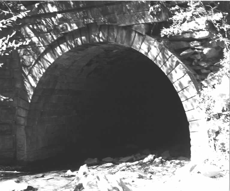
40°20′17″N 78°46′24″W / 40.338056°N 78.773333°WAdams Township 28 Staple Bend Tunnel 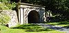
April 19, 1994 Junction of Legislative Route 3035 and Mineral Point
40°21′33″N 78°51′19″W / 40.359167°N 78.855278°WConemaugh Township 29 Westmont Historic District February 24, 1995 Roughly bounded by Clarion Street, Edgehill Drive, Blair and Wayne Streets, Diamond Boulevard, and Stackhouse Park
40°19′20″N 78°56′19″W / 40.322222°N 78.938611°WWestmont 30 Windber Historic District November 14, 1991 Roughly bounded by the borough line, Cambria Avenue, 28th Street, and Big Paint Creek
40°14′10″N 78°49′55″W / 40.236111°N 78.831944°WScalp Level Extends into Somerset County See also
- List of National Historic Landmarks in Pennsylvania
- National Register of Historic Places listings in Pennsylvania
- List of Pennsylvania state historical markers in Cambria County
References
- ^ The latitude and longitude information provided in this table was derived originally from the National Register Information System, which has been found to be fairly accurate for about 99% of listings. For about 1% of NRIS original coordinates, experience has shown that one or both coordinates are typos or otherwise extremely far off; some corrections may have been made. A more subtle problem causes many locations to be off by up to 150 yards, depending on location in the country: most NRIS coordinates were derived from tracing out latitude and longitudes off of USGS topographical quadrant maps created under North American Datum of 1927, which differs from the current, highly accurate GPS system used by Google maps. Chicago is about right, but NRIS longitudes in Washington are higher by about 4.5 seconds, and are lower by about 2.0 seconds in Maine. Latitudes differ by about 1.0 second in Florida. Some locations in this table may have been corrected to current GPS standards.
- ^ "National Register of Historic Places: Weekly List Actions". National Park Service, United States Department of the Interior. Retrieved on November 10, 2011.
- ^ Numbers represent an ordering by significant words. Various colorings, defined here, differentiate National Historic Landmark sites and National Register of Historic Places Districts from other NRHP buildings, structures, sites or objects.
Municipalities and communities of Cambria County, Pennsylvania County seat: Ebensburg City 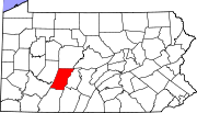
Boroughs Ashville | Brownstown | Carrolltown | Cassandra | Chest Springs | Cresson | Daisytown | Dale | East Conemaugh | Ebensburg | Ehrenfeld | Ferndale | Franklin | Gallitzin | Geistown | Hastings | Lilly | Lorain | Loretto | Nanty Glo | Northern Cambria | Patton | Portage | Sankertown | Scalp Level | South Fork | Southmont | Summerhill | Tunnelhill‡ | Vintondale | Westmont | Wilmore
Townships Adams | Allegheny | Barr | Blacklick | Cambria | Chest | Clearfield | Conemaugh | Cresson | Croyle | Dean | East Carroll | East Taylor | Elder | Gallitzin | Jackson | Lower Yoder | Middle Taylor | Munster | Portage | Reade | Richland | Stonycreek | Summerhill | Susquehanna | Upper Yoder | Washington | West Carroll | West Taylor | White
CDPs Unincorporated
communitiesFlinton | Kaylor | Mountaindale | Oil City | Revloc | Sidman | St. Michael
Footnotes ‡This populated place also has portions in an adjacent county or counties
Categories:- National Register of Historic Places in Pennsylvania by county
- Cambria County, Pennsylvania
-


Wikimedia Foundation. 2010.