- Cambria County, Pennsylvania
-
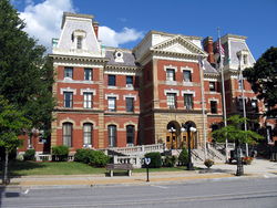
Cambria County, Pennsylvania Cambria County Courthouse
Seal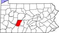
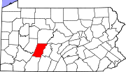
Location in the state of Pennsylvania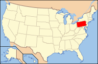
Pennsylvania's location in the U.S.Founded March 26, 1804 Seat Ebensburg Largest city Johnstown Area
- Total
- Land
- Water
693 sq mi (1,795 km²)
688 sq mi (1,782 km²)
5 sq mi (13 km²), 0.78%Population
- (2010)
- Density
143,679
209/sq mi (80.6/km²)Website www.co.cambria.pa.us Cambria County is a county located in the U.S. state of Pennsylvania. It comprises the Johnstown, Pennsylvania, Metropolitan Statistical Area. As of 2010, the population was 143,679.
Cambria County was created on March 26, 1804, from parts of Bedford, Huntingdon, and Somerset counties and was named for the nation of Wales. Its county seat is Ebensburg[1].
Contents
Law and Government
As of November 2008, there are 92,456 registered voters in Cambria County [1].
- Democratic: 57,000 (61.65%)
- Republican: 28,285 (30.59%)
- Other Parties: 7,171 (7.76%)
Despite being overwhelmingly Democratic in registration and the Democrats holding the commissioner majority and all row offices, Cambria is a swing county in statewide elections, with all four statewide winners carrying it in 2008. Cambria County is one of Pennsylvania's most competitive counties. Al Gore received 50.3% of the county vote to 46.4% for George W. Bush in 2000, but Bush carried it with 50.8% of the vote to 48.7% for John Kerry in 2004. Cambria returned to the Democratic Presidential column in 2008, with Barack Obama receiving 49.4% of the vote to 48.7% for John McCain.
County commissioners
- Mark Wissinger, Chairman, Republican
- Doug Lengenfelder, Republican
- Thomas C. Chernisky, Democrat
Other county offices
- Clerk of Courts, Susan Kuhar, Democrat
- Controller, Ed Cernic Jr., Democrat
- Coroner, Dennis Kwiatkowski, Democrat
- Prothonotary, Patty Berkebile, Democrat
- Recorder of Deeds, Andrea Fedore Sims, Democrat
- Register of Wills, Patty Sharbaugh, Democrat
- Sheriff, Bob Kolar, Democrat
- Treasurer, Barbara J. Kline, Democrat
Pennsylvania State Senate
- John N. Wozniak, Democrat, Pennsylvania's 35th Senatorial District
Pennsylvania House of Representatives
District Representative Party 71 Bryan Barbin Democrat 72 Frank Burns Democrat 73 Gary Haluska Democrat United States House of Representatives
District Representative Party 9 Bill Shuster Republican 12 Mark Critz Democratic United States Senate
Senator Party Pat Toomey Republican Bob Casey Democrat Geography
According to the U.S. Census Bureau, the county has a total area of 693 square miles (1,794.9 km2), of which 688 square miles (1,781.9 km2) is land and 5 square miles (12.9 km2) (0.78%) is water.
Adjacent counties
- Clearfield County (north)
- Blair County (east)
- Bedford County (southeast)
- Somerset County (south)
- Westmoreland County (southwest)
- Indiana County (west)
National protected areas
- Allegheny Portage Railroad National Historic Site (part)
- Johnstown Flood National Memorial
Demographics
Historical populations Census Pop. %± 1810 2,117 — 1820 3,287 55.3% 1830 7,076 115.3% 1840 11,256 59.1% 1850 17,773 57.9% 1860 29,155 64.0% 1870 36,569 25.4% 1880 46,811 28.0% 1890 66,375 41.8% 1900 104,837 57.9% 1910 166,131 58.5% 1920 197,839 19.1% 1930 203,146 2.7% 1940 213,459 5.1% 1950 209,541 −1.8% 1960 203,283 −3.0% 1970 186,785 −8.1% 1980 183,263 −1.9% 1990 163,029 −11.0% 2000 152,598 −6.4% 2010 143,679 −5.8% [2][3] As of the census[4] of 2000, there were 152,598 people, 60,531 households, and 40,616 families residing in the county. The population density was 222 people per square mile (86/km²). There were 65,796 housing units at an average density of 96 per square mile (37/km²). The racial makeup of the county was 95.80% White, 2.83% Black or African American, 0.09% Native American, 0.38% Asian, 0.02% Pacific Islander, 0.25% from other races, and 0.64% from two or more races. 0.89% of the population were Hispanic or Latino of any race. 27.7% were of German, 10.2% Irish, 10.1% Italian, 10.0% Polish, 6.5% Slovak, 6.2% American and 5.6% English ancestry according to Census 2000.
There were 60,531 households out of which 27.00% had children under the age of 18 living with them, 52.80% were married couples living together, 10.40% had a female householder with no husband present, and 32.90% were non-families. 29.80% of all households were made up of individuals and 15.60% had someone living alone who was 65 years of age or older. The average household size was 2.38 and the average family size was 2.96.
In the county, the population was spread out with 21.00% under the age of 18, 9.00% from 18 to 24, 26.20% from 25 to 44, 24.10% from 45 to 64, and 19.70% who were 65 years of age or older. The median age was 41 years. For every 100 females there were 94.20 males. For every 100 females age 18 and over, there were 91.30 males.
Municipalities
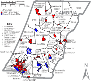
Under Pennsylvania law, there are four types of incorporated municipalities: cities, boroughs, townships, and, in at most two cases, towns. The following cities, boroughs and townships are located in Cambria County:
Cities
Boroughs
Townships
- Adams Township
- Allegheny Township
- Barr Township
- Blacklick Township
- Cambria Township
- Chest Township
- Clearfield Township
- Conemaugh Township
- Cresson Township
- Croyle Township
- Dean Township
- East Carroll Township
- East Taylor Township
- Elder Township
- Gallitzin Township
- Jackson Township
- Lower Yoder Township
- Middle Taylor Township
- Munster Township
- Portage Township
- Reade Township
- Richland Township
- Stonycreek Township
- Summerhill Township
- Susquehanna Township
- Upper Yoder Township
- Washington Township
- West Carroll Township
- West Taylor Township
- White Township
Census-designated places
Census-designated places are geographical areas designated by the U.S. Census Bureau for the purposes of compiling demographic data. They are not actual jurisdictions under Pennsylvania law. Other unincorporated communities, such as villages, may be listed here as well.
- Beaverdale-Lloydell
- Belmont
- Colver
- Elim
- Flinton
- Salix-Beauty Line Park
- Spring Hill
- St. Michael-Sidman
- Twin Rocks
- Vinco
Education
Colleges and universities
- Christ the Saviour Seminary
- Mount Aloysius College
- Saint Francis University
- University of Pittsburgh at Johnstown [2]
Community, junior, and technical colleges
- Cambria-Rowe Business College
- Pennsylvania Highlands Community College
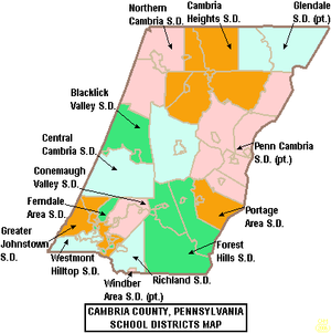
Public School Districts
- Blacklick Valley School District
- Cambria Heights School District
- Central Cambria School District
- Conemaugh Valley School District
- Ferndale Area School District
- Forest Hills School District
- Glendale School District
- Greater Johnstown School District
- Northern Cambria School District
- Penn Cambria School District
- Richland School District
- Westmont Hilltop School District
- There are 11 public cyber charter schools in Pennsylvania that are available for free statewide, to children K-12. See: Education in Pennsylvania.
Recreation
There are two Pennsylvania state parks in Cambria County.
- Prince Gallitzin State Park is named for Demetrius Gallitzin, a Russian nobleman turned Catholic priest who was instrumental in the settlement of Cambria County.
- Laurel Ridge State Park surrounds a 70-mile (113-km) hiking trail that begins in Cambria County and ends at Ohiopyle State Park in Fayette County.
See also
- Cambria Somerset Authority - Water supply authority for Cambria County and Somerset County
- List of municipal authorities in Cambria County, Pennsylvania
- National Register of Historic Places listings in Cambria County, Pennsylvania
References
- ^ "Find a County". National Association of Counties. http://www.naco.org/Counties/Pages/FindACounty.aspx. Retrieved 2011-06-07.
- ^ http://factfinder2.census.gov
- ^ http://mapserver.lib.virginia.edu/
- ^ "American FactFinder". United States Census Bureau. http://factfinder.census.gov. Retrieved 2008-01-31.
External links
- Cambria County official website
- Cambria County Historical Society
- Pennsylvania Department of Transportation Map of Cambria County showing cities, boroughs, unincorporated villages, and townships.
Municipalities and communities of Cambria County, Pennsylvania City Boroughs Ashville | Brownstown | Carrolltown | Cassandra | Chest Springs | Cresson | Daisytown | Dale | East Conemaugh | Ebensburg | Ehrenfeld | Ferndale | Franklin | Gallitzin | Geistown | Hastings | Lilly | Lorain | Loretto | Nanty Glo | Northern Cambria | Patton | Portage | Sankertown | Scalp Level | South Fork | Southmont | Summerhill | Tunnelhill‡ | Vintondale | Westmont | Wilmore
Townships Adams | Allegheny | Barr | Blacklick | Cambria | Chest | Clearfield | Conemaugh | Cresson | Croyle | Dean | East Carroll | East Taylor | Elder | Gallitzin | Jackson | Lower Yoder | Middle Taylor | Munster | Portage | Reade | Richland | Stonycreek | Summerhill | Susquehanna | Upper Yoder | Washington | West Carroll | West Taylor | White
CDPs Unincorporated
communitiesFlinton | Kaylor | Mountaindale | Oil City | Revloc | Sidman | St. Michael
Footnotes ‡This populated place also has portions in an adjacent county or counties
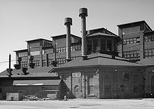
Metro Area Johnstown · Westmont · Brownstown · Richland Township · East Conemaugh · Ferndale · Franklin · DaisytownHistory/Attractions Johnstown Flood · Johnstown Flood National Memorial · South Fork Dam · Allegheny Portage Railroad · Cambria Iron Company · Inclined Plane · Grandview Cemetery · Staple Bend Tunnel · Stone Bridge · Conemaugh RiverTransportation Education Industry Entertainment/Sports Pasquerilla Performing Arts Center · Johnstown Symphony Orchestra · Johnstown Blue Birds · Johnstown Jets · Johnstown Chiefs · Cambria County War Memorial Arena · Point StadiumMedia/Pop Culture TV/Radio Broadcast television in West-Central Pennsylvania, including Johnstown, Altoona and State College Local stations WPSU (3.1 PBS, 3.2 Create, 3.3 PBS World) - WJAC (6.1 NBC, 6.2 Me-TV) - WWCP (8.1 Fox, 8.2 WATM) - WTAJ (10.1 CBS) - WSCP-CA (13 Ind) - WPCW (19.1 CW) - WATM (23.1 ABC HD, 23.2 WWCP HD, 23.3 This TV) - WHVL-LP (29.1 MNTV, 29.2 A1) - W36BE-D (16.1 ABC, 16.2 Antenna TV) - W41CF (41 Ind) - WKBS (47.1 COR) - WLLS-LP (49 A1)
Local cable
channelsIUP-TV (Ind)
Adjacent locals Pennsylvania Broadcast television: Binghamton, NY • Buffalo, NY • Elmira, NY • Erie • Johnstown/Altoona/State College • New York City • Philadelphia • Pittsburgh • Scranton/Wilkes-Barre • Susquehanna Valley (Harrisburg) • Washington, DC • Youngstown, OH
Radio stations in the Johnstown, Pennsylvania market By FM frequency By AM frequency By callsign ¹ Audio for WJAC-TV Pennsylvania radio markets: Allentown-Bethlehem • Altoona • Bradford-Coudersport • Chambersburg-Waynesboro • Erie • Harrisburg-Lebanon-Carlisle • Lancaster • Montrose • New Castle • Philadelphia • Pittsburgh • Reading • State College • Sunbury-Selinsgrove-Lewisburg • Wilkes Barre-Scranton • Sayre-Towanda-Mansfield-Wellsboro • Williamsport • York
Other Pennsylvania radio regions: Bedford • Indiana • Johnstown • Lewistown-Mifflintown • Meadville-Franklin • Punxsutawney-DuBois • St. Marys-Emporium-Kane • Stroudsburg • Warren
Categories:- Pennsylvania counties
- Cambria County, Pennsylvania
- 1804 establishments in the United States
- Populated places established in 1804
Wikimedia Foundation. 2010.

