- Luzerne County, Pennsylvania
-
Luzerne County, Pennsylvania 
Seal
Location in the state of Pennsylvania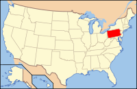
Pennsylvania's location in the U.S.Founded September 25, 1786 Seat Wilkes-Barre Largest city Wilkes-Barre Area
- Total
- Land
- Water
907 sq mi (2,349 km²)
891 sq mi (2,308 km²)
16 sq mi (41 km²), 1.80%Population
- (2010)
- Density
320,918
360/sq mi (139/km²)Website www.luzernecounty.org Luzerne County Heads of State Government – Head Commissioner Maryanne Petrilla (D) – Commissioner Thomas Cooney (D) – Commissioner Stephen A. Urban (R) Luzerne County is a county in northeastern Pennsylvania, with a total population of 320,918 (as of the 2010 census). It is located in the northern Anthracite area called "The Coal Region". Its county seat is Wilkes-Barre. It is part of the Scranton–Wilkes-Barre metropolitan area. Luzerne County saw the largest increase in Hispanics of any county in the United States with 10,000 or more Hispanic as of the 2010 census. The county's Hispanic population grew by over 440% from 2000 to 2010[1].
Contents
History
The Luzerne County Historical Society maintains the storehouse for the collective memory of Luzerne County and its environs. It records and interprets the history, traditions, events, people and cultures that have directed and molded life within the region.[1]
18th century
 Battle of Wyoming in 1778
- 1769: The Pennamite-Yankee War (or the Yankee-Pennamite Wars) began when settlers from Connecticut and Pennsylvania fought over land claims along the North Branch of the Susquehanna River in the present Wyoming Valley.
- July 3, 1778: A force of British and Tories led by John Butler, with the assistance of about 700 Indians, attacked and killed nearly 300 Wyoming Valley settlers. Today in Wyoming, PA a monument marks the grave site of the victims from the Battle of Wyoming.
- September 11, 1780: Reports of Tory activity in the region caused Captain Daniel Klader and a platoon of 40 to 50 men from Northampton County, Pennsylvania to investigate. Captain Klader's men made it as far north as present-day Conyngham, when they were ambushed by the Seneca nation and by the Tories. 18 of Klader's men were killed in what is known as the Sugarloaf Massacre.
- September 25, 1786: Luzerne County was formed from part of Northumberland County.
19th century
 Mine workers began their protest march near Harwood and many were eventually killed by the Luzerne County sheriff in Lattimer in 1897.
- September 6, 1869: A mine fire killed 110 people in Avondale, an unincorporated community in Plymouth Township.
- June 28, 1896: The Newton Coal Company's Twin Shaft Mine in Pittston City caved-in and killed 58 miners.[2][3]
- September 10, 1897: Sheriff James Martin formed a posse and fired on a group of unarmed miners in what is known today as the Lattimer massacre. Luzerne is infamous for being the last county whose sheriff legally formed a posse to restore order in a time of civil unrest.
20th century
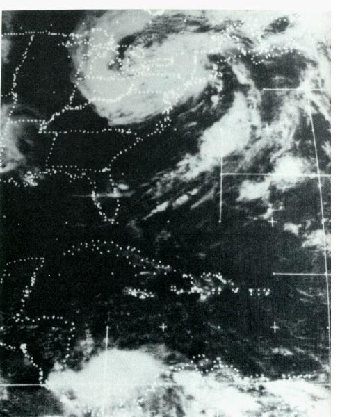
 Remnants of Agnes over Pennsylvania. This resulted in major flooding
- 1915: A mine fire in Laurel Run, Pennsylvania caused a section of the town to be relocated.
- June 5, 1919: An explosion at the Baltimore Colliery in Wilkes-Barre, Pennsylvania killed 92 miners.
- 1934: The right arm of Hughestown, Pennsylvania resident, Harry Tompkins, was crushed by an Erie Railroad train. This resulted in the U.S. Supreme Court case, Erie Railroad Co. v. Tompkins, which laid the foundation for a large part of modern American civil procedure.
- January 22, 1959: The Knox Mine disaster in Port Griffith, Jenkins Township claimed the lives of 12 people and essentially shut down the mining industry in Northeastern Pennsylvania.
- June 1972: Hurricane Agnes was responsible for massive flooding in and around Wilkes-Barre, Pennsylvania.
- 1974–1989: Alleged ghost hauntings took place in the home of Jack and Janet Smurl in West Pittston. This resulted in the 1991 film The Haunted.
- September 25, 1982: George Banks kills 13 people in a shooting rampage in Wilkes-Barre and Jenkins Township.
- 1992: The opening scenes from the movie School Ties was filmed in West Pittston; it shows David Green, the hero of the movie (played by Brendan Fraser), hanging out with friends in the streets of the tiny town.
21st century
- May 21, 2000: A plane crash in Bear Creek Township, PA near the intersection of Bear Creek Boulevard (PA-Route 115) and the Northeast Extension of the Pennsylvania Turnpike killed the pilot as well as all 19 passengers.
- December 1, 2006: a tornado left a path of destruction approximately 15 miles (24 km) long (this included parts of Mountain Top).
- September 2011: Luzerne County witnessed historical flooding from Tropical Storm Lee. The Susquehanna River reached a record high of 42.6 feet (13 meters) in Wilkes-Barre. The river topped the 40.9-foot (12.5 meters) level in flooding caused by Hurricane Agnes in 1972. The Greater Pittston, Wilkes-Barre, and Nanticoke areas were hit the hardest.[4][5][6]
Geography
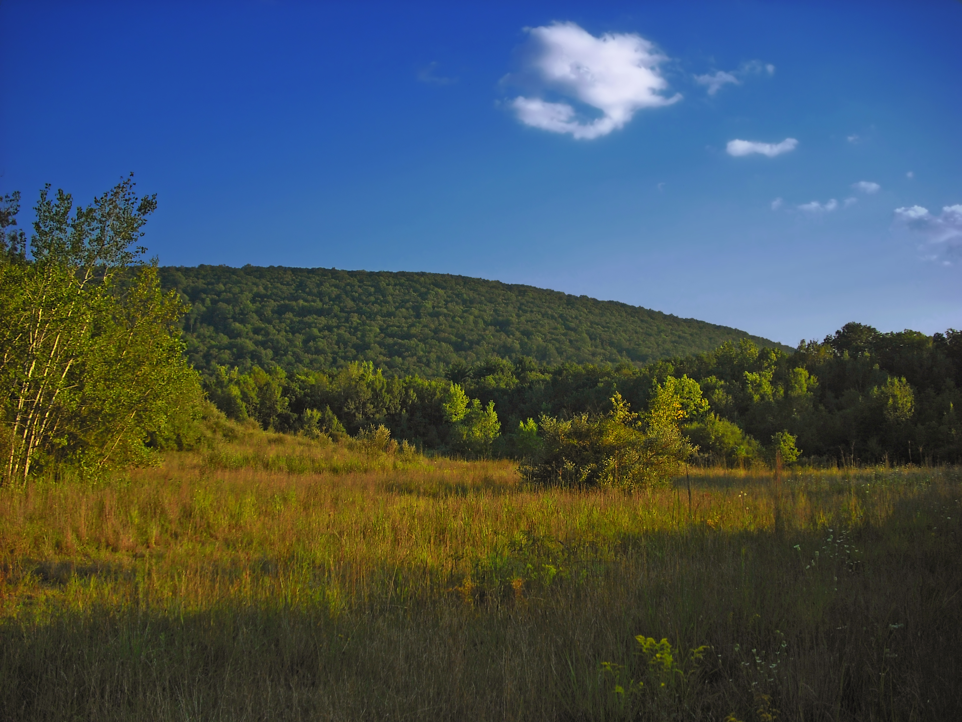
 Lehigh Gorge State Park in Luzerne County during the fall
According to the U.S. Census Bureau, the county has a total area of 907 square miles (2,349 km²), of which 891 square miles (2,307 km²) is land and 16 square miles (42 km²) (1.80%) is water. The Wyoming Valley in the North and Mid part of the county is flat at the Susquehanna Basin and rises from 700 feet (210 m) to 2,000 feet (610 m) in some places. Bear Creek, on the eastern side of the valley, has a mean elevation of about 2,000 feet (610 m), while Pittston, on the Susquehanna Basin, is about 700 feet (210 m). The Valley goes as north as Exeter Township-Dallas Township to as on the west side from Plymouth Township-Bear Creek Township and as on the east side from Duryea to Bear Creek Township; South as Hanover Township to Bear Creek Township. The county is crossed by a series of east-to-west mountains. The Susquehanna River drains most of the county while the Lehigh River drains some eastern and southeastern portions and forms part of its southeast boundary.
Adjacent counties
- Wyoming County (north)
- Lackawanna County (northeast)
- Monroe County (east)
- Carbon County (southeast)
- Schuylkill County (south)
- Columbia County (west)
- Sullivan County (northwest)

Sullivan County Wyoming County Lackawanna County Columbia County 
Monroe County  Luzerne County, Pennsylvania

Schuylkill County Carbon County Demographics
Historical populations Census Pop. %± 1790 4,892 — 1800 12,839 162.4% 1810 18,109 41.0% 1820 20,027 10.6% 1830 27,379 36.7% 1840 44,006 60.7% 1850 56,072 27.4% 1860 90,244 60.9% 1870 160,915 78.3% 1880 133,065 −17.3% 1890 201,203 51.2% 1900 257,121 27.8% 1910 343,186 33.5% 1920 390,991 13.9% 1930 445,109 13.8% 1940 441,518 −0.8% 1950 392,241 −11.2% 1960 346,972 −11.5% 1970 342,301 −1.3% 1980 343,079 0.2% 1990 328,149 −4.4% 2000 319,255 −2.7% 2010 320,918 0.5% [7][8] As of the 2010 census, the county was 90.7% White, 3.4% Black or African American, 0.2% Native American, 1.0% Asian, 3.3% were of some other race, and 1.5% were two or more races. 6.7% of the population was of Hispanic or Latino ancestry[2]. The Hispanic population was just 1.1% of the population in 2000.
As of the census[9] of 2000, there were 319,250 people, 130,687 households, and 84,293 families residing in the county. The population density was 358 people per square mile (138/km²). There were 144,686 housing units at an average density of 162 per square mile (63/km²). The racial makeup of the county was 96.63% White, 1.69% Black or African American, 0.09% Native American, 0.58% Asian, 0.01% Pacific Islander, 0.43% from other races, and 0.57% from two or more races. 1.16% of the population were Hispanic or Latino of any race. 22.2% were of Polish, 15.6% Italian, 13.8% Irish, 12.1% German and 5.3% Slovak ancestry according to Census 2000.
There were 130,687 households out of which 26.50% had children under the age of 18 living with them, 48.80% were married couples living together, 11.50% had a female householder with no husband present, and 35.50% were non-families. 31.30% of all households were made up of individuals and 16.00% had someone living alone who was 65 years of age or older. The average household size was 2.34 and the average family size was 2.95.
In the county, the population was spread out with 21.00% under the age of 18, 8.10% from 18 to 24, 27.20% from 25 to 44, 24.00% from 45 to 64, and 19.70% who were 65 years of age or older. The median age was 41 years. For every 100 females there were 93.00 males. For every 100 females age 18 and over, there were 89.50 males.
Luzerne County is the only county in the United States with a plurality of citizens reporting Polish as their primary ancestry; the majority of Pennsylvanians report German or Pennsylvania Dutch.
Politics
 Luzerne County Courthouse
As of November 2008, there are 187,849 registered voters in Luzerne County.[10]
- Democratic: 111,317 (59.26%)
- Republican: 61,085 (32.52%)
- Other Parties: 15,447 (8.22%)
While the Democratic Party has been historically dominant in county-level politics, on the statewide and national levels Luzerne County leans toward the Democratic Party but only slightly. In 2000 Democrat Al Gore won 52% of the vote and Republican George W. Bush won 43%. In 2004 it was much closer with Democrat John Kerry winning 51% to Republican George Bush's 47%. In 2006 both Democrats Governor Ed Rendell and now Senator Bob Casey Jr. won 67.5% and 60.6% of the vote in Luzerne County, respectively. In 2008 all four statewide winners carried it, with Barack Obama receiving 53.6% of the county vote to 45.2% for John McCain.
Luzerne County is represented by three County Commissioners[11] and all county row offices have been held by Democrats since the 2007 election,[12] when Republican incumbents Recorder of Deeds Mary Dysleski and Sheriff Barry Stankus lost re-election. However, in 2011 Republican Stefanie J. Salavantis defeated the incumbent District Attorney in a close race.
County commissioners
- Maryanne C. Petrilla (Commissioner Chairperson), D
- Thomas P. Cooney, D
- Stephen A. Urban, R
Recent county commissioners
- Gregory A. Skrepenak, D (2004–2009)
Other county offices
- Acting Clerk of Courts, Thomas Pisano
- Controller, Walter L. Griffith, Jr.
- Coroner, John P. Corcoran
- District Attorney, Stefanie J. Salavantis, R
- Prothonotary, Carolee Medico Olenginski
- Recorder of Deeds, James O'Brien
- Register of Wills, Dorothy Stankovic
- Sheriff, John F. Gilligan
- Treasurer, Michael L. Morreale
United States Senate
United States House of Representatives
- Tom Marino, R, Pennsylvania's 10th congressional district
- Lou Barletta, R, Pennsylvania's 11th congressional district
Pennsylvania State Senate
- John Yudichak, D, Pennsylvania's 14th Senatorial District
- Lisa Baker, R, Pennsylvania's 20th Senatorial District
- John Blake, D, Pennsylvania's 22nd Senatorial District
- John Gordner, R, Pennsylvania's 27th Senatorial District
Pennsylvania House of Representatives
- Jim Wansacz, D, Pennsylvania's 114th Representative District
- Tarah Toohil, R, Pennsylvania's 116th Representative District
- Karen Boback, R, Pennsylvania's 117st Representative District
- Michael B. Carroll, D, Pennsylvania's 118th Representative District
- Gerald Mullery, D, Pennsylvania's 119th Representative District
- Phyllis Mundy, D, Pennsylvania's 120th Representative District
- Eddie Day Pashinski, D, Pennsylvania's 121st Representative District
Municipalities

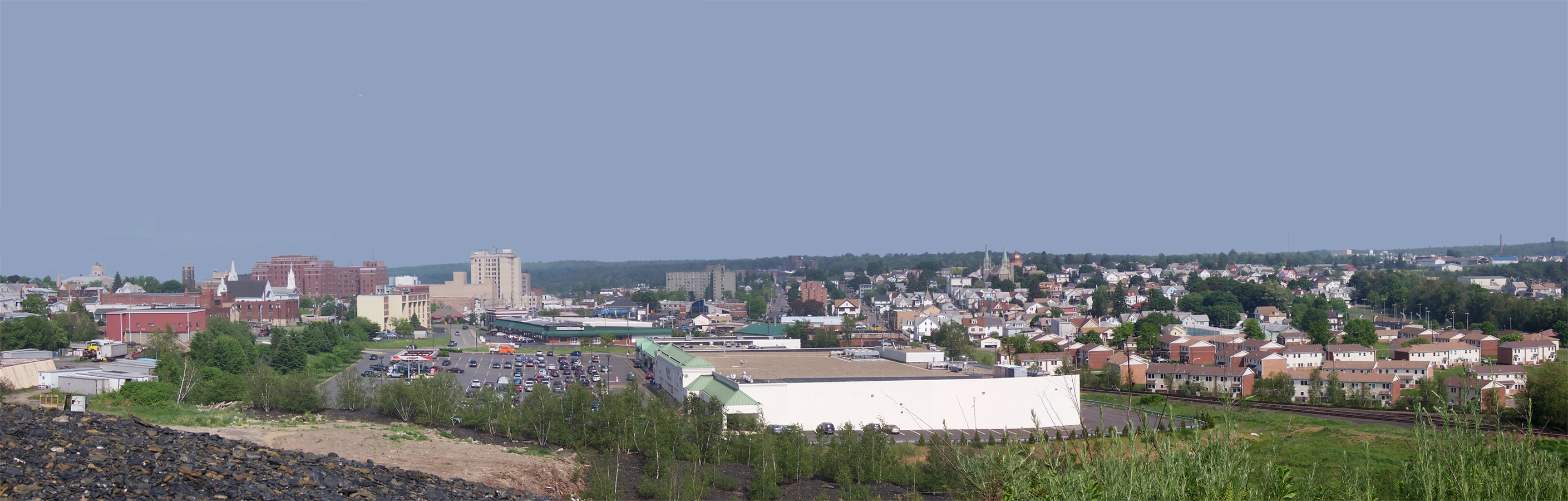
 Hazleton, the second largest city in Luzerne County
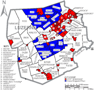 Map of Luzerne County, Pennsylvania with Municipal Labels showing Cities and Boroughs (red), Townships (white), and Census-designated places (blue).
Under Pennsylvania law, there are four types of incorporated municipalities: cities, boroughs, townships, and, in one case Bloomsburg, the only town, towns. The following cities, boroughs and townships are located in Luzerne County:
Cities
- Pittston: 8,104
- Wilkes-Barre (county seat): 43,123
Boroughs
Townships
- Bear Creek Township
- Black Creek Township
- Buck Township
- Butler Township
- Conyngham Township
- Dallas Township
- Dennison Township
- Dorrance Township
- Exeter Township
- Fairmount Township
- Fairview Township
- Foster Township
- Franklin Township
- Hanover Township
- Hazle Township
- Hollenback Township
- Hunlock Township
- Huntington Township
- Jackson Township
- Jenkins Township
- Kingston Township
- Lake Township
- Lehman Township
- Nescopeck Township
- Newport Township
- Pittston Township
- Plains Township
- Plymouth Township
- Rice Township
- Ross Township
- Salem Township
- Slocum Township
- Sugarloaf Township
- Union Township
- Wilkes-Barre Township
- Wright Township
Census-designated places
Census-designated places are geographical areas designated by the U.S. Census Bureau for the purposes of compiling demographic data. They are not actual jurisdictions under Pennsylvania law.
Other places
- Wapwallopen
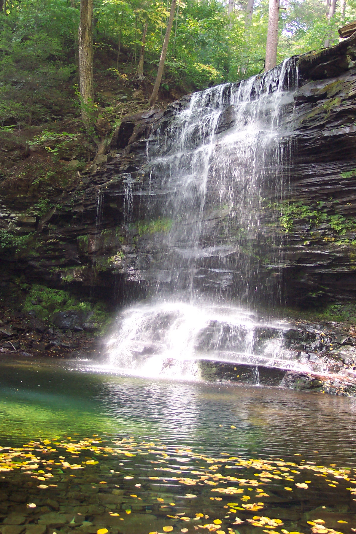
Recreation
There are four Pennsylvania state parks in Luzerne County:
- Frances Slocum State Park (northern Luzerne County)
- Lehigh Gorge State Park (eastern Luzerne County)
- Nescopeck State Park (southern Luzerne County)
- Ricketts Glen State Park (western Luzerne County)
Education
Public School Districts
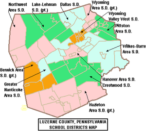 Map of Luzerne County, Pennsylvania School Districts
- Berwick Area School District (also in Columbia County)
- Crestwood School District
- Dallas School District
- Greater Nanticoke Area School District
- Hanover Area School District
- Hazleton Area School District (also in Carbon and Schuylkill Counties)
- Lake-Lehman School District (also in Wyoming County)
- Northwest Area School District
- Pittston Area School District
- Wilkes-Barre Area School District
- Wyoming Area School District (also in Wyoming County)
- Wyoming Valley West School District
Charter Schools
- Bear Creek Community Charter School
Public Vo-Tech Schools
- West Side Area Vocational Technical School WSAVTS
Private Schools
- Dallas Township School
- Graham Academy
- Holy Redeemer High School
- Jenny Lynn Ferraro Academy
- Milford E Barnes Junior School
- MMI Preparatory School
- New Story School
- Wilkes Barre Academy
- Wyoming Seminary
Data from EdNA - Education Names and Addresses report[13]
Colleges and Universities
- Luzerne County Community College
- King's College
- Misericordia University
- Penn State Hazleton
- Penn State Wilkes-Barre
- Wilkes University
See also
- List of municipal authorities in Luzerne County, Pennsylvania
- Luzerne County Transportation Authority
- National Register of Historic Places listings in Luzerne County, Pennsylvania
- Pennamite-Yankee War
- USS Luzerne County (LST-902)
References
- ^ Luzerne County Historical Society
- ^ "Twin Shaft Disaster Marker". Hmdb.org. August 19, 2008. http://www.hmdb.org/marker.asp?marker=10470. Retrieved July 21, 2009.
- ^ Pittston, PA Twin Shaft Mine Cave In, June 1896
- ^ Mandatory Evacuation of Wyoming Valley by 4 p.m., Times-Leader, September 8, 2011
- ^ http://www.reuters.com/article/2011/09/09/usa-flooding-idUSN1E7880XA20110909
- ^ Luzerne officials issue mandatory evacuation in footprint of Agnes flood, Times Tribune, September 8, 2011
- ^ http://factfinder2.census.gov
- ^ http://mapserver.lib.virginia.edu/
- ^ "American FactFinder". United States Census Bureau. http://factfinder.census.gov. Retrieved 2008-01-31.
- ^ Current voter statistics
- ^ Luzerne County Commissioners
- ^ "Luzerne County Municipal Election Results – November 2007". Archived from the original on July 21, 2009. http://www.webcitation.org/5iRPR4j7h.
- ^ Pennsylvania Department of Education (2011). "Licensed, Private Academic Schools in Pennsylvania". http://edna.ed.state.pa.us/EntitySearchResult.asp.
External links
- Luzerne County official site.
- "Luzerne County Library System.". Archived from the original on February 12, 2008. http://web.archive.org/web/20080212070523/http://www.luzerneco.lib.pa.us/.
- Luzerne County Convention and Visitors Bureau.
- The Luzerne Foundation – Luzerne County's Community Foundation
- Luzerne County Community College.
Counties Lackawanna • Luzerne • WyomingSettlements
50k-100kSettlements
25k-50kSettlements
10k-25k Commonwealth of Pennsylvania
Topics - Cities
- Politics
- Government
- Delegations
- History
- Geography
- Geology
- Pennsylvanians
- State parks
- Symbols
- Visitor attractions
Metro areas Cities Largest
municipalities- Baldwin
- Berwick
- Bethel Park
- Brentwood
- Carlisle
- Chambersburg
- Columbia
- Darby
- Dunmore
- Elizabethtown
- Emmaus
- Ephrata
- Franklin Park
- Hanover
- Indiana
- Kingston
- Lansdale
- Lansdowne
- Monroeville
- Munhall
- Murrysville
- Norristown
- Penn Hills
- Phoenixville
- Plum
- Pottstown
- State College
- West Chester
- West Mifflin
- Whitehall
- Wilkinsburg
- Wyomissing
- Yeadon
Regions - Allegheny Mountains
- Allegheny National Forest
- Allegheny Plateau
- Atlantic Coastal Plain
- Blue Ridge
- Coal Region
- Cumberland Valley
- Delaware Valley
- Dutch Country
- Endless Mountains
- Happy Valley
- Laurel Highlands
- Lehigh Valley
- Main Line
- Northeast
- Northern Tier
- Northwestern
- Oil Region
- Pennsylvania Highlands
- Piedmont
- The Poconos
- Ridge and Valley
- South Central
- Susquehanna Valley
- Western
- Wyoming Valley
Counties - Adams
- Allegheny
- Armstrong
- Beaver
- Bedford
- Berks
- Blair
- Bradford
- Bucks
- Butler
- Cambria
- Cameron
- Carbon
- Centre
- Chester
- Clarion
- Clearfield
- Clinton
- Columbia
- Crawford
- Cumberland
- Dauphin
- Delaware
- Elk
- Erie
- Fayette
- Forest
- Franklin
- Fulton
- Greene
- Huntingdon
- Indiana
- Jefferson
- Juniata
- Lackawanna
- Lancaster
- Lawrence
- Lebanon
- Lehigh
- Luzerne
- Lycoming
- McKean
- Mercer
- Mifflin
- Monroe
- Montgomery
- Montour
- Northampton
- Northumberland
- Perry
- Philadelphia
- Pike
- Potter
- Schuylkill
- Snyder
- Somerset
- Sullivan
- Susquehanna
- Tioga
- Union
- Venango
- Warren
- Washington
- Wayne
- Westmoreland
- Wyoming
- York
Coordinates: 41°11′N 75°59′W / 41.18°N 75.99°W
Categories:- Pennsylvania counties
- Luzerne County, Pennsylvania
- 1786 establishments
- Polish American history
- Anthracite Coal Region of Pennsylvania


Wikimedia Foundation. 2010.