- Delaware County, Pennsylvania
-
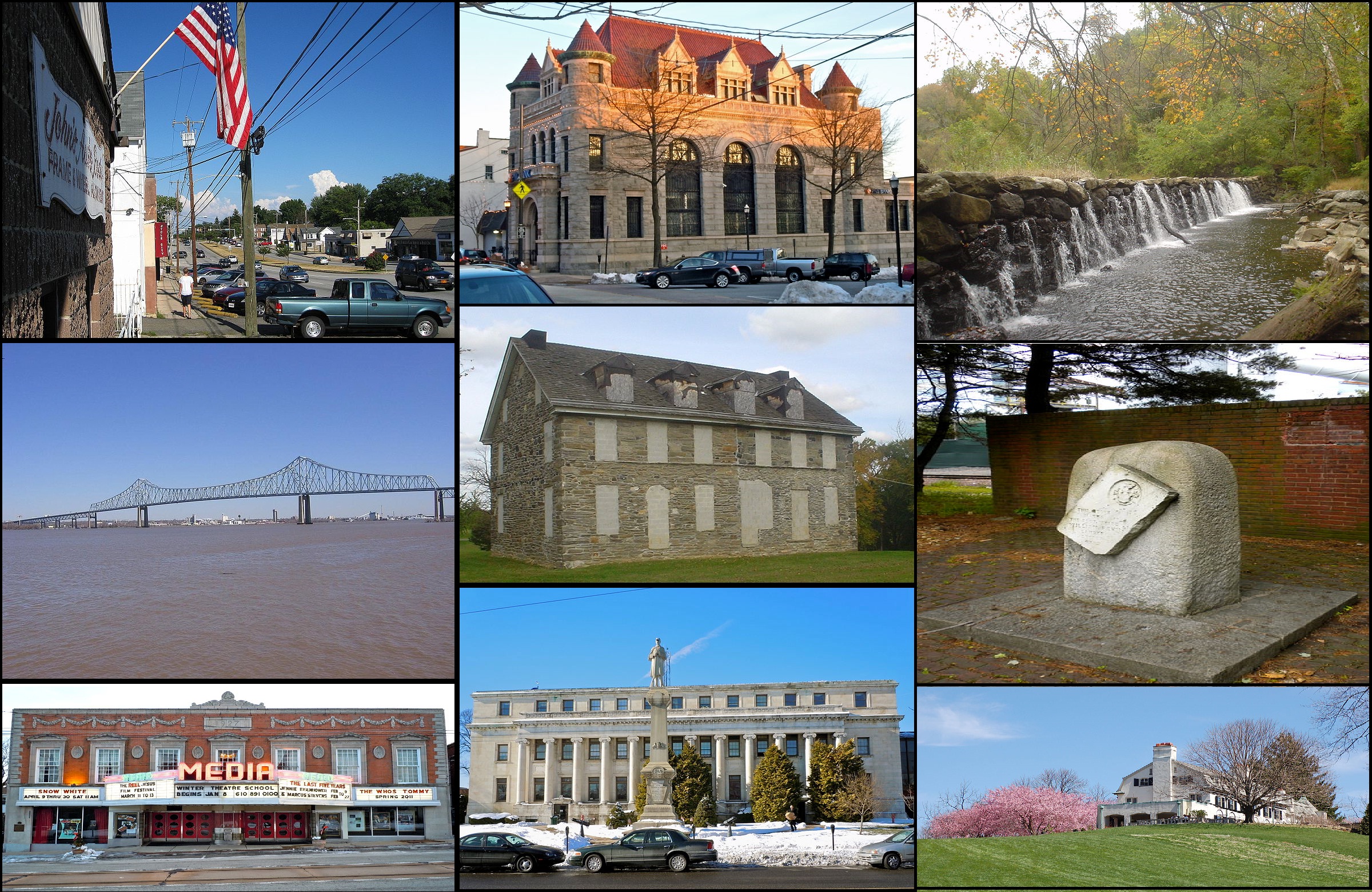
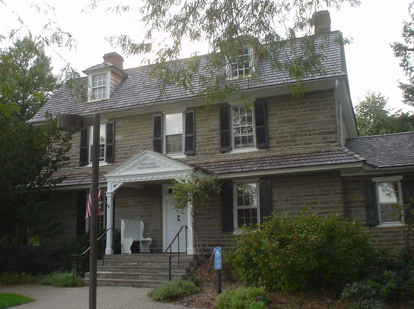
Delaware County, Pennsylvania 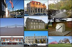 A collage of notable places in Delaware County.
Seal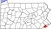
Location in the state of Pennsylvania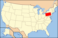
Pennsylvania's location in the U.S.Founded September 26, 1789 Seat Media Largest city Chester Area
- Total
- Land
- Water
191 sq mi (495 km²)
184 sq mi (477 km²)
7 sq mi (18 km²), 3.42%Population
- (2010)
- Density
558,979
3,035/sq mi (1,171.8/km²)Website www.co.delaware.pa.us Delaware County is a county located in the U.S. state of Pennsylvania. As of 2010, the population was 558,979, making it Pennsylvania's fifth most populous county, behind Philadelphia, Allegheny, Montgomery, and Bucks counties.
Delaware County was created on September 26, 1789, from part of Chester County and named for the Delaware River. Its county seat, since 1851, is Media[1]. Chester City, prior to 1851, was the county seat of both Delaware County and, before that, of Chester County.
Delaware County consists of communities adjacent to the city of Philadelphia. Socioeconomically, Delaware County consists of working class, middle-class, and upper-class neighborhoods.
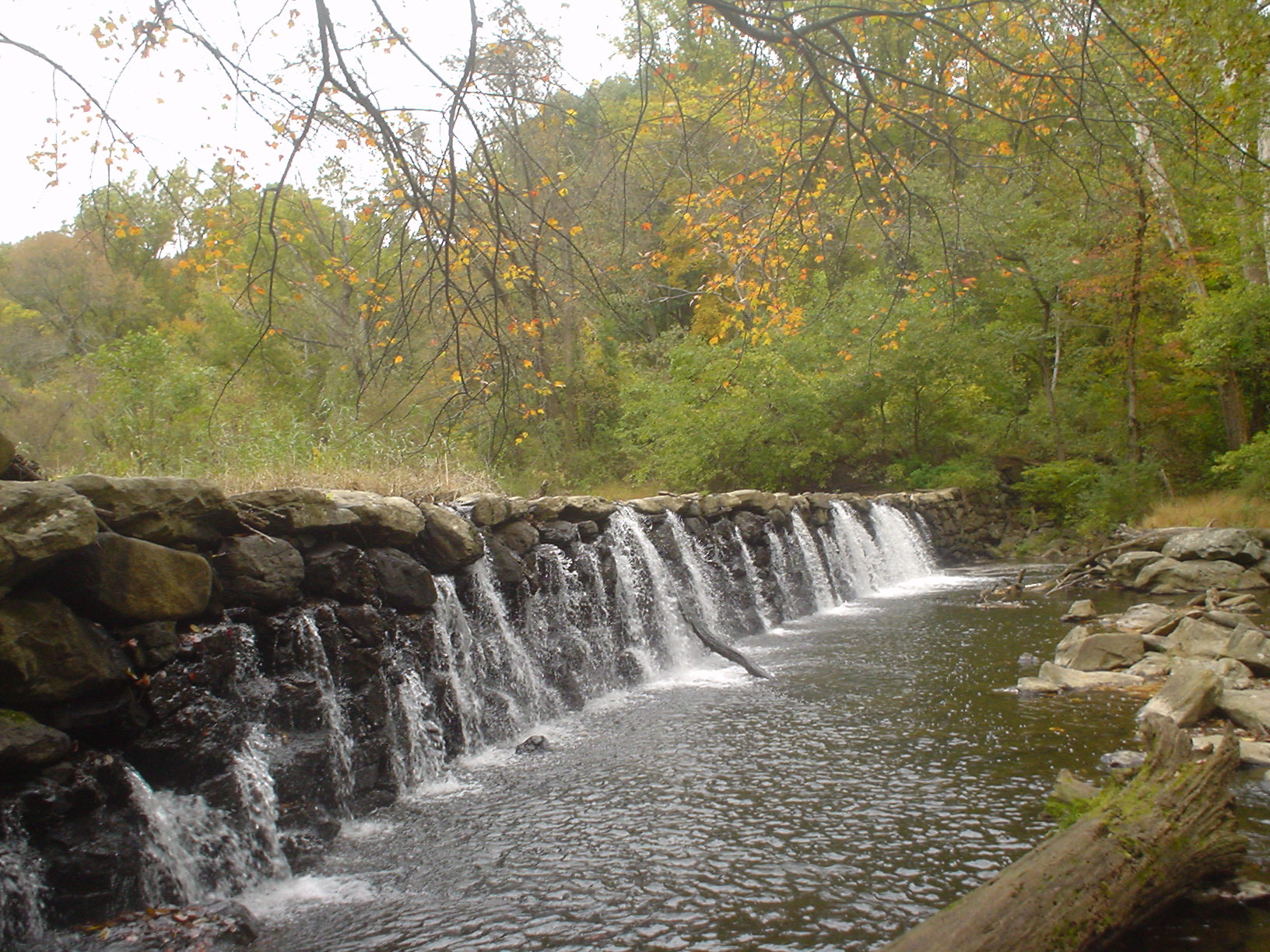
2,600 acres (11 km2) of the county are occupied by the Ridley Creek State Park.
The county, immediately adjacent to and west of Philadelphia, is part of the Delaware Valley area. Delaware County is the only county covered in its entirety by area code 610.
Contents
Geography
Delaware County is roughly diamond- or kite-shaped, with the four sides formed by the Chester County boundary to the northwest, the boundary with the state of Delaware (a portion of the "Twelve Mile Circle") to the southwest, the Delaware River (forming the border with the state of New Jersey to the southeast, and the city of Philadelphia and Montgomery County to the east and northeast.
According to the U.S. Census Bureau, the county has a total area of 191 square miles (494.7 km2), of which 184 square miles (476.6 km2) is land and 7 square miles (18.1 km2) (3.42%) is water. The lowest point in the state of Pennsylvania is located on the Delaware River in Marcus Hook in Delaware County, where it flows out of Pennsylvania and into Delaware.
Waterways in Delaware County generally flow in a southward direction and ultimately drain into the Delaware River. The waterways are, from west to east: the Brandywine River (forming a portion of the county's western boundary with Chester County), Chester Creek, Ridley Creek, Crum Creek, Muckinipates Creek, Darby Creek and Cobbs Creek (forming a portion of the county's eastern boundary with Philadelphia). Crum Creek was dammed in 1931 near Pennsylvania Route 252 to fill Springton Lake (also known as Geist Reservoir), an approximately 391-acre (1.58 km2)[2] drinking water reservoir maintained by Aqua America, the county's largest lake.
Adjacent counties
- Montgomery County (north)
- Philadelphia County (east)
- Gloucester County, New Jersey (southeast)
- New Castle County, Delaware (southwest)
- Chester County (west)
Delaware County is one of four US counties to border the state with whom it shares its name (the others are Nevada County, California, Texas County, Oklahoma, and Ohio County, West Virginia).
National protected area
 John Heinz National Wildlife Refuge
- John Heinz National Wildlife Refuge (part)
History
Delaware County lies in the river and bay drainage area named "Delaware" in honor of Thomas West, 3rd Baron De La Warr, Governor of the nearby English colony of Virginia. The land was "discovered" and explored by Henry Hudson in 1609, and over the next several decades it was variously claimed and settled by the Swedes, the Dutch, and the English. Its original human inhabitants were the Lenni-Lenape tribe of American Indians.
Once the Dutch were defeated and the extent of New York was determined, King Charles II of England made his grant to William Penn in order to found the colony which came to be named Pennsylvania. Penn divided his colony into three counties: Bucks, Philadelphia, and Chester. The riverfront land south of Philadelphia, being the most accessible, was quickly granted and settled. In 1789, the eastern portion of Chester County was divided from the rest. Despite that the eastern portion was the first settled and contained the town of Chester, it was named Delaware County for its river.
Politics and government
Presidential elections results Year Republican Democratic 2008 38.8% 115,013 60.2% 178,264 2004 42.3% 120,425 57.1% 162,601 2000 42.7% 105,836 54.4% 134,861 1996 39.5% 92,628 49.5% 115,946 1992 40.8% 108,587 41.8% 111,210 1988 59.9% 147,656 39.0% 96,144 1984 61.8% 161,754 37.4% 98,027 1980 55.8% 143,282 34.4% 88,314 1976 54.9% 148,679 43.3% 117,252 1972 63.9% 175,414 34.3% 94,144 1968 50.2% 133,777 40.0% 106,695 1964 42.9% 111,189 56.8% 147,189 1960 52.0% 135,672 47.8% 124,629 As of November 2008, there are 406,352 registered voters in Delaware County [1].
- Republican: 190,716 (46.93%)
- Democratic: 172,405 (42.43%)
- Other Parties: 43,231 (10.64%)
Politically, Delaware County has traditionally been a Republican stronghold. It voted for the Republican candidate in nearly every election since 1854 through 1988. As was the case in most of the Philadelphia suburbs, however, the brand of Republicanism that prevailed in the area was traditionally a moderate one. It has operated under a home-rule charter with five at-large councilmembers since 1972. Republicans remain in control of all county council seats and row offices.
In recent elections, however, Delaware County has been trending Democratic and the Republican registration edge has declined rapidly from over twice as many voters as Democrats had in 2002. It narrowly voted for Bill Clinton in 1992, but has gone Democratic in every Presidential election since then by 10 points or more by progressively-increasing margins. In the 2004 election Democratic presidential candidate John Kerry won the county by 14 points. In the 2004 US Senate election, Republican Arlen Specter defeated Joe Hoeffel but Democrat Bob Casey, Jr. defeated Rick Santorum in the 2006 Senate election. In the 2008 presidential election, Democratic Senator Barack Obama defeated Republican Senator John McCain resoundingly, by over 21 points. All three Democratic state row office candidates also carried it in 2008.
Most of Delaware County is located in the state's 7th congressional district, represented by Republican Pat Meehan. The district had been held for 20 years by Republican Curt Weldon until he was ousted by Joe Sestak, a retired admiral, in the 2006 U.S. House of Representatives election. Also in the 2006 election, Democrat Bryan Lentz unseated Republican incumbent State Representative Tom Gannon in the 161st House district. In 2010 Sestak ran for the senate seat vacated by Arlen Specter and was replaced by Meehan, defeating Lentz, who ran as the Democrat. Lentz was replaced in the State House by Joe Hackett, a Republican. A small portion of the county, mostly consisting of the areas around Chester, Yeadon and Darby, is in the Philadelphia-based 1st district, represented by Democrat Bob Brady.
Members of Delaware County Council
Office Holder Party County Councilman (chairman) John J. Whelan Republican County Councilwoman (vice-chair) Christine Fizzano Cannon Republican County Councilman Andy Lewis Republican County Councilman Tom McGarrigle Republican County Councilman Mario Civera Republican Other elected officials
Office Holder Party Controller Edward E. O'Lone Republican District Attorney G. Michael Green Republican Register of Wills Hugh Donahue Republican Sheriff Joseph McGinn Republican United States House of Representatives
District Representative Party 1 Bob Brady Democratic 7 Pat Meehan Republican United States Senate
Senator Party Pat Toomey Republican Bob Casey Democratic Pennsylvania House of Representatives
District Representative Party 159 Thaddeus Kirkland Democratic 160 Stephen Barrar Republican 161 Joe Hackett Republican 162 Nicholas Miccarelli III Republican 163 Nicholas Micozzie Republican 164 Margo Davidson Democratic 165 Bill Adolph Republican 166 Greg Vitali Democratic 168 Tom Killion Republican 185 Maria Donatucci Democratic 191 Ronald G. Waters Democratic Pennsylvania State Senate
District Representative Party 8 Anthony Hardy Williams Democratic 9 Dominic F. Pileggi Republican 17 Daylin Leach Democratic 26 Edwin Erickson Republican Corrections
The George W. Hill Correctional Facility (Delaware County Prison) Delaware County Prison is located in Thornbury Township.[3][4] The jail houses pre-trial inmates and convicted persons who serve county sentences of two years less one day.[4]
Demographics
Historical populations Census Pop. %± 1790 9,469 — 1800 12,809 35.3% 1810 14,734 15.0% 1820 14,810 0.5% 1830 17,323 17.0% 1840 19,791 14.2% 1850 24,679 24.7% 1860 30,597 24.0% 1870 39,403 28.8% 1880 56,101 42.4% 1890 74,683 33.1% 1900 94,762 26.9% 1910 117,906 24.4% 1920 173,084 46.8% 1930 280,264 61.9% 1940 310,756 10.9% 1950 414,234 33.3% 1960 553,154 33.5% 1970 600,035 8.5% 1980 555,007 −7.5% 1990 547,651 −1.3% 2000 550,864 0.6% 2010 558,979 1.5% [5][6] As of the 2010 census, the county was 72.5% White, 19.7% Black or African American, 0.2% Native American or Alaskan Native, 4.7% Asian, 0.0% Native Hawaiian, 2.0% were two or more races, and 0.9% were some other race. 3.0% of the population were of Hispanic or Latino ancestry.
As of 2000[update], there were 550,864 people, 206,320 households, and 139,472 families residing in the county. The population density was 2,990 people per square mile (1,155/km²). There were 216,978 housing units at an average density of 1,178 per square mile (455/km²). The racial makeup of the county was 80.32% White, 14.52% African American, 0.11% Native American, 3.29% Asian, 0.02% Pacific Islander, 0.56% from other races, and 1.19% from two or more races. 1.52% of the population were Hispanic or Latino of any race. 24.6% were of Irish, 17.5% Italian, 10.1% German and 6.7% English ancestry according to Census 2000.
There were 206,320 households out of which 31.50% had children under the age of 18 living with them, 50.80% were married couples living together, 12.90% had a female householder with no husband present, and 32.40% were non-families. 27.60% of all households were made up of individuals and 11.60% had someone living alone who was 65 years of age or older. The average household size was 2.56 and the average family size was 3.17.
In the county, the population was spread out with 24.80% under the age of 18, 8.90% from 18 to 24, 28.80% from 25 to 44, 21.90% from 45 to 64, and 15.60% who were 65 years of age or older. The median age was 37 years. For every 100 females there were 91.20 males. For every 100 females age 18 and over, there were 86.90 males.
The median income for a household in the county was $50,092, and the median income for a family was $61,590. Males had a median income of $44,155 versus $31,831 for females. The per capita income for the county was $25,040. About 5.80% of families and 8.00% of the population were below the poverty line, including 10.00% of those under age 18 and 7.10% of those age 65 or over.
News media
The county itself is serviced by several newspapers, most notably the News of Delaware County, the Delaware County Daily Times, and The Suburban and Wayne Times. The Philadelphia Inquirer also has a significant presence, reflecting Delaware County's status as a suburb of Philadelphia.
On Nov. 26, 2010, the Haverford-Havertown Patch was launched. The news Web site covers Haverford Township and provides hyperlocal news. Patch is owned by AOL.
Transportation
Delaware County is bisected north to south by Blue Route Interstate 476, which connects I-76 in the extreme northern corner of the county to I-95, which parallels the Delaware River along the southeastern edge of the county.
Delaware County is home to SEPTA's 69th Street Terminal in Upper Darby, and is served by the Norristown High Speed Line(P&W), two Red Arrow trolley lines (Routes 101 and 102), four Regional Rail Lines (the Airport Line, Wilmington/Newark Line, Media/Elwyn Line, and Paoli/Thorndale Line), and a host of bus routes.
The western portion of Philadelphia International Airport is located in Delaware County, and the county hosts some airport-related commerce such as Philadelphia's UPS terminal and airport hotels.
Municipalities
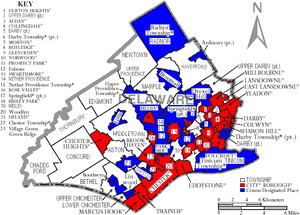 Map of Delaware County, Pennsylvania with Municipal Labels showing Cities and Boroughs (red), Townships (white), and Census-designated places (blue).
There are 49 municipalities in Delaware County. Under Pennsylvania law, there are four types of incorporated municipalities: cities, boroughs, townships, and, in at most two cases, towns. The following cities, boroughs and townships are located in Delaware County:
Cities
Boroughs
Townships
- Aston Township
- Bethel Township
- Chadds Ford Township
- Chester Township
- Concord Township
- Darby Township
- Edgmont Township
- Haverford Township
- Lower Chichester Township
- Marple Township
- Middletown Township
- Nether Providence Township
- Newtown Township
- Radnor Township
- Ridley Township
- Springfield Township
- Thornbury Township
- Tinicum Township
- Upper Chichester Township
- Upper Darby Township
- Upper Providence Township
Census-Designated Places
Census-designated places are geographical areas designated by the U.S. Census Bureau for the purposes of compiling demographic data. They are not actual jurisdictions under Pennsylvania law. Other unincorporated communities, such as villages, may be listed here as well.
See also: Category:Unincorporated communities in PennsylvaniaEducation
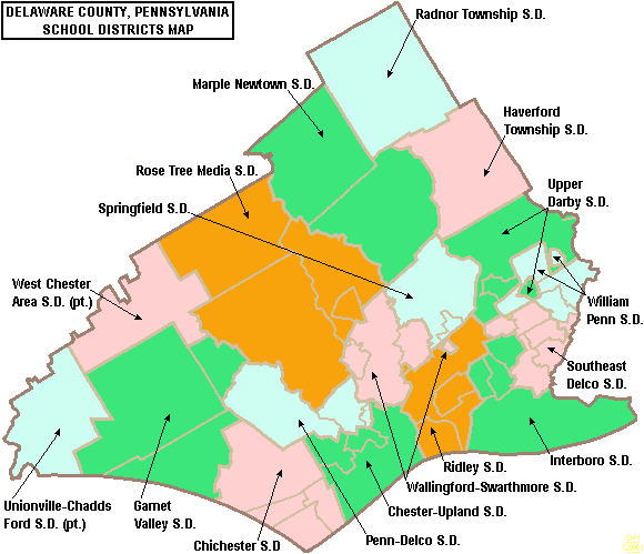
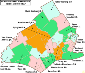 Map of Delaware County, Pennsylvania School Districts
Public school districts
- Chester Upland School District
- Chichester School District
- Garnet Valley School District
- Haverford Township School District
- Interboro School District
- Marple Newtown School District
- Penn-Delco School District
- Radnor Township School District
- Ridley School District
- Rose Tree Media School District
- Southeast Delco School District
- Springfield School District
- Upper Darby School District
- Unionville-Chadds Ford School District
- Wallingford-Swarthmore School District
- West Chester Area School District
- William Penn School District
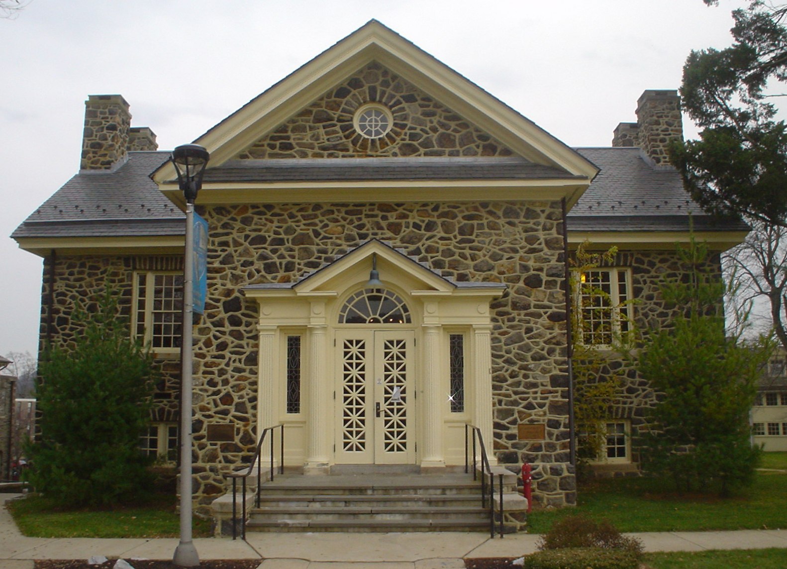
Colleges and universities
 Library at Cheyney University
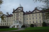 Old Main at Widener University
- Cabrini College
- Cheyney University
- Eastern University
- Delaware County Community College
- Haverford College
- Neumann University
- Pennsylvania Institute of Technology
- Penn State Brandywine
- Rosemont College
- Swarthmore College
- Villanova University
- Widener University
- Williamson Free School of Mechanical Trades
Adult education
- Haverford Adult School
- Main Line School Night
- Upper Darby Adult Evening Program
- Senior Community Services Lifelong Learning
Public libraries
- Aston Free Library
- Collingdale Public Library
- J. Lewis Crozer Library (Chester)
- Darby Free Library
- Folcroft Public Library
- Helen Kate Furness Library (Wallingford)
- Glenolden Library
- Haverford Township Free Library
- Rachel Kohl Community Library (Glen Mills)
- Lansdowne Public Library
- Marple Public Library
- Mary M. Campbell Library (Marcus Hook)
- Media-Upper Providence Free Library
- Middletown Free Library
- Newtown Square Public Library
- Norwood Public Library
- Prospect Park Public Library
- Memorial Library of Radnor Township
- Ridley Park Public Library
- Ridley Township Public Library
- Sharon Hill Public Library
- Springfield Township Library
- Swarthmore Public Library
- Tinicum Memorial Public Library
- Upper Darby & Sellers Memorial Library (main)
- Upper Darby Library-Municipal Branch
- Upper Darby Library-Primos Branch
- Yeadon Public Library
- Delaware County Francis J. Catania Law Library
- Delaware County Library System (government agency)
Recreation
 Dam on Ridley Creek in Ridley Creek State Park
There is one Pennsylvania state park in Delaware County.
Edgmont Country Club is privately owned and just west of the North entrance of the Ridley Creek State Park on West Chester Pike (State Route 3.
Sports
The city of Chester is home to the Philadelphia Union of Major League Soccer. The team plays at PPL Park, a venue located at the base of the Commodore Barry Bridge.
Delaware County is the traditional home of women's professional soccer in the Philadelphia area. The former Philadelphia Charge of the defunct Women's United Soccer Association played at Villanova Stadium, which is located on the campus of Villanova University. The Philadelphia Independence of Women's Professional Soccer succeeds the Charge and will begin playing at PPL Park in 2011.
Delaware County is also the home of a rugby league team called the Aston Bulls, a member of the American National Rugby League.
Climate and weather
Media, Pennsylvania Climate chart (explanation) J F M A M J J A S O N D 2.939282.843303.652373.363464.274563.28365488703.385684.277612.865503.254413.14433Average max. and min. temperatures in °F Precipitation totals in inches Source: The Weather Channel[7] Metric conversion J F M A M J J A S O N D 744-2706-19211383178106231381281810231218429201072516721810821257971Average max. and min. temperatures in °C Precipitation totals in mm See also
- List of municipal authorities in Delaware County, Pennsylvania
- National Register of Historic Places listings in Delaware County, Pennsylvania
References
- ^ "Find a County". National Association of Counties. http://www.naco.org/Counties/Pages/FindACounty.aspx. Retrieved 2011-06-07.
- ^ Chester - Ridley - Crum Watersheds Association
- ^ "Chapter 7 7-11." Comprehensive Zoning Plan. Thornbury Township. Retrieved on September 6, 2011. "The three major institutions found in the Township, the Delaware County Prison, Glen Mills Schools and Cheyney University[...]"
- ^ a b "Delaware County Prison." Delaware County, Pennsylvania. Retrieved on September 6, 2011. "George W. Hill Correctional Facility (Delaware County Prison), which is located on 500 Cheyney Road in Thornbury Township[...]"
- ^ http://factfinder2.census.gov
- ^ http://mapserver.lib.virginia.edu/
- ^ "Monthly Averages for Media, Pennsylvania". The Weather Channel. http://www.weather.com/weather/wxclimatology/monthly/graph/USPA1023. Retrieved 2011-02-15.
External links
- Delaware County official website
- History of Townships in Delaware County, PA
- Ashmead's History of Delaware County, 1884.
- Delaware County Library System
- Delaware County Home Rule Charter
- Delaware County Calendar of Events
- Delaware County History and Genealogy Archive
 Commonwealth of Pennsylvania
Topics - Cities
- Politics
- Government
- Delegations
- History
- Geography
- Geology
- Pennsylvanians
- State parks
- Symbols
- Visitor attractions
Metro areas Cities Largest
municipalities- Baldwin
- Berwick
- Bethel Park
- Brentwood
- Carlisle
- Chambersburg
- Columbia
- Darby
- Dunmore
- Elizabethtown
- Emmaus
- Ephrata
- Franklin Park
- Hanover
- Indiana
- Kingston
- Lansdale
- Lansdowne
- Monroeville
- Munhall
- Murrysville
- Norristown
- Penn Hills
- Phoenixville
- Plum
- Pottstown
- State College
- West Chester
- West Mifflin
- Whitehall
- Wilkinsburg
- Wyomissing
- Yeadon
Regions - Allegheny Mountains
- Allegheny National Forest
- Allegheny Plateau
- Atlantic Coastal Plain
- Blue Ridge
- Coal Region
- Cumberland Valley
- Delaware Valley
- Dutch Country
- Endless Mountains
- Happy Valley
- Laurel Highlands
- Lehigh Valley
- Main Line
- Northeast
- Northern Tier
- Northwestern
- Oil Region
- Pennsylvania Highlands
- Piedmont
- The Poconos
- Ridge and Valley
- South Central
- Susquehanna Valley
- Western
- Wyoming Valley
Counties - Adams
- Allegheny
- Armstrong
- Beaver
- Bedford
- Berks
- Blair
- Bradford
- Bucks
- Butler
- Cambria
- Cameron
- Carbon
- Centre
- Chester
- Clarion
- Clearfield
- Clinton
- Columbia
- Crawford
- Cumberland
- Dauphin
- Delaware
- Elk
- Erie
- Fayette
- Forest
- Franklin
- Fulton
- Greene
- Huntingdon
- Indiana
- Jefferson
- Juniata
- Lackawanna
- Lancaster
- Lawrence
- Lebanon
- Lehigh
- Luzerne
- Lycoming
- McKean
- Mercer
- Mifflin
- Monroe
- Montgomery
- Montour
- Northampton
- Northumberland
- Perry
- Philadelphia
- Pike
- Potter
- Schuylkill
- Snyder
- Somerset
- Sullivan
- Susquehanna
- Tioga
- Union
- Venango
- Warren
- Washington
- Wayne
- Westmoreland
- Wyoming
- York
Delaware Valley Counties Atlantic • Berks • Bucks • Burlington • Camden • Cape May • Cecil • Chester • Cumberland • Delaware • Gloucester • Mercer • Montgomery • New Castle • Ocean • Philadelphia • Salem
Major cities Cities and towns
50k-99kBensalem • Camden • Cherry Hill • Gloucester Township • Levittown • Reading • Trenton • Vineland • WilmingtonCities and towns
25k-50kCategories:- Pennsylvania counties
- Delaware County, Pennsylvania
- 1789 establishments in the United States
- Populated places established in 1789


Wikimedia Foundation. 2010.