- Nether Providence Township, Delaware County, Pennsylvania
-
For other townships in Pennsylvania with similar names, see Providence Township, Pennsylvania.
Nether Providence Township Township Country United States State Pennsylvania County Delaware Elevation 105 ft (32 m) Coordinates 39°53′00″N 75°21′59″W / 39.8833333°N 75.36639°W Area 4.7 sq mi (12.2 km2) - land 4.7 sq mi (12 km2) - water 0.0 sq mi (0 km2), 0% Population 13,456 (2000) Density 2,857.7 / sq mi (1,103.4 / km2) Timezone EST (UTC-5) - summer (DST) EDT (UTC-4) Area code 610 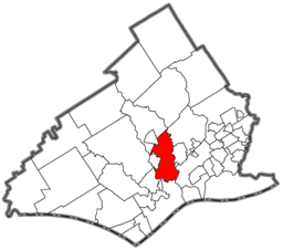 Location of Nether Providence Township in Delaware County
 Location of Nether Providence Township in Pennsylvania
 Location of Pennsylvania in the United States
Website: http://www.netherprovidence.org Nether Providence Township is a first class township in Delaware County, Pennsylvania, United States. Many residents refer to the township by the name of its largest community, Wallingford, because the Wallingford postal code is used for most of the township. The population was 13,456 at the 2000 census.
Contents
Geography
Nether Providence Township is located at 39°53′40″N 75°22′25″W / 39.89444°N 75.37361°W (39.894612, -75.373705)[1].
According to the United States Census Bureau, the township has a total area of 4.7 square miles (12.2 km²), of which, 4.7 square miles (12.2 km²) of it is land and 0.21% is water.
Major boundaries include Crum Creek and Ridley Creek.
History
The first recorded inhabitants of Nether Providence Township were Native Americans of the Lenape tribe, who lived in the area for about five hundred years, but by 1740 few remained. On August 14, 1682, two months before William Penn's landing in Chester, John Sharpless came to the area. Penn had given Sharpless a thousand-acre (4-km²) tract and he settled near Ridley Creek.
By the time Penn arrived, there were several small settlements in the area, which became known as Providence Township. Providence Township comprised today's Nether Providence, Rose Valley, Media, and Upper Providence. On October 17, 1683, the residents of Providence Township petitioned the Court of Chester County, of which they were then a part, to establish a road from Providence to Chester. The court approved the creation of Providence Great Road (now Route 252).
Nether Providence went through four distinct phases from farming, to manufacturing, to resort, and finally, to residential community. By 1729, the area was producing sufficient crops to allow exporting to New England, Canada, and Europe.
Fourteen major mill complexes were built in Nether Providence, six on Crum Creek and eight on Ridley Creek. The first, a cotton mill along Crum Creek, was started by Thomas Allen in 1763. He named his mill for his hometown, Wallingford, England. The mills played an essential part in the growth of Nether Providence. Millhands lived in the self-contained villages that grew up around the mills.
After the Civil War, wealthy Philadelphians built summer residences and vacation resorts in the area.
The first railway was the Leiper Railroad, a horse-drawn quarry rail line, constructed in 1809–1810 and used to haul cut stone until about 1828. That early rail line was superseded by the Leiper Canal.[2] The first steam-locomotive train came through in 1854; it used a single track with a sidetrack at Wallingford. The first post office in Nether Providence was established at Hinkson's Corner in 1873. Trolleys also contributed to the area's development. The first independent trolley was the Chester and Media Electric Railway, chartered in 1892. The last trolley through the township closed in 1938. The Nether Providence Police Department was established in 1935 and automobile parking was regulated in 1947 and speed in 1949.
Demographics
Historical populations Census Pop. %± 1930 2,833 — 1940 3,793 33.9% 1950 6,173 62.7% 1960 10,380 68.2% 1970 13,589 30.9% 1980 12,730 −6.3% 1990 13,229 3.9% 2000 13,456 1.7% www.dvrpc.org/data/databull/rdb/db82/appedixa.xls.</ref> As of the census[3] of 2000, there were 13,456 people, 5,007 households, and 3,755 families residing in the township. The population density was 2,857.7 people per square mile (1,103.1/km²). There were 5,125 housing units at an average density of 1,088.4/sq mi (420.1/km²). The racial makeup of the township was 90.08% White, 6.12% African American, 0.10% Native American, 2.34% Asian, 0.04% Pacific Islander, 0.27% from other races, and 1.06% from two or more races. 1.13% of the population were Hispanic or Latino of any race.
There were 5,007 households out of which 34.5% had children under the age of 18 living with them, 62.3% were married couples living together, 9.8% had a female householder with no husband present, and 25.0% were non-families. 21.7% of all households were made up of individuals and 10.4% had someone living alone who was 65 years of age or older. The average household size was 2.62 and the average family size was 3.08.
In the township the population was spread out with 25.4% under the age of 18, 4.9% from 18 to 24, 25.8% from 25 to 44, 26.3% from 45 to 64, and 17.5% who were 65 years of age or older. The median age was 42 years. For every 100 females there were 90.8 males. For every 100 females age 18 and over, there were 85.8 males.
The median income for a household in the township was $68,059, and the median income for a family was $78,491. Males had a median income of $72,370 versus $49,048 for females. The per capita income for the township was $32,946. About 3.1% of families and 3.4% of the population were below the poverty line, including 5.2% of those under age 18 and 2.1% of those age 65 or over.
Education System
The first area school started in 1810. Nether Providence School District was formed in 1856; it merged with the Swarthmore School District in 1984, creating the Wallingford Swarthmore School District. The Helen Kate Furness Library was founded in 1902.
School-age children within the public education system attend the Kids' Place for kindergarten, Nether Providence Elementary School (NPE), Swarthmore Rutledge Elementary School (SRS), or Wallingford Elementary School (WES) for grades 1 through 5. Strath Haven Middle School (SHMS) includes grades 6th through 8th. Formerly housed in the old Nether Providence High School (NPSH), SHMS was renovated during 2008 through 2010 to add a new wing facing Copples Lane and to demolish the 1927 NPHS building. Architectural elements from the NPSH facade will be incorporated into a stone wall. Strath Haven High School (SHHS), located directly across Providence Road from the Middle School, educates students in grades 9th through 12th. Students from the neighboring boroughs of Swarthmore, Rose Valley, and Rutledge attend the district schools.
Government and Communities
Major communities in Nether Providence are Garden City, South Media and Wallingford. The South Media Fire Company was organized in 1922 and Garden City Fire Company in 1944. Ambulance service is provided by the Media Fire Co and Parkside Fire Company. The Moylan community near Rose Valley is also within Nether Providence Township, as are the Bowling Green, Park Ridge, Pine Ridge, and Wesley Manor communities located north of Baltimore Pike.
Garden City
Within Garden City lies the Waterville, Lapidea, and Crum Creek Manor sections. The Crum Creek Manor section is known for its circular layout. Putnam Village is usually considered within the Garden City community. Garden City has been referred to as a "distinctive lower middle class neighborhood" community.[4] Crum Creek Manor is known as a working class blue collar area of Garden City, made up of row houses and ranch houses built for returning World War II veterans in the 1940s.
The small community of Garden City is located in the southernmost part of Nether Providence. It borders Chester city to the south, where it is cut off by Ridley Creek. It lies southwest of the intersection where Route 252 (South Providence Road) and Route 320 (Chester Road) meet, and it is cut off by Route 252 (or sometimes Harvey Road) at the east. The north and west borders of the community are disputed. Moore Road is loosely used as a northern border for Garden City. West Brookhaven Road (or in some cases Putnam Village) is often used as the western border of Garden City.
Garden City is home to the Garden City Fire Co., the Garden City Chapel, and the Creekside Swim Club. Nether Providence Elementary School is the elementary school for the Garden City Community and is often considered within Garden City.
South Media
South Media is an unincorporated community southeast of Media, Pennsylvania. Though most closely associated with the Media Borough, the neighborhood is municipally part of Nether Providence Township. The neighborhood lies within the Media, PA 19063 postal code. It lies north of Wallingford and Rose Valley and west of N. Providence Road. East Baltimore Pike is usually considered the northern border. It is a diverse working class to lower middle class community, and it is known as having a large African American population. It is home to the South Media Fire Co., the oldest fire company in Nether Providence.
Moylan
Moylan is an unincorporated community located partially in Nether Providence township and partially in Rose Valley Borough. It is home to the Moylan-Rose Valley commuter train station on the Media/Elwyn Line, which is located on Manchester Avenue. To the north Moylan borders the township of Upper Providence and the unincorporated community of South Media. The southern boundary is sometimes disputed, but it is approximately Rose Valley Road.
References
- ^ "US Gazetteer files: 2010, 2000, and 1990". United States Census Bureau. 2011-02-12. http://www.census.gov/geo/www/gazetteer/gazette.html. Retrieved 2011-04-23.
- ^ Morlok, Edward K. (February 12, 2004). "Transportation Data". http://www.seas.upenn.edu/~morlok/morlokpage/transp_data.html. Retrieved May 7, 2011.
- ^ "American FactFinder". United States Census Bureau. http://factfinder.census.gov. Retrieved 2008-01-31.
- ^ Nether Providence / Wallingford PA Named to Money Magazine's Top 10 Places to Live, But Is the Ranking Truly Deserved?
External links
Categories:- Populated places established in 1682
- Townships in Delaware County, Pennsylvania


Wikimedia Foundation. 2010.