- Glenolden, Pennsylvania
Geobox Borough
name = Borough of Glenolden
native_name =
other_name =
other_name1 =
category = Borough
image_size =
image_caption =
flag_size =
symbol =
symbol_size =
nickname =
motto =
country = United States
state = Pennsylvania
region = Delaware
region_type = County
district =
area_imperial = 1.0
area_land_imperial = 1.0
area_water_imperial = 0.0
area_water_percentage = auto
area_percentage_round = 2
area_round = 1
location =
lat_d = 39
lat_m = 53
lat_s = 56
lat_NS = N
long_d = 75
long_m = 17
long_s = 33
long_EW = W
elevation_imperial = 92
elevation_round = 1
population_as_of = 2000
population = 7476
population_density_imperial = 7673.6
population_density_round = 1
established_type =
established =
mayor =
timezone = EST
utc_offset = -5
timezone_DST = EDT
utc_offset_DST = -4
postal_code_type =ZIP Code
postal_code = 19036
area_code = 610
area_code_type =
code2_type =
code2 =
free_type =
free =
free1_type =
free1 =
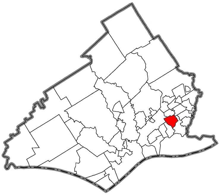
map_caption = Location of Glenolden in Delaware County
map1 = Pennsylvania Locator Map.png
map1_locator = Pennsylvania
map2 = Map of USA PA.svg
map2_caption = Location of Pennsylvania in the United States
website = http://www.glenoldenborough.comGlenolden is a borough in Delaware County,
Pennsylvania ,United States . The population was 7,476 at the2000 census.Geography
Glenolden is located at coor dms|39|53|56|N|75|17|33|W|city (39.898812, -75.292456)GR|1.
According to the
United States Census Bureau , the borough has a total area of 1.0square mile s (2.5km² ), all of it land.Demographics
As of the
census GR|2 of 2000, there were 7,476 people, 3,058 households, and 1,871 families residing in the borough. Thepopulation density was 7,673.6 people per square mile (2,975.8/km²). There were 3,198 housing units at an average density of 3,282.5/sq mi (1,272.9/km²). The racial makeup of the borough was 92.28% White, 4.03% African American, 0.04% Native American, 2.38% Asian, 0.01% Pacific Islander, 0.21% from other races, and 1.04% from two or more races. Hispanic or Latino of any race were 1.18% of the population.There were 3,058 households out of which 28.3% had children under the age of 18 living with them, 44.1% were married couples living together, 12.9% had a female householder with no husband present, and 38.8% were non-families. 33.1% of all households were made up of individuals and 11.5% had someone living alone who was 65 years of age or older. The average household size was 2.43 and the average family size was 3.17.
In the borough the population was spread out with 23.8% under the age of 18, 9.1% from 18 to 24, 31.8% from 25 to 44, 20.6% from 45 to 64, and 14.8% who were 65 years of age or older. The median age was 36 years. For every 100 females there were 90.4 males. For every 100 females age 18 and over, there were 88.3 males.
The median income for a household in the borough was $41,189, and the median income for a family was $48,648. Males had a median income of $39,401 versus $29,083 for females. The
per capita income for the borough was $20,173. About 3.4% of families and 5.0% of the population were below thepoverty line , including 4.6% of those under age 18 and 5.5% of those age 65 or over.Education
Students living in Glenolden attend classes in the
Interboro School District , which consists of Glenolden and its neighboring towns Prospect Park, Norwood, and Tinicum Township. Glenolden School is the home of the borough's public elementary and middle schools. Public School students attendInterboro High School in Prospect Park.The school district's administration offices are located in Prospect Park.
Notable People
*Theresa Grentz, former Illinois women's basketball head coach and
Women's Basketball Hall of Fame inductee, was born in Glenolden. [http://fightingillini.cstv.com/sports/w-baskbl/mtt/grentz_theresa00.html]
*Chris Larsen, Olympic field hockey team member grew up in Glenolden
*Vince Papale , former member of thePhiladelphia Eagles and subject of the movie "Invincible", was born in Glenolden.
*Stephenie LaGrossa, and contestant, was born in Glenolden.References
External links
* [http://www.glenoldenborough.com/ Borough of Glenolden]
* [http://www.delawarecountypa.com/glenolden.html Borough of Glenolden at DelawareCountyPA.com]
Wikimedia Foundation. 2010.