- Colwyn, Pennsylvania
-
Borough of Colwyn Borough Country United States State Pennsylvania County Delaware Elevation 59 ft (18 m) Coordinates 39°54′47″N 75°15′12″W / 39.91306°N 75.25333°W Area 0.3 sq mi (0.8 km2) - land 0.3 sq mi (1 km2) - water 0.0 sq mi (0 km2), 0% Population 2,453 (2000) Density 9,600.3 / sq mi (3,706.7 / km2) Timezone EST (UTC-5) - summer (DST) EDT (UTC-4) Area code 610 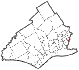 Location of Colwyn in Delaware County
 Location of Colwyn in Pennsylvania
 Location of Pennsylvania in the United States
Website: http://www.colwynboro.com Colwyn is a borough in Delaware County, Pennsylvania, United States. The population was 2,453 at the 2000 census.
Contents
Geography
Colwyn is located at 39°54′47″N 75°15′12″W / 39.91306°N 75.25333°W (39.913062, -75.253409)[1], where Darby Creek and Cobb's Creek intersect.
According to the United States Census Bureau, the borough has a total area of 0.3 square miles (0.78 km2), all of it land.
Demographics
Historical populations Census Pop. %± 1930 2,064 — 1940 2,202 6.7% 1950 2,143 −2.7% 1960 3,074 43.4% 1970 3,169 3.1% 1980 2,851 −10.0% 1990 2,613 −8.3% 2000 2,453 −6.1% www.dvrpc.org/data/databull/rdb/db82/appedixa.xls As of the census[2] of 2000, there were 2,453 people, 850 households, and 602 families residing in the borough. The population density was 9,600.3 people per square mile (3,642.7/km²). There were 954 housing units at an average density of 3,733.7 per square mile (1,416.7/km²). The racial makeup of the borough was 42.64% White, 52.14% African American, 0.12% Native American, 0.98% Asian, 0.69% from other races, and 3.42% from two or more races. Hispanic or Latino of any race were 1.63% of the population.
There were 850 households out of which 40.2% had children under the age of 18 living with them, 37.8% were married couples living together, 26.7% had a female householder with no husband present, and 29.1% were non-families. 24.6% of all households were made up of individuals and 7.9% had someone living alone who was 65 years of age or older. The average household size was 2.89 and the average family size was 3.43.
In the borough the population was spread out with 33.2% under the age of 18, 9.3% from 18 to 24, 30.9% from 25 to 44, 16.8% from 45 to 64, and 9.8% who were 65 years of age or older. The median age was 31 years. For every 100 females there were 90.0 males. For every 100 females age 18 and over, there were 82.5 males.
The median income for a household in the borough was $33,150, and the median income for a family was $39,861. Males had a median income of $33,125 versus $25,880 for females. The per capita income for the borough was $13,883. About 15.7% of families and 16.6% of the population were below the poverty line, including 23.1% of those under age 18 and 13.2% of those age 65 or over.
Education
William Penn School District serves Colwyn.
- Colwyn Elementary School (K-6)
- Penn Wood Middle School (7-8) (Darby)
- Penn Wood High School, Cypress Street Campus (9-10) (Yeadon)
- Penn Wood High School, Green Ave Campus (11-12) (Lansdowne)
References
- ^ "US Gazetteer files: 2010, 2000, and 1990". United States Census Bureau. 2011-02-12. http://www.census.gov/geo/www/gazetteer/gazette.html. Retrieved 2011-04-23.
- ^ "American FactFinder". United States Census Bureau. http://factfinder.census.gov. Retrieved 2008-01-31.
External links
Categories:- Populated places in Pennsylvania with African American majority populations
- Populated places established in 1698
- Boroughs in Delaware County, Pennsylvania


Wikimedia Foundation. 2010.