- Fulton County, Pennsylvania
-
Fulton County, Pennsylvania 
Location in the state of Pennsylvania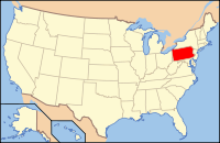
Pennsylvania's location in the U.S.Founded April 19, 1851 Seat McConnellsburg Largest city McConnellsburg Area
- Total
- Land
- Water
438 sq mi (1,134 km²)
438 sq mi (1,134 km²)
0 sq mi (0 km²), 0.11%Population
- (2010)
- Density
14,845
34/sq mi (13/km²)Website fultoncntypa.org/ Fulton County is a county located in the U.S. state of Pennsylvania. As of 2010, the population was 14,845.
Fulton County was created on April 19, 1850[1], from part of Bedford County and named for inventor Robert Fulton.
Its county seat is McConnellsburg[2].
Contents
Geography
According to the U.S. Census Bureau, the county has a total area of 438 square miles (1,134.4 km2), of which 0.11% is water. It is in the watershed of the Chesapeake Bay and, although most of the county is drained by the Potomac River, some northern and northeastern areas are drained by the Juniata River into the Susquehanna River.
Adjacent counties
- Huntingdon County (north)
- Franklin County (east)
- Washington County, Maryland (south)
- Allegany County, Maryland (southwest)
- Bedford County (west)
Geology
Fulton County is situated within the Ridge and Valley physiographic province, which is characterized by folded and faulted sedimentary rocks of early to middle Paleozoic age. (PA Geological Survey Map 13)
The stratigraphic record of sedimentary rocks within the county spans from the Cambrian Shadygrove Formation outcropping just south of McConnelsburg to the Pennsylvanian Allegheny Group at the northernmost tip of the county. No igneous or metamorphic rocks of any kind exist within Fulton county.
Mountain ridges within Fulton County include Rays Hill (along the eastern border with Bedford County), Town Hill, Sideling Hill, Scrub Ridge, and Meadow Grounds Mountain, and all these are held up by the Mississippian Pocono Formation, made of quartz sandstone and conglomerate. Rays Hill and Town Hill form a syncline, as do Scrub Ridge and Meadow Grounds Mountain, and Sideling Hill itself is a syncline. Dickeys Mountain and Tuscarora Mountain (along the western border with Franklin County) also form a syncline, but these ridges are held up by the Tuscarora Formation. Broad Top, located in the northeast corner of the county, is a plateau of relatively flat-lying rocks that are stratigraphically higher, and thus younger (Mississippian and Pennsylvanian), than most of the other rocks within the county. Broad Top extends into Huntingdon County to the north and Bedford County to the west.
All of Fulton County lies far to the south of the glacial boundary, and thus it was never glaciated (PA Geological Survey Map 59). However, during the Pleistocene epoch, or "Ice Age," periglacial (meaning "around glacier" or simply "cold") processes dominated. Most of the county was most likely a tundra during the Pleistocene.
The Broad Top Coal Field is located in Wells Township in the northwestern corner of the county (PA Geologic Survey Map 11). The field contains bituminous coal. There are a few abandoned mines in the area, although acid mine drainage is not as much of an environmental problem in Fulton County as it is in adjacent Bedford and Huntingdon Counties.
Interesting geologic features within Fulton County include some of the following:
- The Meadow Grounds syncline west of McConnellsburg.
- A transpression structure is located on the east side of the Meadow Grounds syncline. This structure consists of a complex set of up-thrust fault blocks of Silurian and Devonian rocks bounded on all sides by north-trending faults.
Demographics
Historical populations Census Pop. %± 1850 7,567 — 1860 9,131 20.7% 1870 9,360 2.5% 1880 10,149 8.4% 1890 10,137 −0.1% 1900 9,924 −2.1% 1910 9,703 −2.2% 1920 9,617 −0.9% 1930 9,231 −4.0% 1940 10,673 15.6% 1950 10,387 −2.7% 1960 10,597 2.0% 1970 10,776 1.7% 1980 12,842 19.2% 1990 13,837 7.7% 2000 14,261 3.1% 2010 14,845 4.1% [3][4] As of the census[5] of 2000, there were 14,261 people, 5,660 households, and 4,097 families residing in the county. The population density was 33 people per square mile (13/km²). There were 6,790 housing units at an average density of 16 per square mile (6/km²). The racial makeup of the county was 98.25% White, 0.66% Black or African American, 0.20% Native American, 0.11% Asian, 0.01% Pacific Islander, 0.04% from other races, and 0.72% from two or more races. 0.36% of the population were Hispanic or Latino of any race. 40.8% were of German, 20.4% American, 8.3% Irish and 6.9% English ancestry according to Census 2000.
There were 5,660 households out of which 31.70% had children under the age of 18 living with them, 59.50% were married couples living together, 8.20% had a female householder with no husband present, and 27.60% were non-families. 24.00% of all households were made up of individuals and 10.60% had someone living alone who was 65 years of age or older. The average household size was 2.50 and the average family size was 2.95.
In the county, the population was spread out with 24.60% under the age of 18, 7.60% from 18 to 24, 28.40% from 25 to 44, 25.00% from 45 to 64, and 14.50% who were 65 years of age or older. The median age was 38 years. For every 100 females there were 100.10 males. For every 100 females age 18 and over, there were 98.60 males.
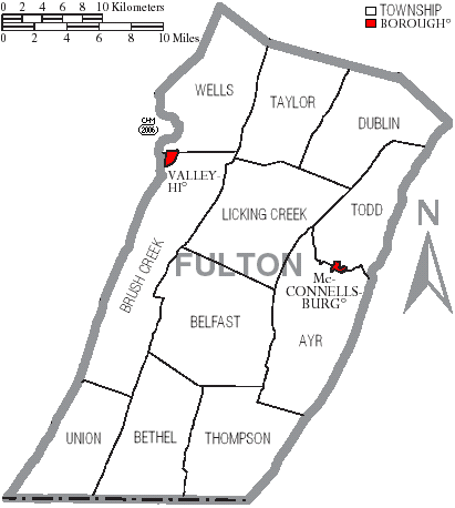
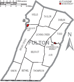 Map of Fulton County, Pennsylvania with Municipal Labels showing Boroughs (red) and Townships (white).
Dialect, Accent, and Language
Almost everyone that lives in Fulton County speaks English as their first language. The dominant form of speech in Fulton County is the Central Pennsylvania accent.
Municipalities
Under Pennsylvania law, there are four types of incorporated municipalities: cities, boroughs, townships, and, in at most two cases, towns. The following boroughs and townships are located in Fulton County:
Boroughs
Townships
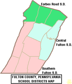 Map of Fulton County, Pennsylvania Public School Districts
Politics
Fulton County is possibly the most Republican county in the American Northeast. In the 2004 U.S. Presidential election, George W. Bush carried the county by a massive 52.6% margin over John Kerry, making it Bush's strongest county in the slightly Democratic state, which Kerry won by a 2.5% margin over Bush. Furthermore, in 2008, John McCain carried Fulton by a 48.6% margin over Barack Obama, McCain's best showing in the Keystone State, which Obama won by a 10.3% margin over McCain.[6] The county has voted for the Republican in every presidential election since 1964. In 2006, Rick Santorum and Lynn Swann received more than 60% of the Fulton County vote despite their defeats statewide.
Education
Public School Districts
- Central Fulton School District
- Forbes Road School District
- Southern Fulton School District
Highway Infrastructure
 Pennsylvania Route 16- known as the Buchanan trail, meets its western terminus in McConnellsburg; serves as a major two-lane through route across South-Central Pennsylvania, as it travels toward Waynesboro in Franklin County
 Pennsylvania Route 26- this long Central Pennsylvania main street sees is final two miles run through the rural corner of Union Township, as it departs a long Bedford County stretch, before reaching the Maryland border
 U.S. Route 30- a winding portion of the famous Lincoln Highway, the highway travels away from I-76, which it parallels through most of the state’s central mountains, to run across the county between the truck stop-lined Breezewood (East Providence Township) in Bedford County toward Franklin County’s Chambersburg; although two-lane for its entire route, there is a limited access segment as the highway makes a short freeway bypass around McConnellsburg
 Interstate 70- just prior to entering the county, the route breaks from its consignment with I-76, and it travels due south through a rural swath of the western portion of the county, as it connects with I-68 just across the Maryland line, along its way to Baltimore
 Interstate 76- a portion of the Pennsylvania Turnpike, this toll interstate has one exit as it crosses the northern portion of the county; the Sideling Hill travel center is located Taylor Township
 Pennsylvania Route 475- a relatively short and highly rural range highway, it meets its southern terminus in Dublin Township, as it travels north through sparely populated portions of Huntingdon County
 Pennsylvania Route 484- this short highway runs entirely within the county, serving the purpose of connecting I-70 with PA 26, as it runs across Union and Bethel Townships
 U.S. Route 522- this routes enters from Maryland to the south as part of a brief consignment with I-70, which it departs three miles into the county; the road serves as the county’s major artery, as it runs through McConnellsburg, past the county’s only shopping center and through its only two stoplights, on its way to a junction with the Pennsylvania Turnpike in Dublin Township and toward Huntingdon County
 Pennsylvania Route 643- just seven miles in length, this very short access route connects I-70 with the hills of Bethel and Brush Creek Townships
 Pennsylvania Route 655- this highway serves as a long, rural ridge route through the state’s central mountains; its southern terminus is with the Maryland boundary in Thompson Township and it exits the county via Taylor Township toward Huntingdon County in the north
 Pennsylvania Route 731- one of the shortest numbered routes in Pennsylvania, this five mile road connects I-70 with Route 484, as it runs entirely through Union Township
 Pennsylvania Route 913- a very rural access route through Bedford and Huntingdon Counties, this road’s final miles are in Wells and Taylor Township
 Pennsylvania Route 915- a mountain ridge cut-off road, this highway travels from rural Bedford County along a valley setting toward its terminus with I-70 in Brush Creek Township
 Pennsylvania Route 928- a rural bi-state connector, this road travels from Ayr Township to the Maryland border via Thompson Township
See also
- List of municipal authorities in Fulton County, Pennsylvania
- National Register of Historic Places listings in Fulton County, Pennsylvania
Municipalities and communities of Fulton County, Pennsylvania Boroughs 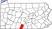
Townships Unincorporated
communitiesCoordinates: 39°55′N 78°07′W / 39.92°N 78.11°W
References
- ^ Fulton County, Pennsylvania Chamber of Commerce and Tourism Website[1]
- ^ "Find a County". National Association of Counties. http://www.naco.org/Counties/Pages/FindACounty.aspx. Retrieved 2011-06-07.
- ^ http://factfinder2.census.gov
- ^ http://mapserver.lib.virginia.edu/
- ^ "American FactFinder". United States Census Bureau. http://factfinder.census.gov. Retrieved 2008-01-31.
- ^ U.S. Election Atlas
Categories:- Pennsylvania counties
- Fulton County, Pennsylvania
- 1851 establishments in the United States


Wikimedia Foundation. 2010.