- U.S. Route 522
Infobox U.S. Route
article_route=522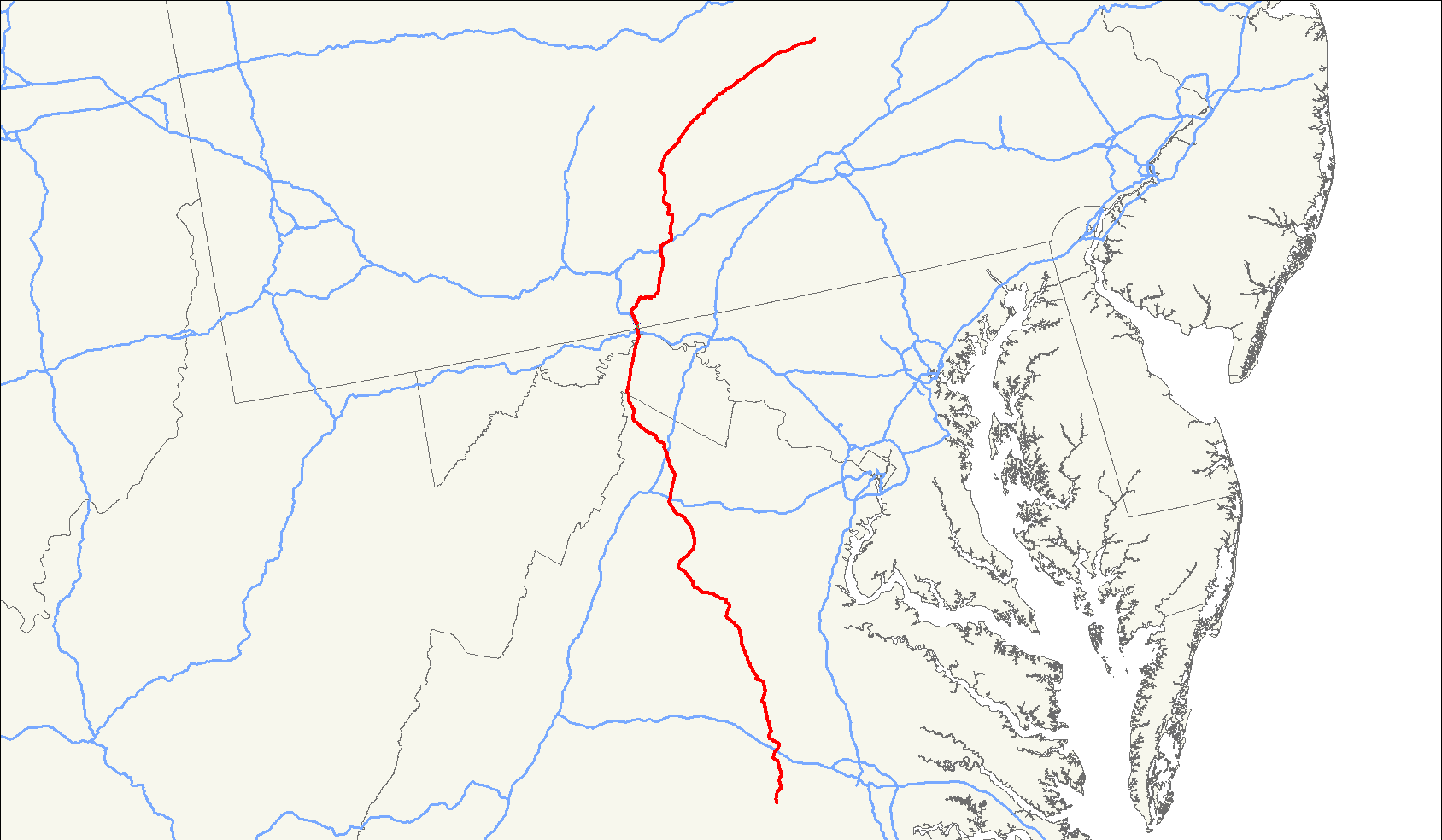
length_mi=308
length_ref=Droz, Robert V. [http://www.us-highways.com/usbt.htm U.S. Highways : From US 1 to (US 830)] . URL accessed 09:24, 24 October 2006 (UTC).]
length_round=0
yrcom=1943
direction_a=South
from=Jct|state=VA|US|60 inPowhatan County, VA
junction=Jct|state=VA|I|64 inGoochland County, VA
Jct|state=VA|US|15|US|29 inCulpeper, VA
jct|state=VA|I|81|US|11|US|17|US|50 inWinchester, VA
Jct|state=MD|I|68|I|70 inHancock, MD
Jct|state=PA|I|76|PATP inFort Littleton, PA
Jct|state=PA|US|22|US|322 inLewistown, PA
direction_b=North
to=Jct|state=PA|US|11|US|15 inSelinsgrove, PA
spur_of=22U.S. Route 522 is a 308 mile (496 km)
spur route ofU.S. Route 22 in the easternUnited States . The southern terminus of the route is atU.S. Route 60 in Powhatan, Virginia. The northern terminus is atU.S. Route 11 andU.S. Route 15 inSelinsgrove, Pennsylvania . US 522 passes through the states ofVirginia ,West Virginia ,Maryland , andPennsylvania .Route description
Virginia
U.S. 522 begins at U.S. 60 north of Powhatan, then passes through Goochland, Gum Spring, Cuckoo, Mineral, Culpeper, Sperryville, Washington, Front Royal, and Winchester before passing into West Virginia en route to Maryland and Pennsylvania.
West Virginia
U.S. 522 travels through Morgan County in West Virginia for about 22 miles.
The West Virginia Division of Highways (WVDOH) has now selected a Preferred Alternative for the US 522 project. In general terms, the route runs parallel to -- and east of -- the existing Route 522 for approximately 22 miles from the Maryland state line to the Virginia state line. It will be, for most of its length, within 50 feet of the current 522. In the vicinity of the proposed Ridge Historic District, however, the alignment extends farther away to avoid impacting either that site or the adjacent fish hatchery. Also, immediately south of the Town of Bath (Berkeley Springs), the projected route would veer further east to avoid the downtown area.
Maryland
U.S. 522 has the shortest stay of any US highway within the state (2.37 miles). It serves the
Fort Tonoloway State Park , near the town of Hancock.Pennsylvania
U.S. 522 begins at Selinsgrove at an intersection with U.S. 11 & U.S. 15. It passes through the towns of Middleburg, Beavertown, Beaver Springs, and McClure before reaching Lewistown, where it begins a concurrency with U.S. 22. It remains concurrent with U.S. 22 to Mount Union where it continues south through the towns of Shirleysburg, Orbisonia, Shade Gap, Burnt Cabins, and Fort Littleton. At Fort Littleton, the
Pennsylvania Turnpike has an intersection with U.S. 522. It then continues south to pass through the towns of McConnellsburg, Webster Mills, Needmore, and Warfordsburg, before beginning a concurrency withInterstate 70 , and then crossing into Maryland.History
US 522 was created in 1926 and signed from Lewistown to Selinsgrove in
Pennsylvania . A year later, US 522 was extended south toHancock, Maryland along its current alignment. The portion fromU.S. Route 40 in Hancock toU.S. Route 22 inMount Union, Pennsylvania was previously U.S. Route 622 from 1925 to 1927. The designation, shown on the 1925U.S. Highway System plan, may not have been signed.Major intersections
Maryland
References
###@@@KEYEND@@@###
Wikimedia Foundation. 2010.