- McConnellsburg, Pennsylvania
-
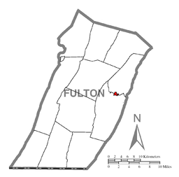
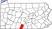
McConnellsburg Borough Named for: Daniel McConnell Country United States State Pennsylvania County Fulton County Elevation 892 ft (272 m) Coordinates 39°55′58″N 77°59′46″W / 39.93278°N 77.99611°W Area 0.4 sq mi (1 km2) Population 1,073 (2000) Density 2,998.2 / sq mi (1,158 / km2) Founded 1786-04-20 - Incorporated 1814-03-26 Timezone EST (UTC-4) - summer (DST) EDT (UTC-5) Zip code 17233 Area code 717 McConnellsburg is a borough in Fulton County, Pennsylvania, United States. The population was 1,073 at the 2000 census. It is the county seat of Fulton County.
McConnellsburg’s historic district was recognized by the United States Department of the Interior in 1993 when it was listed in the National Register of Historic Places. The district consists of 144 structures that contribute to its historic character. Of notable meaning are the numerous taverns, inns, automotive garages and other travel-related structures still in existence today, which includes the Fulton House, the Fulton County Courthouse, and the log cabin of Daniel McConnell, who laid out the borough on April 20, 1786. It was further incorporated on March 26, 1814.
Contents
Economy
Currently McConnellsburg's largest economic driver is Oshkosh Corporation owned- JLG Industries, a major manufacturer of construction and maintenance access-related lifting equipment.
Geography
McConnellsburg is located at 39°55′58″N 77°59′46″W / 39.93278°N 77.99611°W (39.932673, -77.995986)[1].
According to the United States Census Bureau, the borough has a total area of 0.4 square miles (0.9 km²), all of it land. Elevation is 892 feet.
Demographics
As of the census[2] of 2000, there were 1,073 people, 506 households, and 271 families residing in the borough. The population density was 2,998.2 people per square mile (1,150.8/km²). There were 551 housing units at an average density of 1,539.6 per square mile (591.0/km²). The racial makeup of the borough was 97.02% White, 0.84% African American, 0.19% Native American, 0.09% Asian, 0.09% Pacific Islander, and 1.77% from two or more races. Hispanic or Latino of any race were 0.56% of the population.
There were 506 households out of which 22.9% had children under the age of 18 living with them, 37.7% were married couples living together, 12.1% had a female householder with no husband present, and 46.4% were non-families. 42.1% of all households were made up of individuals and 21.3% had someone living alone who was 65 years of age or older. The average household size was 2.01 and the average family size was 2.72.
In the borough the population was spread out with 19.9% under the age of 18, 6.9% from 18 to 24, 24.9% from 25 to 44, 20.4% from 45 to 64, and 28.0% who were 65 years of age or older. The median age was 44 years. For every 100 females there were 80.0 males. For every 100 females age 18 and over, there were 75.9 males.
The median income for a household in the borough was $25,987, and the median income for a family was $33,125. Males had a median income of $28,478 versus $20,577 for females. The per capita income for the borough was $16,884. About 14.9% of families and 17.3% of the population were below the poverty line, including 31.7% of those under age 18 and 14.9% of those age 65 or over.
Media
Radio
- WEEO-FM, 103.7 - talk radio format
Television
- WJAL, channel 68. Licensed in Hagerstown, Maryland, transmitter in McConnelsburg.
References
- ^ "US Gazetteer files: 2010, 2000, and 1990". United States Census Bureau. 2011-02-12. http://www.census.gov/geo/www/gazetteer/gazette.html. Retrieved 2011-04-23.
- ^ "American FactFinder". United States Census Bureau. http://factfinder.census.gov. Retrieved 2008-01-31.
Municipalities and communities of Fulton County, Pennsylvania Boroughs McConnellsburg | Valley-Hi
Townships Unincorporated
communitiesCounty seats of Pennsylvania Cities Allentown | Butler | Easton | Erie | Franklin | Greensburg | Harrisburg | Lancaster | Lebanon | Lock Haven | Meadville | New Castle | Philadelphia | Pittsburgh | Pottsville | Reading | Scranton | Sunbury | Uniontown | Warren | Washington | Wilkes-Barre | Williamsport | York
Boroughs Beaver | Bedford | Bellefonte | Bloomfield | Brookville | Carlisle | Chambersburg | Clarion | Clearfield | Coudersport | Danville | Doylestown | Ebensburg | Emporium | Gettysburg | Hollidaysburg | Honesdale | Huntingdon | Indiana | Jim Thorpe | Kittanning | Laporte | Lewisburg | Lewistown | McConnellsburg | Media | Mercer | Middleburg | Mifflintown | Milford | Montrose | Norristown | Ridgway | Smethport | Somerset | Stroudsburg | Tionesta | Towanda | Tunkhannock | Waynesburg | Wellsboro | West Chester
Town Categories:- County seats in Pennsylvania
- Populated places established in 1786
- Boroughs in Fulton County, Pennsylvania
Wikimedia Foundation. 2010.


