- Tunkhannock, Pennsylvania
Geobox Borough
name = Borough of Tunkhannock
native_name =
other_name =
other_name1 =
category = Borough
image_size =
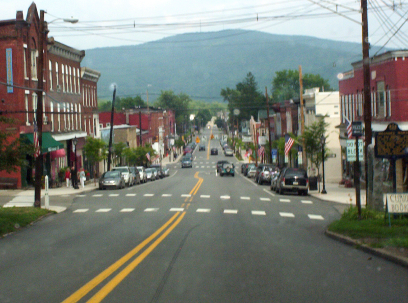
image_caption = Downtown Tunkhannock, looking east along Tioga Street (Business Route 6).
flag_size =
symbol =
symbol_size =
nickname =
motto =
country = United States
state = Pennsylvania
region = Wyoming
region_type = County
district =
area_imperial = 0.9
area_land_imperial = 0.9
area_water_imperial = 0.0
area_water_percentage = auto
area_percentage_round = 2
area_round = 1
location =
lat_d = 41
lat_m = 32
lat_s = 27
lat_NS = N
long_d = 75
long_m = 56
long_s = 52
long_EW = W
elevation_imperial = 692
elevation_round = 1
population_as_of = 2000
population = 1911
population_density_imperial = 2168.2
population_density_round = 1
established =
mayor =
timezone = EST
utc_offset = -5
timezone_DST = EDT
utc_offset_DST = -4
postal_code = 18657
postal_code_type = ZIP code
area_code = 570
area_code_type =
code2_type =
code2 =
free_type =
free =
free1_type =
free1 =

map_size =
map_caption = Location of Tunkhannock in Pennsylvania
map_locator = Pennsylvania
map1 = Map of USA PA.svg
map1_caption = Location of Pennsylvania in the United States
website =Tunkhannock is a borough in Wyoming County,
Pennsylvania , 31 miles (50 km) northwest of Wilkes-Barre. In the past, lumbering was carried on extensively. The chief industry was tanning and there were spool and tub factories, furnaces and machine shops, stave and planing mills, and witch hazel distilleries. Today, many residents are employed by theProcter & Gamble plant nearby. In 1900, 1,305 people lived here, and in 1910, 1,598 people lived here. As of the 2000 census, the borough population was 1,911. It is thecounty seat of Wyoming CountyGR|6.English translations of the Native American Tunkhannock vary, including "meeting of the waters," "small stream," "wilderness stream," and "full of timber."
General Information
*Area Code:570
*ZIP code: 18657
*Main streets/roads: Route 29 (Bridge Street), Business Route 6 (Tioga Street), Route 6 (Grand Army of the Republic Hwy)
*Voting Information: Four Wards (numbered 1,2,3,4); Elected Borough CouncilGeography
Tunkhannock is located at coor dms|41|32|27|N|75|56|52|W|city (41.540836, -75.947703)GR|1.
According to the
United States Census Bureau , the borough has a total area of 0.9square mile s (2.3km² ), all of it land.Demographics
As of the
census GR|2 of 2000, there are 1,911 people, 834 households, and 466 families residing in the borough. Thepopulation density is 2,168.2 people per square mile (838.5/km²). There are 888 housing units at an average density of 1,007.5/sq mi (389.6/km²). The racial makeup of the borough is 99.22% White, 0.16% African American, 0.16% Native American, 0.21% Asian, 0.05% from other races, and 0.21% from two or more races. 0.58% of the population are Hispanic or Latino of any race.There are 834 households out of which 25.2% have children under the age of 18 living with them, 43.2% are married couples living together, 10.1% have a female householder with no husband present, and 44.1% are non-families. 39.0% of all households are made up of individuals and 19.8% have someone living alone who is 65 years of age or older. The average household size is 2.18 and the average family size is 2.94.
In the borough the population is spread out with 21.4% under the age of 18, 8.1% from 18 to 24, 26.0% from 25 to 44, 24.1% from 45 to 64, and 20.4% who are 65 years of age or older. The median age is 41 years. For every 100 females there are 87.0 males. For every 100 females age 18 and over, there are 82.9 males.
The median income for a household in the borough is $32,216, and the median income for a family is $54,063. Males have a median income of $34,097 versus $23,558 for females. The
per capita income for the borough is $20,707. 8.7% of the population and 5.5% of families are below thepoverty line . Out of the total population, 7.7% of those under the age of 18 and 11.6% of those 65 and older are living below the poverty line.References
External links
* [http://www.tunkhannock.com/ tunkhannock.com]
* [http://www.tasd.net/ tasd.net]
Wikimedia Foundation. 2010.