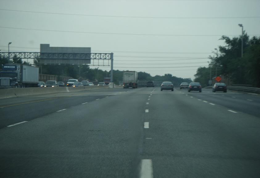
- Interstate 76 (east)
-
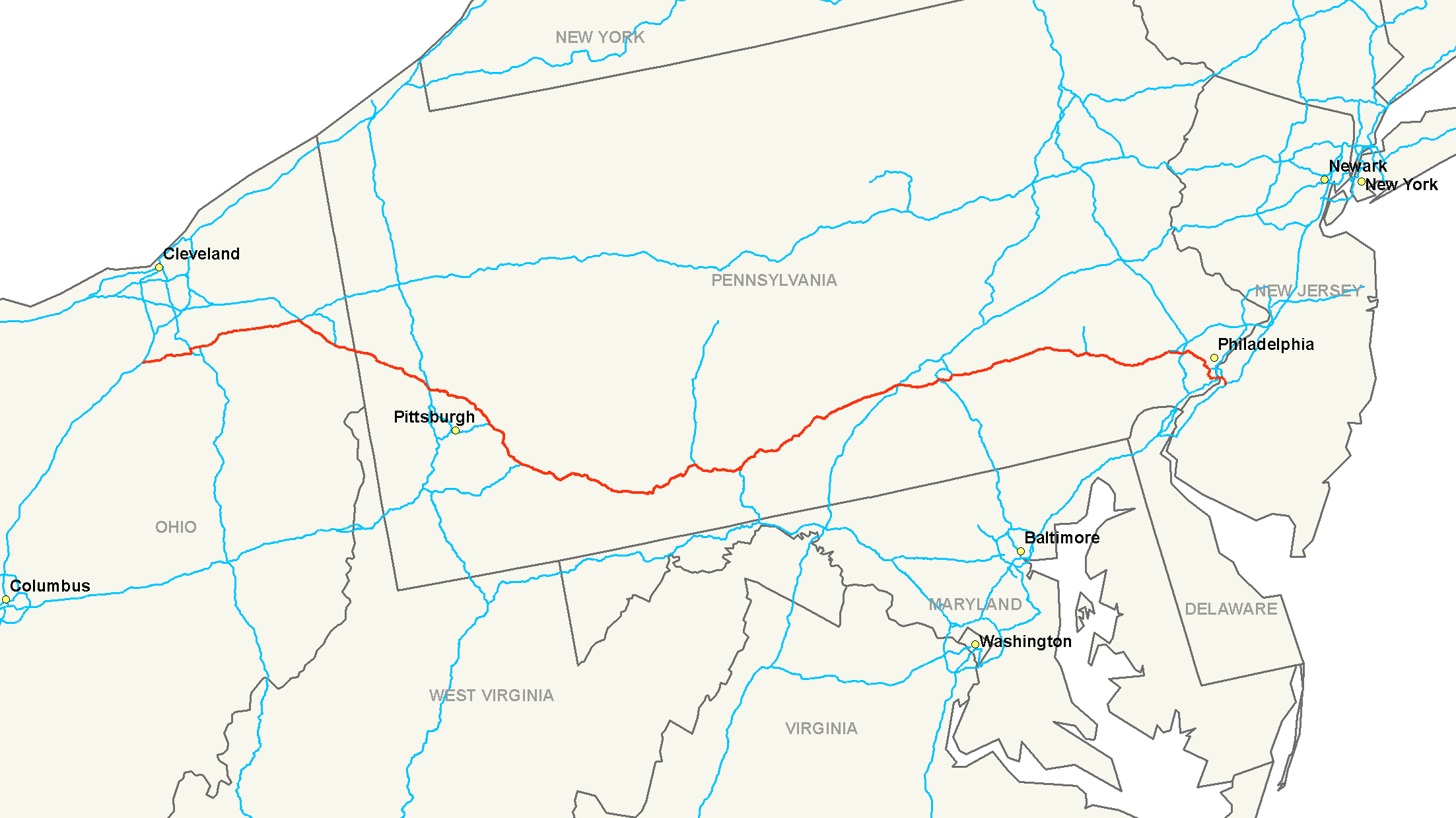
Interstate 76

Route information Length: 434.87 mi[1] (699.86 km) Existed: 1964 – present Major junctions West end: 
 I-71 / US 224 near Westfield Center, OH
 I-77 in Akron, OH

 I-80 / Ohio Tpk. near Youngstown, OH

 I-79 / US 19 in Cranberry, PA
 I-70 in New Stanton, PA
 US 219 in Somerset, PA

 I-99 / US 220 in Bedford, PA
 I-81 near Carlisle, PA
 I-83 near Harrisburg, PA
 I-95 in Philadelphia, PA
East end: 
 I-295 / Route 42 near Camden, NJ
Highway system Main route of the Interstate Highway System
Main • Auxiliary • Business←  PA 75
PA 75PA PA 76  →
→←  Route 75
NJ Route 76  →
→← Route 7676C Route 77  →
→Interstate 76 (I-76) is an Interstate Highway in the United States, running 435 miles (700 km) from an interchange with Interstate 71 west of Akron, Ohio, east to Interstate 295 near Camden, New Jersey.
Just west of Youngstown, I-76 joins the Ohio Turnpike and heads around the south side of Youngstown. In Pennsylvania, I-76 runs across most of the state on the Pennsylvania Turnpike, passing near Pittsburgh and Harrisburg before leaving the Turnpike to enter Philadelphia on the Schuylkill Expressway, crossing the Walt Whitman Bridge into New Jersey. After Interstate 76 reaches its eastern terminus, the freeway continues as Route 42 and the Atlantic City Expressway to Atlantic City.
Contents
Route description
Lengths mi km OH 82.12 132.16 PA 349.67 562.74 NJ 3.08 4.96 434.87 699.86 Ohio
Lodi to Youngstown
I-76 begins at Interstate 71 at exit 209, east of Lodi, Ohio; U.S. Route 224 continues west from the end of I-76. The interchange is currently a double trumpet, but it is currently being reconstructed until 2010. [1]) Officially, I-76 begins at the beginning of the ramp from I-71 north; it merges with US 224 at mile 0.61. After passing through rural Medina County, I-76 enters Summit County and soon crosses State Route 21 (old US 21), once the main north–south route through the area until Interstate 77 replaced it, at a cloverleaf interchange. I-76 then passes Barberton and enters Akron; this section of road was built as US 224.
Soon after entering Akron, I-76 exits the main freeway, which continues east as Interstate 277, onto the short Kenmore Expressway; U.S. Route 224 leaves I-76 there and continues east as a surface road after I-277 ends at Interstate 77. Shortly after heading north from the I-277 interchange, I-76 meets I-77 and again turns east, joining southbound I-77 through downtown Akron on the West Expressway. A partial interchange provides access to State Route 59, the Innerbelt, and then I-76 crosses through the Central Interchange, where I-77 goes south (on the South Expressway) and State Route 8 begins to the north (on the North Expressway); I-76 switches from the West Expressway to the East Expressway.

Leaving the Akron area, I-76 again heads through rural areas, crossing Portage County and entering Mahoning County. West of Youngstown, the freeway crosses the Ohio Turnpike. Officially I-76 ends at the Turnpike overpass and I-76K begins on the Turnpike at the overpass, with a similar change happening with Interstate 80 and I-80K (east on the freeway to Youngstown and west on the Turnpike). In reality, access between the roads is via a double trumpet connection in the northeast corner of the crossing, along which I-76 and I-80 both run in opposite directions.
Ohio Turnpike
The Ohio Turnpike carries I-76 starting from around Youngstown, Ohio until the Pennsylvania border.
Pennsylvania
Pennsylvania Turnpike
From the Ohio border, the Pennsylvania Turnpike carries I-76 into and across most of Pennsylvania, bypassing all major cities - Youngstown to the south, Pittsburgh to the north and Harrisburg to the south. At one point, I-76 used to be routed through Pittsburgh on a route that is now signed as Interstate 376 around the 1970s.
Schuylkill Expressway
At Valley Forge, northwest of Philadelphia, I-76 leaves the Turnpike to run into Philadelphia on the Schuylkill Expressway, while Interstate 276 continues east on the Turnpike. Immediately after exiting, I-76 interchanges with the U.S. Route 202 and U.S. Route 422 freeways, and then crosses Interstate 476 and begins running along the southwest shore of the Schuylkill River. Interchanges provide access to the Roosevelt Expressway (U.S. Route 1) and Vine Street Expressway (Interstate 676); the latter runs through downtown Philadelphia while I-76 bypasses to the south.
 The Schuylkill Expressway at Exit 346 for South Street in Philadelphia, near the University of Pennsylvania.
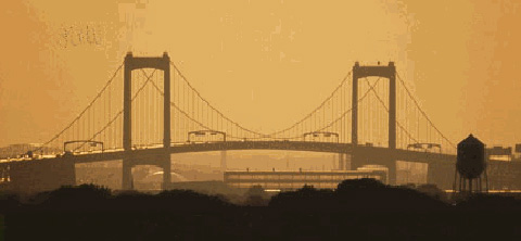
Walt Whitman Bridge
The last interchange before the Walt Whitman Bridge over the Delaware River into New Jersey is with Interstate 95. Some of the ramps involve traffic signals, as the ramps to I-95 were retrofitted into an existing interchange when I-95 was built, and the toll booth for the bridge lies west of the crossing of the two roads.
New Jersey
North-South Freeway
 Walt Whitman Bridge
Just after crossing the Delaware River, I-76 turns south and becomes the North-South Freeway, which carries Interstate 676 north to downtown Camden; the unsigned Route 76C connector runs east to U.S. Route 130 and Route 168. The exit numbers in New Jersey are backwards, running from east to west.

From the I-676 interchange to the end, I-76 originally had local and express lanes in both directions, but the eastbound barrier has since been removed, and now the separation is westbound only; however, the westbound barrier might also be removed in the future due to plans to rebuild the I-295, I-76, and Route 42 interchange. I-76 ends at an interchange with Interstate 295 on the Mount Ephraim/Bellmawr town line, where the local/express split begins heading westbound. Route 42 continues south on the North-South Freeway, feeding into the Atlantic City Expressway to Atlantic City. While the South Jersey Transportation Authority (which owns the ACE) is not against the idea of making Route 42 and the ACE an eastern extension of I-76, they feel that making the change without a compelling reason would only add to motorists' confusion in southern New Jersey.[2]
History
The majority of I-76, along the Pennsylvania Turnpike, includes the first long-distance rural freeway in the U.S.; the Ohio Turnpike and Schuylkill Expressway are also pre-Interstate freeways. By 1955, the section of that route from west of Youngstown to downtown Philadelphia was included in the planned Interstate Highway System, as was present I-76 from west of Youngstown to Akron. (Some early plans called for a new freeway along State Route 14 to the Pennsylvania state line; it is unclear when the proposed route was shifted to the Turnpikes.)
In 1957 the route from Cleveland east to Harrisburg, running roughly along the State Route 14 corridor in Ohio and the Turnpike in Pennsylvania, was labeled Interstate 80, and the rest of the route from Harrisburg to Philadelphia was assigned Interstate 80S. (Interstate 80N would have run from Harrisburg to New York City.) Interstate 78 was assigned to a route from Norwalk, Ohio, paralleling State Route 18 through Akron to Youngstown, and turning south there to end at the planned I-80.
 Current and once-planned Interstates near Cleveland; I-80 would have run via Akron, using what is now I-76 east of Akron.
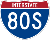
However, the 1957 numbering was drawn on a map from 1947, which did not include several changes that had been approved, specifically the Keystone Shortway across Pennsylvania. (The route in that corridor ran further north, along U.S. Route 6, and was numbered Interstate 84.) Thus, the final numbering, approved in 1958, assigned I-80 to the Norwalk-Youngstown route to reach the Keystone Shortway. The former alignment through Cleveland became Interstate 80N; the Turnpike was still not assigned a number from near Elyria (where I-80N and I-90 would split from it) to west of Youngstown. The route from west of Youngstown to Philadelphia was assigned Interstate 80S, and extended east to I-295 in New Jersey when the three-digit Interstates were assigned in 1959. (The planned I-80N in Pennsylvania became I-78.) Initial spurs of I-80S were I-180 (now I-176), I-280 (now I-276), I-480 (now I-476) and I-680 (now I-676, though it swapped with I-76 in 1972).
I-80 was realigned in Ohio by 1962, largely taking over former I-80N, which ran through Cleveland, joining the Turnpike southwest of Cleveland. However, while I-80N was planned to split from I-80 near Kent and run northwest to Cleveland along State Route 14, the new alignment of I-80 used the Turnpike between the crossing west of Youngstown and the crossing with State Route 14 at Streetsboro. The former I-80 from near Youngstown west to Akron became part of I-80S, as did a new alignment (already built as U.S. Route 224) from Akron west to I-71 east of Lodi; the rest of proposed I-80 west to near Norwalk (which would have crossed I-71 near Medina) was removed from the Interstate Highway System. Ca. 1971, I-80 was moved to the Turnpike between Streetsboro and southwest of Cleveland; the old route became I-480.
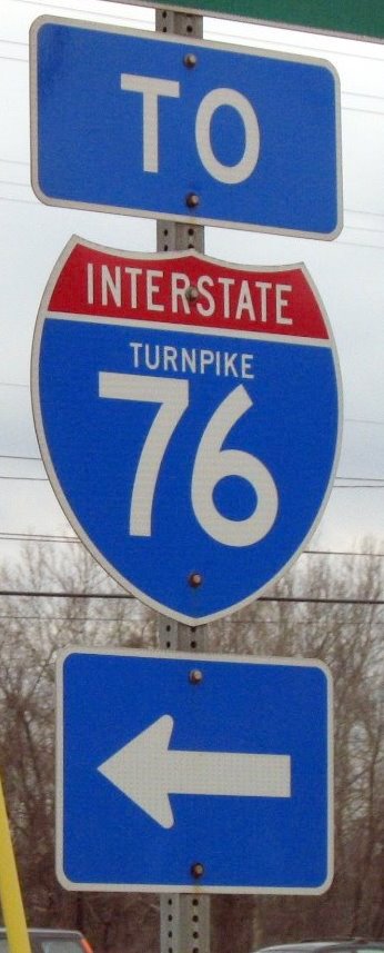
 "To Turnpike 76" sign in Pennsylvania
On April 16, 1963, due in part to the extension of I-79 south from the Pittsburgh area, Pennsylvania proposed a partial renumbering. A new number, tentatively designated I-76, would run from downtown Pittsburgh east on what was then I-70 (I-70S bypassed Pittsburgh to the south on what is now I-70) to the Pennsylvania Turnpike at Monroeville, and then east along the remainder of I-80S to I-295. I-80S would remain on the section of turnpikes from west of Youngstown to Monroeville. This was approved February 26, 1964, and included the renumbering of all X80 spurs to X76.
On June 29, 1970, a renumbering was approved in the Pittsburgh area, with the main effect being rerouting I-79 to bypass Pittsburgh to the west on the former I-279. I-279 was moved to the former I-79 north of downtown, and the former I-79 from downtown southwest to new I-79 became a western extension of I-76. (It was then that I-876 was designated for former I-479.) A realignment and extension of I-76 into Ohio, taking over the rest of I-80S to I-71 east of Lodi, was approved January 11, 1972. The former I-76 from Monroeville west into downtown Pittsburgh became I-376, and I-279 was extended southwest from downtown along former I-76 to I-79. (I-876 was renumbered to I-579 then.) Signs in Ohio were changed September 1, 1972; the old I-80S signs remained for about a year.
On August 29, 1972, a swap of I-76 and I-676 in Philadelphia and Camden was approved. I-76 had been routed along the Vine Street Expressway and Ben Franklin Bridge (now I-676) through Center City Philadelphia, while I-676 used the Schuylkill Expressway and Walt Whitman Bridge to bypass downtown to the south. The switch was made because of delays in building the Vine Street Expressway, better interchange geometry at the splits, and that the Ben Franklin Bridge ends in city streets, rather than in expressway grade.
The renumbering of a Philadelphia Interstate to 76 in the years leading up the to the Bicentennial Celebration of the 1776 signing in Philadelphia of the Declaration of Independence gives rise to the question of the highway number being an intentional tribute to the Spirit of '76. USDoT research into federal documentation of the I-76 renumbering found no evidence of this being intentional.[2]
Exit list
Ohio
Pennsylvania
New Jersey
The entire route is in Camden County.
Location Mile Exit Destinations Notes Gloucester City Walt Whitman Bridge over the Delaware River (state line) Camden 352.69 354 
 US 130 north / I-676 – Camden Waterfront
Eastbound exit and westbound entrance; connection to US 130 is NJ 76C; signed with PA mile marker/exit number 2.21 2 I-676 north – Camden, Ben Franklin BridgeWestbound exit and eastbound entrance Gloucester City 1.15 1D US 130 north – CollingswoodWestbound exit and eastbound entrance 1.15 1C US 130 south – Brooklawn, WestvilleEastbound exit and westbound entrance 0.76 1C US 130 south to I-295 / Route 42 – Mount Ephraim, Gloucester CityWestbound exit and eastbound entrance (provides a U-turn for nonexistent movements at the I-295 interchange) Mount Ephraim 0.13 1B  I-295 north to NJ Turnpike – Trenton
Bellmawr 0.00 1A I-295 south – Delaware Memorial BridgeEastbound exit and westbound entrance 0.00 Route 42 south – Atlantic CityContinuation beyond I-295 Eastern terminus of Interstate 76 1.000 mi = 1.609 km; 1.000 km = 0.621 mi Auxiliary routes
- Interstate 176 runs north from I-76 at Morgantown, Pennsylvania to U.S. Route 422 outside of Reading.
- Interstate 276 runs east from I-76 at Valley Forge, Pennsylvania along the Pennsylvania Turnpike to the Delaware River-Turnpike Toll Bridge, where it currently ends at the state line. Interstate 95 continues north along the New Jersey Turnpike. It will be truncated by several miles at its east end when the Pennsylvania Turnpike/Interstate 95 Interchange Project is completed and I-95 is connected.
- Interstate 376 runs west from I-76 at Monroeville, Pennsylvania through Pittsburgh, becomes a toll road northwest of the airport, intersects I-76 again, and terminates at I-80 in Sharon.
- Interstate 476 begins at Interstate 95 near Chester, Pennsylvania and heads north, crossing I-76 near Conshohocken and I-276 near Plymouth Meeting. From there it continues north on the Northeast Extension of the Pennsylvania Turnpike to Interstate 81 at Clarks Summit, Pennsylvania, north of Scranton. I-476 is the longest three-digit Interstate.
- Pennsylvania Route 576 is a planned southern bypass of Pittsburgh, Pennsylvania, though it could become Interstate 576.
- Interstate 676 is a loop through downtown Philadelphia, Pennsylvania and Camden, New Jersey, crossing the Ben Franklin Bridge. It runs through several traffic signals in Philadelphia, in violation of Interstate standards.
- Interstate 876 was the number for present Interstate 579 in Pittsburgh in the early 1970s.
Auxiliary routes of Interstate 76 
See also
 U.S. Roads portal
 New Jersey portal
 Ohio portal
 Pennsylvania portal
References
- ^ Federal Highway Administration (2002-10-31). "FHWA Route Log and Finder List: Table 1". http://www.fhwa.dot.gov/reports/routefinder/table1.htm. Retrieved 2007-03-28.
- ^ "Was I-76 Numbered to Honor Philadelphia for Independence Day, 1776?". http://www.fhwa.dot.gov/infrastructure/i76.htm. Retrieved 2006-09-17.
- ^ Gregory Pietsch, More I-76 and Atlantic City Expressway, misc.transport.road June 10, 2002 (message ID: zc9N8.56$b22.28752931@newssvr15.news.prodigy.com )
- Was I-76 Numbered to Honor Philadelphia for Independence Day, 1776?
- Kurumi - 3-digit Interstates from I-76
- Ohio Maps and Highway Proposals
- roadfan.com (2005). Cleveland Maps. Retrieved December 15, 2005.
- FHWA Route Log and Finder List
- Ohio straight line diagrams: Medina Summit Portage Mahoning Mahoning (Turnpike) (PDF)
- I-76 (New Jersey) straight line diagram (PDF)
External links
Main Interstate Highways (major interstates highlighted)
4 5 8 10 12 15 16 17 19 20 22 24 25 26 27 29 30 35 37 39 40 43 44 45 49 55 57 59 64 65 66 68 69 70 71 72 73 74 75 76 (W) 76 (E) 77 78 79 80 81 82 83 84 (W) 84 (E) 85 86 (W) 86 (E) 87 88 (W) 88 (E) 89 90 91 93 94 95 96 97 99 H-1 H-2 H-3 Unsigned A-1 A-2 A-3 A-4 PRI-1 PRI-2 PRI-3 Lists Primary Main - Intrastate - Suffixed - Temporary - Future - Gaps Auxiliary Main - Future - Unsigned Other Standards - Business - Bypassed - Tolled Roads in the Susquehanna Valley Beltway Interstate Highways U.S. Routes Limited-access Pennsylvania Routes Other Pennsylvania Routes PA 17 · PA 23 · PA 25 · PA 34 · PA 39 · PA 72 · PA 74 · PA 94 · PA 114 · PA 117 · PA 147 · PA 174 · PA 225 · PA 230 · PA 233 · PA 235 · PA 241 · PA 274 · PA 325 · PA 340 · PA 341 · PA 343 · PA 419 · PA 441 · PA 443 · PA 462 · PA 465 · PA 501 · PA 533 · PA 641 · PA 645 · PA 696 · PA 722 · PA 743 · PA 772 · PA 849 · PA 850 · PA 897 · PA 934 · PA 944 · PA 997 · PA 999Other Quadrant Routes Other notable roads Interstate Highways in Pennsylvania Current Unbuilt 695 • 895Former Future Road transportation infrastructure of the metro Philadelphia area Interstates U.S. Routes Pennsylvania Routes New Jersey Routes Delaware Routes Named roads/streets Benjamin Franklin Parkway · Broad Street · City Avenue · Front Street · Girard Avenue · Market Street · Roosevelt Boulevard · South Street · Chestnut Street · Walnut Street
Pennsylvania Turnpike · New Jersey Turnpike · Delaware Turnpike · Atlantic City Expressway · Schuylkill Expressway · Delaware Expressway · Blue Route · Vine St Expressway · North South Freeway · Lancaster Avenue · Bethlehem Pike · Baltimore Pike · Black Horse PikeBridges Delaware Memorial Bridge · Commodore Barry Bridge · Walt Whitman Bridge · Ben Franklin Bridge · Betsy Ross Bridge · Tacony–Palmyra Bridge · Burlington–Bristol Bridge · Delaware River – Turnpike Toll BridgeControlled-access highways and Expressways in New Jersey Interstate Highways U.S. and state highways Toll roads and other highways Atlantic City Expressway (Brigantine Connector) • Garden State Parkway • New Jersey Turnpike • Palisades Interstate ParkwayCategories:- Interstate Highway System
- Interstate Highways in New Jersey
- Interstate Highways in Pennsylvania
- U.S. Route 30
- Interstate 80
- Interstate 76 (east)
- Toll roads in Pennsylvania
- Roads in the Harrisburg, Pennsylvania area
- Transportation in Camden County, New Jersey


Wikimedia Foundation. 2010.