- Pennsylvania Route 147
-
PA Route 147 
Route information Maintained by PennDOT Length: 57 mi[1] (92 km) Existed: 1928 – present Major junctions South end: 
 US 22/US 322 in Reed Township.
 US 209 in Millersburg
 PA 61 in Sunbury
 US 11 in Northumberland
North end: 
 I-80/I-180 in Turbot Township
Location Counties: Dauphin, Northumberland Highway system Roads in Pennsylvania
Interstate • US • State • Legislative←  PA 146
PA 148  →
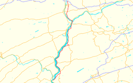
→Pennsylvania Route 147 is a north–south route that runs for 57 miles (92 km) along the east shore of the Susquehanna River in central Pennsylvania, United States. The northern terminus is at an interchange with Interstate 80 and Interstate 180 in Turbot Township. The southern terminus is at an interchange with U.S. Route 22 and U.S. Route 322 in Reed Township.
Contents
Route description
PA 147 is mostly a local road. It becomes a short expressway from Milton area to the northern terminus at an interchange with Interstate 80 and Interstate 180. It parallels the Susquehanna River its entire length. Sections overlap with U.S. Route 11, Pennsylvania Route 61, and Pennsylvania Route 225.
Major intersections
County Location Mile Destinations Notes Dauphin Reed Township 0.0 
 US 22 / US 322
Interchange at Clarks Ferry Bridge Halifax Township  PA 225 south (Peters Mountain Road)
South end of PA 225 concurrency Halifax  PA 225 north (4th Street)
North end of PA 225 concurrency Millersburg  US 209 (Union Street)
Southern terminus of US 209 Northumberland Jackson Township  SR 3012 to PA 225
Sunbury  PA 61 north
South end of PA 61 concurrency  PA 61 south (Market Street)
North end of PA 61 concurrency Northumberland  US 11 north (Water Street)
South end of US 11 concurrency  US 11 south (Water Street)
North end of US 11 concurrency West Chillisquaque Township  PA 405 (Susquehanna Trail)
Southern terminus of PA 405 South end of freeway  PA 45 – Montandon, Lewisburg
Industrial Park Road Milton  PA 642 (Mahoning Street)
 PA 254 (Broadway)
Turbot Township 
 I-80 / I-180 west – Bloomsburg, Bellefonte, Williamsport
Exit 212 (I-80). 1.000 mi = 1.609 km; 1.000 km = 0.621 mi History
From 1926 to 1928, PA 147 from Northumberland to Chillisquaque was signed as U.S. Route 111 and U.S. Route 711. In 1928, the US 711 designation was removed from the road. Eight years later, US 111 was removed from the alignment.
Future
As part of the Central Susquehanna Valley Transportation Project, PA 147 will join PA 61 in a new road starting at their current southern junction in Sunbury, continuing west across the river as far as the new path for U.S. Route 15. PA 147 will then join US 15 northward for this new route until US 15 converges with its business spur near Lewisburg, at which point PA 147 will cross the west branch of the river and resume its current route at a junction with PA 405. PA 405 will replace PA 147 between this junction and the junction with PA 61.[2]
References
- ^ Pennsylvania Highways - Pennsylvania Route 147
- ^ Central Susquehanna Valley Transportation Project: Proposed Roadway Route Designations http://csvt.com/assets/maps/potential%20roadway%20designations.pdf
External links
Roads in the Susquehanna Valley Beltway Interstate Highways U.S. Routes Limited-access Pennsylvania Routes Other Pennsylvania Routes PA 17 · PA 23 · PA 25 · PA 34 · PA 39 · PA 72 · PA 74 · PA 94 · PA 114 · PA 117 · PA 147 · PA 174 · PA 225 · PA 230 · PA 233 · PA 235 · PA 241 · PA 274 · PA 325 · PA 340 · PA 341 · PA 343 · PA 419 · PA 441 · PA 443 · PA 462 · PA 465 · PA 501 · PA 533 · PA 641 · PA 645 · PA 696 · PA 722 · PA 743 · PA 772 · PA 849 · PA 850 · PA 897 · PA 934 · PA 944 · PA 997 · PA 999Other Quadrant Routes SR 3015 · SR 3020Other notable roads Categories:- State highways in Pennsylvania
- Roads in the Harrisburg, Pennsylvania area
- Limited access Pennsylvania state routes
- Transportation in Dauphin County, Pennsylvania
- Transportation in Northumberland County, Pennsylvania
Wikimedia Foundation. 2010.

