- Pennsylvania Route 39
-
PA Route 39

Route information Maintained by PennDOT Length: 17.83 mi[3] (28.69 km) Existed: 1930s[1][2] – present Major junctions West end: North Front Street in Susquehanna Township 
 US 22 / US 322 in Susquehanna Township
 I-81 in West Hanover Township
East end:  US 322 / US 422 near Hummelstown
Location Counties: Dauphin Highway system Roads in Pennsylvania
Interstate • US • State • Legislative←  PA 38
PA 38US 40  →
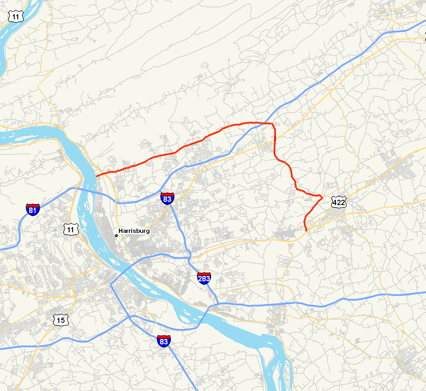
→Pennsylvania Route 39 (PA 39) is a 17.68-mile (28.45 km) long east–west state highway in Dauphin County, Pennsylvania, United States. It starts at North Front Street north of Harrisburg and ends at U.S. Route 322 and U.S. Route 422 near Hummelstown. PA 39 is known as Linglestown Road west of Interstate 81, as Hershey Road from I-81 to Hersheypark Drive, and as Hersheypark Drive south of Hershey Road. The route passes through the northern and eastern suburbs of Harrisburg and passes by Hersheypark and Giant Center.
The Linglestown–Manada Hill portion of PA 39 was originally part of Legislative Route 140, one of hundreds of unsigned legislative routes created by the Sproul Road Bill in 1911. LR 140 was later rerouted to bypass Linglestown to the south, and the Paxtonia – Lower Paxton Township portion of its former routing became LR 140A. This legislative route was initially signed solely as PA 894. PA 39 was assigned in the 1930s to the portion of LR 140A east of Linglestown—overlapping PA 894—and also to LR 22006 between the Susquehanna River and Manadahill. The PA 894 designation was later removed.
PA 39 was extended southward to the vicinity of Hummelstown in two stages. The first extension during the 1940s shifted PA 39's eastern terminus to the junction of Hershey Road and Allentown Boulevard (U.S. Route 22) south of Manadahill. Its terminus was moved to its present location in the early 1960s. Only local realignments and improvements have occurred since.
Contents
Route description
PA 39 begins at an intersection with North Front Street on the east bank of the Susquehanna River in the Dauphin County township of Susquehanna north of Harrisburg. It heads northeast as Linglestown Road through a densely populated neighborhood and widens from two to four lanes as it approaches an interchange with U.S. Route 22 and U.S. Route 322 at the northern tip of Wildwood Lake. East of the exit, the highway reverts back to two lanes and passes through the predominantly residential northern suburbs of Harrisburg. It intersects North Progress Avenue prior to passing into Lower Paxton Township.[4]
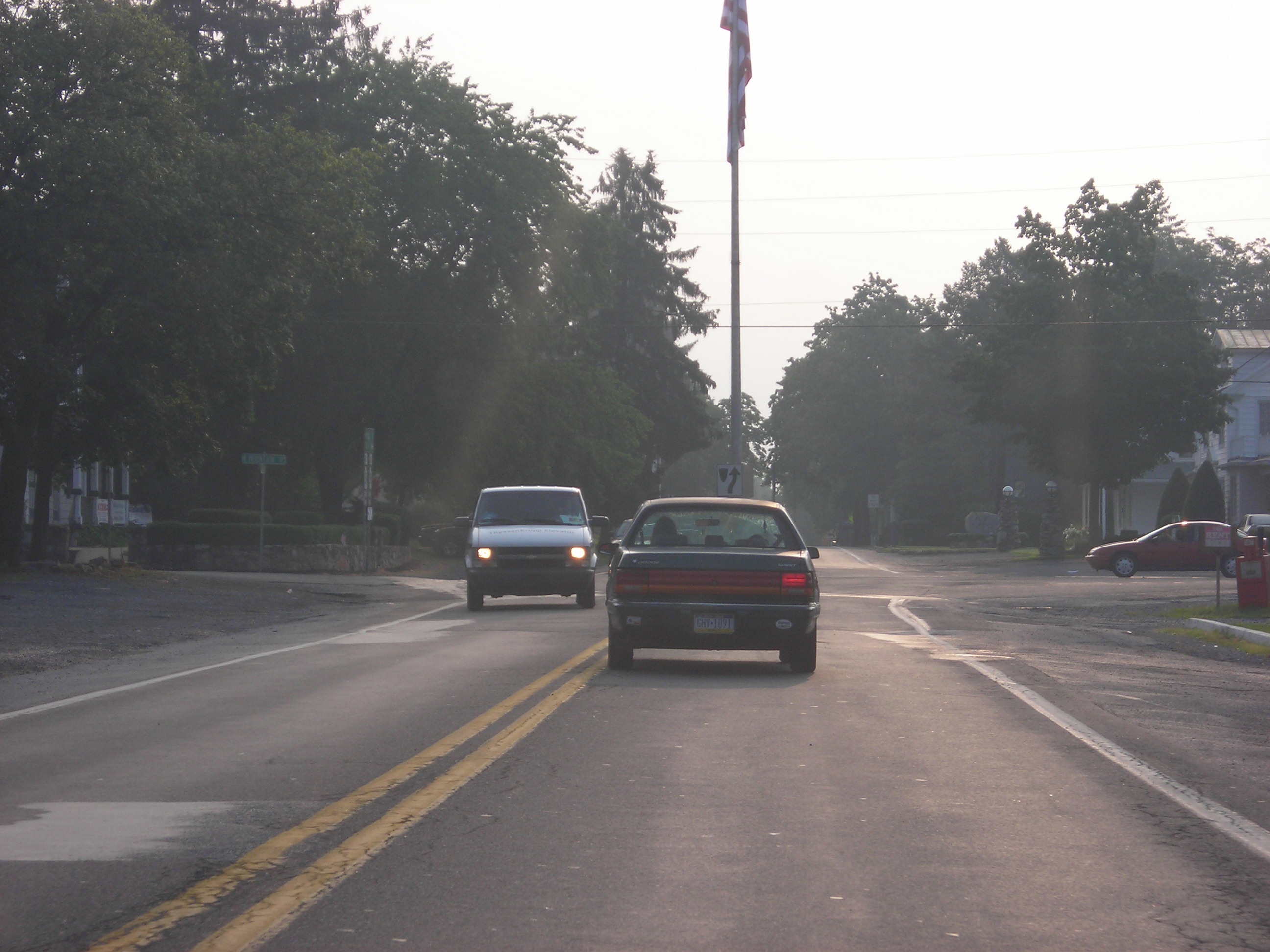
 Flagpole at the PA 39 / North Mountain Road intersection in Linglestown
West of the village of Linglestown, PA 39 intersects Colonial Road (unsigned State Route 3017), a connector highway between PA 39 and US 22, which follows a routing parallel to PA 39 2.5 miles (4.0 km) to the south. PA 39 continues east to Linglestown, where it intersects North Mountain Road at an unorthodox intersection featuring a flagpole in its center. Outside of the village, the amount of development along the highway declines as PA 39 passes through areas of forests and open fields. It enters West Hanover Township upon crossing Beaver Creek and interchanges with Interstate 81 at exit 77. Just east of the interchange, PA 39 intersects Jonestown Road and changes names from Linglestown Road to Hershey Road.[4]
Unlike Linglestown Road, which followed a mostly east–west alignment, Hershey Road has a north–south orientation. It heads south from Jonestown Road to intersect US 22 near Skyline View, here an at-grade roadway named Allentown Boulevard. PA 39 continues onward, snaking southeastward through a rural region of Dauphin County to the vicinity of Hershey. During this stretch, it passes through South Hanover Township and serves the communities of Hanoverale and Union Deposit. The route crosses into Derry Township after crossing over Swatara Creek, then intersects Hersheytown Road near the creek's southern bank. Hershey Road continues south from here as Park Boulevard, a service road for Giant Center and Hersheypark; however, PA 39 veers westward onto Hersheytown Road and bypasses Giant Center to the north. This portion of PA 39 is four lanes wide, the first significant portion of PA 39 to be since the area surrounding I-81.[4]
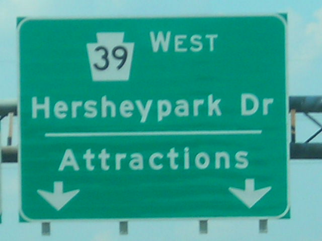
 Overhead signage at the eastern terminus of PA 39 near Hummelstown
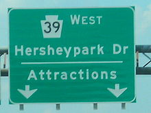
PA 39 heads southwest in a circuitous fashion, bypassing the village of Hershey to the north and west. It passes under a Norfolk Southern Railway line, then enters a highly developed area east of the borough of Hummelstown. Here, PA 39 intersects Walton Avenue, a local street connecting PA 39 to the village. This is the final junction along PA 39 as the route ends 0.3 miles (0.48 km) later at a modified cloverleaf interchange with US 322 and U.S. Route 422.[4]
History
Legislative routes
Legislative Route 140, an unsigned legislative route extending from Harrisburg in the west to Pottsville in the east, was created on May 31, 1911, through the Sproul Road Bill, which established the initial set of legislative routes throughout Pennsylvania. LR 140 entered Linglestown on North Mountain Road, then turned to follow modern PA 39 from Linglestown to Manadahill, where it veered onto Jonestown Road.[5] LR 140 was realigned by 1926 to follow a direct route between Paxtonia and Manadahill via Jonestown Road. The portion of former LR 140 from Paxtonia to the Lower Paxton – West Hanover township line was then redesignated as LR 140A.[6] All of LR 140A was designated as the signed PA 894 by 1930.[1]
In the Omnibus Road Bill Act of 1931, LR 22006 was established, spanning the portion of current PA 39 from the Susquehanna River north of Harrisburg to Hanoverdale at the West Hanover – South Hanover township line.[citation needed] The remainder of current PA 39 north of Swatara Creek was a state-aid route designated A-306, which ran from South Hanover Township to Union Deposit.[citation needed]
Designation
PA 39 was assigned in the 1930s to the portion of LR 22006 between the Susquehanna River (at North Front Street) and Manadahill and to the section of LR 140A east of Linglestown, overlapping PA 894 along the latter. During this time, PA 894 was also extended northward along Piketown Road to a junction with PA 443 near Piketown.[1][2][7] The overlap between PA 39 and PA 894 was eliminated in the 1940s when the entirety of the PA 894 designation was removed.[7][8]
The first change to PA 39's routing came in the 1940s. During this time, U.S. Route 22 was rerouted through Dauphin and Lebanon County to follow Allentown Boulevard instead of Jonestown Road. As a result, PA 39 was extended a short distance southward along LR 22006 on what is now Jonestown Road, Harper Drive, and Hershey Road to meet the new alignment of US 22 south of Manadahill.[7][8] It was extended further southward on LR 22006 and A-306, as well as parts of Legislative Routes 22011 and 22013 in the early 1960s to a new terminus at U.S. Route 322 and U.S. Route 422 near Hummelstown. At the time, it was routed on Hanover Street in the vicinity of Union Deposit.[9][10] The portion of Hanover Street south of Canal Street had previously been part of PA 340 from the 1930s to the early-to-mid-1950s.[1][8][11][12]
A new highway around the eastern fringe of Union Deposit was constructed in the late 1960s and opened to traffic as a realignment of PA 39 by 1970.[10][13][14] Park Boulevard in Hershey was rerouted by 1990 to intersect the new bypass and provide a direct connection between Hersheypark and PA 39.[15] A smaller-scale rerouting of PA 39 in Manadahill was completed by 1972, placing PA 39 on its current alignment in the area.[16]
Improvements
In the early 1970s, the portion of PA 39 in Susquehanna Township from North Sixth Street to Laurelwood Drive was converted from a two-lane roadway to a four-lane divided highway as part of the construction of the US 22 and US 322 bypass.[13][16] The divided highway was extended west to North Front Street in the early 1990s.[15][17] To the southeast, the segment of PA 39 south of West Chocolate Avenue near Hummelstown was rebuilt as a divided highway ca. 1990.[15][18] All of Hersheypark Drive east to Laudermilch Road was converted into a divided highway by 1995.[17] The piece of PA 39 near I-81 was reconstructed into a four-line divided roadway ca. 1990.[15][18]
Linglestown square
Since 1996, the village has been considering making improvements to the village square. At the center of the square is a flag pole located in the middle of the road. The initial plan was to move the flag pole and insert a traffic light. After long debate, that idea was shot down. It was replaced by the "Linglestown Plan", proposed on March 31, 2000. Nearly seven years later, on February 20, 2007, Lower Paxton Township approved a modified version of the Linglestown Action Plan, which involves the addition of roundabouts, other approaches to slowing down traffic through the square, and general community improvement.[19][20] On September 11, 2009, PennDOT awarded a construction bid for the project to E. Wintermyer Co. of Etters.[21]
In June 2011, the project entered its final phase. The roundabouts were opened to two way traffic[22], with the remaining work to be done August 2011.
Road widening
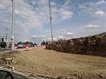 Road widening at the intersection of PA 39 and Progress Avenue.
Plans are in development to build a new shopping center near the intersection of PA 39 and Progress Avenue. As a result, Susquehanna Township is considering widening PA 39 from the US 22 / US 322 bypass to Progress Avenue.[23] The shopping center began construction in late 2008. Road work began in August 2009.
West Hanover Township also plans on making improvements to the area surrounding PA 39's interchange with Interstate 81. Currently, there is only one traffic light in the vicinity, located at Jonestown Road. West Hanover Township plans to install traffic lights and add additional lanes to handle the increased truck traffic caused by the construction of warehouses nearby in 2003 and 2004.[24][25] Road work began in August 2009, from Fairville Avenue to Jonestown Road.
Major intersections
The entire route is in Dauphin County.
Location Mile[3][4] Destinations Notes Susquehanna Township 0.00 North Front Street Former routing of US 22 and US 322 Harrisburg 0.39 Industrial Road An intermodal connector of the National Highway System[26] Susquehanna Township 0.43 US 22 / US 322Interchange 2.26 North Progress Avenue (SR 3015) Former northern terminus of PA 543 West Hanover Township 9.60 I-81Exit 77 (I-81) 11.11 US 22Former eastern terminus of PA 39 Derry Township 15.67 Hersheypark Drive (SR 2016) 17.83 US 322 / US 422Interchange; western terminus of US 422 1.000 mi = 1.609 km; 1.000 km = 0.621 mi References
- ^ a b c d Pennsylvania Department of Highways (1930). Tourist Map of Pennsylvania (Map). ftp://ftp.dot.state.pa.us/public/pdf/BPR_pdf_files/Maps/Statewide/Historic_OTMs/1930fr.pdf. Retrieved May 3, 2009.
- ^ a b Thibodeau, William A. (1938). The ALA Green Book (1938–39 ed.). Automobile Legal Association.
- ^ a b "Pennsylvania State Roads (GIS data set)". Pennsylvania Department of Transportation. January 2009. http://www.pasda.psu.edu/uci/MetadataDisplay.aspx?entry=PASDA&file=PaStateRoads2009_01.xml&dataset=54. Retrieved May 3, 2009.
- ^ a b c d e Yahoo! Inc. Yahoo! Maps – Overview of PA 39 (Map). Cartography by NAVTEQ. http://maps.yahoo.com/#mvt=m&lat=40.309155&lon=-76.78421&zoom=13&q1=40.324309%2C-76.89912&w0=&q2=40.32601%2C-76.892436&w1=&q3=40.326043%2C-76.891631&w2=40.33503005827232%2C-76.71272277832031&q4=40.266048%2C-76.687433. Retrieved May 3, 2009.
- ^ Breuker and Kessler, Co. (1911) (PDF). Map of Pennsylvania showing state highways as adopted under the Sproul Road Bill (Map). Cartography by Ralph C. Benedict and Charles W. Erisman. ftp://ftp.dot.state.pa.us/public/pdf/BPR_pdf_files/Maps/Statewide/Historic_OTMs/1911.pdf. Retrieved May 3, 2009.
- ^ Williams–Webb Co., Inc. (March 1926) (PDF). Map of the public roads in Dauphin County, Pennsylvania (Map). Cartography by Pennsylvania State Highway Department. ftp://ftp.dot.state.pa.us/public/pdf/BPR_PDF_FILES/Maps/Type_10_GHS_Historical_Scans/Dauphin_1926.pdf. Retrieved May 3, 2009.
- ^ a b c Pennsylvania Department of Highways (1941) (PDF). General Highway Map – Dauphin County, Pennsylvania (Map). ftp://ftp.dot.state.pa.us/public/pdf/BPR_PDF_FILES/Maps/Type_10_GHS_Historical_Scans/Dauphin_1941.pdf. Retrieved May 3, 2009.
- ^ a b c Pennsylvania Department of Highways (1950). Official Road Map of Pennsylvania (Map). ftp://ftp.dot.state.pa.us/public/pdf/BPR_pdf_files/Maps/Statewide/Historic_OTMs/1950fr.pdf. Retrieved May 3, 2009.
- ^ Pennsylvania Department of Highways (1960). Official Map of Pennsylvania (Map). ftp://ftp.dot.state.pa.us/public/pdf/BPR_pdf_files/Maps/Statewide/Historic_OTMs/1960fr.pdf. Retrieved May 3, 2009.
- ^ a b Pennsylvania Department of Highways (1964) (PDF). General Highway Map – Dauphin County, Pennsylvania (Map). ftp://ftp.dot.state.pa.us/public/pdf/BPR_PDF_FILES/Maps/Type_10_GHS_Historical_Scans/Dauphin_1964_Sheet_1.pdf. Retrieved May 3, 2009.
- ^ Pennsylvania Department of Highways (1940). Official Road Map of Pennsylvania (Map). ftp://ftp.dot.state.pa.us/public/pdf/BPR_pdf_files/Maps/Statewide/Historic_OTMs/1940fr.pdf. Retrieved May 3, 2009.
- ^ United States Geological Survey (1956). Hummelstown Quadrangle – Pennsylvania (Map). 1:62,500. 15 Minute Series (Topographic). http://historical.mytopo.com/getImage.asp?fname=hmml56sw.jpg&state=PA. Retrieved May 3, 2009.
- ^ a b Pennsylvania Department of Highways (1970). Official Map of Pennsylvania (Map). ftp://ftp.dot.state.pa.us/public/pdf/BPR_pdf_files/Maps/Statewide/Historic_OTMs/1970fr.pdf. Retrieved May 3, 2009.
- ^ National Bridge Inventory. "Details on structure 220039033 (PA 39 bridge over Swatara Creek)". http://nationalbridges.com/nbi_record.php?StateCode=42&struct=220039033000000. Retrieved May 3, 2009.
- ^ a b c d Pennsylvania Department of Transportation (1990) (PDF). General Highway Map – Dauphin County, Pennsylvania (Map). ftp://ftp.dot.state.pa.us/public/pdf/BPR_PDF_FILES/Maps/Type_10_GHS_Historical_Scans/Dauphin_1990_Sheet_1.pdf. Retrieved May 3, 2009.
- ^ a b Pennsylvania Department of Transportation (1972) (PDF). General Highway Map – Dauphin County, Pennsylvania (Map). ftp://ftp.dot.state.pa.us/public/pdf/BPR_PDF_FILES/Maps/Type_10_GHS_Historical_Scans/Dauphin_1972_Sheet_1.pdf. Retrieved May 3, 2009.
- ^ a b Pennsylvania Department of Transportation (1995) (PDF). General Highway Map – Dauphin County, Pennsylvania (Map). ftp://ftp.dot.state.pa.us/public/pdf/BPR_PDF_FILES/Maps/Type_10_GHS_Historical_Scans/Dauphin_1995.pdf. Retrieved May 3, 2009.
- ^ a b Pennsylvania Department of Transportation (1989). Pennsylvania Official Transportation Map (Map). ftp://ftp.dot.state.pa.us/public/pdf/BPR_pdf_files/Maps/Statewide/Historic_OTMs/1989fr.pdf. Retrieved May 3, 2009.
- ^ Fishlock, Diana (February 21, 2007). "Linglestown project approved". The Patriot-News. http://www.pennlive.com/news/patriotnews/index.ssf?/base/news/117203558070610.xml&coll=1. Retrieved March 11, 2007.
- ^ "Village of Linglestown Action Plan" (PDF). Village of Linglestown Committee. March 31, 2000. Archived from the original on February 15, 2006. http://web.archive.org/web/20060215044916/http://www.lowerpaxton-pa.gov/linglestown/action_plan.pdf. Retrieved May 3, 2009.
- ^ "Bid awarded for Linglestown square project". Linglestown Gazette. September 11, 2009. http://linglestownpa.blogspot.com/2009/09/bid-awarded-for-linglestown-square.html. Retrieved September 18, 2009.
- ^ Hessen, Beth Anne (June 20, 2011). "Roundabouts confuse drivers on Linglestown Road". The Patriot-News. http://www.pennlive.com/midstate/index.ssf/2011/06/roundabouts_confuse_drivers_on.html. Retrieved July 4, 2011.
- ^ Cassidy, Carrie (March 5, 2007). "More lanes weighed for Route 39 traffic". The Patriot-News. http://www.pennlive.com/news/patriotnews/index.ssf?/base/news/1173071416123440.xml&coll=1. Retrieved March 11, 2007.
- ^ "West Hanover Township Newsletter" (PDF). West Hanover Township. 2005. http://www.westhanover.com/Meeting%20Minutes%20-%20Hearings%20-%20Newsletters/Newsletters/TWP%20Newsletter%20Archive/2005%20.pdf%20files/WINTER%202005.pdf. Retrieved June 29, 2007.
- ^ McCormick, M. Diane (July 8, 2008). "'Traffic is already crazy'". The Patriot-News. http://www.pennlive.com/news/patriotnews/index.ssf?/base/news/1215482243154660.xml&coll=1. Retrieved September 18, 2009.
- ^ Federal Highway Administration (December 2003) (PDF). National Highway System: Harrisburg, PA (Map). http://www.fhwa.dot.gov/hep10/nhs/maps/pa/harrisburg_pa.pdf. Retrieved May 3, 2009.
External links
Roads in the Susquehanna Valley Beltway Interstate Highways U.S. Routes Limited-access Pennsylvania Routes Other Pennsylvania Routes PA 17 · PA 23 · PA 25 · PA 34 · PA 39 · PA 72 · PA 74 · PA 94 · PA 114 · PA 117 · PA 147 · PA 174 · PA 225 · PA 230 · PA 233 · PA 235 · PA 241 · PA 274 · PA 325 · PA 340 · PA 341 · PA 343 · PA 419 · PA 441 · PA 443 · PA 462 · PA 465 · PA 501 · PA 533 · PA 641 · PA 645 · PA 696 · PA 722 · PA 743 · PA 772 · PA 849 · PA 850 · PA 897 · PA 934 · PA 944 · PA 997 · PA 999Other Quadrant Routes SR 3015 · SR 3020Other notable roads Categories:- State highways in Pennsylvania
- Transportation in Dauphin County, Pennsylvania
- Roads in the Susquehanna Valley


Wikimedia Foundation. 2010.