- Hummelstown, Pennsylvania
Infobox Settlement
official_name =Hummelstown, Pennsylvania
other_name =
native_name =
nickname =
settlement_type =Borough
motto =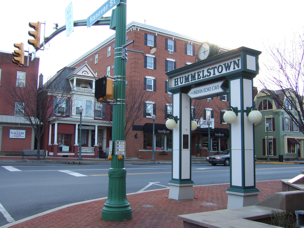
imagesize =
image_caption =Hummelstown square
flag_size =
image_
seal_size =
image_shield =
shield_size =
image_blank_emblem =
blank_emblem_size =
mapsize =250x200px
map_caption =
mapsize1 =
map_caption1 =
image_dot_
dot_mapsize =
dot_map_caption =
dot_x =
dot_y =
|pushpin_
pushpin_label_position =left
pushpin_map_caption =Location within the state of Pennsylvania
pushpin_mapsize =
pushpin_label_position =
pushpin_map_caption =
pushpin_mapsize =
subdivision_type =Country
subdivision_name =United States
subdivision_type1 =State
subdivision_name1 =Pennsylvania
subdivision_type2 =County
subdivision_name2 =Dauphin
subdivision_type3 =
subdivision_name3 =
subdivision_type4 =
subdivision_name4 =
government_footnotes =
government_type =
leader_title =
leader_name =
leader_title1 =
leader_name1 =
leader_title2 =
leader_name2 =
leader_title3 =
leader_name3 =
leader_title4 =
leader_name4 =
established_title =Settled
established_date =1762
established_title2 =Incorporated (borough)
established_date2 =1874
area_magnitude =
unit_pref =
unit_pref =Imperial
area_footnotes =
area_total_km2 =3.6
area_land_km2 =
area_water_km2 =
area_total_sq_mi =1.4
area_land_sq_mi =
area_water_sq_mi =
area_water_percent =
area_urban_km2 =
area_urban_sq_mi =
area_metro_km2 =
area_metro_sq_mi =
area_blank1_title =
area_blank1_km2 =
area_blank1_sq_mi =
population_as_of =2000
population_footnotes =
population_note =
population_total =4360
population_density_km2 =1247.0
population_density_sq_mi =3233.6
population_metro =
population_density_metro_km2 =
population_density_metro_sq_mi =
population_urban =
population_density_urban_km2 =
population_density_urban_sq_mi =
population_blank1_title =
population_blank1 =
population_density_blank1_km2 =
population_density_blank1_sq_mi =
timezone =Eastern (EST)
utc_offset =-5
timezone_DST =EDT
utc_offset_DST =-4
latd =40
latm =15
lats =55
latNS =N
longd =76
longm =42
longs =31
longEW =W
elevation_footnotes =
elevation_m =
elevation_ft =456
postal_code_type =
postal_code =
area_code =717
blank_name =
blank_info =
blank1_name =
blank1_info =
website = [http://www.hummelstown.net// Borough of Hummelstown]
footnotes =Hummelstown is a borough in
Dauphin County, Pennsylvania ,United States . The population was 4,360 as of the2000 census . Hummelstown is a part of theLower Dauphin School District . The current mayor of Hummelstown is Brad Miller.History
Hummelstown was founded as Frederickstown in 1762 when two Germans, Frederick and Rosina Hummel, bought the land for 200
pound sterling s. They then made building lots and sold them to German settlers. During the mid 19th century the Union Canal atSwatara Creek was the driving force behind the local economy, promoting trade and transportation. The Brownstone Quarries from 1867 to 1929 provided much growth and stability to the town.Geography
Hummelstown is located at coor dms|40|15|55|N|076|42|30|W|city (40.265168, -76.710995) at an elevation of 384 feet.
According to the
United States Census Bureau , the borough has a total area of 1.4square mile s (3.6 km²).1.4 square miles (3.5 km²) of it is land and 0.1 square miles (0.1 km²) of it (3.57%) is water.Demographics
As of the
census GR|2 of 2000, there were 4,360 people, 1,879 households, and 1,200 families residing in the borough. Thepopulation density was 3,233.6 people per square mile (1,247.0/km²). There were 1,953 housing units at an average density of 1,448.4/sq mi (558.6/km²). The racial makeup of the borough was 97.02% White, 0.32% African American, 0.02% Native American, 1.06% Asian, 0.07% Pacific Islander, 0.67% from other races, and 0.85% from two or more races. Hispanic or Latino of any race were 1.51% of the population.There were 1,879 households out of which 29.3% had children under the age of 18 living with them, 49.1% were married couples living together, 10.5% had a female householder with no husband present, and 36.1% were non-families. 31.5% of all households were made up of individuals and 12.3% had someone living alone who was 65 years of age or older. The average household size was 2.32 and the average family size was 2.91.
In the borough the population was spread out with 23.6% under the age of 18, 7.4% from 18 to 24, 32.0% from 25 to 44, 21.1% from 45 to 64, and 15.9% who were 65 years of age or older. The median age was 38 years. For every 100 females there were 95.0 males. For every 100 females age 18 and over, there were 93.4 males.
The median income for a household in the borough was $41,625, and the median income for a family was $50,572. Males had a median income of $36,500 versus $27,547 for females. The
per capita income for the borough was $21,394. About 4.2% of families and 6.7% of the population were below the poverty line, including 6.3% of those under age 18 and 7.2% of those age 65 or over.In 2005 Hummelstown was named the 61st best town in the United States of America to live in, as voted on by "
The New York Times " in association with "Time", "Life", and several other high-profile magazines on "Money Magazine"'s website [Money Magazine's web site [http://money.cnn.com/magazines/moneymag/bplive/2005/top100/top100_3.html] ] ."Money Magazine" (via their website and magazine) lists the median household income for Hummelstown to be $60,666 as of 2005, compared to the average in the United States which is $68,053 in 2005. The sales tax is 6.00%, compared to that of 6.77% nation-wide. The median house price is $154,815 compared to that of the nation average of $315,351. [Money Magazine's Hummelstown staistics: [http://money.cnn.com/magazines/moneymag/bplive/2005/snapshots/44257.html] ]
Government
Officials
Points of interest
The town is home to a unique historical landmark, the Warwick Hotel, which is still a
tavern reminiscent of its pre-Revolutionary War days.George Washington once spent a night there as well as drank from its bar - which is still the same bar. Fact|date=January 2008The Indian Echo Caverns are one of the main attractions in Hummelstown. It was originally used by the Susquehannock Indians who lived and hunted in the nearby area until they vanished in the 1670s. In 1929 it opened to the public.
Home to
Hummelstown is home to the
Lower Dauphin High School . Hummelstown is also home to theHummelstown Brownstone Company , with the Hummelstown Quarry being the largest producer ofbrownstone on the East Coast.Hummelstown also features a historical society near the back of the town beyond the church completely made of
Hummelstown brownstone . The Hummelstown Historical Society is both a museum and an information center on the town, it offers tours for the local schools including Nye Elementary as well as the previously used Price Building.Hummelstown is also home to [http://www.thesunontheweb.com/ The Sun]
newspaper , which covers Hummelstown,Hershey and the lowerDauphin community.Parks
Hummelstown has several parks within its borough. Such as:
*Herbert A Schaffner Memorial Park - PreviouslyBorough Park :*Named in honor of Herbert Schaffner
*Barry E Mehaffie Memorial Park - PreviouslyWest End Park :*Named in honor of Barry Mehaffie
*Hummel Nature Trail
*Bud Alexander Memorial Park - located in the Graystone Development of Hummelstown:*Named in honor of Bud Alexander, former mayor of Hummelstown
*Keller Fieldschools
Hummelstown has four schools within its borough, all connected to the
Lower Dauphin School District . They are:
*The Price Building
*The Nye Elementary School
*Lower Dauphin Middle School
*Lower Dauphin High School Churches
Hummelstown is home to numerous churches, quite a few of which are along the
Main Street of town. Some of which are:
* "Zion Evangelical Lutheran Church"
* "Trinity United Methodist Church"
* "First United Church of Christ"
* "The Bridge Church"Bars
*The Warwick Hotel
*The Boro Bar
*VFW
*"Chicks"
*Rosie's East End:* OnMay 21 st2008 Rosie's East Endexplode d.Famous residents
Hummelstown has a few famous residents.
Actors and actresses
*Former
Sprint Corporation spokesmanBrian Baker
*Wife of Brian Baker, of "Becker " andStar Trek "Deep Space Nine " Terry FarrellEvents
Numerous events are commonly held in Hummelstown, such as:
*The Lollipop Drop,New Year's Eve
*Movie Nights, movies shown at the Herbert Schaffner Memorial Park
*Taste of Hummelstown - an event in Hummelstown where all of the restaurants put up a stand along Main Street and people may sample their foods.
*The Hummelstown Craftsfair - A yearly crafts-fair held in September during which the western part of main street is closed to accomodate the vendor's stands and related foot traffic. This is reminiscent of an old time market.Hummelstown in literature
* 1862
ee also
*
Hummelstown brownstone
*Hummelstown Brownstone Company References
External links
* [http://www.thesunontheweb.com/ The Sun newspaper]
* [http://www.hummelstown.net/ Hummelstown's Official Homepage]

Wikimedia Foundation. 2010.