- Pennsylvania Route 283
-
PA Route 283
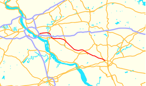
Route information Maintained by PennDOT Length: 29 mi[1] (47 km) Existed: 1967 – present Major junctions West end: South Eisenhower Blvd. in Highspire 
 I-76/PA Tpk in Lower Swatara Township
 I-283 in Lower Swatara Township.
 Airport Connector near Harrisburg
 PA 230 near Mount Joy
East end:  US 30 in Lancaster
Location Counties: Dauphin, Lancaster Highway system Roads in Pennsylvania
Interstate • US • State • Legislative← I-283PA 284  →
→Pennsylvania Route 283 (PA Route 283 or PA 283, officially State Route 300 or SR 300 due to the presence of Interstate 283) is a 29-mile (47 km) long state highway in the U.S. state of Pennsylvania. It connects Harrisburg to Lancaster as a freeway, paralleling the old U.S. Route 230 (now partly Pennsylvania Route 230). The number was assigned based on the proximity of Interstate 283, but Interstate 283 and PA 283 are not the same roadway; the two intersect at a cloverleaf interchange. Because the road is built to Interstate Standards, it is one of the few non-interstate designated highways in Pennsylvania with a posted speed limit of 65 mph (105 km/h) for a considerable distance.
Contents
Route description
Dauphin County
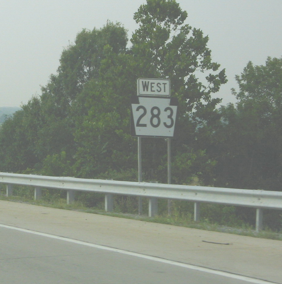
 PA 283 reassurance shield.
PA 283 begins at an intersection with Eisenhower Boulevard (Quadrant Route 3001) near Highspire that connects to Pennsylvania Route 230. PA 283 is one of few Pennsylvania Highways to end at a Quadrant Route. From there, PA 283 intersects Interstate 283 at exit 1 and Interstate 76 (Pennsylvania Turnpike) at exit 247 (Harrisburg East exit) at a cloverleaf interchange. East of I-283 and I-76, PA 283 is a 29-mile (47 km) long freeway. In Lower Swatara Township, PA 283 has an exit to a freeway road (Quadrant Route 3032) that connects to Harrisburg International Airport and Pennsylvania Route 441. This exit has access to Penn State Harrisburg. East of PA 441, PA 283 has an exit to Union Street and Fulling Mill Road which are detours to PA 441. After crossing the Swatara Creek and entering Londonderry Township, PA 283 has an exit to Hummelstown on Vine Street. In Middletown, PA 283 passes over I-76/PA Turnpike and Pennsylvania Route 341. The next exit is an exit that leads to both PA 341 and PA 230.
Lancaster County
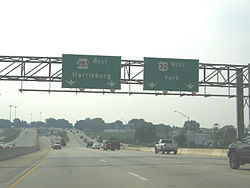
The first exit in Lancaster County is an exit to Pennsylvania Route 743. Just east of PA 743, PA 283 passes over Pennsylvania Route 241. In Mount Joy, PA 283 has an exit to Rheems and Elizabethtown. In Rapho Township, PA 283 interchanges with Pennsylvania Route 772. The next exit is split up into two interchanges that lead to the eastern terminus of PA 230 on the Harrisburg Pike. (East of here, PA 283 has a narrow median strip as it is using old Route 230.) In East Hempfield Township, PA 283 interchanges with Spooky Nook Road to Salunga. The next exit is a diamond interchange with the western terminus of Pennsylvania Route 722. In Manheim Township, PA 283 interchanges with Pennsylvania Route 741 and Pennsylvania Route 72. PA 283 terminates (ends) at an interchange with U.S. Route 30 in Lancaster. The first exit is to US 30 west, then the second exit is to Fruitville Pike, and the final exit is to US 30 east.[2][3]
Exit list
County Location Mile[4] Destinations Notes Dauphin Lower Swatara Township 0.0 To PA 230 (Eisenhower Boulevard)Westbound exit and eastbound entrance. 0.1 I-76 / Penna. Tpk. – Philadelphia, PittsburghHarrisburg East exit of PA Turnpike 0.3 I-283 north – Harrisburg1.8  PA 441 south / SR 3032 – Harrisburg International Airport
Penn State Harrisburg 2.9 To PA 441 (North Union Street / Fulling Mill Road)Londonderry Township 3.9 Middletown, Hummelstown 6.8  To PA 230 (Toll House Road) / PA 341
Lancaster Mount Joy Township 11.6  PA 743 – Hershey, Elizabethtown
15.0 Rheems, Elizabethtown Rapho Township 20.0  PA 772 – Manheim, Mount Joy
21.2 Esbenshade Road Eastbound Exit, Westbound Entrance 21.8 PA 230 – Mount JoyEastern terminus of PA 230, Westbound exit, Eastbound entrance. East Hempfield Township 22.5 Spooky Nook Road - Salunga 25.4  PA 722 – Landisville
Western terminus of PA 722. Continues westbound as State Rd. 27.0  PA 741 – Millersville, East Petersburg
Manheim Township 27.8  PA 72 (Manheim Pike)
Lancaster 28.4 US 30 west – YorkEastbound exit and westbound entrance. 28.7 Fruitville Pike Eastbound exit and westbound entrance. 29.0 US 30 east – PhiladelphiaEastbound exit and westbound entrance. References
- ^ Pennsylvania Highways - Pennsylvania Route 283
- ^ Pennsylvania Tourism and Transportation Map
- ^ Rand Mcnally 2007 Atlas
- ^ DeLorme Street Atlas USA 2007
Roads in the Susquehanna Valley Beltway Interstate Highways U.S. Routes Limited-access Pennsylvania Routes Other Pennsylvania Routes PA 17 · PA 23 · PA 25 · PA 34 · PA 39 · PA 72 · PA 74 · PA 94 · PA 114 · PA 117 · PA 147 · PA 174 · PA 225 · PA 230 · PA 233 · PA 235 · PA 241 · PA 274 · PA 325 · PA 340 · PA 341 · PA 343 · PA 419 · PA 441 · PA 443 · PA 462 · PA 465 · PA 501 · PA 533 · PA 641 · PA 645 · PA 696 · PA 722 · PA 743 · PA 772 · PA 849 · PA 850 · PA 897 · PA 934 · PA 944 · PA 997 · PA 999Other Quadrant Routes Other notable roads Categories:- State highways in Pennsylvania
- Roads in the Harrisburg, Pennsylvania area
- Limited access Pennsylvania state routes


Wikimedia Foundation. 2010.