- Pennsylvania Route 284
-
PA Route 284
Route information Maintained by PennDOT Length: 9.04 mi[1] (14.55 km) Existed: 1928 – present Major junctions West end:  PA 287 in English Center
East end:  US 15 in Buttonwood
Location Counties: Lycoming Highway system Roads in Pennsylvania
Interstate • US • State • Legislative←  PA 283
PA 285  →
→Pennsylvania Route 284 is an 9.04-mile (14.55 km) long state highway located in Lycoming County in Pennsylvania. The western terminus is at PA 287 in English Center. The eastern terminus is at US 15 in Buttonwood. The route is rather isolated, passing through forestry most of its length. Route 284 was designated as a spur of Pennsylvania Route 84 in the 1928 renumbering of state highways in Pennsylvania. The route was paved in 1932 and has remained relatively untouched since, although Route 84 was re-designated as Route 287 in 1961 to avoid duplication with Interstate 84.
Contents
Route description
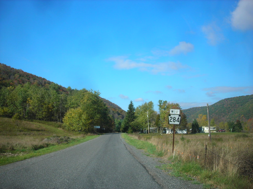
 Route 284 heading northward as a two-lane unstriped roadway north of English Center
Traffic Route 284 begins at an intersection with Route 287 just north of the community of English Center, Pennsylvania. Route 284 progresses to the northeast, crossing as a one-lane highway through the desolate portions of Lycoming County. For the first few miles, the route passes through deep trees and some nearby residences before turning northward at a clearing in English Center. The route continues northward, paralleling the Little Pine Creek around the bases of large hills, some of which reach 1,600 feet (490 m) high.[2]
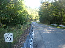 Route 284 heading westbound through Pine Township as a one-lane highway
After passing Stahineckers Pond, Route 284 crosses Texas Creek and soon over the Little Pine Creek, paralleling Flicks Run until the intersection with Flooks Run Road, where it continues northward along Blockhouse Creek. Most of the surroundings along Route 284 are rather desolate, populated by forestry. At the intersection with Schmouder Drive, there are some residences, but the one-lane highway continues eastward into the community of Buttonwood. After the intersection with Homer Hollow Road, Route 284 becomes two-lanes as it enters the interchange with U.S. Route 15 southbound. Heading through the trumpet, Route 284 curves to the northwest through Buttonwood, interchanging with U.S. Route 15 northbound, where the designation terminates.[1]
History
Route 284 was first designated along its current alignment during the 1928 renumbering of state highways in Pennsylvania. The designation was done as a spur to the alignment of Route 84, which was designated from Piatt Township to the New York state line.[3] The entire alignment of Route 284 was paved by the Pennsylvania Department of Highways in 1932, including the bridge over Flooks Run and Blacks Creek.[4] However, the alignment has remained relatively unchanged since. In 1961, with the designation of Interstate 84, the alignment of Route 84 was re-designated as Route 287 to avoid duplication.[5] In 1974, Route 284 was adjusted for the construction of the new U.S. Route 15 alignment. This was adjusted in 1998 with the construction of U.S. Route 15 in preparations for Interstate 99.[6] In 1998 and 2002 respectively, both the Blacks Creek and Flooks Run bridges were reconstructed,[7] and during the ensuing ten years after, several bridges were also replaced.[8]
Major intersections
The entire route is in Lycoming County.
Location Mile[1] Destinations Notes English Center 0.00 PA 287Western terminus of PA 284 Buttonwood 8.34 US 15 southInterchange 9.04 US 15 northInterchange, Eastern terminus of PA 284 1.000 mi = 1.609 km; 1.000 km = 0.621 mi See also
- Pennsylvania Route 184 - the other spur to Route 84 to the south of Route 284.
References
- ^ a b c Yahoo! Inc. Yahoo! Maps – Overview map of Pennsylvania Route 284 (Map). Cartography by NAVTEQ. http://maps.yahoo.com/#mvt=h&lat=41.49727&lon=-77.139123&zoom=17&q1=41.452197%2C-77.277192&q2=41.497093%2C-77.136977. Retrieved 26 February 2010.
- ^ Google, Inc. Google Maps – Overview map of Route 284 in English Center (terrain mode) (Map). Cartography by Google, Inc. http://maps.google.com/maps?f=q&source=s_q&hl=en&geocode=&q=English+Center+PA&sll=40.506278,-74.415958&sspn=0.008614,0.021973&ie=UTF8&hq=&hnear=English+Center,+Lycoming,+Pennsylvania&ll=41.469969,-77.253971&spn=0.016979,0.043945&t=p&z=15. Retrieved 26 February 2010.
- ^ Pennsylvania Department of Highways (1928). Official Road Map of Pennsylvania State Highways (Map). Cartography by Pennsylvania Department of Highways.
- ^ Pennsylvania Department of Highways (1932). Official Road Map of Pennsylvania State Highways (Map). Cartography by Pennsylvania Department of Highways.
- ^ Pennsylvania Department of Highways (1961). Road Map of Pennsylvania (Map). Cartography by Pennsylvania Department of Highways.
- ^ Inventory, National Bridge (2008). "Structure Number: 410015177103250". Washington D.C.: United States Department of Transportation. http://nationalbridges.com/nbi_record.php?StateCode=42&struct=410015177103250. Retrieved 26 February 2010.
- ^ Inventory, National Bridge (2008). "Structure Number: 410284016000000". Washington D.C.: United States Department of Transportation. http://nationalbridges.com/nbi_record.php?StateCode=42&struct=410284016000000. Retrieved 26 February 2010.
- ^ Inventory, National Bridge (2008). "Structure Number: 410284007403610". Washington D.C.: United States Department of Transportation. http://nationalbridges.com/nbi_record.php?StateCode=42&struct=410284007403610. Retrieved 26 February 2010.
External links
- Kitsko, Jeffrey J. (2009). "PA 284". Pennsylvania Highways. pp. 251–300. http://www.pahighways.com/state/PA251-300.html#PA284. Retrieved 26 February 2010.
Categories:- State highways in Pennsylvania
- Transportation in Lycoming County, Pennsylvania


Wikimedia Foundation. 2010.