- Pennsylvania Route 233
-
PA Route 233
Route information Maintained by PennDOT Length: 53.2 mi[1] (85.6 km) Existed: 1928 – present Major junctions South end:  PA 997 in Mont Alto
 US 30 near Fayetteville
 PA 174 in Dickinson
 I-81 near Newville
 US 11 near Newville
 PA 533 in Newville
 PA 641 in Newville
North end:  PA 274 near Green Park
Location Counties: Franklin, Adams, Cumberland, Perry Highway system Roads in Pennsylvania
Interstate • US • State • Legislative←  PA 232
PA 234  →
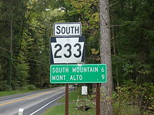
→Pennsylvania Route 233 (PA 233) is a north–south highway in south central Pennsylvania. It runs from the village of Mont Alto, just north of Waynesboro and the Maryland state line to Green Park. It runs through Mont Alto and Caledonia state parks.
Contents
Route description
Franklin County
 PA 233 southbound in Greene Township
PA 233 begins at an intersection with PA 997 in Mont Alto, Franklin County, heading east on two-lane undivided Park Street. The road passes homes, becoming the border between Quincy Township to the north and Mont Alto to the south before fully entering Mont Alto again. The route heads entirely into Quincy Township as it passes the Penn State Mont Alto campus. From here, PA 233 becomes Mont Alto Road and continues near Mont Alto State Park and heads into Michaux State Forest. The route turns northeast to ascend Rocky Mountain, a part of the South Mountain range, becoming an unnamed road. The road enters Guilford Township and makes a hairpin turn to the south to descend the mountain, crossing back into Quincy Township. PA 233 curves east before heading northeast through more forests and entering Guilford Township again. The route turns north-northeast onto Rocky Mountain Road and runs through more mountainous areas, heading into Greene Township. Here, PA 233 passes through Caledonia and crosses US 30 before running through forested Caledonia State Park as an unnamed road, turning northeast.[1][2]
Adams County
PA 233 crosses into Franklin Township in Adams County, leaving Caledonia State Park and continuing northeast through more of Michaux State Forest on Pine Grove Road. At this point, the route runs between East Big Flat Ridge to the northwest and Piney Mountain to the southeast, paralleling Conococheague Creek. The road stops following the creek as it heads into Menallen Township, running through more areas of mountains.[1][3]
Cumberland County
PA 233 heads into Cumberland County and becomes Centerville Road, briefly passing through Southampton Township and South Newton Township before continuing into Cooke Township. The road runs through more mountainous areas of Michaux State Forest, passing near Pine Grove Furnace State Park before reaching the community of Pine Grove Furnace. At this point, the route turns to the north and runs through more rural areas, turning northwest to leave the state forest and continue through more forested areas. PA 233 curves north again and crosses into Penn Township, passing through more dense forests before heading north-northwest into open agricultural areas with a few homes, running through South Fairview. The road crosses a Norfolk Southern railroad line and Yellow Breeches Creek prior to running through more farmland with some woods and residences, reaching a junction with PA 174. From here, the route turns northwes through more farm fields, reaching an interchange with I-81. Past this, PA 233 continues through more rural areas as it comes to an intersection with US 11.[1][4]
At this point, the road crosses into West Pennsboro Township and passes through more agricultural areas with occasional patches of woodland and residences. The route becomes the border between Newville to the west and West Pennsboro Township to the east before fully entering Newville at the crossing of the Big Spring Creek. Here, PA 233 becomes South High Street and passes homes, intersecting PA 533 prior to heading into the commercial downtown and crossing PA 641. Past this junction, the route becomes North High Street and passes more residences along with a few businesses. The route heads into North Newton Township and becomes Doubling Gap Road, running through farmland and woodland with some homes. PA 233 crosses the Conodoguinet Creek into Lower Mifflin Township and curves north through more agricultural areas, coming to a bridge over I-76 (Pennsylvania Turnpike). From here, the road winds north through farmland with some woods and residences, turning to the northwest. Farther northwest, the route intersects the western terminus of PA 944 before reaching the northern terminus of PA 997 near McCrea. PA 233 curves north through into more wooded areas with some farms and homes. The road turns northeast and heads into forested areas at the base of Blue Mountain that are a part of the Tuscarora State Forest, passing near Colonel Denning State Park before ascending the mountain.[1][4]
Perry County
At the summit of Blue Mountain, PA 233 crosses into Southwest Madison Township in Perry County, leaving the Tuscarora State Forest boundaries and descending the forested mountain as it continues northeast. The route heads into woodland with some farm fields and homes, heading into Tyrone Township. The road runs through more agricultural areas as it heads more to the east and crosses Sherman Creek. PA 233 passes homes and comes into Landisburg, reaching an intersection with PA 850. At this point, PA 233 turns northwest to form a concurrency with PA 850 on Carlisle Street, passing more residences. The road crosses back into Tyrone Township and becomes unnamed, heading north through farmland with some homes. PA 850 splits from PA 233 by heading to the northwest, and PA 233 continues northeast on Green Park Road, running through farms and woods with occasional residences. The route turns north into open agricultural areas with some homes, reaching its northern terminus at PA 274 in Green Park.[1][5]
Major intersections
County Location Mile Destinations Notes Franklin Mont Alto PA 997 (Main Street, Anthony Highway)Southern terminus of PA 233 Caledonia US 30 (Lincoln Highway)Caledonia State Park No major junctions in Adams County Cumberland Dickinson PA 174 (Walnut Bottom Road) I-81Interchange US 11 (Ritner Highway)Newville PA 533 (Fairfield Street)Eastern terminus of PA 533 PA 641 (Main Street)McCrea  PA 944 (Enola Road)
Western terminus of PA 944 PA 997 (Roxbury Road)Northern terminus of PA 997 Perry Landisburg  PA 850 east (Main Street)
Southern end of PA 850 concurrency PA 850 westNorthern end of PA 850 concurrency Green Park PA 274 (Shermans Valley Road)Northern terminus of PA 233 1.000 mi = 1.609 km; 1.000 km = 0.621 mi References
- ^ a b c d e f Google, Inc. Google Maps – overview of Pennsylvania Route 233 (Map). Cartography by Google, Inc. http://maps.google.com/maps?f=d&source=s_d&saddr=Pennsylvania+233+%26+Pennsylvania+997,+Mont+Alto,+Franklin,+Pennsylvania+17237&daddr=39.9710718,-77.3935738+to:PA+233+and+PA+274&geocode=Fbv5XwIdvoxg-ylxdR35fqLJiTEuTWJeQVh0vg%3BFf_oYQIdWxFj-ylP__-IbgjJiTGcWwNw1xYCTw%3BFaUcaAIdnlRk-ymPFCKTSiTJiTGmudor4_l3hA&hl=en&mra=ls&via=1&sll=40.341311,-77.277145&sspn=0.117495,0.338173&ie=UTF8&t=h&z=9. Retrieved June 11, 2011.
- ^ PennDOT (2011). Franklin County, Pennsylvania Highway Map (Map). ftp://ftp.dot.state.pa.us/public/pdf/BPR_pdf_files/Maps/GHS/Roadnames/franklin_GHSN.PDF. Retrieved March 8, 2011.
- ^ PennDOT (2011). Adams County, Pennsylvania Highway Map (Map). ftp://ftp.dot.state.pa.us/public/pdf/BPR_pdf_files/Maps/GHS/Roadnames/adams_GHSN.PDF. Retrieved February 22, 2011.
- ^ a b PennDOT (2011). Cumberland County, Pennsylvania Highway Map (Map). ftp://ftp.dot.state.pa.us/public/pdf/BPR_pdf_files/Maps/GHS/Roadnames/cumberland_GHSN.PDF. Retrieved May 15, 2011.
- ^ PennDOT (2011). Perry County, Pennsylvania Highway Map (Map). ftp://ftp.dot.state.pa.us/public/pdf/BPR_pdf_files/Maps/GHS/Roadnames/perry_GHSN.PDF. Retrieved June 10, 2011.
Roads in the Susquehanna Valley Beltway Interstate Highways U.S. Routes Limited-access Pennsylvania Routes Other Pennsylvania Routes PA 17 · PA 23 · PA 25 · PA 34 · PA 39 · PA 72 · PA 74 · PA 94 · PA 114 · PA 117 · PA 147 · PA 174 · PA 225 · PA 230 · PA 233 · PA 235 · PA 241 · PA 274 · PA 325 · PA 340 · PA 341 · PA 343 · PA 419 · PA 441 · PA 443 · PA 462 · PA 465 · PA 501 · PA 533 · PA 641 · PA 645 · PA 696 · PA 722 · PA 743 · PA 772 · PA 849 · PA 850 · PA 897 · PA 934 · PA 944 · PA 997 · PA 999Other Quadrant Routes Other notable roads Categories:- State highways in Pennsylvania


Wikimedia Foundation. 2010.