- Franklin County, Pennsylvania
-
Franklin County, Pennsylvania 
Seal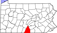
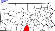
Location in the state of Pennsylvania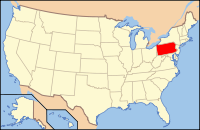
Pennsylvania's location in the U.S.Founded September 9, 1784
From: Cumberland County
Eponym: Benjamin FranklinSeat Chambersburg[1] Largest city Chambersburg Area
- Total
- Land
- Water
773 sq mi (2,002 km²)
772 sq mi (1,999 km²)
1 sq mi (3 km²), 0.09%[2]Population
- (2010)
- Density
149,618
194/sq mi (74.8/km²)Website www.co.franklin.pa.us Franklin County is a county located in South Central Pennsylvania; it lies to a large extent within the Cumberland Valley. Originally part of Lancaster County (1729), then Cumberland County (1750), Franklin County became an independent jurisdiction on September 9, 1784, named in honor of Founding Father Benjamin Franklin.[3]
Contents
Geography
Franklin County is in the watershed of the Chesapeake Bay and the overwhelming majority of it is drained by the Potomac River, but the Conodoguinet Creek and the Sherman Creek drain northeastern portions into the Susquehanna River.
Adjacent counties
- Juniata County (north)
- Perry County (northeast)
- Cumberland County (northeast)
- Adams County (east)
- Frederick County, Maryland (southeast)
- Washington County, Maryland (south)
- Fulton County (west)
- Huntingdon County (northwest)
Demographics
Historical populations Census Pop. %± 1790 15,662 — 1800 19,638 25.4% 1810 23,083 17.5% 1820 31,892 38.2% 1830 35,037 9.9% 1840 37,793 7.9% 1850 39,904 5.6% 1860 42,126 5.6% 1870 45,365 7.7% 1880 49,855 9.9% 1890 51,433 3.2% 1900 54,902 6.7% 1910 59,775 8.9% 1920 62,275 4.2% 1930 65,010 4.4% 1940 69,378 6.7% 1950 75,927 9.4% 1960 88,172 16.1% 1970 100,833 14.4% 1980 113,629 12.7% 1990 121,082 6.6% 2000 129,308 6.8% 2010 149,618 15.7% [4][5] As of the census[2] of 2000, there were 129,313 people, 50,633 households, and 36,405 families residing in the county. The population density was 168 people per square mile (65/km²). There were 53,803 housing units at an average density of 70 per square mile (27/km²). The racial makeup of the county was 95.33% White, 2.33% Black or African American, 0.15% Native American, 0.55% Asian, 0.03% Pacific Islander, 0.74% from other races, and 0.86% from two or more races. 1.75% of the population were Hispanic or Latino of any race. 40.2% were of German, 19.4% American, 7.6% Irish and 6.0% English ancestry according to Census 2000. 96.0% spoke English and 2.1% Spanish as their first language.
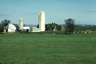
 A farm in Franklin County, Pennsylvania
There were 50,633 households out of which 30.80% had children under the age of 18 living with them, 60.00% were married couples living together, 8.20% had a female householder with no husband present, and 28.10% were non-families. 23.70% of all households were made up of individuals and 10.70% had someone living alone who was 65 years of age or older. The average household size was 2.49 and the average family size was 2.94.
In the county, the population was spread out with 24.00% under the age of 18, 7.90% from 18 to 24, 28.20% from 25 to 44, 23.70% from 45 to 64, and 16.00% who were 65 years of age or older. The median age was 38 years. For every 100 females there were 94.80 males. For every 100 females age 18 and over, there were 91.90 males.
In 2001, Franklin County was featured in David Brooks' article "One Nation, Slightly Divisible" in The Atlantic as a representative Red or Republican Party county.[6]
Municipalities
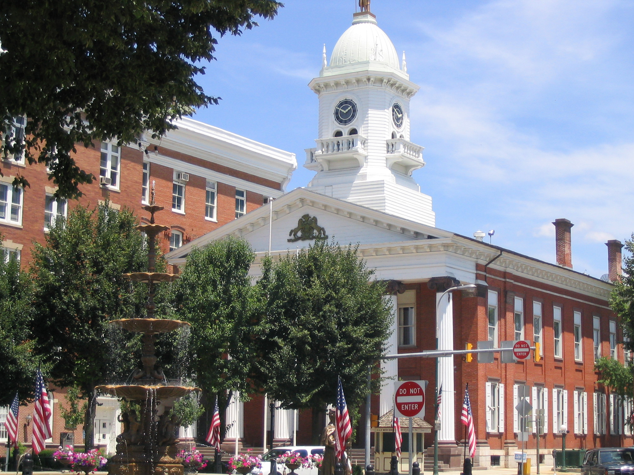
 Chambersburg is the county seat and largest municipality in Franklin County.
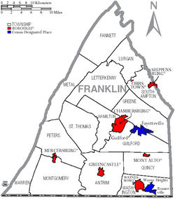 Map of Franklin County, Pennsylvania with Municipal Labels showing Boroughs (red), Townships (white), and Census-designated places (blue).
Under Pennsylvania law, there are four types of incorporated municipalities: cities, boroughs, townships, and, in at most two cases, towns. The following boroughs and townships are located in Franklin County:
Boroughs
- Orrstown
- Shippensburg (partial)
- Waynesboro
Townships
- Antrim Township
- Fannett Township
- Greene Township
- Guilford Township
- Hamilton Township
- Letterkenny Township
- Lurgan Township
- Metal Township
- Montgomery Township
- Peters Township
- Quincy Township
- Southampton Township
- St. Thomas Township
- Warren Township
- Washington Township
Census-designated places
Census-designated places are geographical areas designated by the U.S. Census Bureau for the purposes of compiling demographic data. They are not actual jurisdictions under Pennsylvania law. Other unincorporated communities, such as villages, may be listed here as well.
Other
- State Line
- Marion
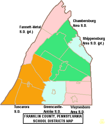
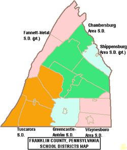 Map of Franklin County, Pennsylvania School Districts
Education
Public School Districts
- Chambersburg Area School District
- Fannett-Metal School District
- Greencastle-Antrim School District
- Shippensburg Area School District
- Tuscarora School District
- Waynesboro Area School District
Private schools
- Mercersburg Academy
- Shalom Christian Academy
- Cumberland Valley Christian School
- Corpus Christi Catholic School
Universities and Colleges
Other
- Franklin County Career and Technology Center
Intermediate Unit
Lincoln Intermediate Unit (IU#12) region includes: Adams County, Franklin County and York County. The agency offers school districts, home schooled students and private schools many services including: Special education services, combined purchasing, and instructional technology services. It runs Summer Academy which offers both art and academic strands designed to meet the individual needs of gifted, talented and high achieving students. Additional services include: Curriculum Mapping, Professional Development for school employees, Adult Education, Nonpublic School Services, Business Services, Migrant & ESL (English as a Second Language), Instructional Services, Special Education, Management Services, and Technology Services. It also provides a GED program to adults who want to earn a high school diploma and literacy programs. The Lincoln Intermediate Unit is governed by a 13 member Board of Directors, each a member of a local school board from the 25 school districts. Board members are elected by school directors of all 25 school districts for three-year terms that begin July 1.[7] There are 29 intermediate units in Pennsylvania. They are funded by school districts, state and federal program specific funding and grants. IUs do not have the power to tax.
Recreation
There are three Pennsylvania state parks in Franklin County.
- Caledonia State Park straddles the Franklin and Adams County line along U.S. Route 30 between Chambersburg and Gettysburg.
- Buchanan's Birthplace State Park is the birthplace of the 15th President of the United States, James Buchanan.
- Mont Alto State Park is the oldest state park in Pennsylvania.
See also
- List of municipal authorities in Franklin County, Pennsylvania
- National Register of Historic Places listings in Franklin County, Pennsylvania
- Bloom Brothers Department Stores
References and notes
- ^ "Find a County". National Association of Counties. http://www.naco.org/Counties/Pages/FindACounty.aspx. Retrieved 2011-06-07.
- ^ a b "American FactFinder". United States Census Bureau. http://factfinder.census.gov. Retrieved 2008-01-31.
- ^ http://www.co.franklin.pa.us/Pages/CommissCountyHistoricalFacts.aspx
- ^ http://factfinder2.census.gov
- ^ http://mapserver.lib.virginia.edu/
- ^ David Brooks (December 2001). "One Nation, Slightly Divisible". The Atlantic. http://www.theatlantic.com/past/docs/issues/2001/12/brooks.htm. Retrieved November 11, 2010.
- ^ Lincoln Intermediate Unit 12 website accessed April 2010
Franklin County in the American Civil WarPart of: Pennsylvania in the American Civil WarCampaigns & Battles Fights & Skirmishes Other Actions Units - 77th Pennsylvania Infantry
- 126th Pennsylvania Infantry
- 2nd Pennsylvania Heavy Artillery
- Battery B, Pennsylvania Light Artillery
People Municipalities and communities of Franklin County, Pennsylvania Boroughs Chambersburg | Greencastle | Mercersburg | Mont Alto | Orrstown | Shippensburg‡ | Waynesboro
Townships Antrim | Fannett | Greene | Guilford | Hamilton | Letterkenny | Lurgan | Metal | Montgomery | Peters | Quincy | Southampton | St. Thomas | Warren | Washington
CDPs Unincorporated
communitiesBlue Ridge Summit | Cove Gap | Johnston | Marion | Old Forge | Roxbury | Scotland | State Line
Footnotes ‡This populated place also has portions in an adjacent county or counties
Categories:- Pennsylvania counties
- Franklin County, Pennsylvania
- States and territories established in 1784


Wikimedia Foundation. 2010.