- Dunmore, Pennsylvania
-
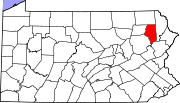
Dunmore Borough Dunmore, PennsylvaniaOfficial name: Borough of Dunmore Country United States State Pennsylvania County Lackawanna Elevation 1,001 ft (305 m) Coordinates 41°25′03″N 75°37′28″W / 41.4175°N 75.62444°W Area 9.0 sq mi (23.3 km2) - land 8.9 sq mi (23 km2) - water 0.1 sq mi (0 km2), 1.11% Population 14,057 (2010) Density 1,579.4 / sq mi (610 / km2) Mayor Patrick W. Loughney Timezone EST (UTC-5) - summer (DST) EDT (UTC-4) Zip Code 18512 Area code 570 Website: http://www.dunmoreborough.com Dunmore is a borough in Lackawanna County, Pennsylvania, adjoining Scranton. Dunmore was settled in 1835 and incorporated in 1862. Extensive anthracite coal, brick, stone, and silk interests had led to a rapid increase in the population to 8,315 in 1890, 12,583 in 1900, 17,615 in 1910, 20,250 in 1920, and 23,086 in 1940. The population was 14,057 at the 2010 census. Dunmore contains several schools: Dunmore High School, Holy Cross High School formerly known as Bishop O'Hara, and Saint Mary's of Mount Carmel Elementary School.
Contents
History
Dunmore is one of the numerous villages which sprang from the original township of Providence, Pennsylvania. Purchased from the natives in 1754, the territory now embracing this village offered its solitude to the pioneers seeking a home in the wilderness between the Delaware and the Susquehanna rivers until the summer of 1783.
At this time, William Allsworth, a shoemaker by trade, who had visited the Connecticut land at Wyoming for the purpose of selecting a place for his home the year previous, reached the point at evening, where he encamped and lit his fire in the forest where Dunmore was thus founded. The need of more places of rest to cheer the emigrants traveling with heavy burdens induced Mr. Allsworth to fix his abode at this spot. Deer and bear were so abundant for many years within sight of his clearing, that his family never trusted to his rifle in vain for a supply of venison or the substantial haunches of the bear.
The house of Mr. Allsworth, famed for the constant readiness of the host to smooth by his dry jokes and kind words the ruggedness of every man’s daily road, became a common point of interest and attraction to the emigrant or the wayfarer. The descendants of Mr. Allsworth have filled many places of trust and usefulness in the county, and adorned the various walks of social life. In the summer of 1795, Charles Dolph, John Carey, and John West began the labor of clearing and plowing lands in the neighborhood of Bucktown or Corners, as this place was long called after the first foot-path opened from Blakeley to the Roaring Brook crossed the Wyoming road at Allsworth’s.
Edward Lunnon, Isaac Dolph, James Brown, Philip Swartz and Levi De Puy, purchased land of the State between 1799–1805 and located in this portion of Providence Township. The old tavern, long since vanished with its round swinging sign and low bar-room, one corner of which, fortified with long pine-pickets, extended from the bar to the very ceiling, in times of yore, was owned successively by Wm. Allsworth, Philip Swartz, Isaac Dolph, Henry W. Drinker, and Samuel De Puy.
The external aspect of Dunmore promised so much by its agricultural expectations in 1813, that Dr. Orlo Hamlin, with his young wife, was induced to settle a mile north of Allsworth. He was the first physician and surgeon locating in Providence. The population of Dunmore and Blakeley, doubling in numbers and increasing in wealth, warranted Stephen Tripp in erecting a saw and grist mill in 1820, on the Roaring Brook half a mile south of the village.
A store was opened at the Corners in 1820 under the auspices of the Drinker Turnpike; but the village, consisting of but four houses, had but a negative existence until the Pennsylvania Coal Company, in 1847-1848, turned the sterile pasture-fields around it into a town liberal in the extent of its territory and diversified by every variety of life.
By 1875, the township of Providence was dissolved and the land split up into various smaller boroughs and towns with Dunmore being one of them. Today, Dunmore is a borough bordering the city of Scranton, Pennsylvania.
The name Dunmore comes from Dunmore Park, in the Falkirk area of Scotland (home of the Dunmore Pineapple).
Geography
Dunmore is located at 41°25′3″N 75°37′28″W / 41.4175°N 75.62444°W (41.417530, -75.624432)[1].
According to the United States Census Bureau, the borough has a total area of 9 square miles (23 km2), of which, 8.9 square miles (23 km2) of it is land and 0.1 square miles (0.26 km2) of it (1.11%) is water.
Demographics
As of the census[2] of 2010, there were 14,057 people, 5,999 households, and 3,388 families residing in the borough. The population density was 1,579.4 people per square mile (610/km²). There were 6,530 housing units at an average density of 733.7 per square mile (286.6/km²). The racial makeup of the borough was 95.2% White, 1.1% African American, 0.05% Native American, 1.8% Asian, 0.05% Pacific Islander, 0.8% from other races, and 1% from two or more races. Hispanic or Latino of any race were 2.3% of the population.
There were 5,999 households out of which 22% had children under the age of 18 living with them, 40.6% were married couples living together, 11.5% had a female householder with no husband present, and 43.5% were non-families. 37.9% of all households were made up of individuals and 16% had someone living alone who was 65 years of age or older. The average household size was 2.18 and the average family size was 2.93.
In the borough the population was spread out with 17.9% under the age of 18, 62.1% from 18 to 64, and 20% who were 65 years of age or older. The median age was 42.1 years.
The median income for a household in the borough was $33,280, and the median income for a family was $43,354. Males had a median income of $32,855 versus $24,167 for females. The per capita income for the borough was $19,851. About 6.7% of families and 10.5% of the population were below the poverty line, including 11.1% of those under age 18 and 11.8% of those age 65 or over.
Notable people
- Christopher F. Burne is a U.S. Air Force Brigadier General.
- Carol Ann Drazba, a 1961 graduate of Dunmore High School, was one of the first two American women to be killed in Vietnam when the helicopter that she and fellow nurse Elizabeth Ann Jones of Allendale, S.C., crashed on February 18, 1966, killing all seven people on board. A monument to Drazba will be unveiled on Blakely Street near the borough building this fall.
- Nestor Chylak American league baseball umpire for 25 years. He was one of only 8 umpires to be elected to Baseball Hall of Fame in Cooperstown 1999. Chylak was also a War Hero in the Battle of the Bulge who won the Purple Heart and Silver Star for valor in combat. Ted Williams claimed Chylak to be "the best ever at his craft." Chylak died in 1982.
- John Francis Ropek 1917-2009. Oceanographer for the first under the ice Polar expedition of the USS Nautilus (SSN-571).
- Paul W. Richards American Astronaut who flew on Mission STS-102 a board The Space Shuttle Discovery
- Tim Ruddy was a center for the Miami Dolphins from 1994 - 2003. Most of his career he was the center of Pro Football Hall of Fame quarterback Dan Marino.
References
- ^ "US Gazetteer files: 2010, 2000, and 1990". United States Census Bureau. 2011-02-12. http://www.census.gov/geo/www/gazetteer/gazette.html. Retrieved 2011-04-23.
- ^ "American FactFinder". United States Census Bureau. http://factfinder2.census.gov. Retrieved 2011-05-14.
External links
Municipalities and communities of Lackawanna County, Pennsylvania Cities Boroughs Townships Benton | Carbondale | Clifton | Covington | Elmhurst | Fell | Glenburn | Greenfield | Jefferson | La Plume | Madison | Newton | North Abington | Ransom | Roaring Brook | Scott | South Abington | Spring Brook | Thornhurst | Waverly | West Abington
CDPs Unincorporated
communityCounties Settlements
50k-100kSettlements
25k-50kSettlements
10k-25kCategories:- Populated places established in 1783
- Boroughs in Lackawanna County, Pennsylvania
Wikimedia Foundation. 2010.


