- Mayfield, Pennsylvania
-
Borough of Mayfield Settlement Country United States State Pennsylvania County Lackawanna Elevation 1,004 ft (306 m) Coordinates 41°32′18″N 75°32′12″W / 41.53833°N 75.53667°W Area 2.4 sq mi (6.2 km2) - land 2.4 sq mi (6 km2) - water 0.0 sq mi (0 km2), 0% Population 1,807 (2010) Density 752.9 / sq mi (290.7 / km2) Borough Established in 1881 Mayor Alexander J. Chelik Timezone EST (UTC-5) - summer (DST) EDT (UTC-4) Zip Code 18433 Area code 570 
 Location of Mayfield in Pennsylvania
 Location of Pennsylvania in the United States
Website: http://www.mayfieldborough.org/ Mayfield is a borough in Lackawanna County, Pennsylvania, about 14 miles (23 km) northeast of Scranton. In the past, it contained a silk mill and a coal mining industry. In 1900, 2,300 people lived here, and in 1910, 3,662 people inhabited Mayfield. The population was 1,807 at the 2010 census.
Geography
Mayfield is located at 41°32′18″N 75°32′12″W / 41.53833°N 75.53667°W (41.538331, -75.536554)[1].
According to the United States Census Bureau, the borough has a total area of 2.4 square miles (6.2 km2), all of it land.
Demographics
As of the census[2] of 2010, there were 1,807 people, 739 households, and 515 families residing in the borough. The population density was 752.9 people per square mile (290.7/km²). There were 800 housing units at an average density of 333.3 per square mile (130.2/km²). The racial makeup of the borough was 97.7% White, 0.8% African American, 0.1% Native American, 0.4% Asian, 0.4% from other races, and 0.6% from two or more races. Hispanic or Latino of any race were 1.1% of the population.
There were 739 households out of which 29.8% had children under the age of 18 living with them, 48.8% were married couples living together, 13.5% had a female householder with no husband present, and 30.3% were non-families. 25.7% of all households were made up of individuals and 11.1% had someone living alone who was 65 years of age or older. The average household size was 2.45 and the average family size was 2.93.
In the borough the population was spread out with 23.2% under the age of 18, 59.9% from 18 to 64, and 16.9% who were 65 years of age or older. The median age was 41.6 years.
The median income for a household in the borough was $30,074, and the median income for a family was $38,167. Males had a median income of $29,336 versus $20,427 for females. The per capita income for the borough was $17,106. About 6.0% of families and 7.5% of the population were below the poverty line, including 3.2% of those under age 18 and 10.1% of those age 65 or over.
References
- ^ "US Gazetteer files: 2010, 2000, and 1990". United States Census Bureau. 2011-02-12. http://www.census.gov/geo/www/gazetteer/gazette.html. Retrieved 2011-04-23.
- ^ "American FactFinder". United States Census Bureau. http://factfinder2.census.gov. Retrieved 2011-05-14.
Municipalities and communities of Lackawanna County, Pennsylvania Cities 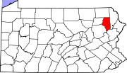
Boroughs Townships Benton | Carbondale | Clifton | Covington | Elmhurst | Fell | Glenburn | Greenfield | Jefferson | La Plume | Madison | Newton | North Abington | Ransom | Roaring Brook | Scott | South Abington | Spring Brook | Thornhurst | Waverly | West Abington
CDPs Unincorporated
communityCategories:- Populated places established in 1881
- Boroughs in Lackawanna County, Pennsylvania


Wikimedia Foundation. 2010.