- National Highway System (United States)
-
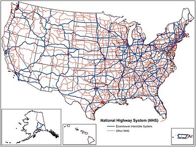
The National Highway System (NHS) is a network of strategic highways within the United States, including the Interstate Highway System and other roads serving major airports, ports, rail or truck terminals, railway stations, pipeline terminals and other strategic transport facilities.
Individual states are encouraged to focus federal funds on improving the efficiency and safety of this network which makes up 4% of the nation's roads, but carries 40% of the traffic and 75% of heavy truck traffic. About 90% of America's population lives within 5 miles (8.0 km) of an NHS road. The roads within the system were identified by the United States Department of Transportation in cooperation with the states, local officials, and metropolitan planning organizations and approved by the United States Congress in 1995.
Contents
History
The Intermodal Surface Transportation Efficiency Act of 1991 provided that certain key routes such as the Interstate Highway System, be included.[citation needed]
The United States Congress approved the NHS in 1995 by passing the National Highway System Designation Act.
Overview
The 160,000-mile (260,000 km) National Highway System includes roads from one of more of the following road networks:[1]
- The Interstate Highway System
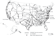
- The Strategic Highway Network (STRAHNET) of importance to the United States' strategic defense policy including links from major military installations and this Strategic Highway Network
- Access to 207 airports, 198 ports, 190 rail or truck terminals, 67 Amtrak railway stations, 58 pipeline terminals as well as 82 intercity bus terminals, 307 public transit stations, 37 ferry terminals and 20 multi-purpose passenger terminals[2]
The system includes 4% of the nation's roads, but carries more than 40% of all highway traffic, 75% of heavy truck traffic, and 90% of tourist traffic.[2] All urban areas with a population of over 50,000 and about 90% of America's population live within 5 miles (8.0 km) of the network,[2] which is the longest in the world.[3]
See also
References
- ^ "The National Highway System". US Department for Transportation. http://www.fhwa.dot.gov/planning/nhs/.
- ^ a b c "The National Highway System: A Commitment to America's Future". US Department for Transportation. http://www.fhwa.dot.gov/publications/publicroads/96spring/p96sp2.cfm.
- ^ "China Expressway System to Exceed US Interstates". New Geography. http://www.newgeography.com/content/002003-china-expressway-system-exceed-us-interstates.
- Note: This article was adapted from public domain Federal Highway Administration web sites.
External links
- STRAHNET description at US military's Transportation Engineering Agency's website.
- STRAHNET article at the GlobalSecurity.org website.
- Weingroff, Richard F. "Backbone: Creation Of The National Highway System"
Categories:- Interstate Highway System
- Roads in the United States
- U.S. Highway System
Wikimedia Foundation. 2010.


