- West Hanover Township, Pennsylvania
Infobox Settlement
official_name = Pagename
settlement_type = Township
nickname =
motto =
imagesize =
image_caption =
image_
mapsize = 250x200px
map_caption = Map of Dauphin County, Pennsylvania highlighting West Hanover Township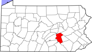
mapsize1 = 250x200px
map_caption1 = Map of Dauphin County, Pennsylvania
subdivision_type = Country
subdivision_name =United States
subdivision_type1 = State
subdivision_name1 =Pennsylvania
subdivision_type2 = County
subdivision_name2 = Dauphin
government_footnotes =
government_type =
leader_title =
leader_name =
leader_title1 =
leader_name1 =
leader_title2 =
leader_name2 =
established_title = Settled
established_date =
established_title1 = Incorporated
established_date1 = 1842
unit_pref = Imperial
area_footnotes =
area_magnitude =
area_total_km2 =
area_land_km2 =
area_water_km2 =
area_total_sq_mi = 23.4
area_land_sq_mi =
area_water_sq_mi =
population_as_of = 2000
population_footnotes =
population_total = 6505
population_density_km2 =
population_density_sq_mi = 278.1
timezone = Eastern (EST)
utc_offset = -5
timezone_DST = EDT
utc_offset_DST = -4
postal_code_type =
postal_code =
area_code = 717
website =
footnotes =West Hanover Township is a township in Dauphin County,
Pennsylvania ,United States . The population was 6,505 at the 2000 census.Geography
According to the
United States Census Bureau , the township has a total area of 23.4 square miles (60.6km² ), of which, 23.4 square miles (60.6 km²) of it is land and 0.04% is water.Unincorporated communities and
census designated place s in West Hanover Township.
*Skyline View,Pennsylvania History
West Hanover Township was originally a part of the County of Lancaster Pennsylvania and Paxton Township. "As part of the extended Lancaster County of 1736-37, the inhabitants presented a petition to a session of the Lancaster County Court to the effect that those living here were inconvenienced by the large size of the township. They asked to be divided by natural existing boundaries."
In February of 1785 by action of the court of Lancaster, the segments of East and West Hanover Townships were named with the formal creation of Dauphin County. It was not until 1842 that East and West Hanover Townships of Dauphin County were finally designated as separate precincts. The boundaries have remained unchanged since that date.
Two years before the adoption of the Declaration of Independence, the people of Hanover adopted the "Hanover Resolves." These resolutions vigorously proclaimed opinion, obligation, means and purpose which resulted from the dissatisfaction with the provincial government representing the Crown for the lack of protection from the Indian terror and no voice in Parliament or the Provincial Government. The Hanover Resolves are now famous in Pennsylvania as the earliest known resolutions for independence from Great Britain.
Historical sources list the earliest settlements in the Hanovers as prior to 1735. Many of these settlers were of Scots-Irish Presbyterian origin who came in large numbers with English Presbyterian and Protestant refugees to Penn's Woods.
Early recorded church history dates the Hanover Church with its distinct Presbyterian membership, as serving the community from 1736 to 1786. It provided a meeting place for settlers to make plans to erect block houses as forts along the ridge of the First Mountain. Barnett's Fort came to be protection from marauding Indians stirred up by the French to invade English settlements. With incoming German settlers to replace residents uprooted by colonial wars and the Revolutionary War, this first congregation died out.
The oldest area of population concentration was the little hamlet of Manada Hill (now a flourishing commercial district of truck stops, restraints, and convenience stores off Interstate 81). It was the only village of the Township, containing the post office and a few stores and shops to supply the surrounding neighborhood. Traveling peddlers provided incidental needs before the establishment of the country store. Three churches surrounded the village within a radius of three miles (5 km): a small Lutheran congregation; to the southeast the German Baptists built a church taken over in 1860 by the Hanoverdale Church of the Brethren; and to the northeast, the Zion Lutheran Church.
Other community centers have grown up around churches that served the population. Hanoverdale, founded in pre-Revolutionary times, had a typical country store, Schaffner's Store, which operated until 1955. It is now converted to apartments. This building also contained a post office for area residents. The Schaffner and Kuntz families have been prominent leaders in the development of that area.
Mount Laurel area with its nucleus of residences, church and the Mount Laurel Recreation Park is also identified as Piketown. Community spirit and activities here are strong through the function of Mount Laurel Community Park. Fox's store that once served this area, containing a post office until 1934, is now converted to apartments.
Population statistics provide an interesting history of the Township development. Records of 1800 list 1,862 inhabitants and thirteen (13) slaves; ten (10) years later the population had increased to 2,601 inhabitants and three (3) slaves. For the year 1820 there were 2,618 inhabitants. The next eighty (80) years saw the exodus from farm to factory locations, and the population now dropped to 1,010 people by 1900. The 1950 census recorded 1,495.
Following the adoption of the Constitution of the United States, Hanover district was free to develop its lands and homes. German settlers (so-called Pennsylvania Dutch) became predominant in the community as industrious, frugal and skillful cultivators of the lands. Farming became the basic occupation of the area with supportive minor industries such as blacksmithing, tanning, saw mills and grain mills. Sawmills became a thriving business. They were powered by steam and located near a good spring or creek.
An effort at providing railroad transportation to the area was the South Mountain Railroad Company. Many local people had faith in this enterprise and invested heavily in its stock. They soon faced financial ruin. The plan was a good one had it been completed. It was to connect with the Pennsylvania Railroad at Lucknow and extend east to Poughkeepsie, New York, trackage to be just south of the First Mountain and run a short distance north of Linglestown. It is possible even today to find areas where grading for this track had actually been completed.
This proposed railroad would have crossed West Hanover Township north of Route 39, crossing Beaver Creek approximately one-half mile north of the Beaver Creek Bridge. Swinging south across Moyer Road one-quarter mile east of its intersection with Piketown Road. It finally passed out of the Township about one-half mile south of Moyer Road.
Actual work started in April 1873. Two local men had the contract to grade the first two miles (3 km) or roadway and were paid $.25 per cubic yard for grading. Their pay for the masonry work was $3.50 per cubic yard. Benjamin Moyer was paid $1.00 per hour for use of his plow and four-horse team. Laborers were paid $1.00 per day. However, financial problems forced curtailment of the project after several months of work.
The economy of West Hanover Township has historically centered around agriculture, and the Township remained predominately rural until the 1950's when housing developments of single family homes began to appear. During the 1960's, 70's and 80's suburban development continued. The only major industry since the 1920's was Lenkerbrook Farm Dairy. Today the dairy is no longer in operation but new industries and commercial development have occurred along Route 22 and at the Manada Hill interchange on I-81. The Township can expect further residential, industrial and commercial growth into the 1990's and next century.
SOURCE: West Hanover Township Historical Society, West Hanover Township Comprehensive Plan, 2005
Demographics
The earliest US census figures reveal a total population of 1862 residents in the year 1800. As of the
census GR|2 of 2000, there were 6,505 people, 2,502 households, and 1,944 families residing in the township. Thepopulation density was 278.1 people per square mile (107.4/km²). There were 2,584 housing units at an average density of 110.5/sq mi (42.7/km²). Recent estimates published by the US Census Bureau in 2005 established an estimated 19% growth rate, or population over 7700.The racial makeup of the township was 97.34% White, 1.15% African American, 0.03% Native American, 1.00% Asian, 0.03% Pacific Islander, 0.11% from other races, and 0.34% from two or more races. Hispanic or Latino of any race were 0.54% of the population.
There were 2,502 households out of which 29.4% had children under the age of 18 living with them, 68.7% were married couples living together, 6.1% had a female householder with no husband present, and 22.3% were non-families. 18.4% of all households were made up of individuals and 8.3% had someone living alone who was 65 years of age or older. The average household size was 2.60 and the average family size was 2.96.
In the township the population was spread out with 22.5% under the age of 18, 5.6% from 18 to 24, 27.6% from 25 to 44, 29.1% from 45 to 64, and 15.1% who were 65 years of age or older. The median age was 42 years. For every 100 females there were 98.8 males. For every 100 females age 18 and over, there were 95.1 males.
The median income for a household in the township was $53,144, and the median income for a family was $57,009. Males had a median income of $41,158 versus $31,230 for females. The
per capita income for the township was $21,723. About 2.4% of families and 3.1% of the population were below thepoverty line , including 2.2% of those under age 18 and 3.3% of those age 65 or over.References

Wikimedia Foundation. 2010.