- Pennsylvania Route 14
-
"PA 14" redirects here. PA 14 may also refer to Pennsylvania's 14th congressional district.
PA Route 14
Route information Maintained by PennDOT Length: 53.09 mi[3] (85.44 km) Existed: 1927[1][2] – present Major junctions South end:  US 15 in Trout Run
North end:  NY 14 near Fassett
Location Counties: Lycoming, Tioga, Bradford Highway system Roads in Pennsylvania
Interstate • US • State • Legislative←  PA 13
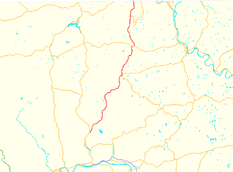
PA 13US 15 →Pennsylvania Route 14 is a Pennsylvania highway that runs for 52 miles (84 km). It runs from U.S. Route 15 in Trout Run, Pennsylvania to the New York-Pennsylvania border at Fassett, Pennsylvania, co-signed with U.S. Route 6 for a short distance in Troy. The highway continues in New York as New York State Route 14.
It once extended south all the way to the Maryland border, following Lycoming Creek Road, High Street, Hepburn Street, Market Street and East Third Street through the Williamsport area. It roughly followed the Susquehanna Trail to Northumberland, U.S. Route 11 to Shamokin Dam, US 15 to York Springs, and Pennsylvania Route 94 to Maryland.
Contents
Route description
PA 14 begins at US 15 in Trout Run in Lycoming County and heads northeast, paralleling Lycoming Creek[4]. It then turns more northerly at Bodines before crossing into Tioga County. It runs through Roaring Branch before entering Bradford County.
In Bradford County, PA 14 provides access to Grover, then forms a short concurrency with PA 414, splitting up in Canton. North of Canton, PA 14 passes through Alba before serving as the west terminus of PA 514 south of Troy. At Troy, PA 14 joins with US 6. PA 14 then splits off to the north to Columbia Cross Roads. PA 14 then runs through Snedekerville, Gillett, and Fassett before crossing the New York state line and becoming NY 14.
History
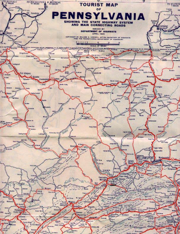
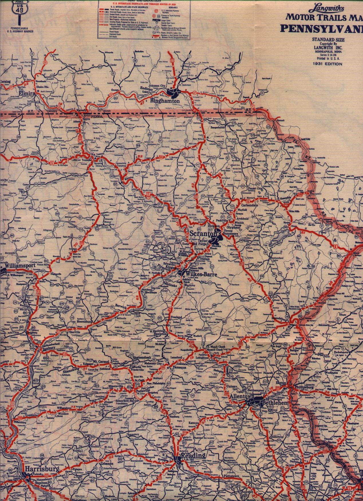
PA 14 was formed in 1927, stretching from the Maryland state line to the New York state line. When formed, it was concurrent with several U.S. Highways in the Williamsport area, including U.S. Routes 111, 120, and 220. From Harrisburg to York, it followed U.S. Route 15 and what is today Pennsylvania Route 94 via the Susquehanna Trail.[1][2] In 1930, the route was realigned onto what is now Pennsylvania Route 405 from Lewisburg to Muncy.[5][6]
By 1940, US 111 was redesignated as U.S. Route 15. As in previous years, PA 14 remained concurrent with the roadway now carrying US 15 to Northumberland. From Northumberland south to Duncannon, PA 14 was realigned onto the western bank of the Susquehanna River, creating an overlap with U.S. Route 11. At Duncannon, US 11 split from PA 14 and crossed the Susquehanna while PA 14 continued south along the riverbank to Lemoyne, a suburb of Harrisburg. Here, PA 14 joined US 11 on a brief overlap east across the Susquehanna into Harrisburg. At Front Street, US 11 turned north while PA 14 continued east on Market Street. PA 14 then turned right onto 4th Street, following the road out of Harrisburg to Paxtang, where PA 14 terminated at U.S. Route 322 and U.S. Route 422.[7][8]
In the 1950s, from Muncy to Clarks Ferry, PA 14 ran east of the Susquehanna River on what is now Interstate 180 and Pennsylvania Route 147; the US 15 designation was moved west to run concurrent with US 11. From Clarks Ferry to Harrisburg, PA 14 was concurrent with U.S. Routes 22, and 322. [9][10] By 1960, PA 14 was truncated to end at US 22 and US 322 in Clarks Ferry.[11]
By 1970, the Susquehanna Riverbank extension of PA 14 became Pennsylvania Route 147. PA 14 was truncated to terminate at U.S. Route 15 in Trout Run.[12]
Major intersections
County Location Mile[3] Destinations Notes Lycoming Lewis Township 0.00 US 15Interchange, southern terminus 4.49 Field Station Road Formerly PA 943[13] State Game Lands 133 Bradford Canton Township 21.90 Main Street Formerly PA 942[14], village of Grover 23.87  PA 414 west
South end of PA 414 concurrency Canton 25.39 PA 414 east (Main Street)North end of PA 414 concurrency Troy Township 33.14  PA 514
Western terminus of PA 514 Troy 36.05  US 6 west (Main Street)
South end of US 6 concurrency 36.85 US 6 east (Roosevelt Highway)North end of US 6 concurrency New York state line 53.09 NY 14Northern terminus, continues as NY 14 1.000 mi = 1.609 km; 1.000 km = 0.621 mi References
- ^ a b Pennsylvania Department of Highways (April 1926). Tourist map of Pennsylvania (Map). http://www.mapsofpa.com/roadcart/pa26map.jpg. Retrieved 2007-09-06.
- ^ a b Pennsylvania Department of Highways (1927). Pennsylvania Map (Map). http://www.mapsofpa.com/roadcart/1927_2043m.jpg. Retrieved 2007-09-06.
- ^ a b DeLorme Street Atlas USA software, Toggle Measure Tool
- ^ American Automobile Association. New Jersey-Pennsylvania (Map) (2006 ed.).
- ^ Pennsylvania Department of Highways (1930) (PDF). Pennsylvania state map (Map). ftp://ftp.dot.state.pa.us/public/pdf/BPR_pdf_files/Maps/Statewide/Historic_OTMs/1930fr.pdf. Retrieved 2007-09-06.
- ^ Langwith (1931). Pennsylvania Motor Trails Map (eastern half) (Map). http://www.mapsofpa.com/roadcart/1931parcom.jpg. Retrieved 2007-09-06.
- ^ Pennsylvania Department of Highways (1940) (PDF). Pennsylvania state map (front side) (Map). ftp://ftp.dot.state.pa.us/public/pdf/BPR_pdf_files/Maps/Statewide/Historic_OTMs/1940fr.pdf. Retrieved 2007-09-06.
- ^ Pennsylvania Department of Highways (1940) (PDF). Pennsylvania state map (back side) (Map). ftp://ftp.dot.state.pa.us/public/pdf/BPR_pdf_files/Maps/Statewide/Historic_OTMs/1940bk.pdf. Retrieved 2007-09-06.
- ^ Pennsylvania Department of Highways (1950) (PDF). Pennsylvania state map (front side) (Map). ftp://ftp.dot.state.pa.us/public/pdf/BPR_pdf_files/Maps/Statewide/Historic_OTMs/1950fr.pdf. Retrieved 2007-09-07.
- ^ Pennsylvania Department of Highways (1950) (PDF). Pennsylvania state map (back side) (Map). ftp://ftp.dot.state.pa.us/public/pdf/BPR_pdf_files/Maps/Statewide/Historic_OTMs/1950bk.pdf. Retrieved 2007-09-07.
- ^ Pennsylvania Department of Highways (1960) (PDF). Pennsylvania state map (front side) (Map). ftp://ftp.dot.state.pa.us/public/pdf/BPR_pdf_files/Maps/Statewide/Historic_OTMs/1960fr.pdf. Retrieved 2007-09-07.
- ^ Pennsylvania Department of Highways (1970) (PDF). Pennsylvania state map (front side) (Map). ftp://ftp.dot.state.pa.us/public/pdf/BPR_pdf_files/Maps/Statewide/Historic_OTMs/1970fr.pdf. Retrieved 2007-09-07.
- ^ Pennsylvania Department of Highways (1941) (PDF). Lycoming County Map (Sheet 1) (Map). ftp://ftp.dot.state.pa.us/public/pdf/BPR_PDF_FILES/Maps/Type_10_GHS_Historical_Scans/Lycoming_1941_Sheet_1.pdf. Retrieved 2007-09-07.
- ^ Pennsylvania Department of Highways (1941) (PDF). Bradford County Map (Sheet 2) (Map). ftp://ftp.dot.state.pa.us/public/pdf/BPR_PDF_FILES/Maps/Type_10_GHS_Historical_Scans/Bradford_1941_Sheet_2.pdf. Retrieved 2007-09-07.
External links
Categories:- State highways in Pennsylvania
- Transportation in Lycoming County, Pennsylvania
- Transportation in Bradford County, Pennsylvania


Wikimedia Foundation. 2010.