- Lewis Township, Lycoming County, Pennsylvania
Infobox Settlement
official_name = Lewis Township,
Lycoming County,
Pennsylvania
other_name =
native_name =
nickname =
settlement_type = Township
motto =
imagesize =
image_caption = TheSheshequin Path ran alongLycoming Creek in Lewis Township.
flag_size =
image_
seal_size =
image_shield =
shield_size =
image_blank_emblem =
blank_emblem_size =
mapsize = 250x200px
map_caption = Map of Lycoming County, Pennsylvania highlighting Lewis Township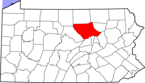
mapsize1 = 250x200px
map_caption1 = Map of Lycoming County, Pennsylvania=
pushpin_mapsize =
subdivision_type = Country
subdivision_name =United States
subdivision_type1 = State
subdivision_name1 =Pennsylvania
subdivision_type2 = County
subdivision_name2 = Lycoming
subdivision_type3 =
subdivision_name3 =
subdivision_type4 =
subdivision_name4 =
government_footnotes =
government_type =
leader_title =
leader_name =
leader_title1 =
leader_name1 =
leader_title2 =
leader_name2 =
leader_title3 =
leader_name3 =
leader_title4 =
leader_name4 =
established_title = Settled
established_date = 1812
established_title1 = Incorporated
established_date1 = 1835
established_title3 =
established_date3 =
area_magnitude =
unit_pref = Imperial
area_footnotes =
area_total_km2 = 98.0
area_land_km2 = 98.0
area_water_km2 = 0.0
area_total_sq_mi = 37.8
area_land_sq_mi = 37.8
area_water_sq_mi = 0.0
area_water_percent =
area_urban_km2 =
area_urban_sq_mi =
area_metro_km2 =
area_metro_sq_mi =
area_blank1_title =
area_blank1_km2 =
area_blank1_sq_mi =
population_as_of = 2000
population_footnotes =
population_note =
population_total = 1139
population_density_km2 = 11.6
population_density_sq_mi = 30.1
population_metro =
population_density_metro_km2 =
population_density_metro_sq_mi =
population_urban =
population_density_urban_km2 =
population_density_urban_sq_mi =
population_blank1_title =
population_blank1 =
population_density_blank1_km2 =
population_density_blank1_sq_mi =
timezone = Eastern Time Zone (North America)
utc_offset = -5
timezone_DST = EDT
utc_offset_DST = -4
latd = 41 |latm = 24 |lats = 1 |latNS = N
longd = 77 |longm = 2 |longs = 40 |longEW = W
elevation_footnotes =
elevation_m = 528
elevation_ft = 1732
postal_code_type =
postal_code =
area_code =
blank_name = FIPS code
blank_info = 42-42944GR|2
blank1_name = GNIS feature ID
blank1_info = 1216753GR|3
website =
footnotes =Lewis Township is a township in Lycoming County,
Pennsylvania , in the United States. The population was 1,139 at the 2000 census. It is part of the Williamsport, PennsylvaniaMetropolitan Statistical Area .History
Lewis Township was formed from part of Hepburn Township in 1835. It is named for Ellis Lewis who was the president judge of the local district court at the time. The township was expanded in on December 10, 1846 when part of Cascade Township was added to Lewis Township. This was done at the request of the residents of the area who geographically cut off from the rest of Cascade Township.
Lycoming Creek and the Sheshequin Path
Lycoming Creek and theSheshequin Path played an important role in the early history of Lewis Township. The path was a major Native Americantrail in that ran between two Native American villages: "French Margaret's Town" on theWest Branch Susquehanna River (part of modern day Williamsport in Lycoming County) and "Sheshequin" on the North Branch of theSusquehanna River (modern day Ulster Township, in Bradford County). The path ran north and east along Lycoming Creek in Lycoming County and followed much ofTowanda Creek in Bradford County. It was a shortcut between the two main branches of the Susquehanna River and was used by early settlers as well as Native Americans.cite book | last = Wallace | first = Paul A.W. | title = Indian Paths of Pennsylvania | edition = Fourth Printing
date = 1987 | publisher = Pennsylvania Historical and Museum Commission | location = Harrisburg,Pennsylvania | id = ISBN 978-0-89271-090-4 | quote = (Note: ISBN refers to 1998 impression.) | pages = pp. 63-64]Lycoming Creek which begins to the north of Lewis Township in McNett Township also served as a highway of sorts during the colonial era of Pennsylvania's history. The stream was used by early explorers and the Native Americans in the area as a means of travel. They were able to float their canoes down the creek and into the West Branch Susquehanna River. This mode of transportation was considerably faster than walking the path.
Conrad Weiser guided Moravian missonaries along the creek and path to reachOnondaga the capital of theIroquois Confederacy in 1737. Raiding parties of Indian warriors used the creek and path in 1770 when conducting attacks on theWest Branch Susquehanna Valley strongholds of Fort Muncy and Fort Freeland. ColonelThomas Hartley led the6th Pennsylvania Regiment up the Sheshequin Path during theAmerican Revolution . Hartley's expedition in 1778 preceded theSullivan Expedition of 1779. Both Hartley and Sullivan were instrumental in claiming the frontier of Pennsylvania and New York for the forces of theContinental Army . As Hartley and his men passed through Lewis Township the Sheshequin path was widened. The widening of the path helped to open this area to settlement in the years following the Revolution.cite book
last = Meginness
first = John Franklin
title = History of Lycoming County, Pennsylvania: including its aboriginal history; the colonial and revolutionary periods; early settlement and subsequent growth; organization and civil administration; the legal and medical professions; internal improvement; past and present history of Williamsport; manufacturing and lumber interests; religious, educational, and social development; geology and agriculture; military record; sketches of boroughs, townships, and villages; portraits and biographies of pioneers and representative citizens, etc. etc."
origdate = 1892
url = http://www.usgennet.org/usa/pa/county/lycoming/history/lyco-history-01.html
accessdate = 2007-04-14
edition = 1st Edition
publisher = Brown, Runk & Co.
location = Chicago, IL
id = ISBN 0-7884-0428-8
chapter =
chapterurl = http://www.usgennet.org/usa/pa/county/lycoming/history/Chapter-34.html
quote = (Note: ISBN refers to Heritage Books July 1996 reprint. URL is to a scan of the 1892 version with some OCR typos).]Early settlement
Lewis Township was largely uninhabited until after the Revolutionary War. A
squatter named A.M. Slack is believed to have been the first permanent settler. He built a cabin and cleared some land in the area that is now the village of Bodines. The village of Trout Run has its beginnings during the construction of the Williamson Road. This road which stretched from Williamsport,Pennsylvania to Painted Post,New York helped to open north central Pennsylvania to settlement. Charles Williamson, the builder of the road, established a supply depot at Trout Run.Much of Lewis Township is covered with steep slopes that were carved into the
Allegheny Plateau by the streams that drain into the West Branch Susquehanna River. The geography of the township has limited the development of the township. A narrow valley along Lycoming Creek is where most of the settlement of Lewis Township has occurred. James Kyle arrived in the area sometime around 1800. He owned 260 acres along Lycoming Creek. Kyle took out an advertisement in the Lycoming Gazette. The ad placed on March 14, 1810 read as follows. cquote|(For sale:) A valuable farm situated on Lycoming creek, twelve miles from Williamsport, containing 260 acres, between thirty and forty of which are cleared, with six acres of meadow, a thriving young orchard of apple trees, and a nice peach orchard. A square log house and kitchen, a good log barn, one of the best mill seats on Lycoming, on which there is a grist mill. In a word, the place is fit for almost any public business, as the great road (Williamson) leading to the State of New York passes through it.Kyle's farm was eventually sold to Robert Allen. Robert and his family were among the most successful and prominent early settlers. Allen was born in Northumberland on August 6, 1797. His father, John Allen, was a native of
County Down ,Ireland and his mother was fromScotland . John Allen moved from Northumberland to a section of land along Lycoming Creek between Cogan Station and Hepburnville in Hepburn Township. He died in 1819 and his farm was divided among his children. Robert Allen sold his share of the farm to his brothers and moved further north along Lycoming Creek and bought the land that was formerly owned by James Kyle. Allen and his wife Mary Ann Hews improved the Kyle Farm. They rose to a position of prominence as the owners of aninn that was frequently busy with visitors who were moving along the Williamson Road. Allen was also employed as a surveyor andcivil engineer . He spent several years working for the United States Government in theNorthwest Territory especially in what is nowMichigan along theDetroit River andLake Huron . Allen died in 1849 and his wife died in 1883. Her parents Henry and Martha Hews were part of the failed "English Settlement" in Pine Township. They had migrated to Pennsylvania from Chard,Somerset ,England . After struggling the survive in Pine Township, Henry Hews cleared and established several successful farms in Tioga County and northern Lycoming County before finally settling near Trout Run where his daughter met and married Robert Allen.Lewis Township has changed little over the years. The population has risen to 1,139 as of the 2000 census up from 985 in the census of 1890. Trout Run is on
U.S. Route 15 which follow the old Williamson Road. This highway is currently part if theInterstate 99 project.Geography
Lewis Township is bordered by Cogan House Township to the west, McIntyre Township to the north, Cascade Township to the east, Gamble Township to the southeast, Hepburn Township is in the extreme southeast corner of Lewis Township, and by Lycoming Township to the south.
As the crow flies , Lycoming County is about convert|130|mi|km|0 northwest ofPhiladelphia and convert|165|mi|km|0 east-northeast of Pittsburgh.According to the
United States Census Bureau , the township has a total area of 37.8square mile s (98.0km² ), all of it land.Demographics
As of the
census GR|2 of 2000, there were 1,139 people, 451 households, and 304 families residing in the township. Thepopulation density was 30.1 people per square mile (11.6/km²). There were 572 housing units at an average density of 15.1/sq mi (5.8/km²). The racial makeup of the township was 98.68% White, 0.35% African American, 0.09% Native American, 0.09% Asian, and 0.79% from two or more races. Hispanic or Latino of any race were 0.79% of the population.There were 451 households out of which 29.9% had children under the age of 18 living with them, 53.0% were married couples living together, 11.1% had a female householder with no husband present, and 32.4% were non-families. 25.1% of all households were made up of individuals and 7.5% had someone living alone who was 65 years of age or older. The average household size was 2.53 and the average family size was 3.00.
In the township the population was spread out with 24.7% under the age of 18, 7.3% from 18 to 24, 29.7% from 25 to 44, 26.4% from 45 to 64, and 11.9% who were 65 years of age or older. The median age was 38 years. For every 100 females there were 104.1 males. For every 100 females age 18 and over, there were 100.0 males.
The median income for a household in the township was $34,074, and the median income for a family was $38,661. Males had a median income of $27,989 versus $20,300 for females. The
per capita income for the township was $14,780. About 7.8% of families and 10.0% of the population were below thepoverty line , including 9.2% of those under age 18 and 10.6% of those age 65 or over.References

Wikimedia Foundation. 2010.