- Muncy Creek Township, Lycoming County, Pennsylvania
-
Muncy Creek Township,
Lycoming County,
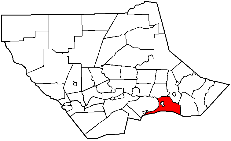
Pennsylvania— Township — Muncy Creek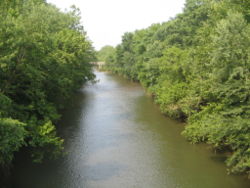 Map of Lycoming County, Pennsylvania highlighting Muncy Creek Township
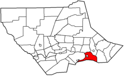 Map of Lycoming County, Pennsylvania
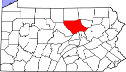
Coordinates: 41°11′45″N 76°46′9″W / 41.19583°N 76.76917°WCoordinates: 41°11′45″N 76°46′9″W / 41.19583°N 76.76917°W Country United States State Pennsylvania County Lycoming Settled 1773 Incorporated 1797 Area - Total 20.7 sq mi (53.7 km2) - Land 20.1 sq mi (52.2 km2) - Water 0.6 sq mi (1.5 km2) Elevation[1] 525 ft (160 m) Population (2000) - Total 3,487 - Density 173.1/sq mi (66.8/km2) Time zone Eastern (EST) (UTC-5) - Summer (DST) EDT (UTC-4) ZIP code 17756 Area code(s) 570 FIPS code 42-52288[2] GNIS feature ID 1216764[1] - For other places named 'Muncy', please see Muncy (disambiguation).
Muncy Creek Township is a township in Lycoming County, Pennsylvania, in the United States. The population was 3,487 at the 2000 census. It is part of the Williamsport, Pennsylvania Metropolitan Statistical Area. The unincorporated village of Clarkstown is located in Muncy Creek Township.
Contents
History
Muncy Creek Township was formed when Muncy Township was divided for the second time in 1797. The township is named for Muncy Creek a tributary of the West Branch Susquehanna River that flows threw it. Some of the oldest settlements of Lycoming County are in Muncy Creek Township.[3] The township also played an important role in the development and regular use of the Pennsylvania Canal along the West Branch Susquehanna River. The hamlet of Port Penn rose up along the section of the canal that passed through Muncy Creek Township. This hamlet, greatly reduced in population, was a very busy and sometimes dangerous place.[3]
Muncy Dam was built across the river at Muncy Creek Township. This dam provided the water that was needed to fill the canal along a stretch canal that began at Port Penn and ended at Sunbury. The dam, canal and towing path were all constructed for a considerable amount of money. Around these construction projects, the hamlet of Port Penn was built.[4] Upon completion of the canal in 1834 it was already a thriving community featuring a manufacturer of canal boats. Other businesses in Port Penn included hotels and taverns that provided housing and food for the men working on the canal, and a blacksmith and a saddle maker. There was a butcher who also operated a grocery business, a weaver, a wagon builder, a shoemaker, an ice business, as well as several teachers, masons and general merchants.[4]
Port Penn quickly gained a reputation as being a dangerous place that attracted "unsavory" characters.[3] Gambling and prize fighting were two popular past times. Large amounts of alcohol were consumed by the participants furthering the danger. An organized group of counterfeiters had an operation in a cabin in Muncy Creek Township that passed fake coins onto the boatmen and others that passed by Port Penn on the canal. A riot took place during the construction of the canal that resulted in several deaths. A man named Barney McCue is responsible for at least two murders at Port Penn, one in 1870 and another four years later in 1874. Many children drowned in the canal and river. The railroad that largely replaced the canal was not less dangerous as several lives were claimed on the rails. Even the so called "Last Raft" to be floated down the West Branch took several lives at Port Penn. The raft hit the railroad bridge and sent 45 passengers into the river, seven of whom died.[4]
The canal in Muncy Creek Township brought vast amounts of goods that were stored in warehouses in Port Penn and Muncy. The farmers and industrialists of Lycoming County used these warehouses to store their goods before they were sent south on the canal. The chief exports of the county were hogs, wheat, flour, lumber, dried and salted meats, leather and whiskey. Whiskey was a very big business. At least 13 distilleries in the area produced and out put of 1,200 to 1,500 gallons of whiskey a day. Muncy Creek Township also was home to a thriving commercial fishing industry. The dam was an ideal point to catch fish. The bottleneck in the river caused by the dam and canal locks caused the fish to be forced into one easy to reach location. Baskets were placed along the dam and locks and tremendous amounts of fish and eels were easily caught.[3] The dams and locks at Port Penn were destroyed by numerous floods in the West Branch Susquehanna River Valley during the late 1800s. This caused the canal to be abandoned as it was replaced by the railroads. Port Penn was since faded away. There are several homes in the area, but as a hamlet it no longer exists. Parts of Port Penn have been annexed by the borough of Muncy and others are in Muncy Creek Township. Lycoming College and the Muncy Historical Society have spearheaded an effort to uncover the history of Port Penn.[4][5]
Geography
Muncy Creek Township is bordered by the West Branch Susquehanna River to the west, Muncy and Wolf Townships to the north, Moreland Township to the east and Montour and Northumberland Counties to the south.[6] As the crow flies, Lycoming County is about 130 miles (209 km) northwest of Philadelphia and 165 miles (266 km) east-northeast of Pittsburgh.
According to the United States Census Bureau, the township has a total area of 20.7 square miles (53.7 km²).20.1 square miles (52.2 km²) of it is land and 0.6 square miles (1.5 km²) of it (2.84%) is water.
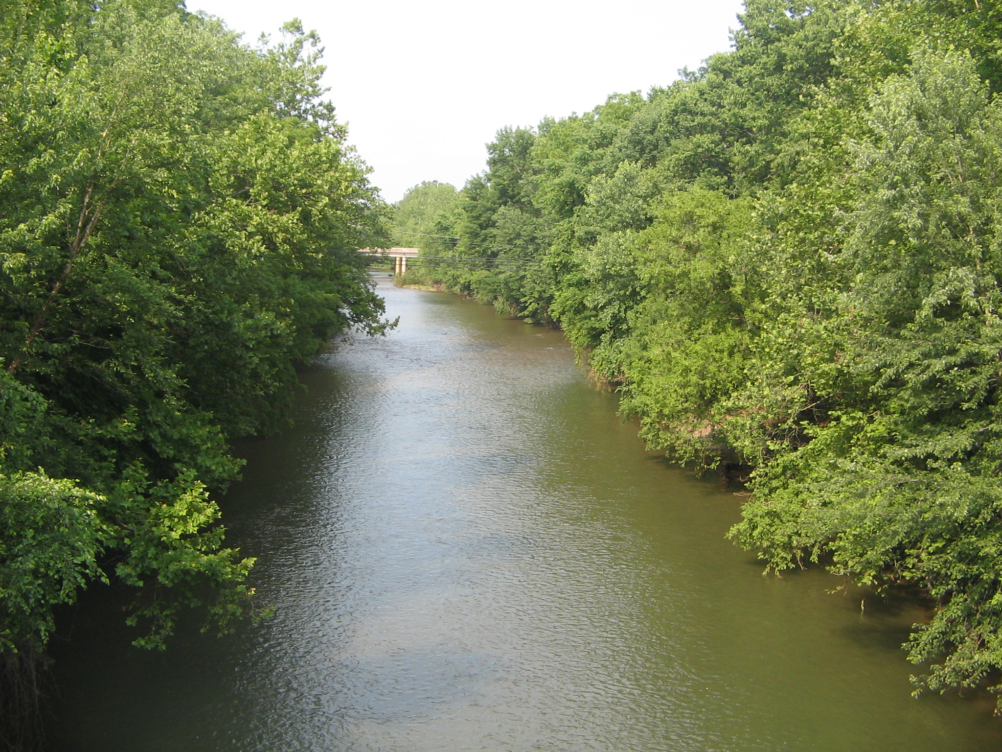
Muncy Creek has its confluence with the West Branch Susquehanna River in the township, and the township surrounds the borough of Muncy.[6]
Demographics
As of the census[2] of 2000, there were 3,487 people, 1,360 households, and 1,005 families residing in the township. The population density was 173.1 people per square mile (66.8/km²). There were 1,453 housing units at an average density of 72.1/sq mi (27.8/km²). The racial makeup of the township was 98.68% White, 0.17% African American, 0.11% Native American, 0.60% Asian, 0.09% from other races, and 0.34% from two or more races. Hispanic or Latino of any race were 0.23% of the population.
There were 1,360 households out of which 29.9% had children under the age of 18 living with them, 62.4% were married couples living together, 8.2% had a female householder with no husband present, and 26.1% were non-families. 21.8% of all households were made up of individuals and 12.2% had someone living alone who was 65 years of age or older. The average household size was 2.48 and the average family size was 2.86.
In the township the population was spread out with 22.1% under the age of 18, 7.0% from 18 to 24, 25.6% from 25 to 44, 26.2% from 45 to 64, and 19.0% who were 65 years of age or older. The median age was 42 years. For every 100 females there were 92.2 males. For every 100 females age 18 and over, there were 87.2 males.
The median income for a household in the township was $33,403, and the median income for a family was $39,818. Males had a median income of $29,545 versus $22,554 for females. The per capita income for the township was $15,500. About 8.2% of families and 10.7% of the population were below the poverty line, including 14.5% of those under age 18 and 13.0% of those age 65 or over.
Schools
Muncy School District - public school
External links
See also
For histories of the other townships in Lycoming County see
References
- ^ a b "US Board on Geographic Names". United States Geological Survey. 2007-10-25. http://geonames.usgs.gov. Retrieved 2008-01-31.
- ^ a b "American FactFinder". United States Census Bureau. http://factfinder.census.gov. Retrieved 2008-01-31.
- ^ a b c d Lloyd, Thomas W. (1929). History of Lycoming County Pennsylvania. Indianapolis, IN: HISTORICAL PUBLISHING COMPANY. http://freepages.genealogy.rootsweb.com/~foulkrod/lloyd/LloydTOC.htm. Retrieved 2007-04-28.
- ^ a b c d "History of Port Penn, Muncy Canal". Muncy Historical Society. http://www.muncyhistoricalsociety.org/dig/index.html. Retrieved 2007-04-28.
- ^ Meginness, John Franklin (1892). History of Lycoming County, Pennsylvania: including its aboriginal history; the colonial and revolutionary periods; early settlement and subsequent growth; organization and civil administration; the legal and medical professions; internal improvement; past and present history of Williamsport; manufacturing and lumber interests; religious, educational, and social development; geology and agriculture; military record; sketches of boroughs, townships, and villages; portraits and biographies of pioneers and representative citizens, etc. etc. (1st Edition ed.). Chicago, IL: Brown, Runk & Co.. ISBN 0-7884-0428-8. http://www.usgennet.org/usa/pa/county/lycoming/history/Chapter-34.html. Retrieved 2007-04-28. "(Note: ISBN refers to Heritage Books July 1996 reprint. URL is to a scan of the 1892 version with some OCR typos)."
- ^ a b Pennsylvania Department of Transportation, Bureau of Planning and Research, Geographic Information Division. "2007 General Highway Map Lycoming County Pennsylvania" (Map). 1:65,000, . ftp://ftp.dot.state.pa.us/public/pdf/BPR_pdf_files/Maps/GHS/Roadnames/lycoming_GHSN.PDF. Retrieved 2009-12-26.
Municipalities and communities of Lycoming County, Pennsylvania County seat: Williamsport City 
Boroughs Townships Anthony | Armstrong | Bastress | Brady | Brown | Cascade | Clinton | Cogan House | Cummings | Eldred | Fairfield | Franklin | Gamble | Hepburn | Jackson | Jordan | Lewis | Limestone | Loyalsock | Lycoming | McHenry | McIntyre | McNett | Mifflin | Mill Creek | Moreland | Muncy Creek | Muncy | Nippenose | Old Lycoming | Penn | Piatt | Pine | Plunketts Creek | Porter | Shrewsbury | Susquehanna | Upper Fairfield | Washington | Watson | Wolf | Woodward
CDPs Faxon | Garden View | Kenmar | Oval | Rauchtown‡
Unincorporated
communitiesGhost town Footnotes ‡This populated place also has portions in an adjacent county
Categories:- Townships in Lycoming County, Pennsylvania
- Populated places established in 1773

Wikimedia Foundation. 2010.