- McHenry Township, Lycoming County, Pennsylvania
-
McHenry Township,
Lycoming County,
Pennsylvania— Township — Pine Creek Gorge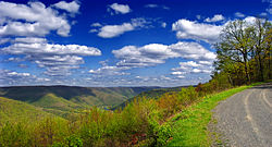 Map of Lycoming County, Pennsylvania highlighting McHenry Township
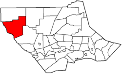 Map of Lycoming County, Pennsylvania
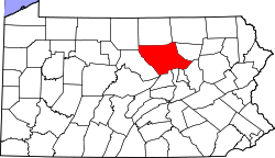
Coordinates: 41°23′10″N 77°27′12″W / 41.38611°N 77.45333°WCoordinates: 41°23′10″N 77°27′12″W / 41.38611°N 77.45333°W Country United States State Pennsylvania County Lycoming Settled 1785 Incorporated 1861 Government – Type Board of Supervisors – Chairman Paul W. Hoffmaster II – Vice-chairman Jay F. McCormick, Jr. Area – Total 76.5 sq mi (198.1 km2) – Land 76.0 sq mi (196.9 km2) – Water 0.5 sq mi (1.2 km2) Elevation[1] 1,896 ft (578 m) Population (2000) – Total 145 – Density 1.9/sq mi (0.7/km2) Time zone Eastern (EST) (UTC-5) – Summer (DST) EDT (UTC-4) FIPS code 42-46184[2] GNIS feature ID 1216757[1] Website McHenry Township McHenry Township is a township in Lycoming County, Pennsylvania, in the United States. The population was 145 at the 2000 census. It is part of the Williamsport, Pennsylvania Metropolitan Statistical Area.
Contents
History
McHenry Township was tentatively formed from parts of Cummings, Brown and Cogan House Townships on November 15, 1856. It was originally known as Kingston Township. Soon afterwards the name was changed to McHenry in honor of a Jersey Shore surveyor, Alexander H. McHenry.[3] The formal establishment of the township remained in limbo for nearly five years. Some of the residents in the area were opposed to the formation of a new township. In fact it took sixteen years for what is now McHenry Township to finally be formed. The initial proposal was placed before the court in 1845 and again in 1855, this was followed by the 1856 case and was finally settled on August 21, 1861 when it was formed from Cummings and Brown Township.
The first warrant for land in what is now McHenry Township was issued to John Nixon on May 17, 1785. John English was a squatter on the land as early as 1784. McHenry Township was settled by Claudius Boatman and Comfor Wanzer's families in 1785. Abraham Harris was the next settler in the area arriving in 1802. Boatman migrated from France. He initially lived in the Mifflinburg before moving further up the West Branch Susquehanna River and Pine Creek to western Lycoming County. Boatman and his wife Esther had a rather large family. Most of them married and remained in McHenry Township upon reaching adulthood. One daughter, Fanny, married John English the original McHenry Township pioneer. Another daughter, Rebecca, married and lived a long life despite being scalped when she was 15 in 1802.[3] Esther Boatman served as a nurse and rural physician for the pioneers along Pine Creek. The descendants of Claudius Boatman remain in fairly large numbers in western Lycoming County.
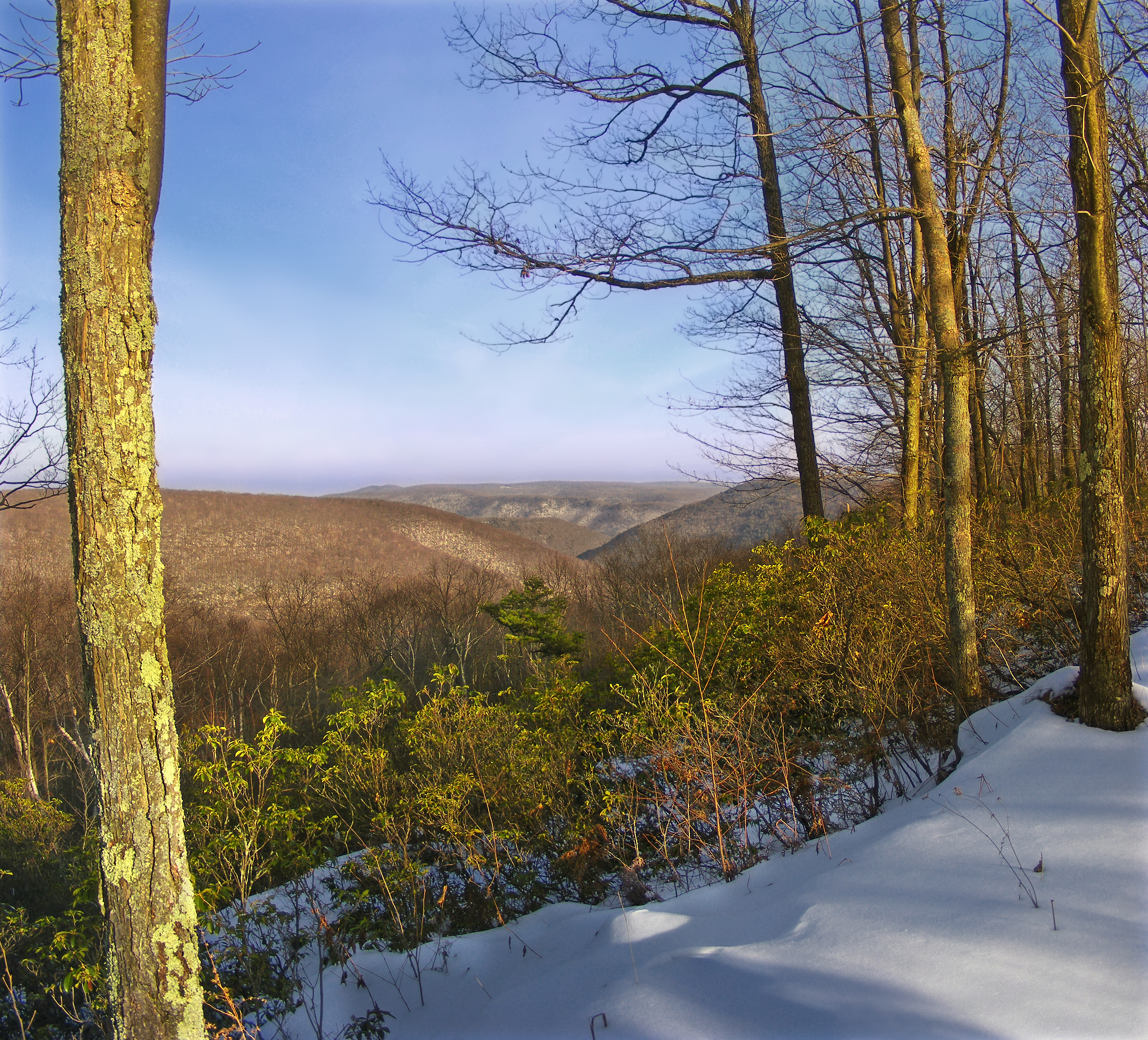
Lumbering was the primary industry in McHenry Township during the mid-to-late 19th century. Thousands of acres of old-growth forest were cleared to meet the demands for lumber during the lumber era that swept throughout Pennsylvania. Williamsport which is just south and east of McHenry Township, was known at the "Lumber Capital of the World." Logs were floated down Pine Creek and into the West Branch Susquehanna River to various sawmills along both streams and in Williamsport.
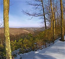
McHenry Township is a very rural and remote section of Lycoming County. The hills and valleys are now covered with a thriving second growth forest. The population as of the 2000 census was just 145.
Geography
McHenry Township is bordered by Brown Township to the north, Pine Township to the east, Cummings Township to the south and Clinton County to the west.[4] As the crow flies, Lycoming County is about 130 miles (209 km) northwest of Philadelphia and 165 miles (266 km) east-northeast of Pittsburgh.
According to the United States Census Bureau, the township has a total area of 76.5 square miles (198.1 km²).76.0 square miles (196.9 km²) of it is land and 0.5 square miles (1.2 km²) of it (0.61%) is water.
Demographics
As of the census[2] of 2000, there were 145 people, 79 households, and 42 families residing in the township. The population density was 1.9 people per square mile (0.7/km²). There were 514 housing units at an average density of 6.8/sq mi (2.6/km²). The racial makeup of the township was 97.93% White, 0.69% from other races, and 1.38% from two or more races. Hispanic or Latino of any race were 2.07% of the population.
There were 79 households out of which 8.9% had children under the age of 18 living with them, 44.3% were married couples living together, 3.8% had a female householder with no husband present, and 46.8% were non-families. 40.5% of all households were made up of individuals and 21.5% had someone living alone who was 65 years of age or older. The average household size was 1.84 and the average family size was 2.45.
In the township the population was spread out with 9.0% under the age of 18, 5.5% from 18 to 24, 17.9% from 25 to 44, 34.5% from 45 to 64, and 33.1% who were 65 years of age or older. The median age was 57 years. For every 100 females there were 116.4 males. For every 100 females age 18 and over, there were 120.0 males.
The median income for a household in the township was $25,000, and the median income for a family was $28,750. Males had a median income of $23,571 versus $13,750 for females. The per capita income for the township was $19,269. There were 11.5% of families and 4.2% of the population living below the poverty line, including no under eighteens and none of those over 64.
See also
For histories of the other townships in Lycoming County see
References
- ^ a b "US Board on Geographic Names". United States Geological Survey. 2007-10-25. http://geonames.usgs.gov. Retrieved 2008-01-31.
- ^ a b "American FactFinder". United States Census Bureau. http://factfinder.census.gov. Retrieved 2008-01-31.
- ^ a b Meginness, John Franklin (1892). History of Lycoming County, Pennsylvania: including its aboriginal history; the colonial and revolutionary periods; early settlement and subsequent growth; organization and civil administration; the legal and medical professions; internal improvement; past and present history of Williamsport; manufacturing and lumber interests; religious, educational, and social development; geology and agriculture; military record; sketches of boroughs, townships, and villages; portraits and biographies of pioneers and representative citizens, etc. etc. (1st Edition ed.). Chicago, IL: Brown, Runk & Co.. ISBN 0-7884-0428-8. http://www.usgennet.org/usa/pa/county/lycoming/history/Chapter-34.html. Retrieved 2007-04-18. "(Note: ISBN refers to Heritage Books July 1996 reprint. URL is to a scan of the 1892 version with some OCR typos)."
- ^ Pennsylvania Department of Transportation, Bureau of Planning and Research, Geographic Information Division. "2007 General Highway Map Lycoming County Pennsylvania" (Map). 1:65,000. ftp://ftp.dot.state.pa.us/public/pdf/BPR_pdf_files/Maps/GHS/Roadnames/lycoming_GHSN.PDF. Retrieved 2009-12-26.
Municipalities and communities of Lycoming County, Pennsylvania City 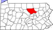
Boroughs Townships Anthony | Armstrong | Bastress | Brady | Brown | Cascade | Clinton | Cogan House | Cummings | Eldred | Fairfield | Franklin | Gamble | Hepburn | Jackson | Jordan | Lewis | Limestone | Loyalsock | Lycoming | McHenry | McIntyre | McNett | Mifflin | Mill Creek | Moreland | Muncy Creek | Muncy | Nippenose | Old Lycoming | Penn | Piatt | Pine | Plunketts Creek | Porter | Shrewsbury | Susquehanna | Upper Fairfield | Washington | Watson | Wolf | Woodward
CDPs Faxon | Garden View | Kenmar | Oval | Rauchtown‡
Unincorporated
communitiesGhost town Footnotes ‡This populated place also has portions in an adjacent county
Categories:- Townships in Lycoming County, Pennsylvania
- Populated places established in 1785


Wikimedia Foundation. 2010.