- Cummings Township, Lycoming County, Pennsylvania
-
Cummings Township,
Pennsylvania— Township — Waterville is a village in Cummings Township Map of Lycoming County, Pennsylvania highlighting Cummings Township
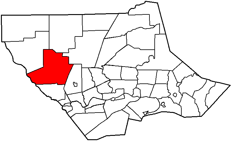
 Map of Lycoming County, Pennsylvania
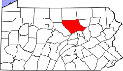
Coordinates: 41°20′10″N 77°20′40″W / 41.33611°N 77.34444°WCoordinates: 41°20′10″N 77°20′40″W / 41.33611°N 77.34444°W Country United States State Pennsylvania County Lycoming Settled 1784 Formed 1832 Area - Total 69.4 sq mi (179.7 km2) - Land 68.9 sq mi (178.5 km2) - Water 0.5 sq mi (1.2 km2) 0.69% Elevation 1,719 ft (524 m) Population (2000) - Total 355 - Density 5.2/sq mi (2.0/km2) Time zone Eastern Time Zone (North America) (UTC-5) - Summer (DST) EDT (UTC-4) ZIP code 17776 Area code(s) 570 FIPS code 42-17696[1] GNIS feature ID 1216746[2] Cummings Township is a township in Lycoming County, Pennsylvania, in the United States. The population was 355 at the 2000 census. It is part of the Williamsport, Pennsylvania Metropolitan Statistical Area. Cummings Township is home to two of the 120 Pennsylvania state parks, Little Pine State Park and Upper Pine Bottom State Park.
Contents
History
Cummings Township was formed by the Pennsylvania General Assembly in 1832 from parts of Mifflin and Brown Townships. It was named for John Cummings who was an assiociate judge in the local court system at the time. Early industry in the county included quarries of flag and building stone and lumber.[3]
The Little Pine and Pine Valleys in Cummings Township were used by the Iroquois and Algonkian tribes as a hunting ground. Historians believe that there may have been a Shawnee village and burial ground just to the north of Little Pine State Park on Little Pine Creek.[4]
By the mid 19th century the demand for lumber reached Upper Pine Bottom area, where White pine and hemlock covered the surrounding mountainsides. Lumbermen came and harvested the trees and sent them down Pine Creek to the West Branch Susquehanna River to the Susquehanna Boom and sawmills at Williamsport.[3][4] James and John English were the first to build a sawmill in the area in the Little Pine Area. They built two sawmills in 1809 on Little Pine Creek. In 1816, the village of English Mills sprang up around the two sawmills. The lumber era at Little Pine lasted until 1909, when the last log raft was floated down Little Pine Creek. Remnants of the lumber era can be seen today in and around the park.
Waterville is the most significant population center in Cummings Township. Michael and Henry Wolf arrived in the area from Berks County in 1817. The helped to establish Waterville by building a sawmill and clearing some land for farming. A post office was established in Waterville in 1849. Other early business establishments were two stores and a hotel, which stands today.[3]
Tiadaghton State Forest lands were acquired by the state by the early 1900s. The site which became the park was "Upper Pine Bottom Class B Public Campground" by 1924 (Class B Public Campgrounds were on secondary highways and had a lean-to shelter for camping). During the Great Depression, the Civilian Conservation Corps built a pavilion at the site in 1936, but it is no longer extant. The park was not officially transferred from the Bureau of Forests to State Parks until 1962.[5]
Geography
Cummings Township is bordered by Clinton County to the west, McHenry, Pine and Cogan House Townships to the north, Mifflin Township to the east, and Watson Township to the south.[6] As the crow flies, Lycoming County is about 130 miles (209 km) northwest of Philadelphia and 165 miles (266 km) east-northeast of Pittsburgh.
According to the United States Census Bureau, the township has a total area of 69.4 square miles (180 km2).68.9 square miles (178.5 km²) of it is land and 0.5 square miles (1.3 km2) of it (0.69%) is water. The township lies entirely in the Pine Creek drainage basin. Little Pine Creek, one of Pine Creek's major tributaries, has its confluence with Pine Creek in the unincorporated village of Waterville.
Cummings Township contains two Pennsylvania state parks. Little Pine State Park is on Little Pine Creek and Pennsylvania Route 4001, 4.0 miles (6.4 km) northeast of Waterville. Upper Pine Bottom State Park is on Upper Pine Bottom Run and Pennsylvania Route 44, west of Pine Creek and Waterville.[6] Portions of Tiadaghton State Forest are also located in the township.
Waterville
Waterville is an unincorporated community in the dense woods of the Glaciated Allegheny Plateau in south-central Cummings Township. It lies in the deep valley of Pine Creek, Pine Creek Gorge, at the mouth of Little Pine Creek. Pennsylvania Route 44 travels through Waterville, heading south-southeastward along Pine Creek to the borough of Jersey Shore.[7] The city of Williamsport, the county seat of Lycoming County, is to the east.[7]
Demographics
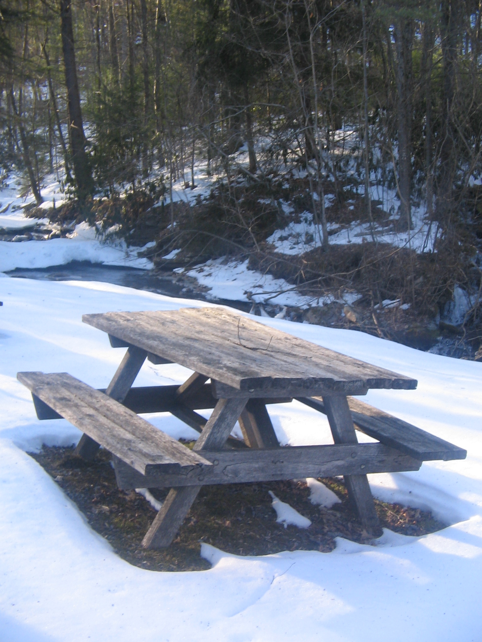
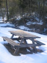 Picnic table and Upper Pine Bottom Run at Upper Pine Bottom State Park
As of the census[1] of 2000, there were 355 people, 153 households, and 106 families residing in the township. The population density was 5.2 people per square mile (2.0/km²). There were 400 housing units at an average density of 5.8/sq mi (2.2/km²). The racial makeup of the township was 99.72% White and 0.28% African American. Hispanic or Latino of any race were 0.28% of the population.
There were 153 households out of which 25.5% had children under the age of 18 living with them, 58.2% were married couples living together, 5.9% had a female householder with no husband present, and 30.1% were non-families. 22.9% of all households were made up of individuals and 11.8% had someone living alone who was 65 years of age or older. The average household size was 2.31 and the average family size was 2.69.
In the township the population was spread out with 20.8% under the age of 18, 5.1% from 18 to 24, 25.4% from 25 to 44, 27.9% from 45 to 64, and 20.8% who were 65 years of age or older. The median age was 44 years. For every 100 females there were 107.6 males. For every 100 females age 18 and over, there were 99.3 males.
The median income for a household in the township was $38,594, and the median income for a family was $42,292. Males had a median income of $33,125 versus $21,250 for females. The per capita income for the township was $18,626. About 6.2% of families and 5.5% of the population were below the poverty line, including none of those under age 18 and 5.4% of those age 65 or over.
See also
For histories of the other townships in Lycoming County see
References
- ^ a b "American FactFinder". United States Census Bureau. http://factfinder.census.gov. Retrieved 2008-01-31.
- ^ "US Board on Geographic Names". United States Geological Survey. 2007-10-25. http://geonames.usgs.gov. Retrieved 2008-01-31.
- ^ a b c Meginness, John Franklin (1892). History of Lycoming County, Pennsylvania: including its aboriginal history; the colonial and revolutionary periods; early settlement and subsequent growth; organization and civil administration; the legal and medical professions; internal improvement; past and present history of Williamsport; manufacturing and lumber interests; religious, educational, and social development; geology and agriculture; military record; sketches of boroughs, townships, and villages; portraits and biographies of pioneers and representative citizens, etc. etc. (1st Edition ed.). Chicago, IL: Brown, Runk & Co.. ISBN 0-7884-0428-8. http://www.usgennet.org/usa/pa/county/lycoming/history/Chapter-34.html. Retrieved 2007-02-28. "(Note: ISBN refers to Heritage Books July 1996 reprint. URL is to a scan of the 1892 version with some OCR typos)."
- ^ a b "Little Pine State Park". Pennsylvania Department of Conservation and Natural Resources. http://www.dcnr.state.pa.us/stateparks/parks/littlepine.aspx. Retrieved 2009-06-07.
- ^ Cupper, Dan (1993). Our Priceless Heritage: Pennsylvania’s State Parks 1893-1993. Harrisburg, Pennsylvania: Commonwealth of Pennsylvania, Pennsylvania Historical and Museum Commission for Department of Natural Resources, Bureau of State Parks. ISBN 0-89271-056-X.
- ^ a b Pennsylvania Department of Transportation, Bureau of Planning and Research, Geographic Information Division. "2007 General Highway Map Lycoming County Pennsylvania" (Map). 1:65,000. ftp://ftp.dot.state.pa.us/public/pdf/BPR_pdf_files/Maps/GHS/Roadnames/lycoming_GHSN.PDF. Retrieved 2009-12-24.
- ^ a b DeLorme. Pennsylvania Atlas & Gazetteer. 8th ed. Yarmouth: DeLorme, 2003, pp. 49, 50. ISBN 0-89933-280-3.
Municipalities and communities of Lycoming County, Pennsylvania County seat: Williamsport City 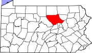
Boroughs Townships Anthony | Armstrong | Bastress | Brady | Brown | Cascade | Clinton | Cogan House | Cummings | Eldred | Fairfield | Franklin | Gamble | Hepburn | Jackson | Jordan | Lewis | Limestone | Loyalsock | Lycoming | McHenry | McIntyre | McNett | Mifflin | Mill Creek | Moreland | Muncy Creek | Muncy | Nippenose | Old Lycoming | Penn | Piatt | Pine | Plunketts Creek | Porter | Shrewsbury | Susquehanna | Upper Fairfield | Washington | Watson | Wolf | Woodward
CDPs Faxon | Garden View | Kenmar | Oval | Rauchtown‡
Unincorporated
communitiesGhost town Footnotes ‡This populated place also has portions in an adjacent county
Categories:- Townships in Lycoming County, Pennsylvania
- Populated places established in 1784

Wikimedia Foundation. 2010.