- Anthony Township, Lycoming County, Pennsylvania
Infobox Settlement
official_name = Anthony Township,
Lycoming County,
Pennsylvania
other_name =
native_name =
nickname =
settlement_type = Township
motto =
imagesize =
image_caption =Larrys Creek passing through Anthony Township
flag_size =
image_
seal_size =
image_shield =
shield_size =
image_blank_emblem =
blank_emblem_size =
mapsize = 250x200px
map_caption = Map of Lycoming County, Pennsylvania highlighting Anthony Township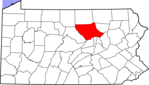
mapsize1 = 250x200px
map_caption1 = Map of Lycoming County, Pennsylvania
subdivision_type = Country
subdivision_name =United States
subdivision_type1 = State
subdivision_name1 =Pennsylvania
subdivision_type2 = County
subdivision_name2 = Lycoming
subdivision_type3 =
subdivision_name3 =
subdivision_type4 =
subdivision_name4 =
government_footnotes =
government_type =
leader_title =
leader_name =
leader_title1 =
leader_name1 =
leader_title2 =
leader_name2 =
leader_title3 =
leader_name3 =
leader_title4 =
leader_name4 =
established_title = Settled
established_date = 1770
established_title2 = Formed
established_date2 = 1844
established_title3 =
established_date3 =
area_magnitude =
unit_pref = Imperial
area_footnotes =
area_total_km2 = 41.1
area_land_km2 = 41.1
area_water_km2 = 0.0
area_total_sq_mi = 15.9
area_land_sq_mi = 15.9
area_water_sq_mi = 0.0
area_water_percent =
area_urban_km2 =
area_urban_sq_mi =
area_metro_km2 =
area_metro_sq_mi =
area_blank1_title =
area_blank1_km2 =
area_blank1_sq_mi =
population_as_of = 2000
population_footnotes =
population_note =
population_total = 904
population_density_km2 = 22.0
population_density_sq_mi = 57.0
population_metro =
population_density_metro_km2 =
population_density_metro_sq_mi =
population_urban =
population_density_urban_km2 =
population_density_urban_sq_mi =
population_blank1_title =
population_blank1 =
population_density_blank1_km2 =
population_density_blank1_sq_mi =
timezone = Eastern Time Zone (North America)
utc_offset = -5
timezone_DST = EDT
utc_offset_DST = -4
latd = 41 |latm = 17 |lats = 29 |latNS = N
longd = 77 |longm = 10 |longs = 16 |longEW = W
elevation_footnotes =
elevation_m = 325
elevation_ft = 1066
postal_code_type =
postal_code =
area_code =
blank_name = FIPS code
blank_info = 42-02656GR|2
blank1_name = GNIS feature ID
blank1_info = 1216738GR|3
website =
footnotes =Anthony Township is a township in Lycoming County,
Pennsylvania , in the United States. The population was 904 at the 2000 census. It is part of the Williamsport,Pennsylvania Metropolitan Statistical Area .History
Anthony Township was formed from part of Lycoming Township on
September 7 ,1844 by thePennsylvania General Assembly . It is named in honor of Joseph B. Anthony who was ajudge in Lycoming County at the time.When colonial settlers first arrived in what is now Anthony Township they were outside the western boundary of what was then the
Province of Pennsylvania . These settlers were not under the jurisdiction or protection of any type from any of theThirteen Colonies . They became known as theFair Play Men . These men established their own form of government, known as the "Fair Play System", with three elected commissioners who ruled on land claims and other issues for the group. In a remarkable coincidence, the Fair Play Men made their ownDeclaration of Independence from Britain onJuly 4 ,1776 beneath the "Tiadaghton Elm" on the banks of Pine Creek.A
German Baptist congregation was incorporated onFebruary 8 ,1879 , under the title of the "German Baptist Church of Anthony Township". It was one of the first German Baptist churches founded in America along with two other churches in Lycoming County, one on Blooming Grove Road north of Williamsport and the other in Fairfield Township near Montoursville. These churches were more commonly known as the Dunker or Dunkard Churches for their practice of immersing believers three times, once in the name of the Father, once in the name of the Son, and once in the name of the Holy Spirit.A spur of the plank road along
Larrys Creek was built into Anthony Township, but it is not known how far it extended. (Landis claims it may have run nearly as far north as the covered bridge in Cogan House Township).Geography
Anthony Township is bordered by Cogan House Township to the north, Lycoming Township to the east, Woodward Township to the south and Mifflin Township to the west.
As the crow flies , Lycoming County is about 130 miles (209 km) northwest ofPhiladelphia and 165 miles (266 km) east-northeast of Pittsburgh.According to the
United States Census Bureau , the township has a total area of 15.9square mile s (41.1km² ).15.9 square miles (41.1 km²) of it is land and 0.06% is water.Demographics
As of the
census GR|2 of 2000, there were 904 people, 306 households, and 260 families residing in the township. Thepopulation density was 57.0 people per square mile (22.0/km²). There were 319 housing units at an average density of 20.1/sq mi (7.8/km²). The racial makeup of the township was 99.45% White, 0.33% Asian, and 0.22% from two or more races. Hispanic or Latino of any race were 0.44% of the population.There were 306 households out of which 37.3% had children under the age of 18 living with them, 77.1% were married couples living together, 5.6% had a female householder with no husband present, and 15.0% were non-families. 10.1% of all households were made up of individuals and 4.2% had someone living alone who was 65 years of age or older. The average household size was 2.95 and the average family size was 3.19.
In the township the population was spread out with 27.0% under the age of 18, 7.4% from 18 to 24, 32.9% from 25 to 44, 23.5% from 45 to 64, and 9.3% who were 65 years of age or older. The median age was 37 years. For every 100 females there were 108.3 males. For every 100 females age 18 and over, there were 108.2 males.
The median income for a household in the township was $44,583, and the median income for a family was $47,431. Males had a median income of $32,875 versus $20,096 for females. The
per capita income for the township was $15,932. About 5.8% of families and 7.2% of the population were below thepoverty line , including 7.6% of those under age 18 and 17.6% of those age 65 or over.References
*cite journal
first = Milton W.
last = Landis
year = Summer 1967
title = "The Larrys Creek Plank Road"
journal = The Journal of the Lycoming County Historical Society
volume = Volume IV,
issue = 1
url = http://web.archive.org/web/20051118154755/www.lycoming.org/lchsmuseum/Articles/VOLIV1.htm
accessdate = 2008-02-20*cite journal
last = Landis
first = Milton W.
year = 1966
month = October
title = The Larrys Creek Covered Bridge in Cogan House Township
journal = Now and Then (The Journal of the Muncy, Pennsylvania Historical Society)
volume = XV
issue = 5
pages = 258*cite book
others = The Lycoming County Unit of the Pennsylvania Writers Project of theWork Projects Administration
title = A Picture of Lycoming County
origdate = 1939
url = http://www.libraries.psu.edu/do/digitalbookshelf/2799521/
format = PDF
accessdate = 2007-03-13
edition = First edition
publisher = The Commissioners of Lycoming County Pennsylvania*cite book
last = Meginness
first = John Franklin
title = History of Lycoming County, Pennsylvania: including its aboriginal history; the colonial and revolutionary periods; early settlement and subsequent growth; organization and civil administration; the legal and medical professions; internal improvement; past and present history of Williamsport; manufacturing and lumber interests; religious, educational, and social development; geology and agriculture; military record; sketches of boroughs, townships, and villages; portraits and biographies of pioneers and representative citizens, etc. etc."
origdate = 1892
url = http://www.usgennet.org/usa/pa/county/lycoming/history/lyco-history-01.html
accessdate = 2007-03-13
edition = 1st Edition
publisher = Brown, Runk & Co.
location = Chicago, IL
id = ISBN 0-7884-0428-8
chapter =
chapterurl = http://www.usgennet.org/usa/pa/county/lycoming/history/Chapter-34.html
quote = (Note: ISBN refers to Heritage Books July 1996 reprint. URL is to a scan of the 1892 version with some OCR typos).

Wikimedia Foundation. 2010.