- Muncy Township, Pennsylvania
"For other places named 'Muncy', please see
Muncy (disambiguation) ."Infobox Settlement
official_name = Muncy Township,
Pennsylvania
other_name =
native_name =
nickname =
settlement_type = Township
motto =
imagesize =
image_caption = The Quaker Meeting House in Pennsdale
flag_size =
image_
seal_size =
image_shield =
shield_size =
image_blank_emblem =
blank_emblem_size =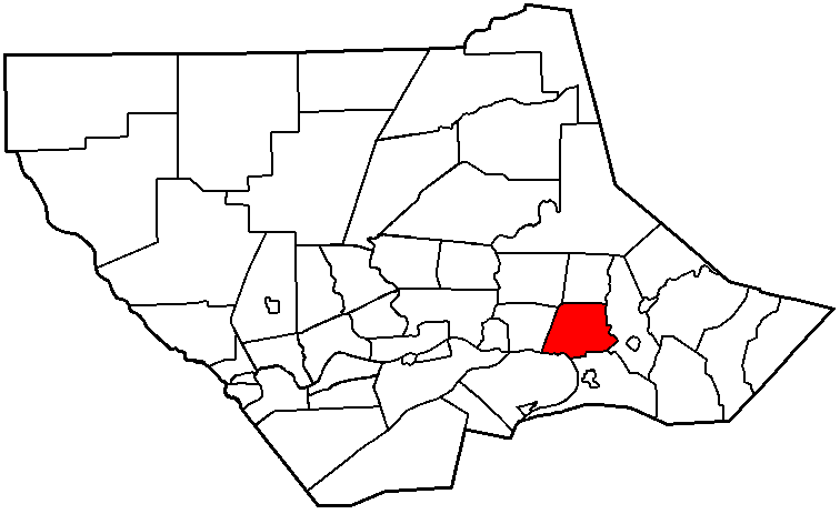
mapsize = 250x200px
map_caption = Map of Lycoming County, Pennsylvania highlighting Muncy Township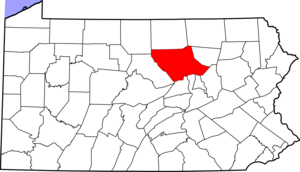
mapsize1 = 250x200px
map_caption1 = Map of Lycoming County, Pennsylvania
subdivision_type = Country
subdivision_name =United States
subdivision_type1 = State
subdivision_name1 =Pennsylvania
subdivision_type2 = County
subdivision_name2 = Lycoming
subdivision_type3 =
subdivision_name3 =
subdivision_type4 =
subdivision_name4 =
government_footnotes =
government_type =
leader_title =
leader_name =
leader_title1 =
leader_name1 =
leader_title2 =
leader_name2 =
leader_title3 =
leader_name3 =
leader_title4 =
leader_name4 =
established_title = Settled
established_date = 1770
established_title2 = Formed
established_date2 = 1772
established_title3 =
established_date3 =
area_magnitude =
unit_pref = Imperial
area_footnotes =
area_total_km2 = 40.8
area_land_km2 = 40.5
area_water_km2 = 0.4
area_total_sq_mi = 15.8
area_land_sq_mi = 15.6
area_water_sq_mi = 0.2
area_water_percent =
area_urban_km2 =
area_urban_sq_mi =
area_metro_km2 =
area_metro_sq_mi =
area_blank1_title =
area_blank1_km2 =
area_blank1_sq_mi =
population_as_of = 2000
population_footnotes =
population_note =
population_total = 1059
population_density_km2 = 26.2
population_density_sq_mi = 67.8
population_metro =
population_density_metro_km2 =
population_density_metro_sq_mi =
population_urban =
population_density_urban_km2 =
population_density_urban_sq_mi =
population_blank1_title =
population_blank1 =
population_density_blank1_km2 =
population_density_blank1_sq_mi =
timezone = Eastern Time Zone (North America)
utc_offset = -5
timezone_DST = EDT
utc_offset_DST = -4
latd = 41 |latm = 14 |lats = 35 |latNS = N
longd = 76 |longm = 48 |longs = 4 |longEW = W
elevation_footnotes =
elevation_m = 156
elevation_ft = 512
postal_code_type =ZIP code
postal_code = 17756
area_code = 570
blank_name = FIPS code
blank_info = 42-52280GR|2
blank1_name = GNIS feature ID
blank1_info = 1215424GR|3
website =
footnotes =Muncy Township is a township in Lycoming County,
Pennsylvania , in the United States. The population was 1,059 at the 2000 census. It is part of the Williamsport, PennsylvaniaMetropolitan Statistical Area .The unincorporated
village of Pennsdale is located here. There is aReligious Society of Friends (Quaker) Meeting House in Pennsdale that was built in 1799, and is one of the oldest buildings and perhaps the oldest house of worship in the county.cite web | url = http://www.pym.org/upper-susquehanna-qm/penn.html | title = Pennsdale Meeting | accessdate = 2007-04-17 | author = Jane C. Keller | publisher = Upper Susquehanna Quarter of the Philadelphia Yearly Meeting of the Religious Society of Friends (Quakers) ]History
Muncy Township, named for the Munsee tribe, was the first township in the county north of the
West Branch Susquehanna River to be formed (predating even Lycoming County itself). It was originally formed as a part of Northumberland County onApril 9 ,1772 .cite book
last = Meginness
first = John Franklin
title = History of Lycoming County, Pennsylvania: including its aboriginal history; the colonial and revolutionary periods; early settlement and subsequent growth; organization and civil administration; the legal and medical professions; internal improvement; past and present history of Williamsport; manufacturing and lumber interests; religious, educational, and social development; geology and agriculture; military record; sketches of boroughs, townships, and villages; portraits and biographies of pioneers and representative citizens, etc. etc."
origdate = 1892
url = http://www.usgennet.org/usa/pa/county/lycoming/history/lyco-history-01.html
accessdate = 2007-04-17
edition = 1st Edition
publisher = Brown, Runk & Co.
location = Chicago, IL
id = ISBN 0-7884-0428-8
chapter =
chapterurl = http://www.usgennet.org/usa/pa/county/lycoming/history/Chapter-34.html
quote = (Note: ISBN refers to Heritage Books July 1996 reprint. URL is to a scan of the 1892 version with some OCR typos).] Muncy Township, as one of the seven original townships of Northumberland County was once an immense township. It had an indefinite norther border. The southern border of the township was the West Branch Susquehanna River. The eastern boundary may have beenMuncy Creek and the western boundary was, like the northern boundary, indefinite. Loyalsock Township was the first township to be formed from Muncy Township in 1786. This division encompassed the land between Loyalsock andLycoming Creek s. The township was divided several more times. Muncy Creek Township was formed in 1797, Shrewsbury Township in 1804, Penn Township in 1828, Wolf Township in 1834 and lastly in 1878 when Mill Creek Township was formed.Samuel Wallis was one of the first permanent settlers in Muncy Township. Known as the "Land King" Wallis operated Muncy Farms which was for its time a large and very successful
farm . Wallis first came to theWest Branch Susquehanna Valley in 1768 as a surveyor. He was born in Harford County,Maryland in 1730 to a wealthy Quaker family. Wallis received a good education and inherited a large fortune. He sought to expand his fortune in various ways. He worked for a while as a shippingmerchant in Philadelphia and became a surveyor. While working as a surveyor Wallis was introduced to what would become his home in 1768. He gave up his job as a surveyor and began acquiring land up and down the West Branch Valley. His holdings are said to have extended as far west as Pine Creek from his base of operations in Muncy Township. Wallis held title to the land that has since become, Muncy, Muncy Creek Township, Muncy Township, Montoursville, Loyalsock Township, Williamsport, Woodward Township, Piatt Township, Porter Township and Jersey Shore. Wallis' home was one of, if not the, first houses to be built in what is now Lycoming County. Samuel Wallis was such an important figure in the early history of Muncy Township that Fort Muncy was built on his land. This fort served as an outpost for the colonial army of Pennsylvania providing a safe haven for settlers from various Indian attacks.Samuel Wallis married Lydia Hollingsworth in Philadelphia on March 1, 1770. They settled at Muncy Farms soon after the marriage and continued to farm while Wallis continued to expand his land holdings. Wallis was forced to flee Muncy Farms during the "
Big Runaway ." During theAmerican Revolutionary War , settlements throughout the Susquehanna valley were attacked by Loyalists and Native Americans allied with the British. After theWyoming Valley battle and massacre in the summer of 1778 (near what is now Wilkes-Barre) and smaller local attacks, the Big Runaway occurred throughout the West Branch Susquehanna valley. Settlers fled feared and actual attacks by the British and their allies. Homes and fields were abandoned, with livestock driven along and a few possessions floated on rafts on the river east to Muncy, then further south to Sunbury. The abandoned property was burnt by the attackers. Some settlers soon returned, only to flee again in the summer of 1779 in the "Little Runaway".Sullivan's Expedition helped stabilize the area and encouraged resettlement, which continued after the war.Wallis returned as soon as it was safe and continued to farm. He also built agristmill along Carpenter's Run. The construction of this mill was entrusted to Colonel Henry Antes of Nippenose Township. Antes was the operator of the most successful mill in the area alongAntes Creek .Samuel Wallis and
James Wilson a signer of theDeclaration of Independence and the Supreme Court appointee ofGeorge Washington became involved withTheophilus Cazenove and theHolland Land Company . This company bought up much of the land that his now northwestern Pennsylvania and westernNew York near theGreat Lakes . Wallis worked as a surveyor and assessor for the land company and Wilson was heavily invested in the operation. Wilson owed a tremendous debt to Wallis and others. He fled to Edenton,North Carolina to escape his debts. Wallis followed him there in an effort to reach a settlement. They reached a prelimary agreement and agreed to meet again. Both men died before the debts could be settled. Wallis contractedyellow fever on his return from North Carolina and died in Philadelphia on October 14, 1798. Wilson died in Edenton, North Carolina on August 21, 1798. Wallis' heir were unable to collect Wilson's debt. Wallis himself left a large debt behind. The heirs were forced to sell Samuel Wallis' land for a fraction of his value to Henry Drinker. Drinker gave the land to his daughter and son-in-law, Elizabeth and Charles Hall. Muncy Farms became known as Hall's Farms.Pennsdale is a village in Muncy Township. It was founded by a group of Quakers in 1799. They built a meetinghouse there. The first meetings were held in Samuel Wallis's home as early as 1791. The Quakers continue to hold meetings in Pennsdale.
Geography
Muncy Township is bordered by Mill Creek Township to the north, Wolf Township to the east, Muncy Creek Townsip and the West Branch Susquehanna River to the south, Fairfield Township to the west, and by Upper Fairfield Township to the northwest.
As the crow flies , Lycoming County is about convert|130|mi|km|0 northwest ofPhiladelphia and convert|165|mi|km|0 east-northeast of Pittsburgh.According to the
United States Census Bureau , the township has a total area of 15.8square mile s (40.8km² ).15.6 square miles (40.5 km²) of it is land and 0.1 square miles (0.4 km²) of it (0.89%) is water.Demographics
As of the
census GR|2 of 2000, there were 1,059 people, 418 households, and 323 families residing in the township. Thepopulation density was 67.8 people per square mile (26.2/km²). There were 437 housing units at an average density of 28.0/sq mi (10.8/km²). The racial makeup of the township was 97.54% White, 0.09% African American, 0.94% Native American, 0.38% Asian, 0.19% from other races, and 0.85% from two or more races. Hispanic or Latino of any race were 0.66% of the population.There were 418 households out of which 27.3% had children under the age of 18 living with them, 69.1% were married couples living together, 5.5% had a female householder with no husband present, and 22.7% were non-families. 19.9% of all households were made up of individuals and 8.1% had someone living alone who was 65 years of age or older. The average household size was 2.49 and the average family size was 2.85.
In the township the population was spread out with 22.8% under the age of 18, 5.2% from 18 to 24, 26.2% from 25 to 44, 29.2% from 45 to 64, and 16.7% who were 65 years of age or older. The median age was 42 years. For every 100 females there were 92.2 males. For every 100 females age 18 and over, there were 92.9 males.
The median income for a household in the township was $36,111, and the median income for a family was $40,595. Males had a median income of $29,762 versus $22,135 for females. The
per capita income for the township was $20,621. About 6.8% of families and 10.4% of the population were below thepoverty line , including 13.0% of those under age 18 and 4.5% of those age 65 or over.References
External links
* [http://www.muncyhistoricalsociety.org/ Muncy Historical Society and Museum of History]
* [http://www.sonesfarmmuseum.com/index.html Sones Farm & Home Museum]
* [http://dsf.seda-cog.org/lyco/lib/lyco/county_map1.pdf Official Lycoming County Map showing all townships, villages, boroughs, cities, county roads, rivers, creeks, and some streams]
* [http://www.pym.org/upper-susquehanna-qm/penn.html Pennsdale Meeting web page]

Wikimedia Foundation. 2010.