- Interstate H-1
Infobox road
state=HI
route=H1
type=I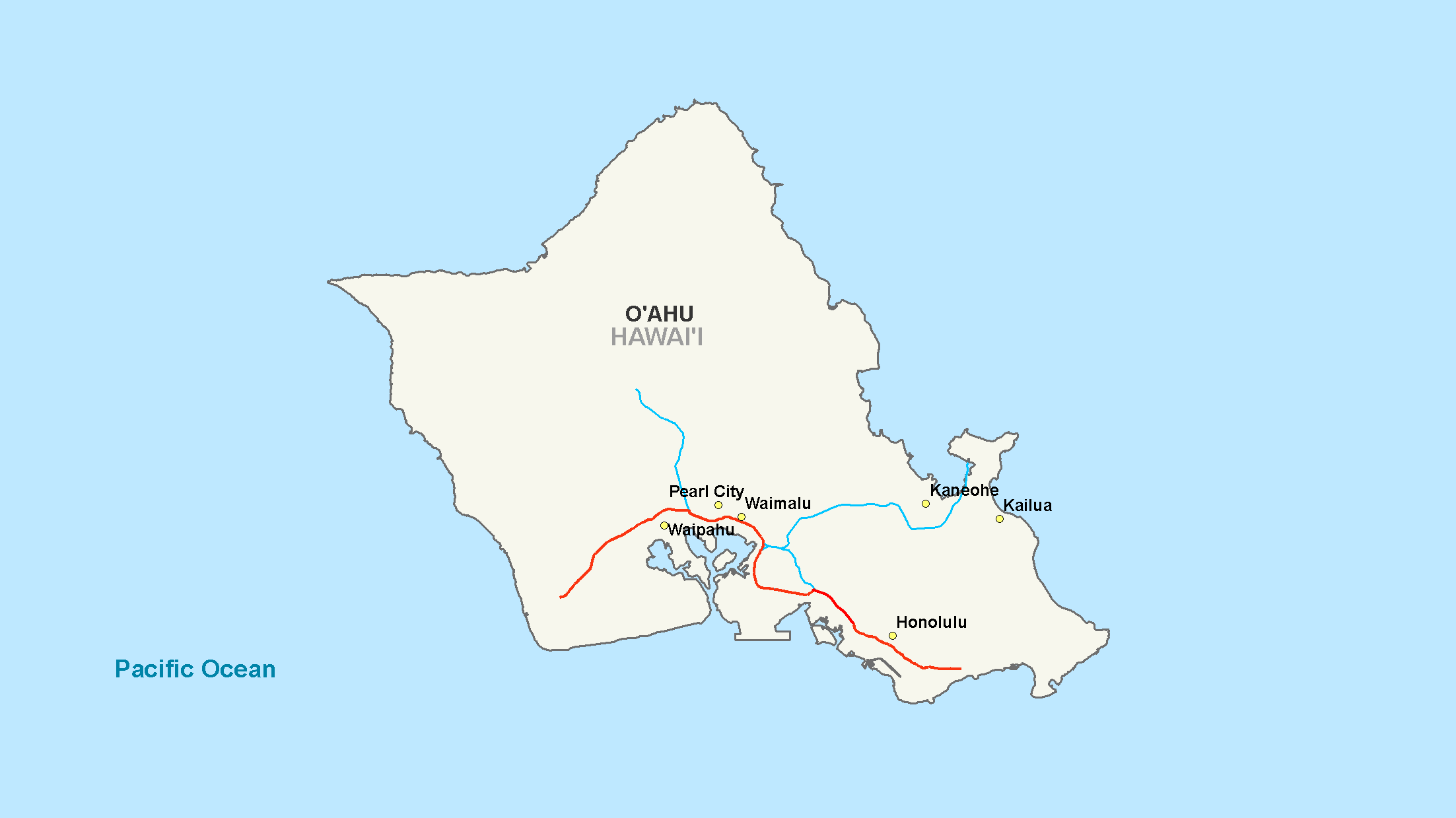
maint=
length_mi=27.16
length_round=2
length_ref= [ [http://www.fhwa.dot.gov/reports/routefinder/table1.htm Route Log - Main Routes of the Eisenhower National System Of Interstate and Defense Highways - Table 1] ]
year_established=1953-1959
direction_a=West
terminus_a=Jct|state=HI|Route|93 in Kapolei
junction=Jct|state=HI|I|2 in Pearl City
Jct|state=HI|I|201 in Aiea
Jct|state=HI|I|3 in Halawa
direction_b=East
terminus_b= Jct|state=HI|Route|72 in Honolulu, HI
previous_type=
previous_route=
next_type=
next_route=Interstate H-1 (abbreviated H-1) is the busiest
Interstate highway inHawaii ,United States , located on the island of O‘ahu. Despite the number, this is an east-west highway—the 'H'-series (for Hawaii) numbering reflects the order in which routes were funded and built. H-1 goes from Route 93 (Farrington Highway) in Kapolei to Route 72 (Kalanianaole Highway) in Kāhala. East of Middle Street inHonolulu (exit 19A), H-1 is also known as theLunalilo Freeway and is sometimes signed as such at older signs in central Honolulu. West of Middle Street, H-1 is also known as the Queen Liliʻuokalani Freeway; this name is shown on some roadmaps. It is the westernmost and southernmost interstate highway in the United States.Route description
Interstate H-1 begins near the Campbell Industrial Park in the town of
Kapolei, Hawaii . West of this point, Hawaii state route 93 (Farrington Highway) continues toward Waianae. The freeway continues east, passing the community of Makakilo until reaching the junction with SR 750 (north to Kunia) and SR 76 (south to Ewa Beach).H-1 then continues along the northern edge of Waipahu approximately convert|3|mi|km until its junction with
Interstate H-2 . It then continues east through the towns of Pearl City and Aiea for approximately convert|5|mi|km to the complex Halawa Interchange, where it meets Interstates H-3 and H-201. The highway then turns south for two miles (3 km), then east soon after the exits forHickam Air Force Base andPearl Harbor . At this point, the highway runs along a viaduct above state route 92 (Nimitz Highway), passing to the north ofHonolulu International Airport .Google Maps street maps andUSGS topographic map s, accessed December 2007 via [http://mapper.acme.com/ ACME Mapper] ]Two miles past the airport exit, three lanes exit the freeway at exit 18A to join Nimitz Highway toward Waikiki, while the remaining two lanes make an S-curve to join the east end of
Interstate H-201 . From here H-1 runs through the city of Honolulu along a series of underpasses and viaducts. H-1 ends in the Kahala district of Honolulu near Kahala Mall, where state route 72 (Kalanianaole Highway) ends.H-1 has a maximum posted speed limit of 60 mph (100 km/h) west of the Kunia-Ewa-Waipahu interchange; a 55 mph (90 km/h) speed limit for the remaining section running to the airport, and a 50 mph (80 km/h) speed limit on the Lunalilo freeway section that runs within the Honolulu area, with a few 45 mph (73 km/h) sections.
History
This was the first freeway of any kind built in the Hawaiian Islands. The portion of H-1 that runs through downtown Honolulu opened in
1953 as the Mauka Arterial; it was added to the Interstate system when Hawaii became a state. This section has been largely unchanged since its inception and its design suffers from having too many on/off ramps, short distanced on-ramps, and on-ramps that enter the freeway almost immediately before an off-ramp (opposite of current design standards). The 'new' section of H-1 was, however, built to modern freeway standards.Exit list
Auxiliary routes
*A portion of the Moanalua Freeway is designated as
Interstate H-201 . Until mid-2004, it was signed as Route 78.References
External links
* [http://www.hawaiihighways.com/oahu-freeways-H1.htm Exit List for Interstate H-1]
* [http://www.hawaiihighways.com/photos-Interstate-H1.htm Photos of Interstate H-1]
Wikimedia Foundation. 2010.