- Pennsylvania Route 152
-
PA Route 152
Route information Maintained by PennDOT Length: 25.1 mi[3] (40.4 km) Existed: 1928[1][2] – present Major junctions South end:  PA 309 in Cheltenham Township
 PA 63 in Horsham Township
 US 202 in Chalfont
North end: PA 309 near TelfordLocation Counties: Bucks, Montgomery Highway system Roads in Pennsylvania
Interstate • US • State • Legislative←  PA 151
PA 153  →
→Pennsylvania Route 152 (abbreviated PA 152) is a 25 mile (40 km) long state highway located in the US state of Pennsylvania. The route, travels north–south from PA Route 309 located in Cedarbrook north to PA Route 309 located east of Telford.
PA 152 is unique to other Pennsylvania Highways because it ends at two interchanges on the same route. From a junction with PA Route 73 to Silverdale, a 21-mile (34 km) portion of PA 152 is known as Limekiln Pike. North of Silverdale, PA 152 runs opposite to its alignment leading up to the northern terminus at another interchange with PA 309.
Contents
Route description
Montgomery County
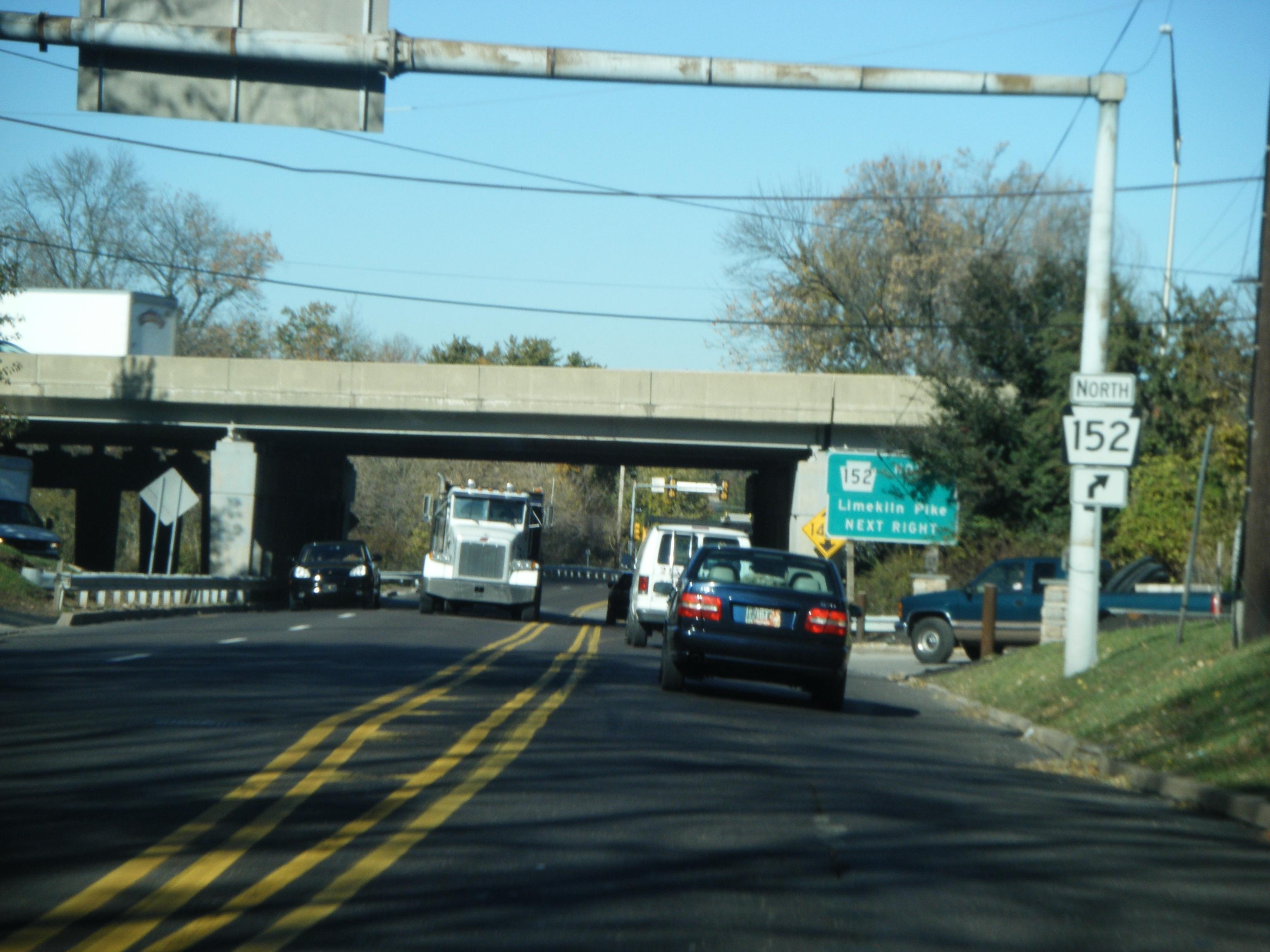
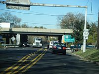 PA 152 northbound approacching split with Susquehanna Road in Dresher.
PA 152 begins at an interchange with PA Route 309 in Cedarbrook, located in Montgomery County about 3,000 feet (910 m) north of the Philadelphia city line. This interchange, formerly a complex web of ramps, was reconstructed with a simpler alignment in 2007. PA 152 begins as Easton Road on a north alignment, and then diverts left onto Limekiln Pike just before intersecting PA Route 73.
North of PA 73, PA 152 continues on a north alignment through the Philadelphia suburb of Cheltenham Township. In Upper Dublin Township, PA 152 passes under Interstate 276, the Pennsylvania Turnpike. North of I-276, the alignment of PA 152 begins to change to a north west alignment through the hamlet of Jarrettown before changing to a solid north alignment.
Then, PA 152 has several important junctions. The first junction is with Norristown Road, then with PA Route 63, and a final junction with Butler Pike. After all of these junctions, PA 152 intersects PA Route 463 in the hamlet of Prospectville. Then it continues on a north alignment as Limekiln Pike.
Bucks County
Upon entering Bucks County, the alignment of PA 152 begins to change more to the west. After entering the borough of Chalfont, the route instantly has a concurrency with U.S. Route 202. Later, PA 152 continues to the north west as Limekiln Pike through rural Bucks County. In the hamlet of Mount Pleasant, the route has wide turns before reaching Silverdale.
PA 152 enters Silverdale from the south as Limekiln Pike, then it has a short wrong-way concurrency with PA Route 113. Then, PA 152 enters the borough of Perkasie as Walnut Street. In Perkasie, the route changes its course to the south to become Constitution Avenue and Park Avenue. Then upon exiting Perkasie it turns to west to become State Road and terminate at another interchange with PA Route 309.[4][5]
History
PA 152 was originally a pathway known as the Limekiln Road built in 1693 to transport lime from kilns from Upper Dublin Township.[6]
In the original 1928 routing[1], PA 152 stretched from US 122 and PA 52 (now US 202) in Chalfont to the Stenton Avenue and Broad Street (US 611) intersection via Ogontz Avenue in the Oak Lane neighborhood of North Philadelphia. The segment within Perkasie known as Walnut Street, Construction Avenue, and Park Avenue was signed as PA 413 from South Perkasie Road to Main Street (then US 309). In 1930, the route was lengthened to PA 113 in Silverdale.[7][8]
In 1947, the northern terminus was moved to US 309 in Sellersville replacing the segment of PA 413. From the late 1940s to the mid 1950s, the southernmost segment on Easton Road from PA 309 to Arcadia University was signed as US 611 Alternate.[9][10]
By 1960, the southern terminus was moved to its current location.[11]
Major intersections
County Location Mile[3] Destinations Notes Montgomery Cheltenham Township 0.0 PA 309 (Fort Washington Expressway)Interchange. 0.2  PA 73 (Church Road)
Upper Dublin Township 6.8 PA 63 (Welsh Road)Horsham Township 9.0  PA 463 (Horsham Road)
Bucks Chalfont 14.3 US 202 (Butler Avenue)Southern terminus of concurrency. 14.5 US 202 (Butler Avenue)Northern terminus of concurrency. Silverdale 20.5  PA 113 (Main Street)
Southern terminus of concurrency. 20.6 PA 113 (Main Street)Northern terminus of concurrency. West Rockhill Township 25.1 PA 309Interchange. 1.000 mi = 1.609 km; 1.000 km = 0.621 mi References
- ^ a b Gulf Oil (1928). Pennsylvania Highway Map (Philadelphia Metro) (Map). http://www.mapsofpa.com/art5pics/1928phila3.jpg. Retrieved 2007-11-08.
- ^ Pennsylvania Department of Highways (1927). Pennsylvania Highway Map (Map). http://www.mapsofpa.com/roadcart/1927_2043m.jpg. Retrieved 2007-11-08.
- ^ a b Calculated using DeLorme Street Atlas USA 2007
- ^ Pennsylvania Department of Transportation (2009). Pennsylvania Official Tourism and Transportation Map (Map). ftp://ftp.dot.state.pa.us/public/pdf/BPR_PDF_FILES/MAPS/Statewide/otm/2009/otm_2009.PDF. Retrieved 2009-10-09.
- ^ Google, Inc. Google Maps – Pennsylvania Route 152 (Map). Cartography by Google, Inc. http://maps.google.com/maps?hl=en&q=from:+E%20Market%20St/RT-308%20@41.926860,%20-73.912580+to:+RT-308%20@41.970313,%20-73.821096. Retrieved 2008-03-01.
- ^ Alderfer, Everett Gordon (1951). The Montgomery County story. Commissioners of Montgomery County. http://books.google.com/books?id=LXozAAAAIAAJ&q=limekiln+pike&dq=limekiln+pike. Retrieved 2009-10-09.
- ^ Automobile Blue Book Inc. (1929). Automobile Blue Book Vol. 3 (Philadelphia) (Map). p. 9, section 2. http://www.broermapsonline.org/members/NorthAmerica/UnitedStates/Midatlantic/Pennsylvania/Philadelphia/bluebook1929_005.html. Retrieved 2009-10-09.
- ^ Pennsylvania Department of Highways (1930). state map (front) (Map). ftp://ftp.dot.state.pa.us/public/pdf/BPR_pdf_files/Maps/Statewide/Historic_OTMs/1930fr.pdf. Retrieved 2009-10-09.
- ^ United States Department of the Army (1947). Newark, NJ 1:250,000 Quadrangle (Map). http://www.lib.utexas.edu/maps/topo/250k/txu-pclmaps-topo-us-newark-1947.jpg. Retrieved 2009-10-09.
- ^ United States Department of the Army (1946). Wilmington, DE 1:250,000 Quadrangle (Map). http://www.lib.utexas.edu/maps/topo/250k/txu-pclmaps-topo-us-wilmington-1946-a.jpg. Retrieved 2009-10-09.
- ^ Pennsylvania Department of Highways (1960). state map (back) (Map). ftp://ftp.dot.state.pa.us/public/pdf/BPR_pdf_files/Maps/Statewide/Historic_OTMs/1960bk.pdf. Retrieved 2009-10-09.
Road transportation infrastructure of the metro Philadelphia area Interstates U.S. Routes Pennsylvania Routes New Jersey Routes Delaware Routes Named roads/streets Benjamin Franklin Parkway · Broad Street · City Avenue · Front Street · Girard Avenue · Market Street · Roosevelt Boulevard · South Street · Chestnut Street · Walnut Street
Pennsylvania Turnpike · New Jersey Turnpike · Delaware Turnpike · Atlantic City Expressway · Schuylkill Expressway · Delaware Expressway · Blue Route · Vine St Expressway · North South Freeway · Lancaster Avenue · Bethlehem Pike · Baltimore Pike · Black Horse PikeBridges Delaware Memorial Bridge · Commodore Barry Bridge · Walt Whitman Bridge · Ben Franklin Bridge · Betsy Ross Bridge · Tacony–Palmyra Bridge · Burlington–Bristol Bridge · Delaware River – Turnpike Toll BridgeCommunities Camp Hill · Dresher · Fitzwatertown · Fort Washington · Gilkison's Corner · Jarrettown · Maple Glen · North Hills · Oreland · Rose Valley · Three TunsInfrastructure Major Roads Education Historic Sites Historic Events Battle of Whitemarsh · Great Train Wreck of 1856Website: Upperdublin.netCommunities Educational Institutions National Historic Sites Beth Sholom Synagogue • Curtis Hall Arboretum • Wall House • Grey Towers Castle • St. Paul's Episcopal Church • Milmoral • Camptown Historic District • Rowland House • Elkins Railroad Station • Glenside Memorial HallFamous People See also Pennsylvania's 2nd congressional district • Elkins Estate • Lynnewood HallMajor Roads Regional Rail Stations Infrastructure Categories:- State highways in Pennsylvania

Wikimedia Foundation. 2010.