- Delaware Route 92
-
Delaware Route 92
Route information Maintained by DelDOT Length: 8.83 mi[1] (14.21 km) Major junctions West end:  DE 100 near Montchanin
 US 202 near Talleyville
 DE 261 near Booth Corner, PA
 DE 3 in Brandywine Hundred
 I-95 in Claymont
 DE 491 in Claymont
East end:  US 13 in Claymont
Highway system ←  DE 82
DE 82I-95 →Delaware Route 92 (DE 92) is a two to four-lane, east–west road that runs a short distance to the south of the Pennsylvania/Delaware State Line for most of its 8.83-mile (14.21 km) length and allows a direct connection between U.S. Route 202 in Talleyville, Delaware with I-95 in Claymont, Delaware, the two major highways in Northern Delaware. DE 92 was first built as a state highway east of US 202 during the 1920s and 1930s. By 1968, the route was designated onto its current alignment. In the 1990s, most of DE 92 east of US 202 was widened into a divided highway.
Contents
Route description
Delaware Rt. 92 begins at the intersection with Delaware Rt. 100 and Adams Dam Road near Montchanin, Delaware. Traveling in a southwest–northeast direction, Delaware Rt. 92 between Delaware Rt. 100 and U.S. Rt. 202 is a semi-rural two-lane road called Thompson Bridge Road, passing through Brandywine Creek State Park. After the state park, Delaware Rt. 92 then makes a sharp right onto Beaver Valley Road and then becomes a four-lane roadway upon crossing U.S. Rt. 202.[1][2]
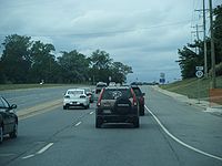 Westbound DE 92 past intersection with DE 261.
Now signed as "Naamans Road," the four-lane roadway, which underwent a total rebuild between the 1970s and 2000, goes past the massive Brandywine Town Center, which was once the Brandywine Raceway harness racing track (which closed down in the late 1980s, but was eventually "replaced" with the building of the Harrah's Racetrack and Casino in Chester, Pennsylvania in 2006), but is now the location of a Target Greatland department and Lowes Home Center stores. Past the Brandywine Center, Delaware Rt. 92 meets Ebright Road, which goes north to the highest point in Delaware (Ebright Azimuth, at 448') and then into Pennsylvania. It then intersects with both Delaware Rts. 261 and 3 (at the northern end of the latter), before intersecting with I-95 at the northern terminus of I-495. The route drops about 400' between Ebright Rd. and I-95, although it is gradual. New Jersey can be seen in the distance from the area around Ebright Rd.[1][2]
It is just after I-95 that Delaware Rt. 92 passes the Tri-State Mall, an early shopping mall that has an indoor mall at the front and a side strip-type mall on the side. While the strip mall has suffered from few vacancies within the past 10 years, most of the main (indoor) mall, despite being anchored by a K-mart and Burlington Coat Factory (recently replacing the Value City that had occupied the space, formerly the Wilmington Dry Goods) store on each end, currently suffers from a lack of long-term tenants, a problem associated with older mini-malls across America.[1][2]
After passing I-95 and Delaware Route 491, Delaware Rt. 92 comes to an end at U.S. Route 13, which, despite being a major north–south road in Delaware, takes on more of a secondary-type appearance at this location. The intersection of Delaware Rt. 92 with U.S. 13 allows an alternative to I-95 to either Philadelphia (via Pennsylvania Route 291 in Chester, Pennsylvania) or to I-495 and U.S. 202 through Wilmington.[1][2]
History
By 1920, what is now DE 92 originally existed as a county road, with the portion east of Foulk Road proposed to become a state highway.[3] The state highway between Foulk Road and Philadelphia Pike was completed by 1924.[4] By 1931, the portion of road between Grubb Road and Foulk Road was upgraded to a state highway.[5] When Delaware first numbered its state highways by 1936, what is now DE 92 remained unnumbered, with the state highway portion extended west to Concord Pike.[6] By 1968, DE 92 was designated onto its current alignment between DE 100 and US 13, with the easternmost portion replacing what had been designated a part of US 13 Bypass.[7] DE 92 was widened into a divided highway by 1997 between US 202 and DE 261 and between DE 3 and DE 491.[8] By 1999, the road was upgraded to a divided highway between DE 261 and DE 3.[9]
Major intersections
The entire route is in New Castle County.
Location Mile[1] Road Notes Montchanin 0.00 DE 100 (Montchanin Road)Western terminus Brandywine Hundred 3.18 US 202 (Concord Pike)5.51 DE 261 (Foulk Road)6.25 DE 3 south (Marsh Road)Claymont 8.12 I-95Interchange DE 491 north (Hickman Road)8.83 US 13 (Philadelphia Pike)Eastern terminus 1.000 mi = 1.609 km; 1.000 km = 0.621 mi See also
 U.S. Roads portal
 Delaware portal
References
- ^ a b c d e f http://www.deldot.gov/information/pubs_forms/manuals/traffic_counts/2006/pdf/rpt_pgs1_38_rev.pdf DelDOT 2006 Traffic Count and Mileage Report
- ^ a b c d Google, Inc. Google Maps – overview of Delaware Route 92 (Map). Cartography by Google, Inc. http://maps.google.com/maps?f=d&source=s_d&saddr=DE+92+and+DE+100&daddr=US+13+and+DE+92&hl=en&geocode=FW1YXwIdtZ9--ymjcpA8cPzGiTHzfTzlCOLUPA%3BFXlzXwIdatiA-yl5YJBrGeTGiTEYWlAJqzRNOw&mra=ls&sll=39.78664,-75.501495&sspn=0.120302,0.338173&ie=UTF8&t=h&z=13. Retrieved February 5, 2011.
- ^ Delaware Department of Transportation (PDF). Delaware Official Highway Map (Map) (1920 ed.). http://www.deldot.gov/archaeology/historic_pres/historic_highway_maps/pdf/cd_002.pdf. Retrieved April 15, 2010.
- ^ Delaware Department of Transportation (PDF). Delaware Official Highway Map (Map) (1924 ed.). http://www.deldot.gov/archaeology/historic_pres/historic_highway_maps/pdf/cd_003.pdf. Retrieved August 1, 2010.
- ^ Delaware Department of Transportation (PDF). Delaware Official Highway Map (Map) (1931 ed.). http://www.deldot.gov/archaeology/historic_pres/historic_highway_maps/pdf/cd_005.pdf. Retrieved 2010-08-19.
- ^ Delaware Department of Transportation (PDF). Delaware Official Highway Map (Map) (1936/37 ed.). http://www.deldot.gov/archaeology/historic_pres/historic_highway_maps/pdf/cd_008.pdf. Retrieved April 15, 2010.
- ^ Delaware Department of Transportation (PDF). Delaware Official Highway Map (Map) (1968 ed.). http://www.deldot.gov/archaeology/historic_pres/historic_highway_maps/pdf/cd_044.pdf. Retrieved April 20, 2010.
- ^ Delaware Department of Transportation (PDF). Delaware Official Highway Map (Map) (1997 ed.). http://www.deldot.gov/archaeology/historic_pres/historic_highway_maps/pdf/cd_056.pdf. Retrieved February 5, 2011.
- ^ Delaware Department of Transportation (PDF). Delaware Official Highway Map (Map) (1999 ed.). http://www.deldot.gov/archaeology/historic_pres/historic_highway_maps/pdf/cd_074.pdf. Retrieved February 5, 2011.
Road transportation infrastructure of the metro Philadelphia area Interstates U.S. Routes Pennsylvania Routes New Jersey Routes Delaware Routes Named roads/streets Benjamin Franklin Parkway · Broad Street · City Avenue · Front Street · Girard Avenue · Market Street · Roosevelt Boulevard · South Street · Chestnut Street · Walnut Street
Pennsylvania Turnpike · New Jersey Turnpike · Delaware Turnpike · Atlantic City Expressway · Schuylkill Expressway · Delaware Expressway · Blue Route · Vine St Expressway · North South Freeway · Lancaster Avenue · Bethlehem Pike · Baltimore Pike · Black Horse PikeBridges Delaware Memorial Bridge · Commodore Barry Bridge · Walt Whitman Bridge · Ben Franklin Bridge · Betsy Ross Bridge · Tacony–Palmyra Bridge · Burlington–Bristol Bridge · Delaware River – Turnpike Toll BridgeCategories:- State highways in Delaware
- Transportation in New Castle County, Delaware


Wikimedia Foundation. 2010.