- Delaware Route 15
-
Delaware Route 15
Route information Maintained by DelDOT Length: 57.04 mi[1] (91.80 km) Major junctions South end:  DE 14 west of Milford

 US 13 / US 13 Alt. in Canterbury
 DE 10 west of Camden
 DE 8 in Dover
 DE 300 southwest of Clayton
 DE 6 west of Clayton

 US 301 / DE 299 in Middletown
North end: 
 US 301 / DE 71 / DE 896 in Summit
Highway system ← DE 14DE 16  →
→Delaware Route 15 (DE 15) is a state highway in the U.S. state of Delaware. The route runs from Delaware Route 14 west of Milford in Kent County to U.S. Route 301 and Delaware Routes 71 and 896 in Summit, New Castle County, just south of Summit Bridge. Delaware Route 15 winds a path through many rural sections of Delaware, turning along many different roads. Most of the route, with the exception of the southern part of the route from Canterbury to Milford, runs to the west of U.S. Route 13. Delaware Route 15 skirts the western outskirts or misses many notable Delaware towns, including Wyoming, Dover, Clayton, and Middletown. What is now DE 15 was paved in several stages from the 1930s to the 1960s. By the 1980s, the route was designated between DE 14 in Milford and US 13 in Canterbury. By 1990, it was extended north to US 301/DE 299 near Middletown and then to US 301/DE 71/DE 896 near the Summit Bridge by 1994.
Contents
Route description
Kent County
Delaware Route 15 begins at an intersection with Delaware Route 14 west of the city of Milford and proceeds in a northwest direction on Canterbury Road. It intersects Delaware Route 12 and reaches the community of Canterbury, where it meets U.S. Route 13. It follows US 13 for a short distance and continues to the north along with U.S. Route 13 Alternate on Upper King Road. The two head to the town of Woodside where Delaware Route 15 turns west along Delaware Route 10 Alternate.[1][2]
The route follows Delaware Route 10 Alternate for a short distance before turning north on Dundee Road. It then intersects Delaware Route 10 and the name changes to Moose Lodge Road. Delaware Route 15 then turns east onto Westville Road and enters the town of Wyoming.[1][2]
In Wyoming, Delaware Route 15 turns north on Railroad Avenue West, paralleling a Norfolk Southern rail line to the west through the town. The route exits Wyoming on Wyoming Mill Road, which carries Delaware Route 15 north through agricultural land to the western end of Dover. It then heads east on North Street, passing through the West Dover industrial district, before turning north on Saulsbury Road. The route intersects Delaware Route 8 and then heads north to the intersection with Walker Road, where the name changes to McKee Road.[1][2]
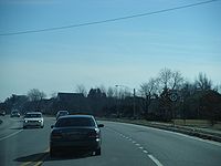 Southbound Delaware Route 15 (McKee Road) past Scarborough Road in Dover.
Delaware Route 15 then intersects Scarborough Road, which provides access to U.S. Route 13 and the Delaware Route 1 turnpike. It then leaves Dover, turning west on Denneys Road West and then north on Kenton Road. The route meets Delaware Route 42, and it continues west for a brief concurrency with DE 42 on Seven Hickories Road. Delaware Route 15 then heads north on Mount Friendship Road.[1][2]
Mount Friendship Road carries Delaware Route 15 to Delaware Route 300, which it follows for a very short distance, before heading north on Alley Corners Road. The route then meets Delaware Route 6, and it follows Delaware Route 6 east toward Clayton. Along the west edge of Clayton, Delaware Route 15 turns to the north on West Duck Creek Road and heads into New Castle County.[1][2]
New Castle County
Delaware Route 15 enters New Castle County and the name becomes Clayton Greenspring Road. It then turns northwest on Greenspring Road and heads into the Blackbird State Forest. The route then turns north on Dexter Corner Road and then branches to the northwest on Blackbird Station Road, leaving the Blackbird State Forest.[1][2]
The road name changes to Dogtown Road and then Delaware Route 15 makes a right turn onto Levels Road. The route then heads north to meet U.S. Route 301 and Delaware Route 299 on the western edge of Middletown. Delaware Route 15 follows these two routes eastward toward Middletown. It then branches off from US 301, heading to the northwest on Bunker Hill Road.[1][2]
Delaware Route 15 then turns to the north onto Choptank Road. It meets Delaware Route 286, which heads west toward Chesapeake City, Maryland. At this intersection, Delaware Route 15 takes on the name of Bethel Church Road. It then turns to the east and ends at U.S. Route 301 and Delaware Routes 71 and 896 in Summit, just south of the Summit Bridge.[1][2]
History
By 1920, the roads that comprise present-day DE 15 existed as county roads.[3] Bunker Hill Road was paved by 1932, with Levels Road being constructed as a state highway by this time.[4] By 1936, the segment between DE 12 and US 13, Brenford Road, a portion north of DE 6, and Bethel Church Road were paved.[5] Kenton Road were paved by 1939.[6] By 1942, paving was completed on the sections between DE 14 and Carpenters Bridge Road and from DE 8 to Kenton Road, and the entire segment between Clayton and Middletown excluding a portion of Blackbird Station Road.[7] The remainder of the road between Milford and Canterbury, the portion between Woodside and DE 10, the portion between Wyoming and Dover, and the segment of Choptank Road between Bohemia Church Road and Bethel Church Road were all paved by 1952.[8] The remainder of the route between Clayton and Middletown was paved by 1954.[9] By 1957, paving was completed on the remainder of Choptank Road.[10] The section between Woodside and Wyoming was fully paved by 1959.[11] The Mt. Friendship Road part of the current route was paved by 1964.[12] By 1966, the paving of present-day DE 15 was completed when Alley Corner Road was paved.[13] DE 15 was designated to run from DE 14 near Milford north to US 13 in Canterbury by 1984.[14] The route was extended north to US 301/DE 299 west of Middletown by 1990.[15] By 1994, DE 15 was extended farther north to US 301/DE 71/DE 896 near the Summit Bridge by 1994.[16]
Major intersections
County Location Mile[1] Destinations Notes Kent Milford 0.00 DE 14 (Milford-Harrington Highway)Southern terminus Felton 6.94  DE 12 (Midstate Road)
Canterbury 10.14
US 13 (Dupont Highway) / US 13 Alt. (Upper King Road)Brief overlap with US 13, south end of US 13 Alt. overlap Woodside 11.90
US 13 Alt. north (Upper King Road) / DE 10 Alt. east (Main Street)North end of US 13 Alt. overlap, south end of DE 10 Alt. overlap 12.41
DE 10 Alt. west (Main Street)North end of DE 10 Alt. overlap Camden 14.14 DE 10 (Willow Grove Road)Dover 20.34 DE 8 (Forrest Avenue)Seven Hickories 26.71  DE 42 east (Seven Hickories Road)
South end of DE 42 overlap 27.28 DE 42 west (Seven Hickories Road)North end of DE 42 overlap Clayton 30.52 DE 300 west (Wheatleys Pond Road)South end of DE 300 overlap 30.68 DE 300 east (Wheatleys Pond Road)North end of DE 300 overlap 33.30 DE 6 west (Millington Road)South end of DE 6 overlap 34.55 DE 6 east (Millington Road)North end of DE 6 overlap New Castle Middletown 49.28 US 301 south / DE 299 west (Middletown-Warwick Road)South end of US 301/DE 299 overlap 50.33 US 301 north (Middletown-Warwick Road) / DE 299 east (Main Street) – Middletown, OdessaNorth end of US 301/DE 299 overlap Summit 56.20  DE 286 west (Bethel Church Road)
57.04 US 301 / DE 71 / DE 896 (Summit Bridge Road)Northern terminus 1.000 mi = 1.609 km; 1.000 km = 0.621 mi See also
 U.S. Roads portal
 Delaware portal
References
- ^ a b c d e f g h i j http://www.deldot.gov/information/pubs_forms/manuals/traffic_counts/2006/pdf/rpt_pgs1_38_rev.pdf DelDOT 2006 Traffic Count and Mileage Report
- ^ a b c d e f g h Google, Inc. Google Maps – overview of Delaware Route 15 (Map). Cartography by Google, Inc. http://maps.google.com/maps?f=d&source=s_d&saddr=Delaware+14+%26+State+Road+15,+Milford+North,+Kent,+Delaware+19963&daddr=39.0052851,-75.5233469+to:39.06775,-75.5625+to:39.09941,-75.58326+to:39.134743,-75.5538918+to:39.1887424,-75.5679517+to:39.18777,-75.59092+to:39.2054411,-75.6024958+to:39.2124849,-75.619563+to:39.2287221,-75.6280187+to:39.2665812,-75.6526476+to:39.2995751,-75.6399266+to:39.3227021,-75.6673569+to:39.3423901,-75.6972338+to:39.357722,-75.7017599+to:39.3637482,-75.7164139+to:39.4304552,-75.7420216+to:39.4731859,-75.7378685+to:39.4949059,-75.7425333+to:DE+896+and+bethel+church+road&geocode=Ffj9UQIdu5eA-ymN3aRNR5q4iTFO3EyTwwpvhw%3BFWUsUwId7pp_-ymXwXL4sZy4iTEGkavDzvxDNA%3BFWYgVAId_AF_-ykX5CwgkIK4iTGE7ljqHbVkyw%3BFRKcVAId5LB--ylnIJVkmX3HiTFGln4eQpgx0g%3BFRcmVQIdnSN_-ymvfcB06XzHiTFpuLlNbD4K4g%3BFQb5VQIdsex--yk1_LfWCHvHiTGO4wBMnGLVSQ%3BFTr1VQId-JJ--ynVW7o7vHvHiTH5FSSqiKKqkQ%3BFUE6VgIdwWV--ylnFRdEy3vHiTEeBlF3DrDrAQ%3BFcRVVgIdFSN--yn5QgQEKnrHiTHxFSyJ8zo0QA%3BFTKVVgIdDgJ--ylZhJeRjHnHiTGg-gYLpzgPMA%3BFRUpVwId2aF9-yntx1U9b3fHiTFvWzNWug0Ryg%3BFfepVwIditN9-ylhJyhc3HbHiTH-XgpFAJ3abA%3BFU4EWAIdZGh9-ylJokduY3bHiTGaz1CMZuvHMQ%3BFTZRWAIdr_N8-ykF5zjGCXbHiTF6g6JbnoOmYw%3BFRqNWAIdAeJ8-ynlu4Dm7XXHiTFMRuVSO2IhXw%3BFaSkWAIdw6h8-ykHg3RLIJ7HiTFyA0qv2BXK-A%3BFTepWQIdu0R8-ynnxQQ9IaDHiTGlA3zXW2V9qw%3BFSFQWgId9FR8-ylbcRsx86DHiTFcKUet5hFIgQ%3BFfmkWgIdu0J8-ykl5eWaxqDHiTEtxfVPFt2chQ%3BFVQuWwId91l8-ynTHqjRaqfHiTFJrq2QW-1vog&hl=en&mra=ls&via=1,2,3,4,5,6,7,8,9,10,11,12,13,14,15,16,17,18&sll=39.525594,-75.735068&sspn=0.015095,0.042272&ie=UTF8&t=h&z=9. Retrieved February 8, 2011.
- ^ Delaware Department of Transportation (PDF). Delaware Official Highway Map (Map) (1920 ed.). http://www.deldot.gov/archaeology/historic_pres/historic_highway_maps/pdf/cd_002.pdf. Retrieved April 15, 2010.
- ^ Delaware Department of Transportation (PDF). Delaware Official Highway Map (Map) (1932 ed.). http://www.deldot.gov/archaeology/historic_pres/historic_highway_maps/pdf/cd_006.pdf. Retrieved February 6, 2011.
- ^ Delaware Department of Transportation (PDF). Delaware Official Highway Map (Map) (1936/37 ed.). http://www.deldot.gov/archaeology/historic_pres/historic_highway_maps/pdf/cd_008.pdf. Retrieved April 15, 2010.
- ^ Delaware Department of Transportation (PDF). Delaware Official Highway Map (Map) (1939 ed.). http://www.deldot.gov/archaeology/historic_pres/historic_highway_maps/pdf/cd_012.pdf. Retrieved February 6, 2011.
- ^ Delaware Department of Transportation (PDF). Delaware Official Highway Map (Map) (1942 ed.). http://www.deldot.gov/archaeology/historic_pres/historic_highway_maps/pdf/cd_014.pdf. Retrieved February 6, 2011.
- ^ Delaware Department of Transportation (PDF). Delaware Official Highway Map (Map) (1952/53 ed.). http://www.deldot.gov/archaeology/historic_pres/historic_highway_maps/pdf/cd_026.pdf. Retrieved February 6, 2011.
- ^ Delaware Department of Transportation (PDF). Delaware Official Highway Map (Map) (1954/55 ed.). http://www.deldot.gov/archaeology/historic_pres/historic_highway_maps/pdf/cd_028.pdf. Retrieved February 6, 2011.
- ^ Delaware Department of Transportation (PDF). Delaware Official Highway Map (Map) (1957/58 ed.). http://www.deldot.gov/archaeology/historic_pres/historic_highway_maps/pdf/cd_030.pdf. Retrieved April 29, 2010.
- ^ Delaware Department of Transportation (PDF). Delaware Official Highway Map (Map) (1959/60 ed.). http://www.deldot.gov/archaeology/historic_pres/historic_highway_maps/pdf/cd_032.pdf. Retrieved April 15, 2010.
- ^ Delaware Department of Transportation (PDF). Delaware Official Highway Map (Map) (1964 ed.). http://www.deldot.gov/archaeology/historic_pres/historic_highway_maps/pdf/cd_036.pdf. Retrieved April 15, 2010.
- ^ Delaware Department of Transportation (PDF). Delaware Official Highway Map (Map) (1966 ed.). http://www.deldot.gov/archaeology/historic_pres/historic_highway_maps/pdf/cd_040.pdf. Retrieved August 19, 2010.
- ^ Delaware Department of Transportation (PDF). Delaware Official Highway Map (Map) (1984 ed.). http://www.deldot.gov/archaeology/historic_pres/historic_highway_maps/pdf/cd_062.pdf. Retrieved February 5, 2011.
- ^ Delaware Department of Transportation (PDF). Delaware Official Highway Map (Map) (1990 ed.). http://www.deldot.gov/archaeology/historic_pres/historic_highway_maps/pdf/cd_070.pdf. Retrieved February 6, 2011.
- ^ Delaware Department of Transportation (PDF). Delaware Official Highway Map (Map) (1994 ed.). http://www.deldot.gov/archaeology/historic_pres/historic_highway_maps/pdf/cd_068.pdf. Retrieved April 29, 2010.
Categories:- State highways in Delaware
- Transportation in Kent County, Delaware
- Transportation in New Castle County, Delaware


Wikimedia Foundation. 2010.