- Kent County, Delaware
-
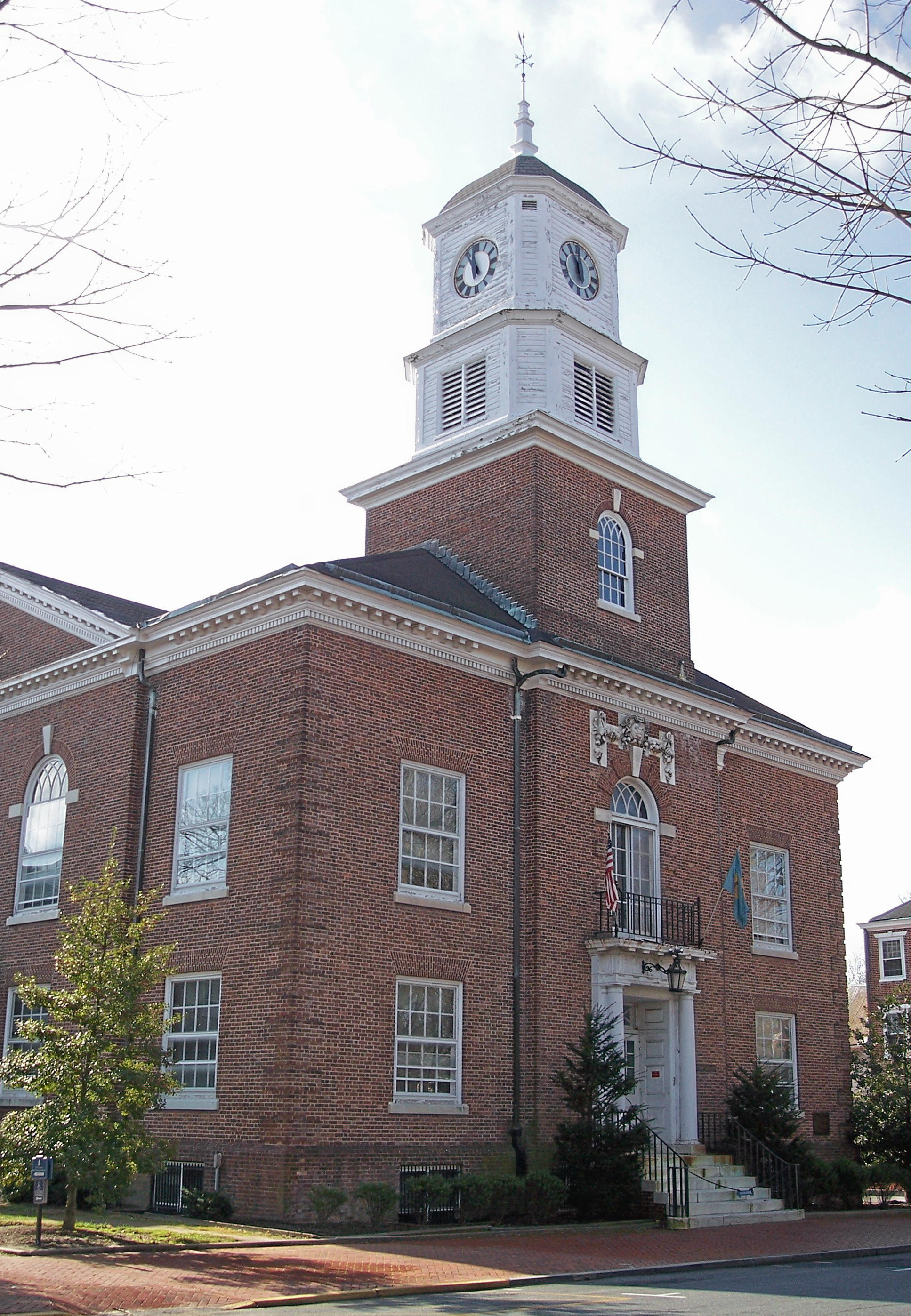
Kent County, Delaware 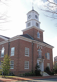 The Kent County Courthouse in Dover in 2006.
Seal
Location in the state of Delaware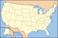
Delaware's location in the U.S.Founded 1683 Seat Dover Largest city Dover Area
- Total
- Land
- Water
800.12 sq mi (2,072 km²)
589.72 sq mi (1,527 km²)
210.40 sq mi (545 km²), 26.30%Population
- (2010)
- Density
162,310
275/sq mi (106.2/km²)Congressional district At-large Website www.co.kent.de.us Kent County is a county located in the central part of the U.S. state of Delaware. It is coextensive with the Dover, Delaware, Metropolitan Statistical Area. As of 2010 the population was 162,310, a 28.1% increase over the previous decade.[1] The county seat is Dover, the state capital. It is named for Kent, an English county.
Contents
History
In about 1670 the English began to settle in the valley of the St. Jones River earlier known as Wolf Creek. On June 21, 1680, The Duke of York chartered St. Jones County, which was carved out of New Amstel/New Castle County and Hoarkill/Sussex County. St. Jones County was transferred to William Penn on August 24, 1682, and became part of Penn's newly chartered Delaware Colony.[2]
Penn ordered a court town to be laid out, and the courthouse was built in 1697. The town of Dover, named after the city of Dover in England's Kent, was finally laid out in 1717, and became the capitol of Delaware in 1777. In 1787 Delaware was first to ratify the U.S. Constitution, and became "the First State." Kent County was a small grain farming region in the 18th Century.
More recently, in the 1960s, Dover was the scene of the manufacturing of the spacesuits worn by NASA astronauts in the Apollo moon flights by ILC Dover, now based in the small town of Frederica. The suits, dubbed the "A7L," was first flown on the Apollo 7 mission in October 1967, and was the suit worn by Neil Armstrong and Buzz Aldrin on the Apollo 11 mission. The company still manufactures spacesuits to this day—the present-day Space Shuttle "soft" suit components (the arms and legs of the suit).
Geography
According to the 2000 census, the county has a total area of 800.12 square miles (2,072.3 km2), of which 589.72 square miles (1,527.4 km2) (or 73.70%) is land and 210.40 square miles (544.9 km2) (or 26.30%) is water.[3]
Adjacent counties
- New Castle County, Delaware - north
- Salem County, New Jersey - northeast¹
- Cumberland County, New Jersey - east¹
- Cape May County, New Jersey - east¹
- Sussex County, Delaware - south
- Caroline County, Maryland - southwest
- Queen Anne's County, Maryland - west
- Kent County, Maryland - west
¹ across Delaware Bay; no land border
The border with Kent County, Maryland is rather unusual since the counties both share the same name. The only other instances in which two neighboring counties with the same name share a state border are Sabine County, Texas and Sabine Parish, Louisiana, Bristol County, Massachusetts and Bristol County, Rhode Island, Union County, Arkansas and Union Parish, Louisiana, and Escambia County, Alabama and Escambia County, Florida respectively.
See also: List of counties bordering eight or more countiesNational protected area
Demographics
Historical populations Census Pop. %± 1790 18,920 — 1800 19,554 3.4% 1810 20,495 4.8% 1820 20,793 1.5% 1830 19,913 −4.2% 1840 19,872 −0.2% 1850 22,816 14.8% 1860 27,804 21.9% 1870 29,804 7.2% 1880 32,874 10.3% 1890 32,664 −0.6% 1900 32,762 0.3% 1910 32,721 −0.1% 1920 31,023 −5.2% 1930 31,841 2.6% 1940 34,441 8.2% 1950 37,870 10.0% 1960 65,651 73.4% 1970 81,892 24.7% 1980 98,219 19.9% 1990 110,993 13.0% 2000 126,697 14.1% 2010 162,310 28.1% [4][5][6] As of the census[7] of 2000, there were 126,697 people, 47,224 households, and 33,623 families residing in the county. The population density was 215 people per square mile (83/km²). There were 50,481 housing units at an average density of 86 per square mile (33/km²). The racial makeup of the county was 73.49% White, 20.66% Black or African American, 0.64% Native American, 1.69% Asian, 0.04% Pacific Islander, 1.27% from other races, and 2.22% from two or more races. 3.21% of the population were Hispanic or Latino of any race. 13.3% were of German, 11.3% United States or American, 10.9% Irish, 10.0% English and 5.4% Italian ancestry according to Census 2000. 92.5% spoke English and 3.3% Spanish as their first language.
There were 47,224 households out of which 35.50% had children under the age of 18 living with them, 52.90% were married couples living together, 13.80% had a female householder with no husband present, and 28.80% were non-families. 23.00% of all households were made up of individuals and 8.40% had someone living alone who was 65 years of age or older. The average household size was 2.61 and the average family size was 3.06.
In the county the population was spread out with 27.30% under the age of 18, 10.10% from 18 to 24, 29.80% from 25 to 44, 21.20% from 45 to 64, and 11.70% who were 65 years of age or older. The median age was 34 years. For every 100 females there were 93.10 males. For every 100 females age 18 and over, there were 89.60 males.
The median income for a household in the county was $40,950, and the median income for a family was $46,504. Males had a median income of $32,660 versus $24,706 for females. The per capita income for the county was $18,662. About 8.10% of families and 10.70% of the population were below the poverty line, including 14.80% of those under age 18 and 8.80% of those age 65 or over.
Communities
Cities
- Dover
- Harrington
- Milford (part of Milford is in Sussex County)
Towns
- Bowers
- Camden
- Cheswold
- Clayton (part of Clayton is in New Castle County)
- Farmington
- Felton
- Frederica
- Hartly
- Houston
- Kenton
- Leipsic
- Little Creek
- Magnolia
- Smyrna (part of Smyrna is in New Castle County)
- Viola
- Woodside
- Wyoming
Census-designated places
- Dover Air Force Base (a CDP as "Dover Base Housing")
- Highland Acres
- Kent Acres
- Rising Sun-Lebanon
- Riverview
- Rodney Village
- Woodside East
Other localities
- Andrewville
- Berrytown
- Little Heaven
- Marydel
Trivia
Kent County, Delaware, is one of the few counties in the United States to border its namesake in another state—in this case, Kent County, Maryland.
See also
References
- ^ http://www.delawareonline.com/article/20110302/NEWS/110302038/New-census-figures-released-Delaware?odyssey=tab%7Ctopnews%7Ctext%7CHome
- ^ NEW YORK: Atlas of Historical County Boundaries by John H. Long and Kathryn Ford Thorne
- ^ "Census 2000 U.S. Gazetteer Files: Counties". United States Census. http://www.census.gov/tiger/tms/gazetteer/county2k.txt. Retrieved 2011-02-13.
- ^ http://www.census.gov/population/www/censusdata/cencounts/files/de190090.txt
- ^ http://factfinder2.census.gov
- ^ http://mapserver.lib.virginia.edu/
- ^ "American FactFinder". United States Census Bureau. http://factfinder.census.gov. Retrieved 2008-01-31.
External links
Municipalities and communities of Kent County, Delaware Cities Dover | Harrington | Milford‡

Towns CDPs Unincorporated
communitiesAndrewville | Berrytown | Little Heaven | Marydel
Hundreds Duck Creek | East Dover | Kenton | Little Creek | Milford | Mispillion | North Murderkill | South Murderkill | West Dover
Footnotes ‡This populated place also has portions in an adjacent county or counties
 State of Delaware
Topics - Index
- Architecture
- Communications
- Culture
- Delegations
- Demographics
- Economy
- Education
- Geography
- Government
- History
- Images
- Landmarks
- Law
- Military
- Music
- Nature
- Organizations
- Parks
- Sports
- Symbols
- Transportation
- Visitor Attractions
Cities Towns - Arden
- Ardencroft
- Ardentown
- Bellefonte
- Bethany Beach
- Bethel
- Blades
- Bowers
- Bridgeville
- Camden
- Cheswold
- Clayton
- Dagsboro
- Delmar
- Dewey Beach
- Ellendale
- Elsmere
- Farmington
- Felton
- Fenwick Island
- Frankford
- Frederica
- Georgetown
- Greenwood
- Hartly
- Henlopen Acres
- Houston
- Kenton
- Laurel
- Leipsic
- Little Creek
- Magnolia
- Middletown
- Millsboro
- Millville
- Milton
- Newport
- Ocean
- Odessa
- Selbyville
- Slaughter Beach
- South Bethany
- Townsend
- Viola
- Woodside
- Wyoming
Counties - Kent
- New Castle
- Sussex
Categories:- Delaware counties
- Kent County, Delaware
- States and territories established in 1683


Wikimedia Foundation. 2010.