- Woodside East, Delaware
Infobox Settlement
official_name = Woodside East, Delaware
settlement_type = CDP
nickname =
motto =
imagesize =
image_caption =
image_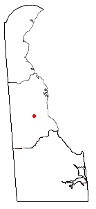
mapsize = 250px
map_caption = Location of Woodside East, Delaware
mapsize1 =
map_caption1 =subdivision_type = Country
subdivision_name =United States
subdivision_type1 = State
subdivision_name1 =Delaware
subdivision_type2 = County
subdivision_name2 = Kent
government_footnotes =
government_type =
leader_title =
leader_name =
leader_title1 =
leader_name1 =
established_title =
established_date =area_footnotes =
unit_pref = Imperial
area_magnitude =
area_total_km2 = 4.4
area_land_km2 = 4.4
area_water_km2 = 0.0
area_total_sq_mi = 1.7
area_land_sq_mi = 1.7
area_water_sq_mi = 0.0population_as_of = 2000
population_footnotes =
population_total = 2174
population_density_km2 = 491.4
population_density_sq_mi = 1272.7timezone = Eastern (EST)
utc_offset = -5
timezone_DST = EDT
utc_offset_DST = -4
elevation_footnotes =
elevation_m =
elevation_ft =
latd = 39 |latm = 3 |lats = 50 |latNS = N
longd = 75 |longm = 32 |longs = 30 |longEW = Wpostal_code_type =
postal_code =
area_code = 302
blank_name = FIPS code
blank_info = 10-80895
blank1_name =
blank1_info =
website =
footnotes =Woodside East is a
census-designated place (CDP) in Kent County,Delaware ,United States . It is part of theDover, Delaware Metropolitan Statistical Area. The population was 2,174 at the 2000 census.Geography
Woodside East is located at coor dms|39|3|50|N|75|32|30|W|city (39.063931, -75.541675)GR|1.
According to the
United States Census Bureau , the CDP has a total area of 1.7square mile s (4.4km² ), all of it land.Demographics
As of the
census GR|2 of 2000, there were 2,174 people, 752 households, and 557 families residing in the CDP. Thepopulation density was 1,272.7 people per square mile (490.9/km²). There were 855 housing units at an average density of 500.5/sq mi (193.1/km²). The racial makeup of the CDP was 66.33% White, 28.24% African American, 0.55% Native American, 0.78% Asian, 0.05% Pacific Islander, 0.87% from other races, and 3.17% from two or more races. Hispanic or Latino of any race were 2.39% of the population.There were 752 households out of which 46.1% had children under the age of 18 living with them, 46.8% were married couples living together, 20.6% had a female householder with no husband present, and 25.8% were non-families. 18.9% of all households were made up of individuals and 3.6% had someone living alone who was 65 years of age or older. The average household size was 2.89 and the average family size was 3.28.
In the CDP the population was spread out with 34.7% under the age of 18, 9.2% from 18 to 24, 30.8% from 25 to 44, 18.5% from 45 to 64, and 6.7% who were 65 years of age or older. The median age was 30 years. For every 100 females there were 90.4 males. For every 100 females age 18 and over, there were 86.5 males.
The median income for a household in the CDP was $32,431, and the median income for a family was $32,344. Males had a median income of $29,750 versus $19,865 for females. The
per capita income for the CDP was $13,542. About 15.0% of families and 16.1% of the population were below thepoverty line , including 19.1% of those under age 18 and 6.8% of those age 65 or over.References
External links
Wikimedia Foundation. 2010.