- Wyoming, Delaware
Infobox Settlement
official_name = Wyoming, Delaware
settlement_type =Town
nickname =
motto =
imagesize =
image_caption =
image_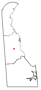
mapsize = 250px
map_caption = Location of Wyoming, Delaware
mapsize1 =
map_caption1 =subdivision_type = Country
subdivision_name =United States
subdivision_type1 = State
subdivision_name1 =Delaware
subdivision_type2 = County
subdivision_name2 = Kent
government_footnotes =
government_type =
leader_title =
leader_name =
leader_title1 =
leader_name1 =
established_title =
established_date =area_footnotes =
unit_pref = Imperial
area_magnitude =
area_total_km2 = 1.8
area_land_km2 = 1.7
area_water_km2 = 0.0
area_total_sq_mi = 0.7
area_land_sq_mi = 0.7
area_water_sq_mi = 0.0population_as_of = 2000
population_footnotes =
population_total = 1141
population_density_km2 = 652.5
population_density_sq_mi = 1690.0timezone = Eastern (EST)
utc_offset = -5
timezone_DST = EDT
utc_offset_DST = -4
elevation_footnotes =
elevation_m = 13
elevation_ft = 43
latd = 39 |latm = 7 |lats = 5 |latNS = N
longd = 75 |longm = 33 |longs = 28 |longEW = Wpostal_code_type =
ZIP code
postal_code = 19934
area_code = 302
blank_name = FIPS code
blank_info = 10-81350
blank1_name = GNIS feature ID
blank1_info = 0217870
website =
footnotes =Wyoming is a town in Kent County,
Delaware ,United States . It was named after theWyoming Valley inPennsylvania . It is part of theDover, Delaware Metropolitan Statistical Area. The population was 1,141 at the 2000 census.Geography
Wyoming is located at coor dms|39|7|5|N|75|33|28|W|city (39.117950, -75.557867)GR|1.
According to the
United States Census Bureau , the town has a total area of 0.7square mile s (1.8km² ), of which, 0.7 square miles (1.8 km²) of it is land and 0.04 square miles (0.1 km²) of it (2.90%) is water.Demographics
Town of Wyoming Website http://www.townofwyoming.com/As of the
census GR|2 of 2000, there were 1,141 people, 448 households, and 315 families residing in the town. Thepopulation density was 1,690.0 people per square mile (647.9/km²). There were 485 housing units at an average density of 718.3/sq mi (275.4/km²). The racial makeup of the town was 79.49% White, 13.32% African American, 0.09% Native American, 3.86% Asian, 0.53% from other races, and 2.72% from two or more races. Hispanic or Latino of any race were 2.54% of the population.There were 448 households out of which 32.8% had children under the age of 18 living with them, 52.5% were married couples living together, 12.7% had a female householder with no husband present, and 29.5% were non-families. 24.1% of all households were made up of individuals and 7.4% had someone living alone who was 65 years of age or older. The average household size was 2.55 and the average family size was 2.99.
In the town the population was spread out with 25.0% under the age of 18, 7.9% from 18 to 24, 31.4% from 25 to 44, 22.8% from 45 to 64, and 13.0% who were 65 years of age or older. The median age was 37 years. For every 100 females there were 99.1 males. For every 100 females age 18 and over, there were 92.8 males.
The median income for a household in the town was $48,452, and the median income for a family was $54,265. Males had a median income of $35,625 versus $25,741 for females. The
per capita income for the town was $21,254. About 1.8% of families and 3.6% of the population were below thepoverty line , including 3.6% of those under age 18 and 3.4% of those age 65 or over.Local attractions
The "Wyoming Peach Festival" occurs every August. It offers Pagants, Homemade Peach Ice Cream and Tours of Fifer Farms. Fifer Farms is the largest Peach & Apple producer in the state.
References
External links
* http://www.townofwyoming.com/
Wikimedia Foundation. 2010.