- Woodside, Delaware
Infobox Settlement
official_name = Woodside, Delaware
settlement_type =Town
nickname =
motto =
imagesize =
image_caption =
image_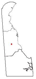
mapsize = 250px
map_caption = Location of Woodside, Delaware
mapsize1 =
map_caption1 =subdivision_type = Country
subdivision_name =United States
subdivision_type1 = State
subdivision_name1 =Delaware
subdivision_type2 = County
subdivision_name2 = Kent
government_footnotes =
government_type =
leader_title =
leader_name =
leader_title1 =
leader_name1 =
established_title =
established_date =area_footnotes =
unit_pref = Imperial
area_magnitude =
area_total_km2 = 0.4
area_land_km2 = 0.4
area_water_km2 = 0.0
area_total_sq_mi = 0.2
area_land_sq_mi = 0.2
area_water_sq_mi = 0.0population_as_of = 2000
population_footnotes =
population_total = 184
population_density_km2 = 436.5
population_density_sq_mi = 1130.6timezone = Eastern (EST)
utc_offset = -5
timezone_DST = EDT
utc_offset_DST = -4
elevation_footnotes =
elevation_m = 17
elevation_ft = 56
latd = 39 |latm = 4 |lats = 15 |latNS = N
longd = 75 |longm = 34 |longs = 3 |longEW = Wpostal_code_type =
ZIP code
postal_code = 19980
area_code = 302
blank_name = FIPS code
blank_info = 10-80830
blank1_name = GNIS feature ID
blank1_info = 0214881
website =
footnotes =Woodside is a town in Kent County,
Delaware ,United States . It is part of theDover, Delaware Metropolitan Statistical Area. The population was 184 at the 2000 census.Geography
Woodside is located at coor dms|39|4|15|N|75|34|3|W|city (39.070869, -75.567390)GR|1.
According to the
United States Census Bureau , the town has a total area of 0.2square mile s (0.4km² ), all of it land.Demographics
As of the
census GR|2 of 2000, there were 184 people, 70 households, and 52 families residing in the town. Thepopulation density was 1,130.6 people per square mile (444.0/km²). There were 72 housing units at an average density of 442.4/sq mi (173.7/km²). The racial makeup of the town was 96.20% White, 0.54% African American, 1.09% Asian, 0.54% from other races, and 1.63% from two or more races. Hispanic or Latino of any race were 1.09% of the population.There were 70 households out of which 31.4% had children under the age of 18 living with them, 61.4% were married couples living together, 11.4% had a female householder with no husband present, and 25.7% were non-families. 20.0% of all households were made up of individuals and 12.9% had someone living alone who was 65 years of age or older. The average household size was 2.63 and the average family size was 2.94.
In the town the population was spread out with 22.3% under the age of 18, 6.5% from 18 to 24, 33.7% from 25 to 44, 25.0% from 45 to 64, and 12.5% who were 65 years of age or older. The median age was 39 years. For every 100 females there were 87.8 males. For every 100 females age 18 and over, there were 81.0 males.
The median income for a household in the town was $54,250, and the median income for a family was $53,750. Males had a median income of $35,417 versus $21,875 for females. The
per capita income for the town was $23,399. About 3.9% of families and 7.9% of the population were below thepoverty line , including none of those under the age of eighteen and 15.0% of those sixty five or over.References
External links
Wikimedia Foundation. 2010.