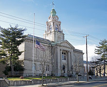
- Cumberland County, New Jersey
-
Cumberland County, New Jersey 
Seal
Location in the state of New Jersey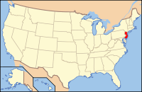
New Jersey's location in the U.S.Founded 1748 Seat Bridgeton Largest city Vineland Area
- Total
- Land
- Water
676 sq mi (1,751 km²)
489 sq mi (1,267 km²)
187 sq mi (484 km²), 27.68%Population
- (2010)
- Density
156,898
321/sq mi (123.8/km²)Website www.co.cumberland.nj.us Cumberland County is a county located in the U.S. state of New Jersey. As of the 2010 Census, the population is 156,898. Its county seat is Bridgeton[1]. Cumberland County is named for Prince William, Duke of Cumberland.[2][3]
This county is part of the Delaware Valley area as well as the Vineland-Millville-Bridgeton Primary Metropolitan Statistical Area.
Contents
Geography
According to the U.S. Census Bureau, the county has a total area of 677 square miles (1,753.4 km2), of which 489 square miles (1,266.5 km2) is land and 187 square miles (484.3 km2) (27.68%) is water.
Cumberland is a low-lying, generally featureless coastal county, with many salt marshes near the Delaware Bay. The highest elevation is at one of 12 areas in Upper Deerfield Township that exceed 140 feet (42.6 m) above sea level; the lowest elevation is sea level.
Adjacent counties
- Gloucester County, New Jersey – north
- Atlantic County, New Jersey – northeast
- Cape May County, New Jersey – southeast
- Kent County, Delaware – west1
- Salem County, New Jersey – northwest

Salem County Gloucester County Atlantic County Kent County, Delaware 
 Cumberland County, New Jersey

Delaware Bay Cape May County 1across Delaware Bay; no land border
Demographics
Historical populations Census Pop. %± 1790 8,248 — 1800 9,529 15.5% 1810 12,670 33.0% 1820 12,668 0% 1830 14,093 11.2% 1840 14,374 2.0% 1850 17,189 19.6% 1860 22,605 31.5% 1870 34,665 53.4% 1880 37,687 8.7% 1890 45,438 20.6% 1900 51,193 12.7% 1910 55,153 7.7% 1920 61,348 11.2% 1930 69,895 13.9% 1940 73,184 4.7% 1950 88,597 21.1% 1960 106,850 20.6% 1970 121,374 13.6% 1980 132,866 9.5% 1990 138,053 3.9% 2000 146,438 6.1% 2010 156,898 7.1% historical census data source:[4][5] [6] As of the census[7] of 2000, there were 146,438 people, 49,143 households, and 35,186 families residing in the county. The population density was 299 people per square mile (116/km²). There were 52,863 housing units at an average density of 108 per square mile (42/km²). The racial makeup of the county was 65.88% White, 20.20% Black or African American, 0.97% Native American, 0.95% Asian, 0.06% Pacific Islander, 9.08% from other races, and 2.85% from two or more races. 19.00% of the population were Hispanic or Latino of any race. 17.4% were of Italian, 9.9% German, 7.9% Irish and 6.7% English ancestry according to Census 2000.
There were 49,143 households out of which 34.10% had children under the age of 18 living with them, 48.70% were married couples living together, 17.30% had a female householder with no husband present, and 28.40% were non-families. 23.60% of all households were made up of individuals and 11.10% had someone living alone who was 65 years of age or older. The average household size was 2.73 and the average family size was 3.19.
In the county the population was spread out with 25.40% under the age of 18, 8.50% from 18 to 24, 31.20% from 25 to 44, 21.90% from 45 to 64, and 13.00% who were 65 years of age or older. The median age was 36 years. For every 100 females there were 104.20 males. For every 100 females age 18 and over, there were 103.50 males.
The median income for a household in the county was $39,150, and the median income for a family was $45,403. Males had a median income of $35,387 versus $25,393 for females. The per capita income for the county was $17,376. About 11.30% of families and 15.00% of the population were below the poverty line, including 20.10% of those under age 18 and 12.90% of those age 65 or over.
The 2005 demography includes the population as 139,968 people, a slight decrease from 2000. The races were 70.1% White, 16.1% Black or African American, 3.3% Native American/Alaska Native, 1.1% Asian, no Pacific Islanders, 8.0% Other races, 1.1% multiracial and 22.7% Hispanic. Cumberland County has the largest percentage of Native Americans in New Jersey as of the 2005 census. [1]
As of 2010 the racial makeup of the county was 50.31% Non-Hispanic whites, 20.23% blacks, 1.11% Native Americans, 1.22% Asians, 0.04% Pacific Islanders, 0.14% Non-Hispanics of some other race, 1.87% Non-Hispanics reporting two or more races and 27.06% Hispanic or Latino.
Government
County government
Cumberland County is governed by a Board of Chosen Freeholders consisting of seven members. Each Freeholder is assigned responsibility for one of the County's departments. These individuals are elected at large by the citizens of Cumberland County in partisan elections and serve staggered three-year terms in office, with two or three seats coming up for election each year.[8]
As of 2011[update], members of the Burlington County Board of Chosen Freeholders (with their term end dates and committee chairmanships listed in parentheses) are Freeholder Director William Whelan (2011; Finance), Deputy Freeholder Director James A. Dunkins (2011; Health), Samuel L. Fiocchi, Sr. (2013; Public Works), Jane Jannarone (2011; Public Affairs, Cultural & History), Carl W. Kirstein (2013; Public Property & Personnel) and Thomas Sheppard (2012; Agriculture).[9]
Freeholder Louis N. Magazzu, whose term was to expire in 2012,[10] announced his resignation on August 2, 2011, after a series of explicit pictures that he had sent to a woman he had known were leaked to a website and published on the Internet. Magazzu apologized to the public and to his family, and announced his resignation immediately.[11]
State representation
The New Jersey Department of Corrections operates three correctional facilities in the county. They are Bayside State Prison, South Woods State Prison, and Southern State Correctional Facility. In 2007, while the state was preparing to close Riverfront State Prison in Camden, it considered establishing a fourth state prison in Cumberland County.[12]
Politics
In the 2004 U.S. Presidential election, John Kerry carried the county by a 6.6% margin over George W. Bush, with Kerry carrying the state by 6.7% over Bush.[13]
Municipalities
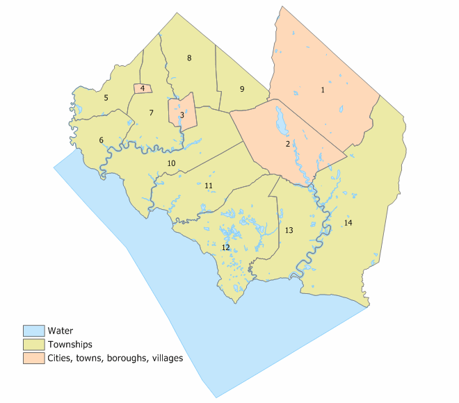
 Index map of Cumberland County Municipalities (click to see index key)
The following municipalities are located in Cumberland County. The municipality type is listed in parentheses after the name, except where the type is included as part of the name. Census-designated places and other unincorporated communities are listed under their municipalities.
- Bridgeton (city)
- Commercial Township
- Deerfield Township
- Downe Township
- Fairfield Township
- Greenwich Township
- Hopewell Township
- Lawrence Township
- Maurice River Township
- Millville (city)
- Shiloh (borough)
- Stow Creek Township
- Upper Deerfield Township
- Vineland (city)
Transportation
Airports
The following public-use airports are located in Cumberland County:
- Bucks Airport (00N) in Bridgeton
- Li Calzi Airport (N50) in Bridgeton
- Millville Municipal Airport (MIV) in Millville
- Kroelinger Airport (29N) in Vineland
See also
References
- ^ "Find a County". National Association of Counties. http://www.naco.org/Counties/Pages/FindACounty.aspx. Retrieved 2011-06-07.
- ^ Baehr, Judy. "Cumberland – A County Born of Hope, Optimism", Cumberland County, New Jersey. Accessed December 13, 2007. "The county was named for William Augustus, the second son of King George II. As the Duke of Cumberland in 1746, he had defeated the Stuart Pretender, Charles Edward (Bonnie Prince Charlie), at the battle of Culloden and established the House of Hanover on the British throne."
- ^ The Origin of New Jersey Place Names: C, GetNJ.com. Accessed December 13, 2007.
- ^ "New Jersey Resident Population by County: 1880 – 1930". http://www.wnjpin.net/OneStopCareerCenter/LaborMarketInformation/lmi01/poptrd5.htm.
- ^ "Geostat Center: Historical Census Browser". University of Virginia Library. http://fisher.lib.virginia.edu/collections/stats/histcensus/. Retrieved 2007-03-02.
- ^ "The Counties and Most Populous Cities and Townships in 2010 in New Jersey: 2000 and 2010". U.S. Census Bureau. 2011-02-03. http://2010.census.gov/news/xls/st34-final_newjersey.xls. Retrieved 2011-02-05.
- ^ "American FactFinder". United States Census Bureau. http://factfinder.census.gov. Retrieved 2008-01-31.
- ^ What is a County Freeholder?, Cumberland County, New Jersey. Accessed February 3, 2008.
- ^ County Freeholders, Cumberland County. Accessed August 3, 2011.
- ^ Louis N. Magazzu, Freeholder Louis N. Magazzu. Accessed August 3, 2011.
- ^ Smith, Joseph P. "Sexting scandal ends S.J. freeholder's career", Courier Post, August 3, 2011. Accessed August 3, 2011. "Louis N. Magazzu resigned from the board of freeholders Tuesday after a decade at the top of Democratic politics. His departure came after an embarrassing sexting scandal made the jump from a private website and local gossip circles into print and television media."
- ^ Jackson, Miles. "IS A NEW PRISON NEEDED?: Facilities offer steady employment in Cumberland Co." Daily Journal. June 23, 2007. A1 News. Retrieved on September 27, 2011. "The county already is home to South Woods State Prison in Bridgeton, Southern State Correctional Facility in Delmont and Bayside State Prison in Leesburg."
- ^ New Jersey Presidential Election Returns by County 2004, Eagleton Institute of Politics at Rutgers University. Accessed August 31, 2008.
External links
Municipalities and communities of Cumberland County, New Jersey Cities 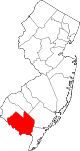
Borough Townships Commercial | Deerfield | Downe | Fairfield | Greenwich | Hopewell | Lawrence | Maurice River | Stow Creek | Upper Deerfield
CDPs Communities Cumberland | Delmont | Dorchester | Fortescue | Leesburg | Mauricetown | Newport | Port Elizabeth | Sea Breeze | Seabrook
 State of New Jersey
Topics Regions - Atlantic Coastal Plain
- Central Jersey
- Delaware River Region
- Delaware Valley
- Gateway Region
- Gold Coast
- Highlands
- Jersey Shore
- Meadowlands
- New York metro area
- North Hudson
- North Jersey
- Pascack Valley
- Piedmont
- Pine Barrens
- Raritan Bayshore
- Ridge-and-Valley Appalachians
- Southern Shore Region
- Skylands Region
- South Jersey
- Tri‑State Region
- West Hudson
Counties Major cities Delaware Valley Counties Atlantic • Berks • Bucks • Burlington • Camden • Cape May • Cecil • Chester • Cumberland • Delaware • Gloucester • Mercer • Montgomery • New Castle • Ocean • Philadelphia • Salem
Major cities Cities and towns
50k-99kBensalem • Camden • Cherry Hill • Gloucester Township • Levittown • Reading • Trenton • Vineland • WilmingtonCities and towns
25k-50kCategories:- New Jersey counties
- Cumberland County, New Jersey
- 1748 establishments in the United States
- Populated places established in 1748


Wikimedia Foundation. 2010.