- National Register of Historic Places listings in Cumberland County, New Jersey
-
List of the National Register of Historic Places listings in Cumberland County, New Jersey
Contents: Counties in New Jersey Atlantic - Bergen - Burlington - Camden - Cape May - Cumberland - Essex - Gloucester - Hudson - Hunterdon - Mercer - Middlesex - Monmouth - Morris - Ocean - Passaic - Salem - Somerset - Sussex - Union - Warren This is intended to be a complete list of properties and districts listed on the National Register of Historic Places in Cumberland County, New Jersey. The locations of National Register properties and districts (at least for all showing latitude and longitude coordinates below) may be seen in a Google map by clicking on "Map of all coordinates".[1]
-
- This National Park Service list is complete through NPS recent listings posted November 10, 2011.[2]
[3] Site name[4] Image Date listed Location[1] City or Town Summary 1 A.J. MEERWALD (Schooner) 
November 7, 1995 22 Miller Ave. on Maurice River, Commercial Township
39°14′5″N 75°1′50″W / 39.23472°N 75.03056°WCommercial Township 2 Beth Hillel Synagogue 
November 7, 1978 Irving Ave.
39°26′3″N 75°7′31″W / 39.43417°N 75.12528°WDeerfield Township 3 Bethel African Methodist Episcopal Church 
November 12, 1999 Sheppards Mill Rd. (Greenwich Township)
39°24′6″N 75°19′48″W / 39.40167°N 75.33°WGreenwich Township 4 Bivalve Oyster Packing Houses and Docks 
February 28, 1996 Shell Rd., Miller and Howard Sts., Commercial Township
39°14′0″N 75°1′56″W / 39.233333°N 75.03222°WCommercial Township 5 Bridgeton Historic District 
October 29, 1982 Roughly bounded by RR Tracks, South Ave., Lake, Commerce, Water, Belmont, Cohensey, and Penn Sts.
39°25′41″N 75°13′57″W / 39.42806°N 75.2325°WBridgeton 6 Jeremiah Buck House 
December 30, 1975 297 E. Commerce St.
39°25′43″N 75°13′36″W / 39.42861°N 75.22667°WBridgeton 7 Deerfield Pike Tollgate House 
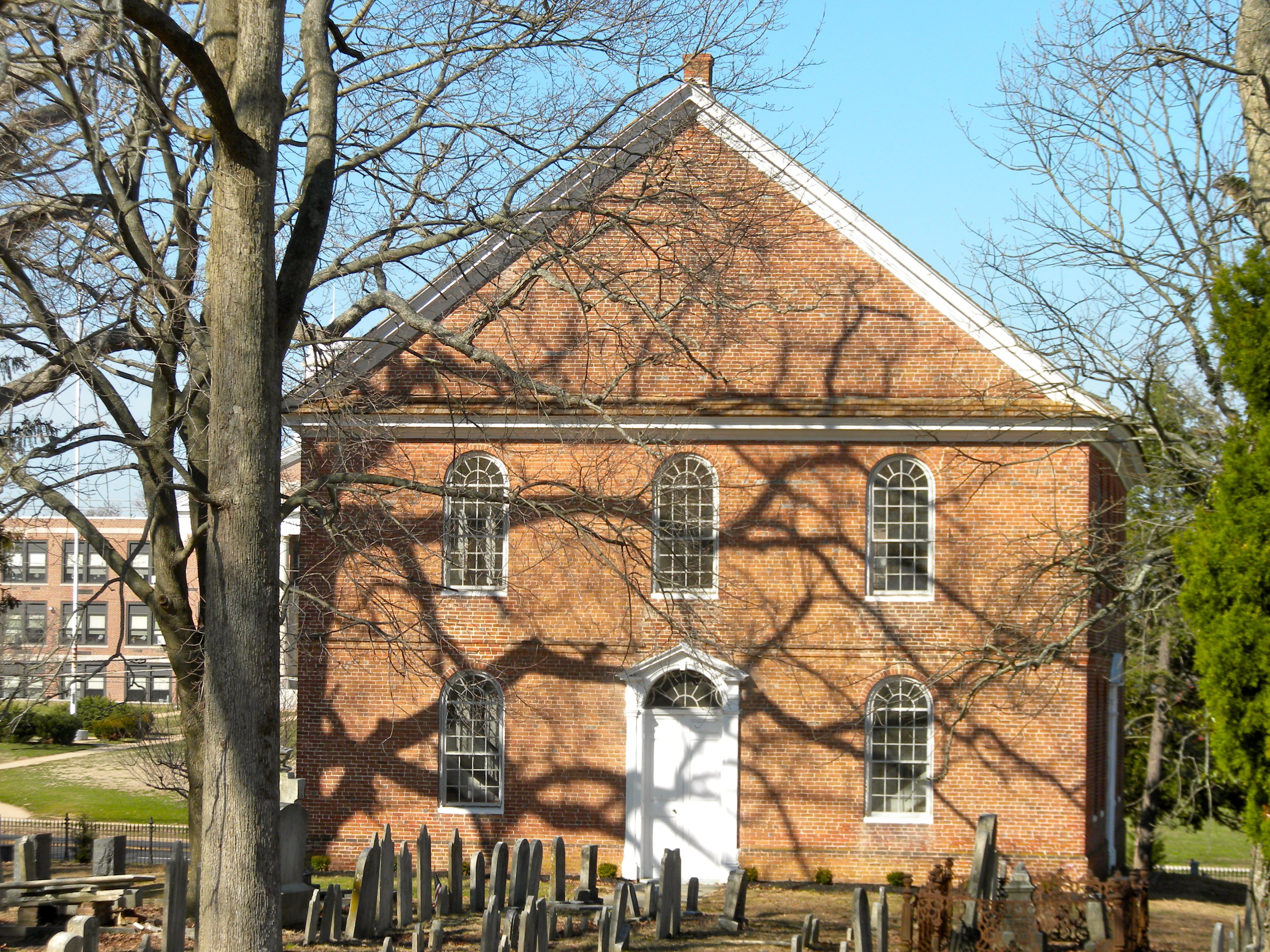
May 21, 1975 89 Old Deerfield Pike
39°27′9″N 75°13′45″W / 39.4525°N 75.22917°WBridgeton Demolished in 2001.[5] 8 Deerfield Presbyterian Church 
September 29, 1980 NE of Seabrook
39°30′42″N 75°14′17″W / 39.51167°N 75.23806°WSeabrook 9 Gen. James Giles House 
March 8, 1978 143 W. Broad St.
39°25′44″N 75°14′33″W / 39.42889°N 75.2425°WBridgeton 10 Greenwich Historic District 
January 20, 1972 Main St. from Cohansey River N to Othello
39°23′51″N 75°20′25″W / 39.3975°N 75.34028°WGreenwich 11 Caesar Hoskins Log Cabin 
September 10, 1987 Jct. of South and Second Sts.
39°17′2″N 74°59′42″W / 39.28389°N 74.995°WMauricetown 12 Indian Head Site 
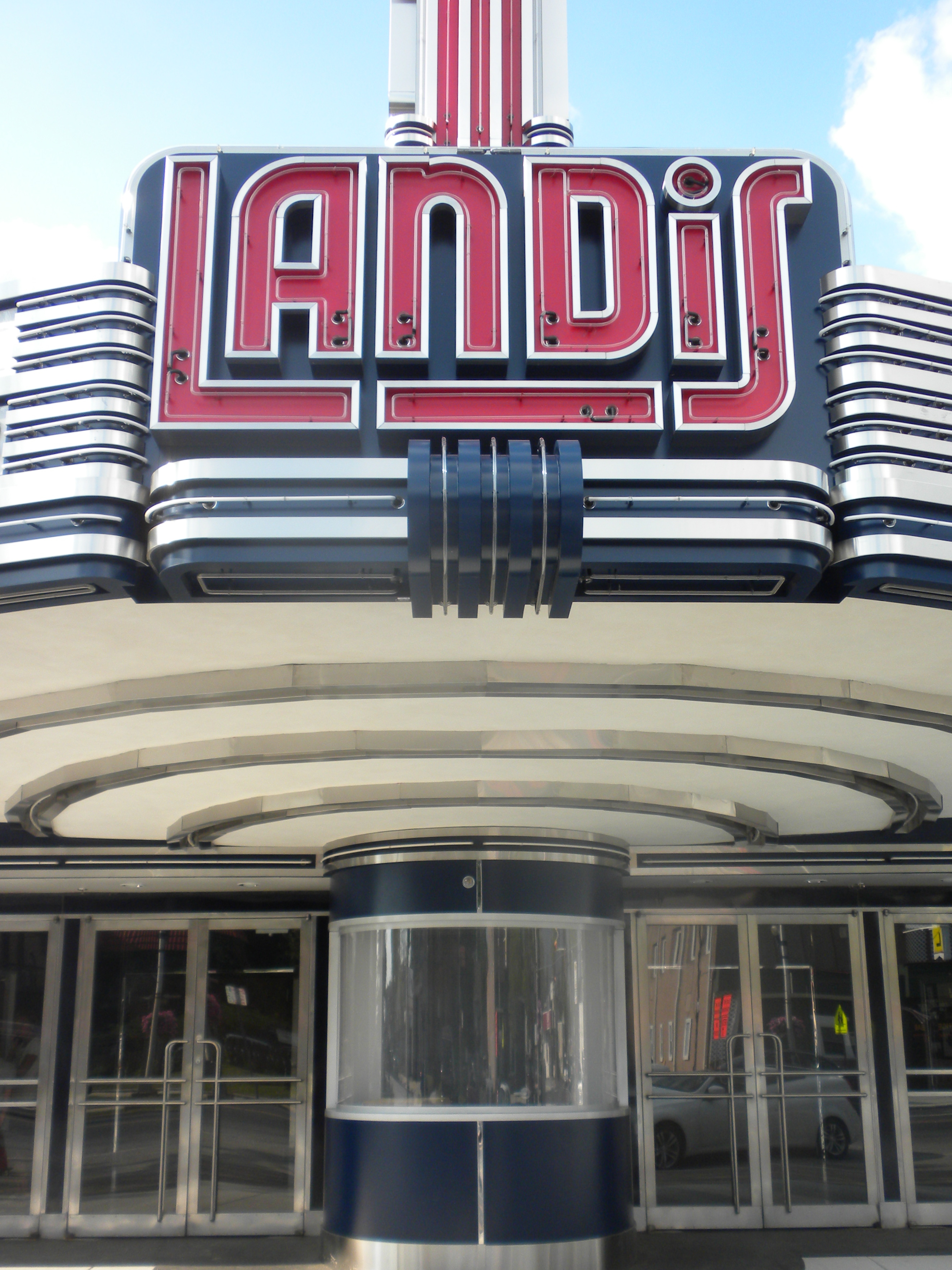
October 27, 2004 Address restricted Deerfield Township 13 Landis Theatre-Mori Brothers Building 
November 22, 2000 830-834 Landis Ave.
39°29′10″N 75°1′3″W / 39.48611°N 75.0175°WVineland 14 Levoy Theatre 
August 14, 1998 126-130 N. High St.
39°23′49″N 75°2′18″W / 39.39694°N 75.03833°WMillville City 22,000-square-foot (2,000 m2) theater built in 1908 Collapsed January 3, 2011[6] 15 Thomas Maskel House 
June 10, 1975 2 mi (3.2 km). W of Greenwich on Bacon's Neck Rd.
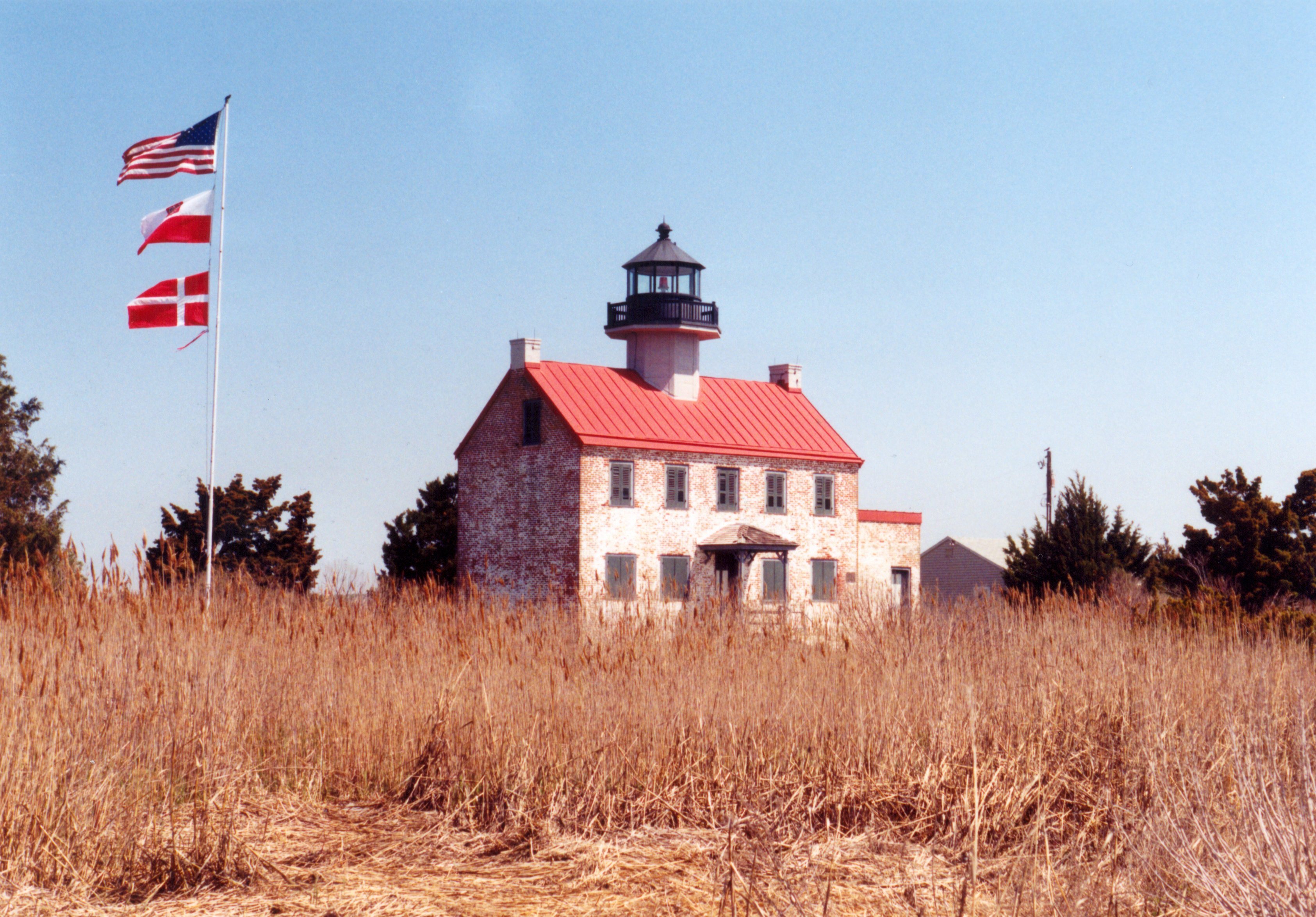
39°24′4″N 75°22′34″W / 39.40111°N 75.37611°WGreenwich 16 Maurice River Lighthouse 
August 25, 1995 Lighthouse Rd., near the jct. of East Point Rd.
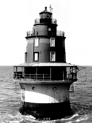
39°11′45″N 75°1′40″W / 39.19583°N 75.02778°WMaurice River Township 17 Miah Maull Shoal Lighthouse 
February 4, 1991 In Delaware Bay 5 mi (8.0 km). SW of Egg Island Point
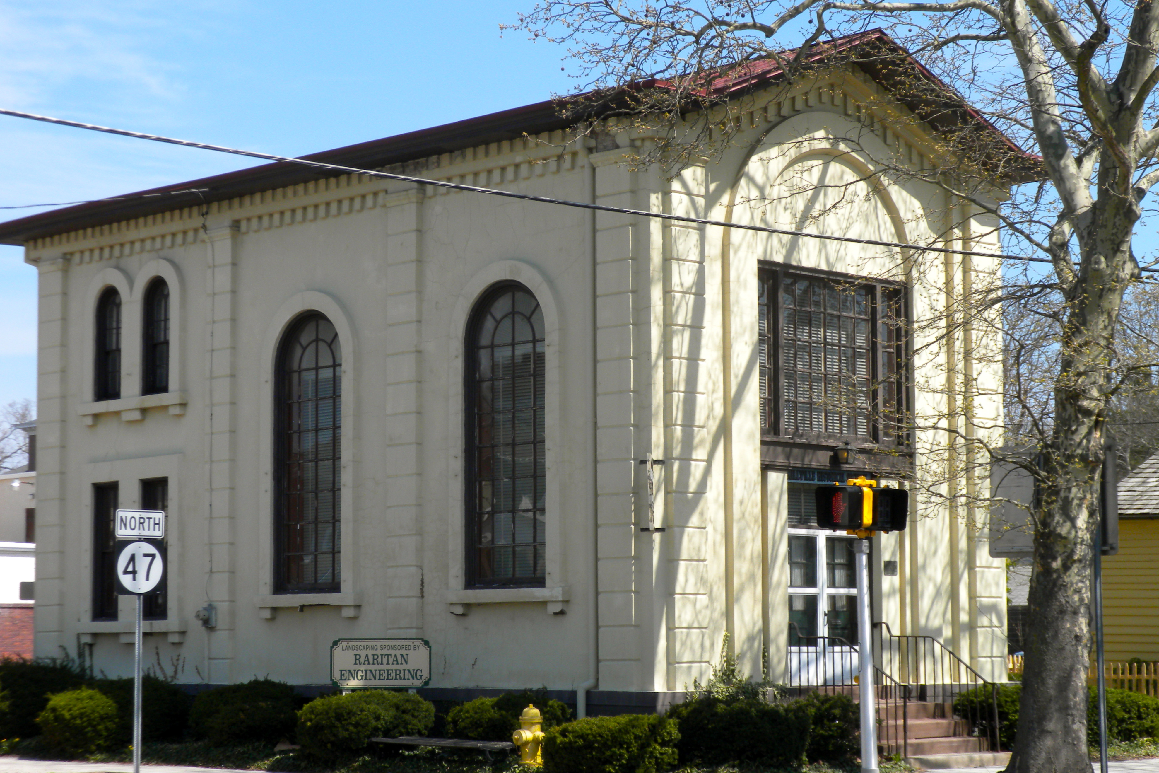
39°7′36″N 75°12′35″W / 39.12667°N 75.20972°WDowne Township 18 Millville's First Bank Building 
November 20, 1980 2nd and E. Main Sts.
39°23′43″N 75°2′14″W / 39.39528°N 75.03722°WMillville 19 Old Broad Street Presbyterian Church and Cemetery 
December 2, 1974 Broad and Lawrence Sts.
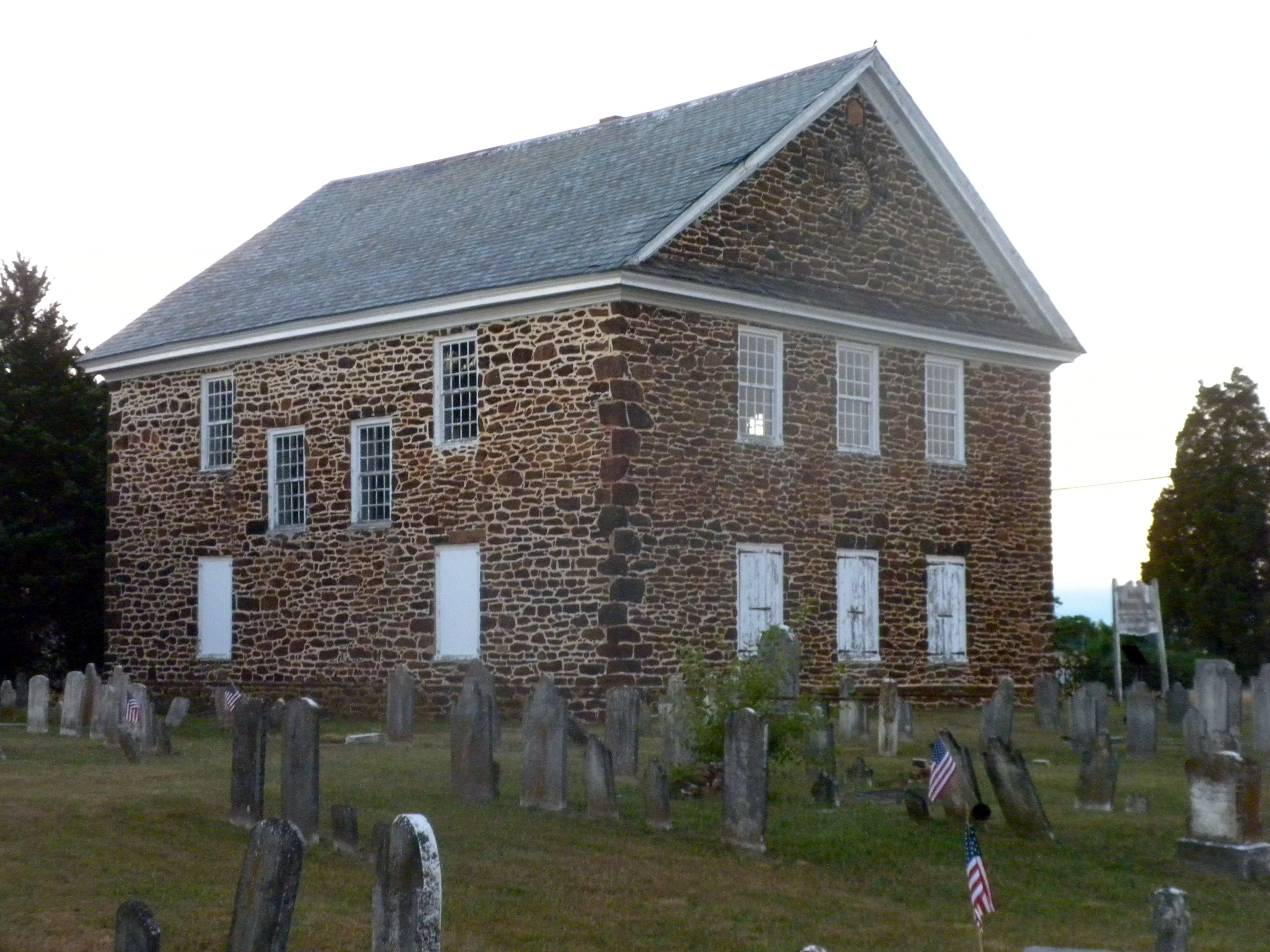
39°25′45″N 75°14′3″W / 39.42917°N 75.23417°WBridgeton 20 Old Stone Church 
May 12, 1977 N of Cedarville on NJ 553
39°21′37″N 75°13′30″W / 39.36028°N 75.225°WCedarville 21 Potter's Tavern 
September 10, 1971 49-51 Broad St.
39°25′40″N 75°14′20″W / 39.42778°N 75.23889°WBridgeton 22 Samuel W. Seeley House 
May 13, 1976 274 E. Commerce St.
39°25′41″N 75°13′37″W / 39.42806°N 75.22694°WBridgeton 23 Ship John Shoal Light Station 
July 19, 2006 In Delaware Bay, 3.3 mi (5.3 km). W-SW of Sea Breeze
39°18′26″N 75°22′36″W / 39.30722°N 75.37667°WSea Breeze 24 Spindrift Sailing Yacht 
April 22, 1982 S. of Bridgeton
39°22′48″N 75°13′24″W / 39.38°N 75.22333°WBridgeton 25 Trinity African Methodist Episcopal Church 
September 29, 1995 Bridgeton-Milltown Rd. (NJ 49), E of Woodruff Rd. (Co. Rd. 553), Fairfield Twp.
39°25′12″N 75°11′3″W / 39.42°N 75.18417°WFairfield Township 26 Vineland High School 
March 3, 1995 61 W. Landis Ave.
39°29′10″N 75°2′17″W / 39.48611°N 75.03806°WVineland References
- ^ a b The latitude and longitude information provided in this table was derived originally from the National Register Information System, which has been found to be fairly accurate for about 99% of listings. For about 1% of NRIS original coordinates, experience has shown that one or both coordinates are typos or otherwise extremely far off; some corrections may have been made. A more subtle problem causes many locations to be off by up to 150 yards, depending on location in the country: most NRIS coordinates were derived from tracing out latitude and longitudes off of USGS topographical quadrant maps created under the North American Datum of 1927, which differs from the current, highly accurate WGS84 GPS system used by Google maps. Chicago is about right, but NRIS longitudes in Washington are higher by about 4.5 seconds, and are lower by about 2.0 seconds in Maine. Latitudes differ by about 1.0 second in Florida. Some locations in this table may have been corrected to current GPS standards.
- ^ "National Register of Historic Places: Weekly List Actions". National Park Service, United States Department of the Interior. Retrieved on November 10, 2011.
- ^ Numbers represent an ordering by significant words. Various colorings, defined here, differentiate National Historic Landmark sites, a [[National Historic Site (United States)|]], and several National Register of Historic Places Districts from other NRHP buildings, structures, sites or objects.
- ^ "National Register Information System". National Register of Historic Places. National Park Service. 2008-04-24. http://nrhp.focus.nps.gov/natreg/docs/All_Data.html.
- ^ http://www.state.nj.us/dep/hpo/1identify/lists/cumberland.pdf Accessed June 16, 2010.
- ^ Walsh, Daniel (May 18, 2010). "Work about to start on renovations of 102-year-old Millville theater". The Press of Atlantic City (Atlantic City, New Jersey). http://www.pressofatlanticcity.com/news/breaking/article_5c92feb8-62e8-11df-890f-001cc4c002e0.html. Retrieved May 18, 2010.
U.S. National Register of Historic Places Topics Lists by states Alabama • Alaska • Arizona • Arkansas • California • Colorado • Connecticut • Delaware • Florida • Georgia • Hawaii • Idaho • Illinois • Indiana • Iowa • Kansas • Kentucky • Louisiana • Maine • Maryland • Massachusetts • Michigan • Minnesota • Mississippi • Missouri • Montana • Nebraska • Nevada • New Hampshire • New Jersey • New Mexico • New York • North Carolina • North Dakota • Ohio • Oklahoma • Oregon • Pennsylvania • Rhode Island • South Carolina • South Dakota • Tennessee • Texas • Utah • Vermont • Virginia • Washington • West Virginia • Wisconsin • WyomingLists by territories Lists by associated states Other  State of New Jersey
Topics Regions - Atlantic Coastal Plain
- Central Jersey
- Delaware River Region
- Delaware Valley
- Gateway Region
- Gold Coast
- Highlands
- Jersey Shore
- Meadowlands
- New York metro area
- North Hudson
- North Jersey
- Pascack Valley
- Piedmont
- Pine Barrens
- Raritan Bayshore
- Ridge-and-Valley Appalachians
- Southern Shore Region
- Skylands Region
- South Jersey
- Tri‑State Region
- West Hudson
Counties Major cities Categories:- National Register of Historic Places in New Jersey
- Cumberland County, New Jersey
-


Wikimedia Foundation. 2010.