- Bridgeton, New Jersey
Infobox Settlement
official_name = Bridgeton, New Jersey
settlement_type =City (New Jersey)
nickname =
motto =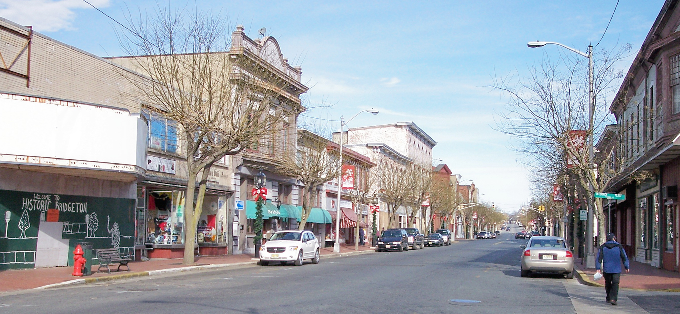
imagesize =
image_caption = Laurel Street in downtown Bridgeton in 2006
image_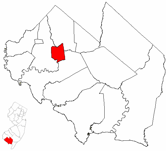
mapsize = 250x200px
map_caption = Bridgeton highlighted in Cumberland County. Inset
mapsize1 = 250x200px
map_caption1 = Census Bureau map of Bridgeton, New Jerseysubdivision_type = Country
subdivision_name =United States
subdivision_type1 = State
subdivision_name1 =New Jersey
subdivision_type2 = County
subdivision_name2 = Cumberland
government_footnotes =
government_type =Faulkner Act (Mayor-Council)
leader_title =Mayor
leader_name = James Begley
leader_title1 = Administrator
leader_name1 = Arch Liston
established_title = Incorporated
established_date =March 1 ,1865 unit_pref = Imperial
area_footnotes =
area_magnitude =
area_total_km2 = 16.7
area_land_km2 = 16.1
area_water_km2 = 0.6
area_total_sq_mi = 6.4
area_land_sq_mi = 6.2
area_water_sq_mi = 0.2population_as_of = 2006
population_footnotes =
population_total = 24389
population_density_km2 = 1413.1
population_density_sq_mi = 3659.8timezone = Eastern (EST)
utc_offset = -5
timezone_DST = EDT
utc_offset_DST = -4
elevation_footnotes = [Gnis|885169|City of Bridgeton,Geographic Names Information System . AccessedJanuary 4 ,2008 .]
elevation_m = 9
elevation_ft = 30
latd = 39 |latm = 25 |lats = 39 |latNS = N
longd = 75 |longm = 13 |longs = 40 |longEW = Wpostal_code_type =
ZIP code
postal_code = 08302
area_code = 856
blank_name = FIPS code
blank_info = 34-07600GR|2 [ [http://mcdc2.missouri.edu/webrepts/commoncodes/ccc_nj.html A Cure for the Common Codes: New Jersey] , Missouri Census Data Center. AccessedJuly 14 ,2008 .]
blank1_name = GNIS feature ID
blank1_info = 0885169GR|3
website = http://www.cityofbridgeton.com
footnotes =Bridgeton is a city in Cumberland County,
New Jersey ,United States , in the south part of the state, on Cohansey creek, nearDelaware Bay . As of theUnited States 2000 Census , the city population was 22,771. It is thecounty seat of Cumberland CountyGR|6. Bridgeton, Millville and Vineland are the three principal New Jersey cities of the Vineland-Millville-BridgetonPrimary Metropolitan Statistical Area which encompasses those cities and all of Cumberland County for statistical purposes.The first settlement in what is now Bridgeton was made by 1686 when Richard Hancock established a sawmill here. [ [http://www.co.cumberland.nj.us/tourism/bridgeton_walking_tour/ Historic Bridgeton Walking Tour] ,
Cumberland County, New Jersey . AccessedOctober 26 ,2007 .] A pioneer iron-works was established here in 1814. Bridgeton was originally incorporated as a township by an Act of theNew Jersey Legislature onMarch 1 ,1865 , from portions of Deerfield Township. Bridgeton city was incorporated onMarch 1 ,1865 , replacing both Bridgeton Township and Cohansey Township."The Story of New Jersey's Civil Boundaries: 1606-1968", John P. Snyder, Bureau of Geology and Topography; Trenton, New Jersey; 1969. p. 119.]Bridgeton has the largest historic district of any incorporated town in New Jersey; it is dominated by large victorian houses and a downtown area constructed in the 1920s. Bridgeton straddles the tidal
Cohansey River and is located near the center of theDelaware Bay lowlands. It is home to the [http://www.cityofbridgeton.com/Recreation/zoo.htm Cohanzick Zoo] and numerous large municipal parks. [ [http://www.cityofbridgeton.com/Services/PublicWorks/Parks.htm Public Works - Parks Division] , City of Bridgeton. AccessedJuly 29 ,2007 .]Although it suffered an economic downturn in the 1980s, immigration from southern
Mexico has recently led to a revitalization. Immigrants work primarily in the agricultural regions around the city, which are among the most productive in the New Jersey. A significant minority of Bridgeton residents speakZapotec .Fact|date=February 2007South Woods State Prison , the largest state prison in New Jersey, is located in Bridgeton.Geography
Bridgeton is located at coor dms|39|25|46|N|75|13|50|W|city (39.429564, -75.230461)GR|1. Bridgeton is located about one hour away from
Philadelphia, Pennsylvania , and 50 minutes away fromWilmington, Delaware . It is also about 1 hour away from Atlantic City and Cape May.According to the
United States Census Bureau , the city has a total area of 6.4square mile s (16.7km² ), of which, 6.2 square miles (16.1 km²) of it is land and 0.2 square miles (0.6 km²) of it (3.57%) is water.Bridgeton borders Upper Deerfield Township, Hopewell Township, and Fairfield Township.
Demographics
USCensusPop
1930= 15699
1940= 15992
1950= 18378
1960= 20966
1970= 20435
1980= 18795
1990= 18942
2000= 22771
estimate=24389
estyear=2006
estref= [http://factfinder.census.gov/servlet/SAFFPopulation?_event=Search&geo_id=16000US3481890&_geoContext=01000US%7C04000US34%7C16000US3481890&_street=&_county=bridgeton&_cityTown=bridgeton&_state=04000US34&_zip=&_lang=en&_sse=on&ActiveGeoDiv=geoSelect&_useEV=&pctxt=fph&pgsl=160&_submenuId=population_0&ds_name=null&_ci_nbr=null&qr_name=null®=null%3Anull&_keyword=&_industry= Census data for Bridgeton city] ,United States Census Bureau , accessedJuly 29 ,2007 .]
footnote=Population 1930 - 1990 [ [http://www.wnjpin.net/OneStopCareerCenter/LaborMarketInformation/lmi01/poptrd6.htm Jersey Resident Population by Municipality: 1930 - 1990] , Workforce New Jersey Public Information Network. AccessedMarch 1 ,2007 .] As of thecensus GR|2 of 2000, there were 22,771 people, 6,182 households, and 4,179 families residing in the city. Thepopulation density was 3,659.8 people per square mile (1,413.5/km²). There were 6,795 housing units at an average density of 1,092.1/sq mi (421.8/km²). The racial makeup of the city was 38.88% White, 41.84% African American, 1.19% Native American, 0.70% Asian, 0.09% Pacific Islander, 13.67% from other races, and 3.63% from two or more races. Hispanic or Latino of any race were 24.49% of the population.There were 6,182 households out of which 36.1% had children under the age of 18 living with them, 35.3% were married couples living together, 26.3% had a female householder with no husband present, and 32.4% were non-families. 27.4% of all households were made up of individuals and 13.1% had someone living alone who was 65 years of age or older. The average household size was 2.96 and the average family size was 3.49.
In the city the population was spread out with 26.0% under the age of 18, 11.2% from 18 to 24, 36.0% from 25 to 44, 15.9% from 45 to 64, and 10.9% who were 65 years of age or older. The median age was 32 years. For every 100 females there were 130.7 males. For every 100 females age 18 and over, there were 139.1 males.
The median income for a household in the city was $26,923, and the median income for a family was $30,502. Males had a median income of $28,858 versus $22,722 for females. The
per capita income for the city was $10,917. About 22.7% of families and 26.6% of the population were below thepoverty line , including 33.3% of those under age 18 and 17.8% of those age 65 or over.The town is highly populated by migrants coming from
Mexico whose languages includeZapotec ,Nahuatl , andMixtec .Government
Local government
The City of Bridgeton is governed under the
Faulkner Act (Mayor-Council) system of municipal government. ["2005 New Jersey Legislative District Data Book",Rutgers University Edward J. Bloustein School of Planning and Public Policy , April 2005, p. 19.] Voters elect a Mayor and five City Council members. Council members are elected at-large in non-partisan elections and serve four-year concurrent terms.The Mayor exercises executive power of the municipality and appoints department heads with Council approval. The Mayor may remove department heads subject to Council disapproval by ⅔ of all members, prepares the budget. The Mayor has veto over ordinances subject to override by ⅔ of all members of Council.
The City Council exercises legislative power of municipality and approves appointment of department heads. The Council may disapprove removal of department heads by ⅔ vote of all members and can override the Mayor's veto by ⅔ of all members. The Council elects one of its own members to serve as Council President
The Mayor exercises executive power of the municipality. Up to 10 departments may be created under the Mayor's direction. A Business Administrator assists the Mayor in budget preparation and administers purchasing and personnel systems. By ordinance, the Business Administrator may supervise administration of departments, subject to Mayor's direction.
The
Mayor of Bridgeton is James Begley. Members of the City Council are Albert Kelly, Celeste Riley, Nicholas Salvatore, William Spence and Dennis Thompson. [http://www.cityofbridgeton.com/Government.htm Bridgeton Municipal Government] , City of Bridgeton. AccessedMay 22 ,2008 .]On Election Day,
May 9 ,2006 , Jim Begley defeated Michael Pirolli, 1,187 to 887. [ [http://www.nj.com/news/bridgeton/index.ssf?/base/news-0/114725417629090.xml&coll=10 Begley mayor in Bridgeton] , "Bridgeton News ",May 10 ,2006 .]Federal, state and county representation
Bridgeton is in the Second Congressional District and is part of New Jersey's 3rd Legislative District. [ [http://www.lwvnj.org/pubs/CG06.pdf 2006 New Jersey Citizen's Guide to Government] , New Jersey
League of Women Voters , p. 55. AccessedAugust 30 ,2006 .]Education
Bridgeton's public schools are operated by
Bridgeton Public Schools . The district is one of 31Abbott District s statewide. [ [http://www.nj.gov/cgi-bin/education/abbotts/abbotturls.pl?string=code&maxhits=100 Abbott Districts] ,New Jersey Department of Education . AccessedMarch 31 ,2008 .] Schools in the district (with 2005-06 enrollment data from theNational Center for Education Statistics [ [http://nces.ed.gov/ccd/schoolsearch/school_list.asp?Search=1&DistrictID=3402250 Data for the Bridgeton Public Schools] ,National Center for Education Statistics . AccessedMay 23 ,2008 .] ) are the [http://www.bridgeton.k12.nj.us/gofecc/ G.O. Foster Early Childhood Center] (394 students), six K-8/PreK-8 elementary schools — [http://www.bridgeton.k12.nj.us/broad/ Broad Street School] (874), [http://www.bridgeton.k12.nj.us/buckshutem/ Buckshutem Road School] (304), [http://www.bridgeton.k12.nj.us/cherry/ Cherry Street School] (438), [http://www.bridgeton.k12.nj.us/indian/ Indian Avenue School] (594), [http://www.bridgeton.k12.nj.us/qml/ Quarter Mile Lane School] (378) and [http://www.bridgeton.k12.nj.us/west/ West Avenue School] (475) — andBridgeton High School for grades 9-12 (1,082). Students from Downe Township and some students from Lawrence Township attend the high school as part ofsending/receiving relationship s. [http://education.state.nj.us/rc/rc06/narrative/11/0540/11-0540-020.html Report Card Narrative for Bridgeton High School] ,New Jersey Department of Education . AccessedMarch 8 ,2007 .]Commerce
Portions of Bridgeton are part of an
Urban Enterprise Zone . In addition to other benefits to encourage employment within the Zone, shoppers can take advantage of a reduced 3½%sales tax rate (versus the 7% rate charged statewide). [ [http://www.state.nj.us/njbusiness/financing/tax/geographic.shtml#2 Geographic & Urban Redevelopment Tax Credit Programs: Urban Enterprise Zone Employee Tax Credit] , State ofNew Jersey . AccessedJuly 28 ,2008 .]Places of interest
*
Old Broad Street Presbyterian Church Cemetery , burial site of six U.S. Congressman, and a Governor of New JerseyNotable residents
Notable current and former residents of Bridgeton include:
*Ella Reeve Bloor (1862-1951), radical labor organizer. [ [http://www.britannica.com/eb/article-9125385/Ella-Reeve-Bloor Ella Reeve Bloor] ,Encyclopædia Britannica . AccessedSeptember 24 ,2007 . "Ella Reeve grew up in Bridgeton, New Jersey."]
*Lucius Elmer (1793-1883), representedNew Jersey's 1st congressional district from 1843-1845. [ [http://bioguide.congress.gov/scripts/biodisplay.pl?index=E000156 Lucius Quintius Cincinnatus Elmer] ,Biographical Directory of the United States Congress . AccessedAugust 20 ,2007 .]
*Douglas H. Fisher , member of theNew Jersey General Assembly who represents the 3rd legislative district and served on the Bridgeton City Council from 1990-1992. [ [http://votesmart.org/bio.php?can_id=55021 Assembly Member Douglas H. Fisher] ,Project Vote Smart . AccessedAugust 8 ,2007 .]
*Goose Goslin (1900-1971),Baseball Hall of Fame left fielder who played for the Washington Senators, St. Louis Browns andDetroit Tigers , in a career that ran from 1921 until 1938. ["News Journal" ofMansfield, Ohio ,January 29 ,1968 . "Reached at his home in Bridgeton, NJ, Goslin said He was "overwhelmed" at the news of his selection."]
*James G. Hampton (1814-1861) representedNew Jersey's 1st congressional district in theUnited States House of Representatives from 1845 to 1849. [ [http://bioguide.congress.gov/scripts/biodisplay.pl?index=H000138 James Giles Hampton] , "Biographical Directory of the United States Congress ". AccessedAugust 25 ,2007 .]
*George Jamison (1962-), NFL linebacker who played for theDetroit Lions . [ [http://www.databasefootball.com/players/playerpage.htm?ilkid=JAMISGEO01 George Jamison player profile] , database Football. AccessedJuly 29 ,2007 .]
*Frank LoBiondo (1946-), Congressman who representsNew Jersey's 2nd congressional district . [ [http://bioguide.congress.gov/scripts/biodisplay.pl?index=L000554 Frank A. Lobiondo biography] ,United States Congress . AccessedAugust 8 ,2007 .]
*Brison Manor (1952-),defensive lineman who played eight seasons in theNational Football League for theDenver Broncos , from 1977-1984. [ [http://www.databasefootball.com/players/playerpage.htm?ilkid=MANORBRI01 Brison Manor] , database Football. AccessedOctober 24 ,2007 .]
*Steve Rammel (1968-), retired U.S.soccer forward who played two seasons inMajor League Soccer . [ [http://www.intermark.com/rapids/rp0305b98.html "COLORADO RAPIDS DEAL STEVE RAMMEL TO METROSTARS FOR 1999 FIRST-ROUND SUPPLEMENTAL DRAFT CHOICE"] , SoccerNews Online,March 5 ,1998 . AccessedMay 23 ,2008 .]
*Elias P. Seeley (1791-1846), 11thGovernor of New Jersey in 1833. [ [http://www.nga.org/portal/site/nga/menuitem.29fab9fb4add37305ddcbeeb501010a0/?vgnextoid=86744fc0d5049010VgnVCM1000001a01010aRCRD&vgnextchannel=e449a0ca9e3f1010VgnVCM1000001a01010aRCRD New Jersey Governor Elias Pettit Seeley] ,National Governors Association . AccessedJuly 29 ,2007 .]
*Joseph Archibald Clark (1822-1914), one of the founders of Cumberland Glass Mfg. Co.
*Clement Waters Shoemaker (1848-1914), one of the founders of Cumberland Glass Mfg. Co. and generous philanthropist.References
External links
* [http://www.cityofbridgeton.com/ City of Bridgeton website]
* [http://www.bridgeton.k12.nj.us/ Bridgeton Public Schools]
*NJReportCard|11|0540|0|Bridgeton Public Schools
* [http://nces.ed.gov/ccd/schoolsearch/school_list.asp?Search=1&DistrictID=3402250 Data for the Bridgeton Public Schools] ,National Center for Education Statistics
* [http://www.bridgetonpd.org/ Bridgeton Police Department]

Wikimedia Foundation. 2010.