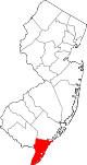
- Cape May, New Jersey
-
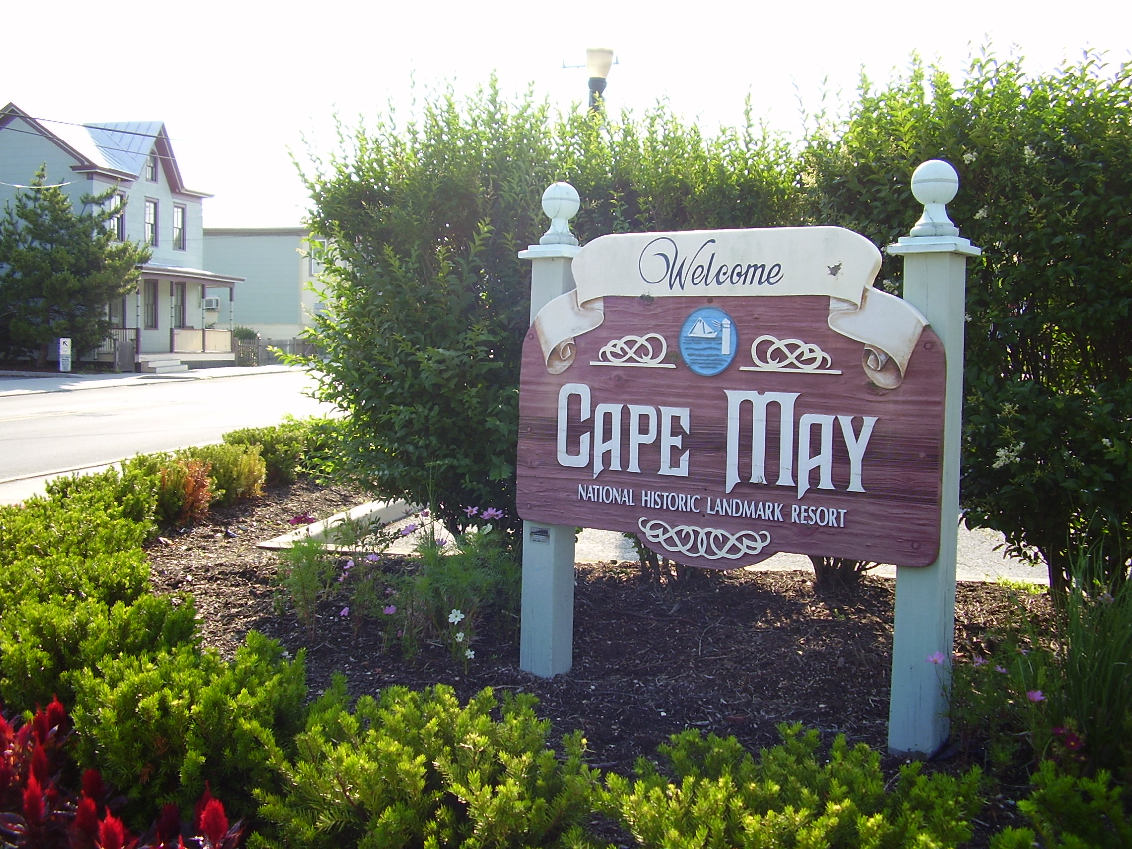
Cape May, New Jersey — City (New Jersey) — Welcome sign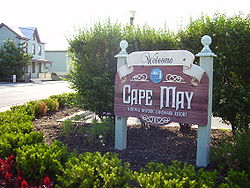
Motto: The Nation's Oldest Seashore Resort Cape May City highlighted in Cape May County. Inset map: Cape May County highlighted in the State of New Jersey.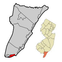 Census Bureau map of Cape May, New Jersey
Coordinates: 38°56′24″N 74°54′19″W / 38.94°N 74.90528°WCoordinates: 38°56′24″N 74°54′19″W / 38.94°N 74.90528°W Country United States State New Jersey County Cape May Incorporated March 8, 1848 Government – Type Faulkner Act (Council-Manager) – Mayor Edward J. Mahaney, Jr. (term ends 2012)[1] – Manager Bruce A. MacLeod[2] Area[3] – Total 2.80 sq mi (7.3 km2) – Land 2.48 sq mi (6.4 km2) – Water 0.32 sq mi (0.8 km2) 11.43% Elevation[4] 10 ft (3 m) Population (2010 Census)[5] – Total 3,607 – Density 1,288.2/sq mi (494.1/km2) Time zone Eastern (EST) (UTC-5) – Summer (DST) EDT (UTC-4) ZIP code 08204[6] Area code(s) 609 FIPS code 34-10270[7][8] GNIS feature ID 0885178[9] Website http://www.capemaycity.com Cape May is a city at the southern tip of Cape May Peninsula in Cape May County, New Jersey, where the Delaware Bay meets the Atlantic Ocean and is one of the country's oldest vacation resort destinations.[10] It is part of the Ocean City Metropolitan Statistical Area. As of the 2010 United States Census, it had a year-round population of 3,607.[5] In the summer, Cape May's population swells to as many as 40,000 to 50,000 with visitors.[11][12] The entire city of Cape May is designated the Cape May Historic District, a National Historic Landmark due to its concentration of Victorian buildings.
With a rich history, award-winning beaches, designation as a top birdwatching location, and many Victorian structures, Cape May is a seaside resort drawing visitors from around the world. Cape May was recognized as one of America's top 10 beaches by the Travel Channel and its beach was ranked fifth in New Jersey in the 2008 Top 10 Beaches Contest sponsored by the New Jersey Marine Sciences Consortium.[13]
Contents
History
The town is named for 1620 Dutch captain named Cornelius Jacobsen Mey who explored and charted the area between 1611–1614, and established a claim for the province of New Netherland. It was later settled by New Englanders from the New Haven Colony. What is now Cape May was originally formed as the borough of Cape Island by an Act of the New Jersey Legislature on March 8, 1848, from portions of Lower Township. It was reincorporated as Cape Island city on March 10, 1851, and finally became Cape May city as of March 9, 1869.[14]
Cape May began hosting vacationers from Philadelphia in the mid 18th century and is recognized by the United States government as the country's oldest seaside resort.[12] It became increasingly popular in the 18th century and was considered one of the finest resorts in America by the 19th century. In 1878 a five-day-long fire destroyed square blocks of the town center and as part of the reconstruction efforts replacement homes were almost uniformly of Victorian style.[15] As a result of this and of more recent preservation efforts, Cape May is noted for its large number of well-maintained Victorian houses — the second largest collection of such homes in the nation after San Francisco. In 1976, the entire city of Cape May was officially designated a National Historic Landmark as the Cape May Historic District, making Cape May the only city in the United States wholly designated as such.[16] That designation is intended to ensure the architectural preservation of these buildings.
Because of the World War II submarine threat off the East Coast of the United States, especially off shore Cape May and at the mouth of the Delaware Bay, numerous United States Navy facilities were located here in order to protect American coastal shipping. Cape May Naval facilities, listed below, provided significant help in reducing the number of ships and crew members lost at sea.[17]
- Naval Air Station, Cape May
- Naval Base, Cape May
- Inshore Patrol, Cape May
- Naval Annex, Inshore Patrol, Cape May
- Joint Operations Office, Naval Base, Cape May
- Welfare and Recreation Office, Cape May
- Dispensary, Naval Air Station, Cape May
- Naval Frontier Base, Cape May
- Degaussing Range (Cold Spring Inlet), Naval Base, Cape May
- Joint Operations Office, Commander Delaware Group, ESF, Cape May
- Anti-Submarine Attack Teacher Training Unit, U.S. Naval Base, Cape May
- Naval Annex, Admiral Hotel, Cape May
Geography
According to the United States Census Bureau, the city has a total area of 2.80 square miles (7.3 km2), of which 2.48 square miles (6.4 km2) is land and 0.32 square miles (0.83 km2) of it (11.43%) is water.[3] Cape May is generally low-lying; its highest point, at the intersection of Washington and Jackson Streets, is a mere 14 feet above sea level.[citation needed]
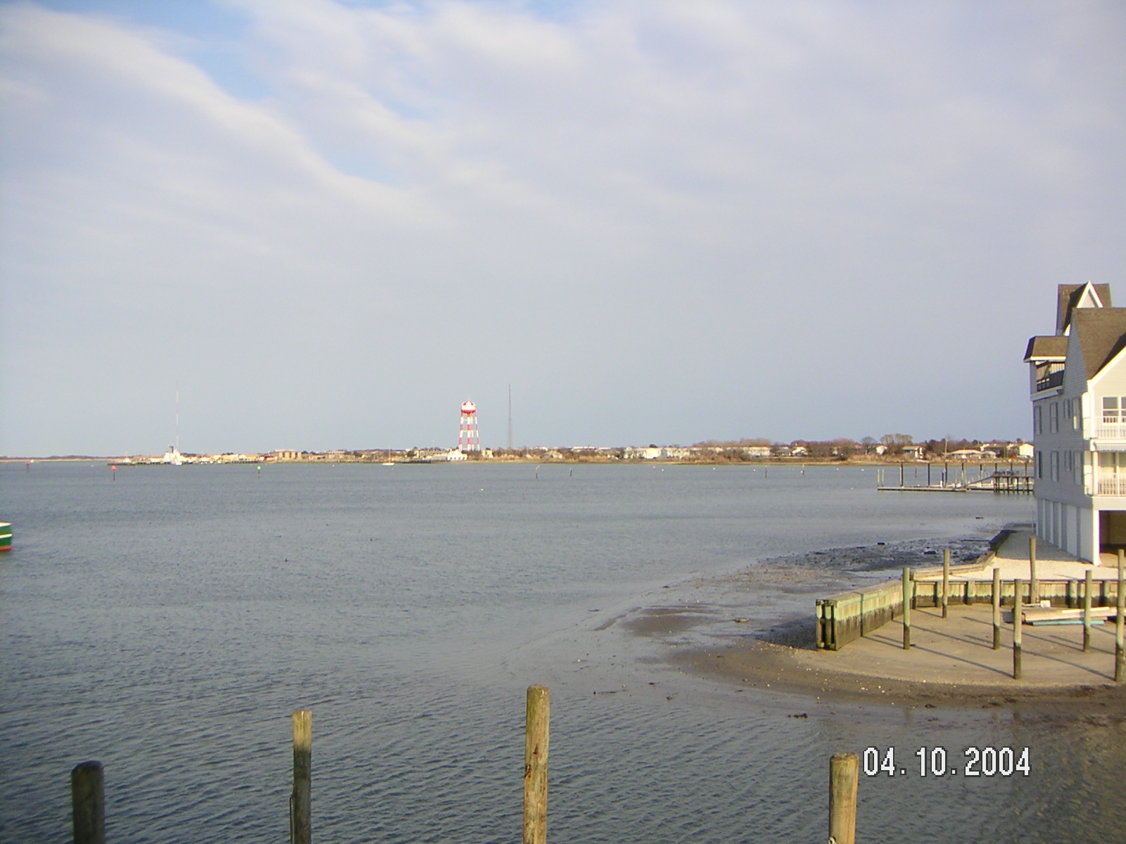
 Cape May Harbor as seen from Devil's Reach.
Cape May borders West Cape May Borough, Lower Township, the Atlantic Ocean, and the Delaware Bay. The Cape May-Lewes Ferry provides transportation across the Delaware Bay to Lewes, Delaware.
Cape May Harbor, which borders Lower Township and nearby Wildwood Crest allows fishing vessels to enter from the Atlantic Ocean, was created as of 1991, after years of dredging completed the harbor which covers 500 acres (200 ha).[18] Cape May Harbor Fest celebrates life in and around the harbor, with the 2011 event commemorating the 100th anniversary of the harbor's creation.[19]
Cape May is the southernmost point in New Jersey.
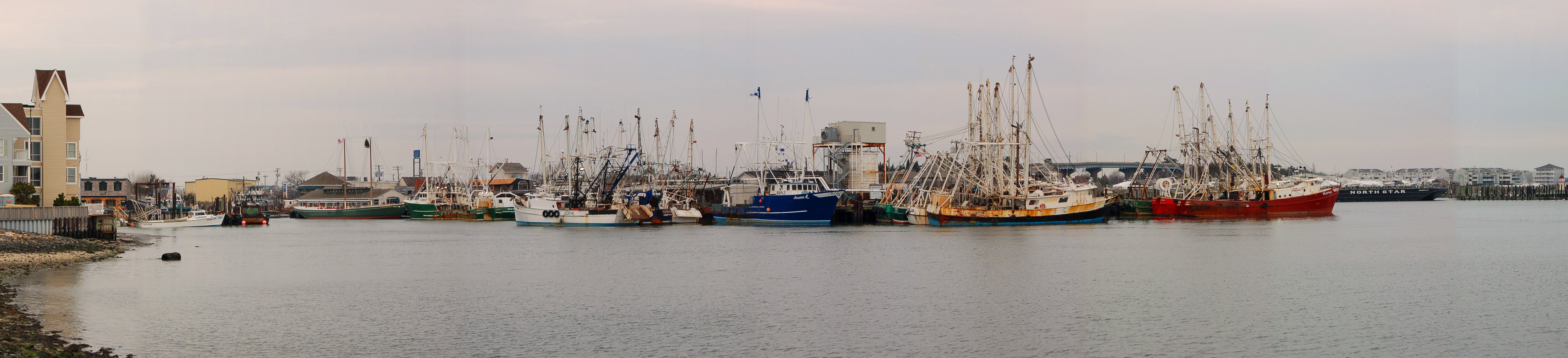
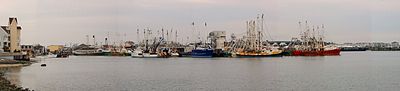 A panorama of Cape May Harbor.
Cape May is located at 38°56′13″N 74°54′40″W / 38.936814°N 74.911094°W (38.936814, −74.911094).[20]
Climate
According to the Köppen climate classification system, Cape May has a humid subtropical climate (Cfa) typical of New Jersey with warm summers and cool winters. Precipitation is distributed fairly evenly throughout the year. Being the southernmost point in New Jersey, Cape May has fairly mild wintertime temperatures. Contrary to that, the summertime has lower temperatures than most places in the state, making the town a popular place to escape the heat. It is in zone 7a/7b which is the same as parts of Coastal Virginia, therefore being Humid/Temperate.It is a perfect location to grow traditional Northeastern Plants including English Yew, Boxwoods and Sugar Maples. Because of the warmer wintertime temperatures, Hardy Palms including Trachycarpus fortunei (Chinese Windmill Palm) and Needle Palms would work quite well in the landscape. Wine grapes also do particularly well, given the long growing season.
Climate data for Cape May Month Jan Feb Mar Apr May Jun Jul Aug Sep Oct Nov Dec Year Average high °F (°C) 42
(6)43
(6)51
(11)60
(16)69
(21)78
(26)84
(29)83
(28)77
(25)66
(19)56
(13)47
(8)63.0 Average low °F (°C) 27
(−3)28
(−2)35
(2)43
(6)53
(12)62
(17)67
(19)66
(19)60
(16)49
(9)40
(4)31
(−1)46.8 Precipitation inches (mm) 3.68
(93.5)3.03
(77)4.18
(106.2)3.31
(84.1)3.65
(92.7)3.01
(76.5)3.39
(86.1)3.78
(96)3.31
(84.1)3.41
(86.6)3.11
(79)3.53
(89.7)41.39
(1,051.3)Source: [21] Demographics
Historical populations Census Pop. %± 1930 2,637 — 1940 2,583 −2.0% 1950 3,607 39.6% 1960 4,477 24.1% 1970 4,392 −1.9% 1980 4,853 10.5% 1990 4,668 −3.8% 2000 4,034 −13.6% 2010 3,607 −10.6% Population sources:
1930–1990[22] 2000[23] 2010[5]As of the census[7] of 2000, there were 4,034 people, 1,821 households, and 1,034 families residing in the city. The population density was 1,623.7 people per square mile (628.0/km2). There were 4,064 housing units at an average density of 1,635.7 per square mile (632.7/km2). The racial makeup of the city was 91.32% White, 5.26% African American, 0.20% Native American, 0.40% Asian, 0.05% Pacific Islander, 1.26% from other races, and 1.51% from two or more races. Hispanic or Latino of any race were 3.79% of the population.[23]
There were 1,821 households out of which 18.0% had children under the age of 18 living with them, 47.6% were married couples living together, 7.0% had a female householder with no husband present, and 43.2% were non-families. 39.4% of all households were made up of individuals and 24.2% had someone living alone who was 65 years of age or older. The average household size was 2.02 and the average family size was 2.69.[23]
In the city the population was spread out with 16.3% under the age of 18, 11.5% from 18 to 24, 19.8% from 25 to 44, 23.9% from 45 to 64, and 28.5% who were 65 years of age or older. The median age was 47 years. For every 100 females there were 97.1 males. For every 100 females age 18 and over, there were 94.5 males.[23]
The median income for a household in the city was $33,462, and the median income for a family was $46,250. Males had a median income of $29,194 versus $25,842 for females. The per capita income for the city was $29,902. About 7.7% of families and 9.1% of the population were below the poverty line, including 7.0% of those under age 18 and 10.9% of those age 65 or over.[23]
Government
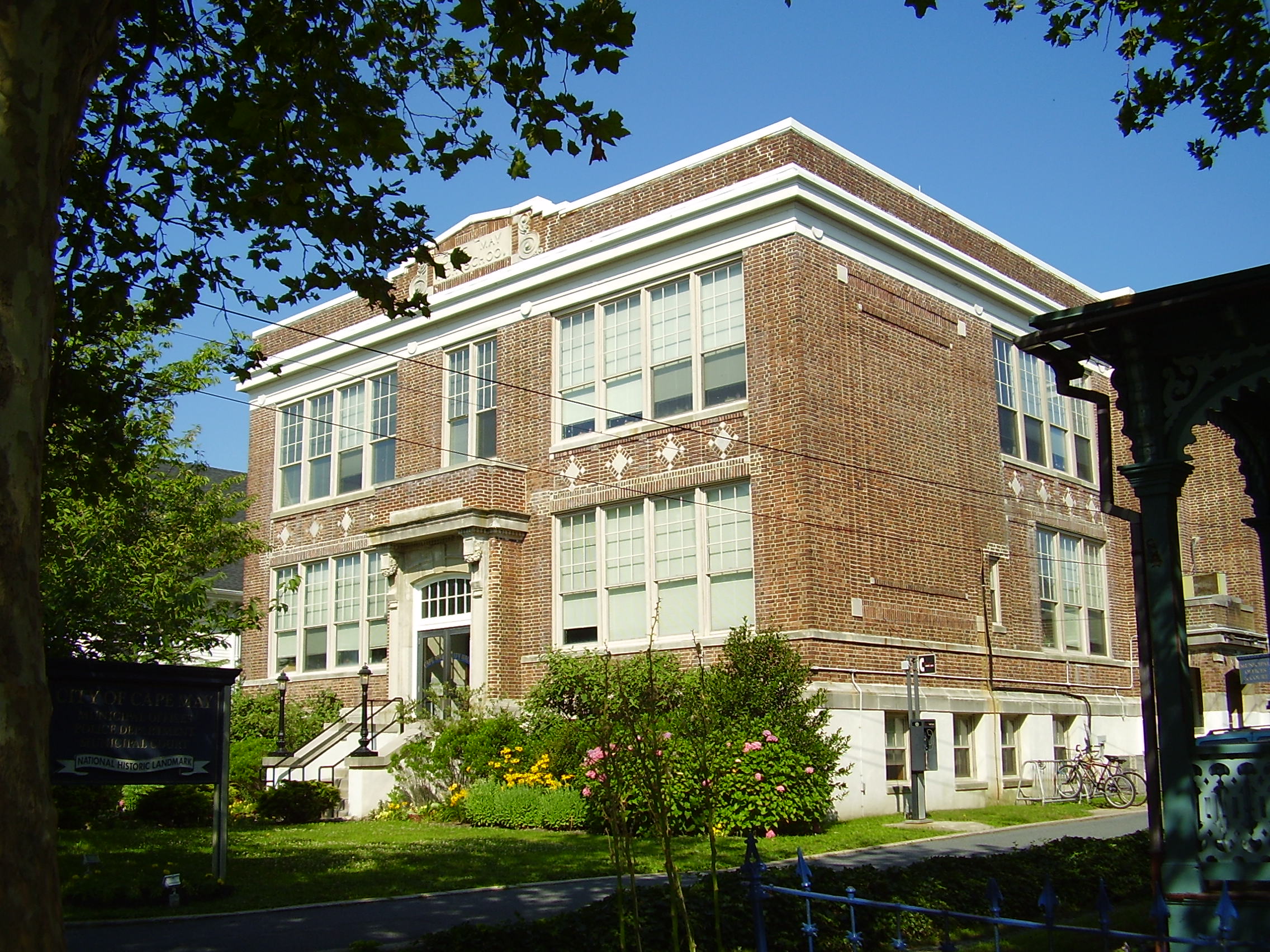
 Cape May Municipal Office, formerly the Cape May High School
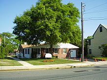 Cape May Housing Authority
Local government
Effective July 1, 2004, the City of Cape May switched to a Council-Manager form of government under the Faulkner Act. The government consists of a Mayor and a Borough Council comprising four council members, with all positions elected at large in non-partisan elections. A Mayor is elected directly by the voters to a four-year term of office. The Borough Council is elected to serve four-year terms on a staggered basis, with three seats coming up for election and then the mayor and the fourth seat two years later. Following the 2004 elections, the first under the new form of government, lots were drawn to determine which of the newly elected members would serve a four-year term, with the other three serving two-year terms. A city manager is responsible for the city's executive functions, managing Cape May's activities and operation.[24][25]
As of 2011[update], the Mayor of Cape May City is Dr. Edward J. Mahaney, Jr. (whose term of office expires June 30, 2012).[26] Members of the Cape May City Council are Deputy Mayor Jack Wichterman (2014), Deanna Fiocca (2014), William Murray (2014) and Terri Swain (2012).[27][28]
Federal, state and county representation
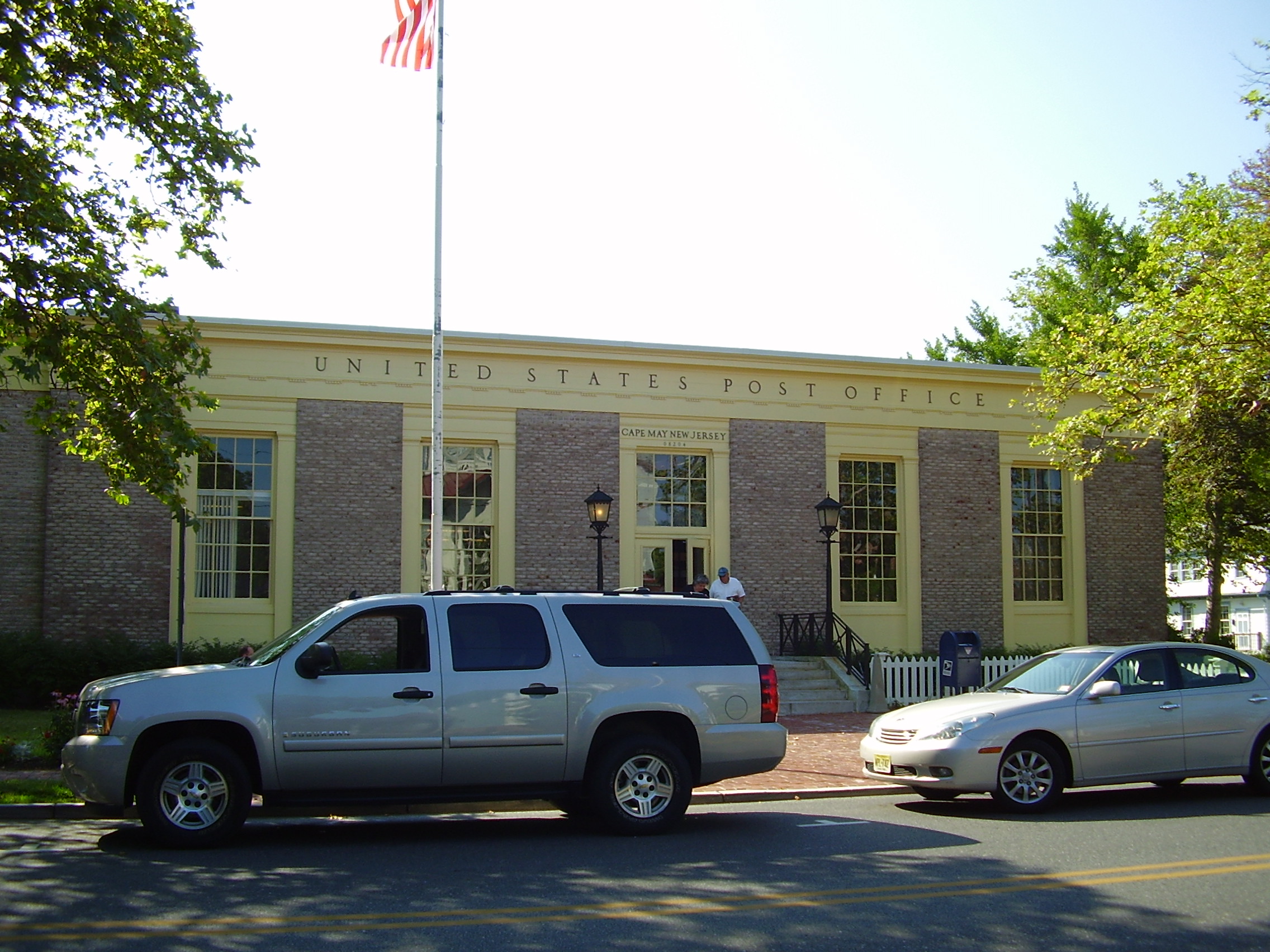
 Cape May Post Office
Cape May is in the 2nd Congressional district and is part of New Jersey's 2nd state legislative district.[29] The legislative district was kept unchanged by the New Jersey Apportionment Commission based on the results of the 2010 Census.[5]
New Jersey's Second Congressional District is represented by Frank LoBiondo (R, Ventnor City). New Jersey is represented in the United States Senate by Frank Lautenberg (D, Cliffside Park) and Bob Menendez (D, Hoboken).
1st legislative district of the New Jersey Legislature, which is represented in the New Jersey Senate by Jeff Van Drew (D, Dennis Township) and in the Assembly by Nelson Albano (D, Vineland) and Matthew W. Milam (D, Vineland).[30] The Governor of New Jersey is Chris Christie (R, Mendham).[31] The Lieutenant Governor of New Jersey is Kim Guadagno (R, Monmouth Beach).[32]
Cape May County is governed by a Board of Chosen Freeholders consisting of five members, elected at-large to three-year terms of office on a staggered basis, with one or two seats coming up for election each year. As of 2011, Cape May County's Freeholders are Freeholder Director Daniel Beyel (Upper Township, term expires December 31, 2011)[33], Leonard C. Desiderio (Sea Isle City, 2012)[34], Ralph E. Sheets, Jr. (2011)[35], M. Susan Sheppard (Ocean City, 2013)[36] and Gerald M. Thornton (2013).[37][38]
Economy
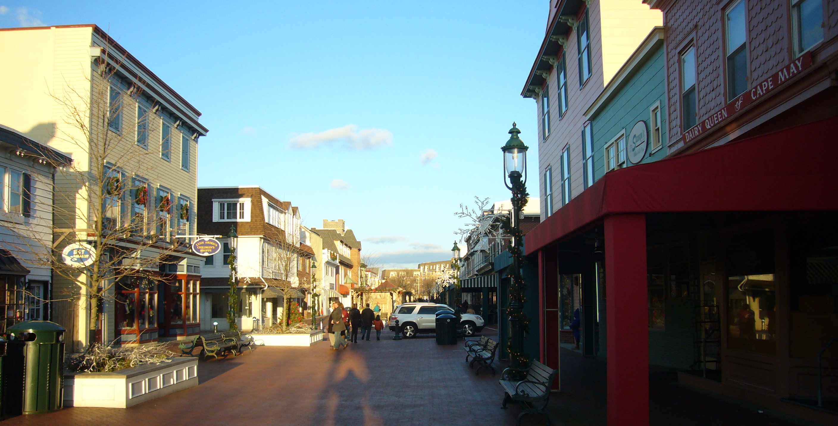
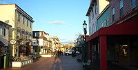 Washington Street Mall
Tourism is the dominant industry. Cape May's economy runs on shops, restaurants, lodgings and tourist attractions on Washington Street Mall, along the boardwalk and elsewhere throughout town. Commercial and sport fishing are also important to Cape May's economy. Marine mammal watching, bird watching, and other forms of eco-tourism have become equally important in Cape May. A small wine growing area is adjacent to Cape May, and tourists to Cape May visit the four local wineries: Hawk Haven Vineyard and Winery, Turdo Vineyards, Natali Vineyards and Cape May Winery.[39]
Arts and culture
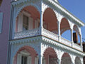
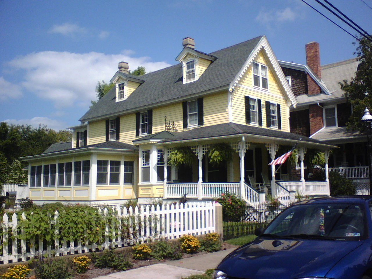
 A Victorian house in Cape May.
Cape May has become known both for its Victorian gingerbread homes and its cultural offerings. The town hosts the Cape May Jazz Festival, the Cape May Music Festival and the Cape May, New Jersey Film Festival. Cape May Stage, an Equity theater founded in 1988, performs at the Robert Shackleton Playhouse on the corner of Bank and Lafayette Streets. East Lynne Theater Company, an Equity professional company specializing in American classics and world premieres, has its mainstage season from June–December and March, with school residencies throughout the year. Cape May is also home for the Mid-Atlantic Center for the Arts, which offers year-round arts classes, African American history tours are transforming the historic Franklin Street School into a Community Cultural Center.
Cape May is the home of the so-called 'Cape May Diamonds'. They show up at Sunset Beach and other beaches in the area. These are in fact clear quartz pebbles that wash down from the Delaware River. They begin as prismatic quartz (including the color sub-varieties such as 'Smoky Quartz' and 'Amethyst') in the quartz veins alongside the Delaware River that get eroded out of the host rock and wash down 200 miles to the shore. Collecting Cape May diamonds is a popular pastime and many tourist shops sell them polished or even as faceted stones.[40]
The Cape May area is also world-famous for the observation of migrating birds, especially in the fall. With over 400 bird species having been recorded in this area and hundreds of local birders, Cape May is arguably the top bird-watching area in the entire Northeastern United States. The Cape May Bird Observatory is based nearby at Cape May Point.[41]
Education
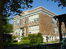
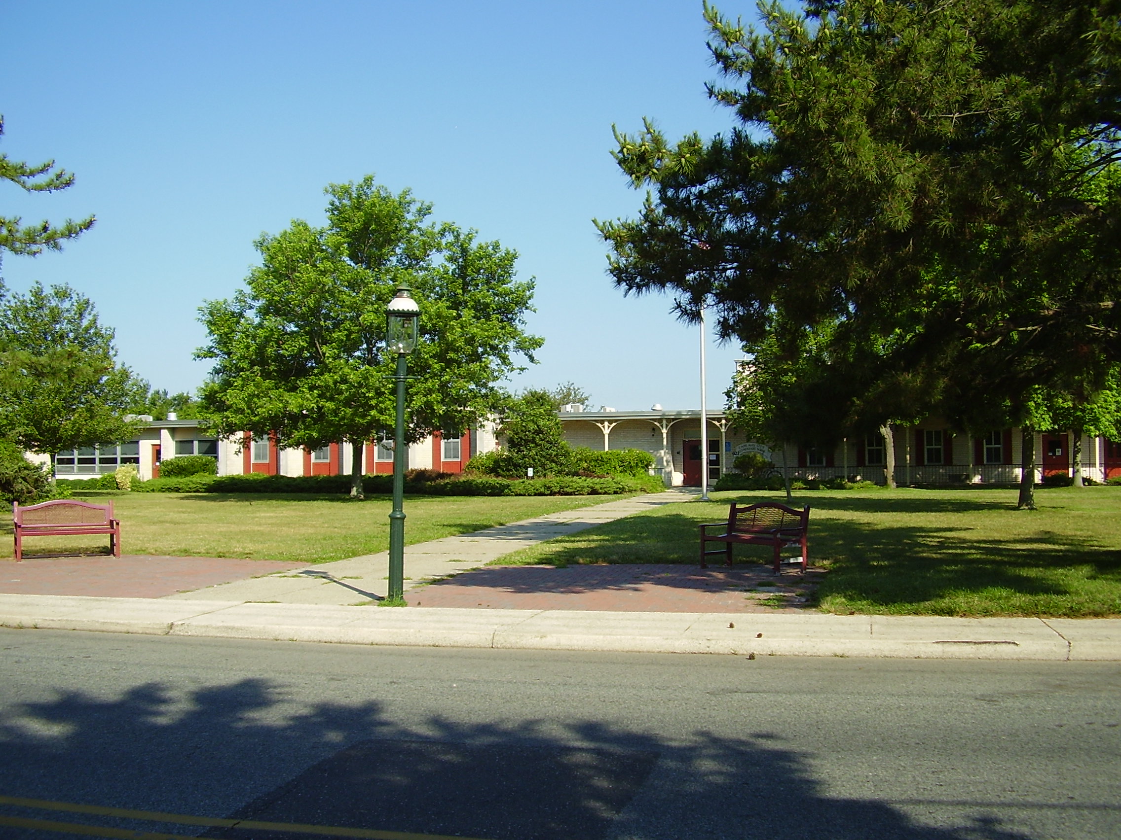
 Cape May City Elementary School
For grades PreK-6, public school students attend Cape May City Elementary School as part of the Cape May City School District, along with those from Cape May Point, a non-operating district, as part of a sending/receiving relationship.[42] The school had an enrollment of 178 students as of the 2009-10 school year.[43] As of 2010, discussions were under way regarding a possible consolidation of the districts of Cape May City, Cape May Point and the West Cape May School District.[44]
For grades 7 – 12, public school students attend the schools of the Lower Cape May Regional School District, which serves students from Cape May City, Cape May Point, Lower Township and West Cape May.[45][46] Schools in the district (with 2009-10 enrollment data from the National Center for Education Statistics[47]) are Richard M. Teitelman School (grades 7 and 8; 545 students) and Lower Cape May Regional High School (9–12; 1,100).
The private Catholic schools serving Cape May are Cape Trinity Regional School (PreK – 8) and Wildwood Catholic High School are located in Wildwood and serve all students from Cape May County under the auspices of the Roman Catholic Diocese of Camden.[48]
The Cape May Branch of the Cape May County Public Library is located in Cape May City.
Media
Cape May is served by several media outlets including WCFA-LP 101.5 FM, a commercial-free jazz and community station, as well as free weekly newspaper Exit Zero and local website Cape May Times. The name Exit Zero refers to the town's location at the far southern end of the Garden State Parkway near the intersection with Route 109. Informally, the entire town is sometimes called Exit Zero.[49]
Coast Guard Training Center Cape May
The United States Coast Guard Training Center Cape May, New Jersey is the nation's only Coast Guard Recruit Training Center. In 1924, the U.S. Coast Guard occupied the base and established air facilities for planes used in support of United States Customs Service efforts. During the Prohibition era, several cutters were assigned to Cape May to foil rumrunners operating off the New Jersey coast. After Prohibition, the Coast Guard all but abandoned Cape May leaving a small air/sea rescue contingent. For a short period of time (1929–1934), part of the base was used as a civilian airport. With the advent of World War II, a larger airstrip was constructed and the United States Navy returned to train aircraft carrier pilots. The over the water approach simulated carrier landings at sea. The Coast Guard also increased its Cape May forces for coastal patrol, anti-submarine warfare, air/sea rescue and buoy service. In 1946, the Navy relinquished the base to the Coast Guard.
In 1948, all entry level training on the East Coast was moved to the U.S. Coast Guard Recruit Receiving Station in Cape May. The Coast Guard consolidated all recruit training functions in Cape May in 1982. Currently over 350 military and civilian personnel and their dependents are attached to Training Center Cape May.[50]
Memorial
Cape May is home to a memorial to fishermen who died at sea. Known as the Cape May Fisherman's Memorial, it was erected over the harbor in 1988 and dedicated to fishermen lost at sea. It is maintained by the City of Cape May but administered by the Friends of the Cape May Fisherman’s Memorial. There is a statue and memorial stones holding the names of local fishermen who died at sea. The memorial has 75 names, starting with Andrew Jeffers, who died in 1893, and includes the six people who died in March 2009 with the sinking of the scalloping boat, the Lady Mary.[51]
The statue is of a fisherman's wife and her two children looking out onto the sheltering waters of Cape May harbor. The statue is located inside a giant compass. An inscription on the base of the statue states: "He hushed the storm to a gentle breeze and the billows of the sea were stalled."
The design is the creation, in granite, of Heather Baird, with Jerry Lynch; Gary Sassi, Celestial Memorial Sculpting Studio, Barre, VT led the project sculptors; and, Douglass Monuments, Cape May Courthouse, NJ, coordinated the project. The monument occupies a dedicated site at the juncture of Baltimore and Missouri Avenues at Harbor Cove, Cape May, NJ.38°56′42″N 74°54′14″W / 38.945°N 74.904°W
Cultural references
- Cape May is the subject of the song On the Way to Cape May, originally sung by Cozy Morley.
- In the AMC (TV network) series Mad Men, Betty Draper's parents have a summer house on Cape May.
- Cape May is a filming location for Out of Season (1998) (see Imdb.com)
- The 1980s horror film The Prowler was filmed entirely on location in Cape May.
Notable residents
Notable current and former residents of Cape May include:
- Maurice Catarcio (1929-2005), professional wrestler for the World Wrestling Federation and record holder in The Guinness Book of World Records.[52]
- Eugene Gifford Grace (1876–1960), president of Bethlehem Steel Corporation from 1916 to 1945.[53]
- T. Millet Hand (1902–56), represented New Jersey's 2nd congressional district in the United States House of Representatives as a Republican from 1945–1957. Hand was the mayor of Cape May from 1937–1944, and was the publisher of the Cape May Star and Wave from 1940 until his death.[54]
- Thomas H. Hughes (1769-1839), the founder and owner of the Congress Hall Hotel, and a Democratic-Republican member of the United States House of Representatives from New Jersey.[55]
- Bill Pilczuk, American swimmer.[56]
- Witmer Stone (1866–1939), ornithologist who did much of his research here.[57]
- Paul Volcker (born 1927), former chairman of the United States Federal Reserve, was born in Cape May, where his father was the City Manager.
Gallery
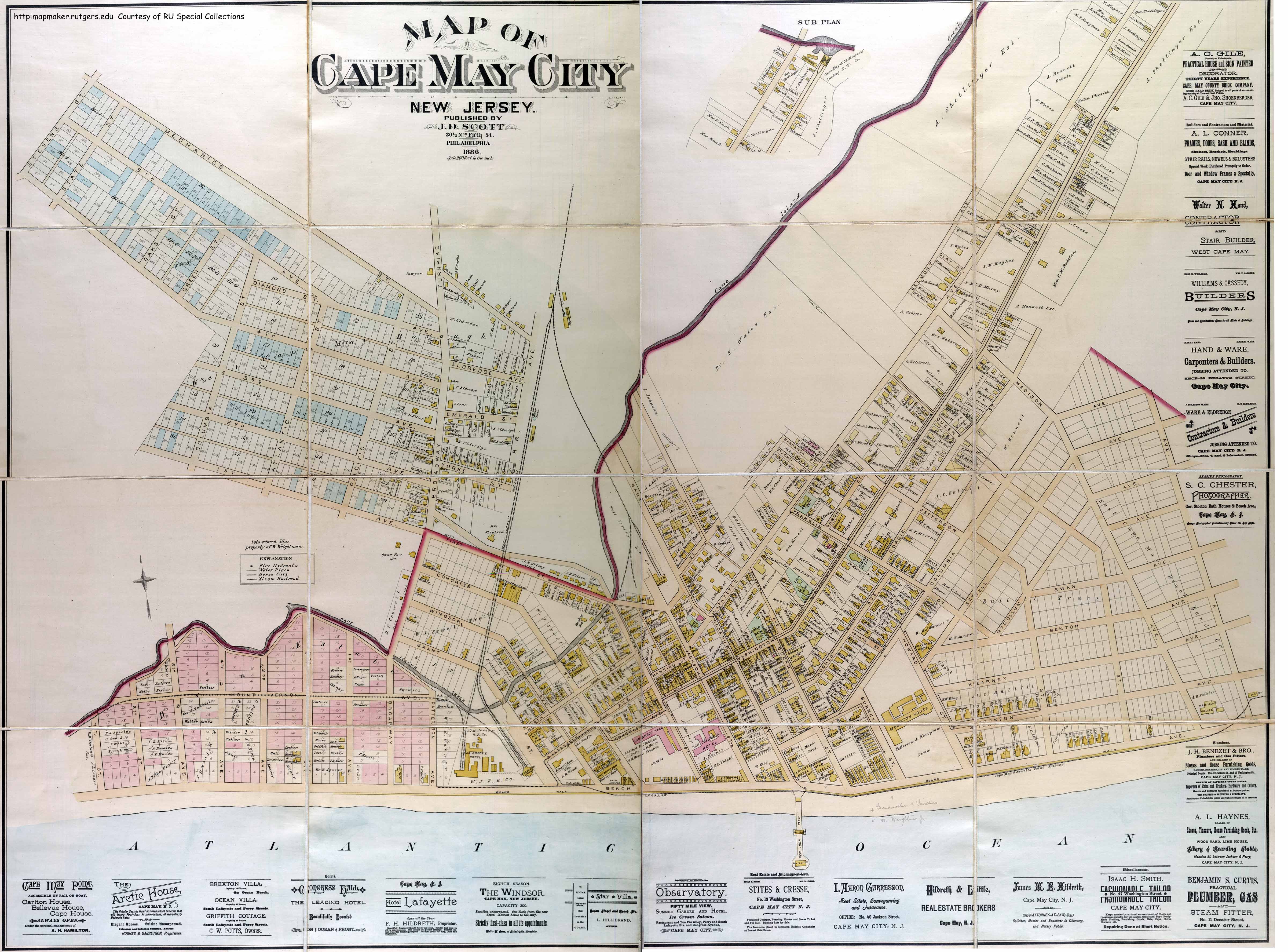
 1886 map of Cape May.
-
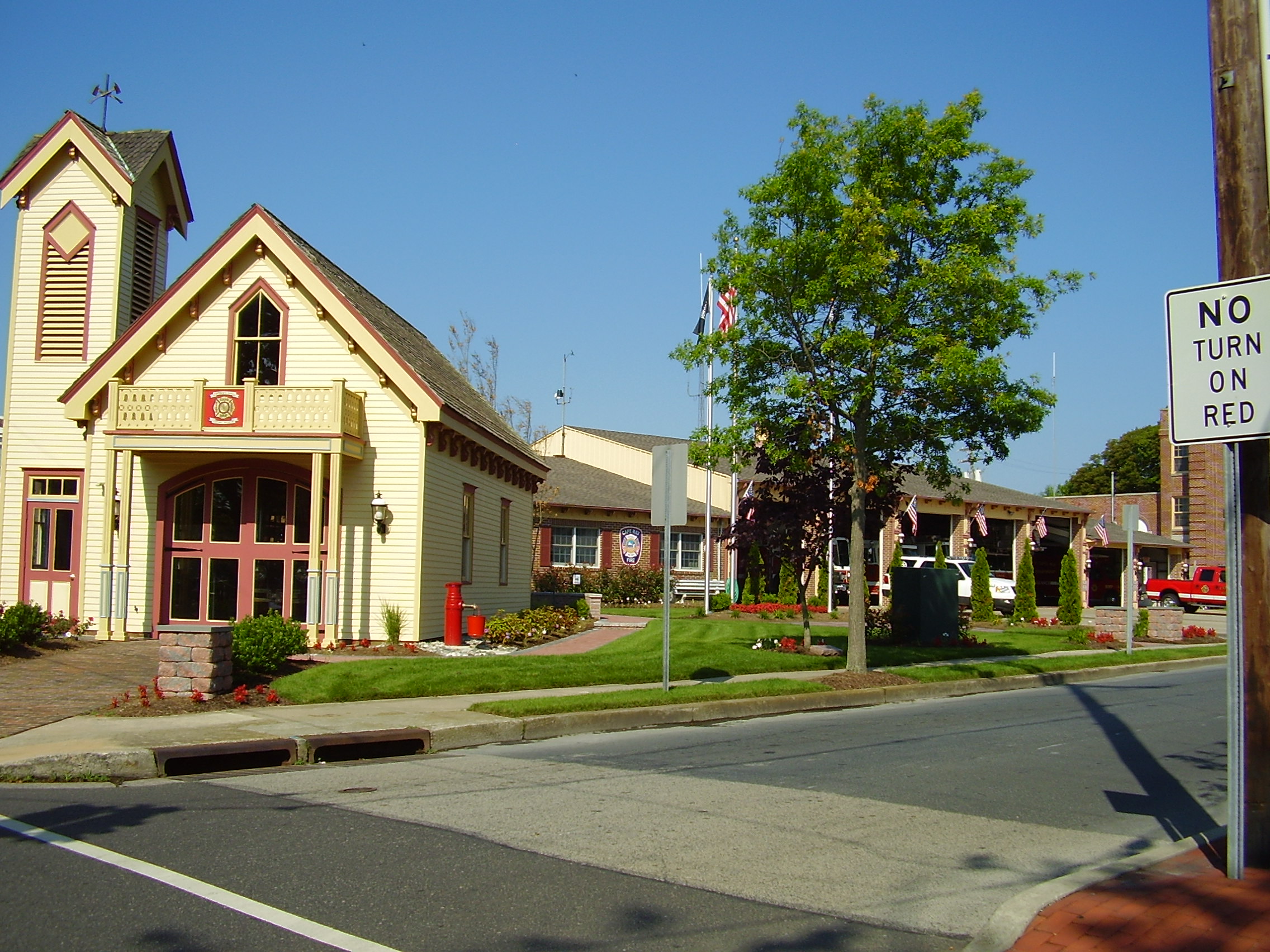
Cape May Fire Department
-
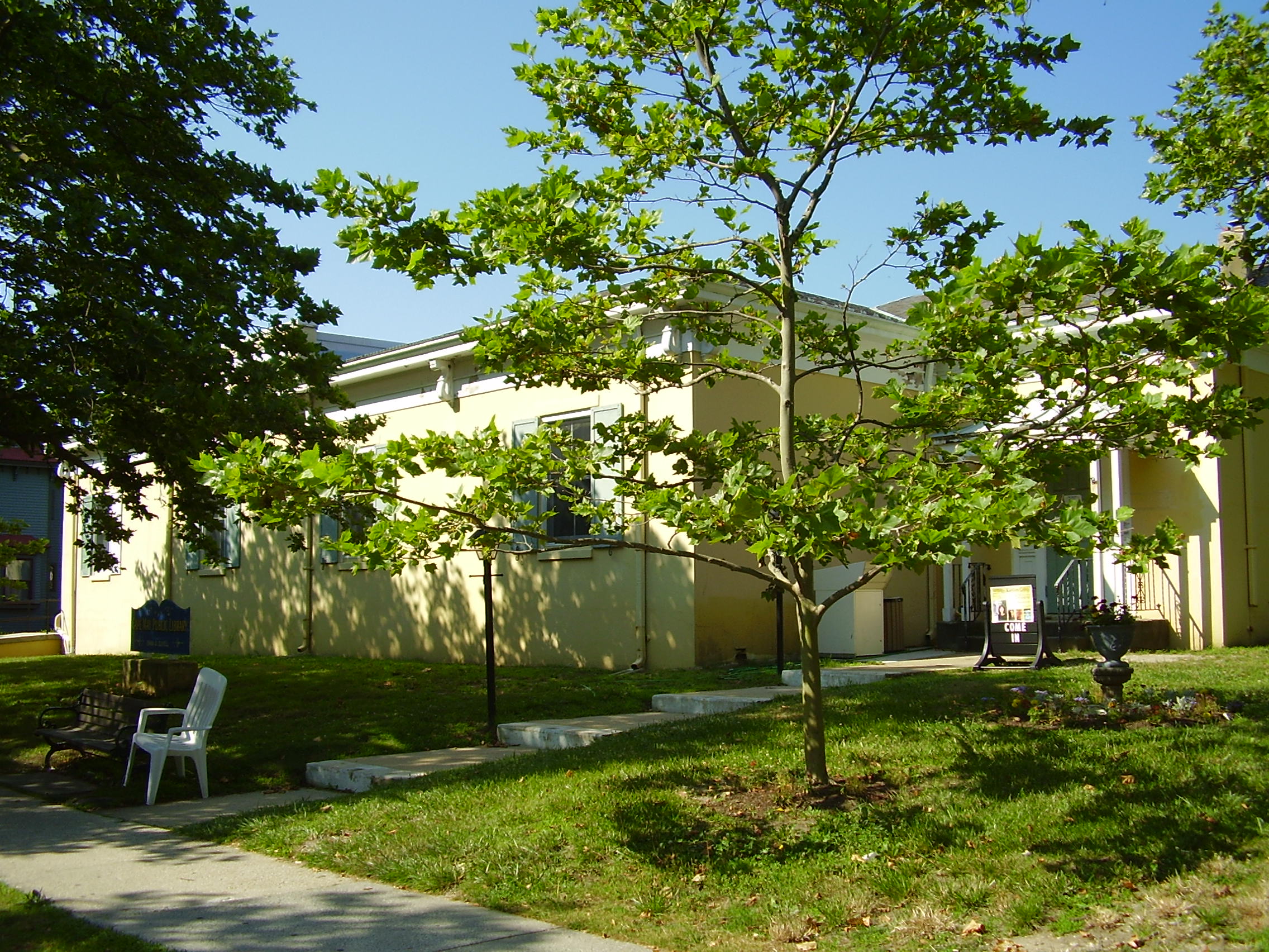
Cape May Library
-
Cape May is famous for its many ornate Victorian homes
-

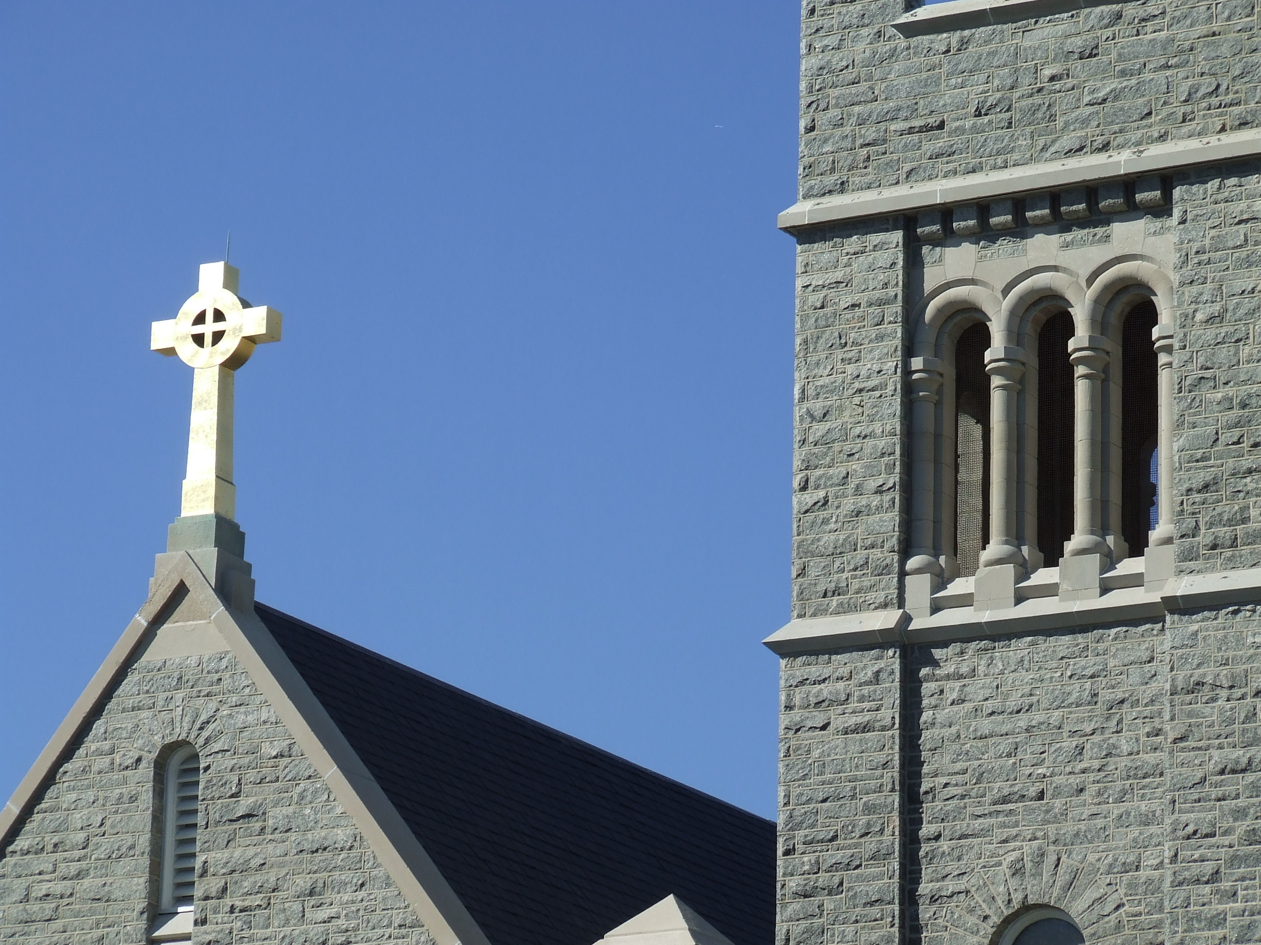
The Star of the Sea Catholic church in Cape May
-

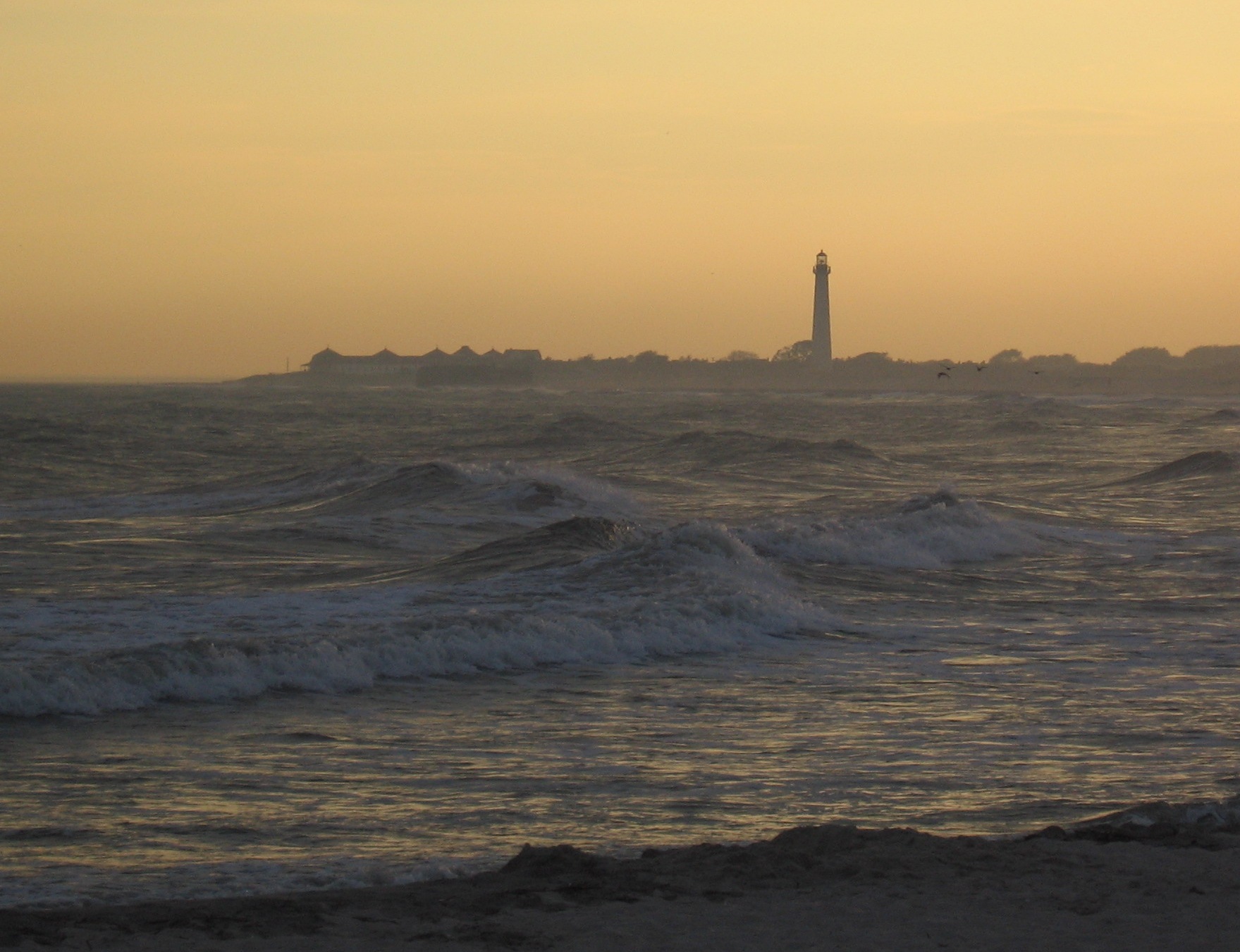
Cape May Lighthouse
-
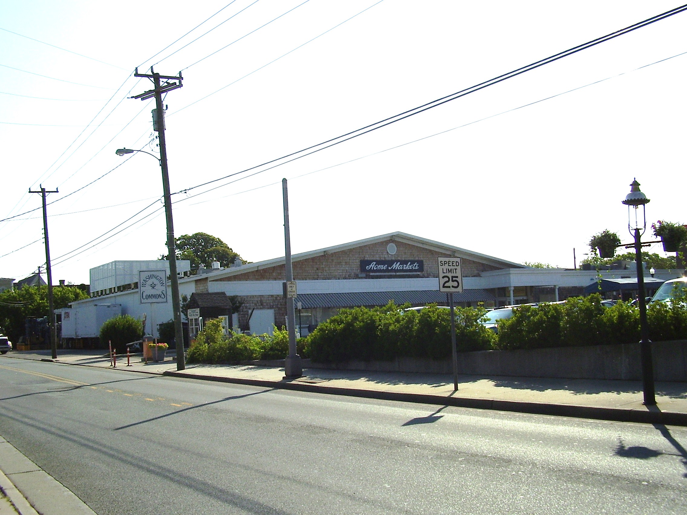
The Acme Market located in Cape May
See also
- Cape May Seashore Lines
- Cape May-Lewes Ferry
- Cape May Light
References
- ^ 2011 New Jersey Mayors Directory, New Jersey Department of Community Affairs. Accessed July 4, 2011.
- ^ Administration, City of Cape May. Accessed July 4, 2011.
- ^ a b GCT-PH1. Population, Housing Units, Area, and Density: 2000 for Cape May County, New Jersey -- County Subdivision and Place, United States Census Bureau. Accessed November 6, 2011.
- ^ U.S. Geological Survey Geographic Names Information System: City of Cape May, Geographic Names Information System. Accessed January 4, 2008.
- ^ a b c d 2011 Apportionment Redistricting: Municipalities sorted alphabetically, New Jersey Department of State, p. 2. Accessed July 4, 2011.
- ^ Look Up a ZIP Code, United States Postal Service. Accessed November 6, 2011.
- ^ a b "American FactFinder". United States Census Bureau. http://factfinder.census.gov. Retrieved 2008-01-31.
- ^ A Cure for the Common Codes: New Jersey, Missouri Census Data Center. Accessed July 14, 2008.
- ^ "US Board on Geographic Names". United States Geological Survey. 2007-10-25. http://geonames.usgs.gov. Retrieved 2008-01-31.
- ^ Johnson, Charles P. "Many Drive To Resorts On Atlantic: Coast Places Draw Drivers From Pittsburgh District", The Pittsburgh Press, June 22, 1930, p. 3 of the Automobile section. Accessed July 4, 2011. "The southern part of New Jersey largely in Cape May County contains other popular resorts. Cape May City, the southernmost part of New Jersey, is said to be the oldest vacation resort in the United States."
- ^ Mulvihill, Geoff via Associated Press. "Dangerous fishing, quaint B&B's share N.J. resort", Delaware County Daily Times, March 30, 2009. Accessed July 4, 2011. "'I don't really think much about the fishing business,' said Jimmy Iapallucci, a cook at Uncle Bill's Pancake House near the beach. He suspects the tourists who swell the community's population from 4,000 to 40,000 each summer don't either."
- ^ a b Staff. "LIFE STYLE; Old Resort Draws New Clientele: Honeymooners", The New York Times, July 23, 1989. Accessed July 4, 2011. "At one time, Cape May was known as the serene Victorian getaway of four Presidents and scores of wealthy New York and Philadelphia industrialists. But recently, Cape May, the nation's oldest seaside resort, has begun to attract a new breed of beachgoer.... Innkeepers here say Cape May's 19th-century ambiance and views of the Atlantic Ocean are the main reasons this sleepy city of 5,000 (50,000 in the summer) has become popular for weddings and honeymoons."
- ^ Urgo, Jacqueline L. (May 23, 2008). "Triumph for South Jersey". The Philadelphia Inquirer. Archived from the original on June 5, 2008. http://web.archive.org/web/20080605225601/http://www.philly.com/philly/hp/entertainment/19204259.html. Retrieved May 30, 2008.
- ^ "The Story of New Jersey's Civil Boundaries: 1606–1968", John P. Snyder, Bureau of Geology and Topography; Trenton, New Jersey; 1969. p. 113.
- ^ Victorian Cape May, Cape May Times. Accessed July 4, 2011. "Cape May looked a lot different before the fire of 1878. The town is the oldest seashore resort in the nation. In the 1800's, Cape May had quite a collection of classically designed seaside hotels. The fire of 1878 wiped out 30 blocks of the early seashore town, including some of the resort's major hotels, including the original Congress Hall.... And, for the most part, the new buildings that went up were built in the modern style of the day...later known as the Victorian style... lots of gingerbread trim, gables and turrets."
- ^ Kent, Bill. "DEVELOPMENT; If They Build It, Will Even More Come? Cape May Ponders Parking Garage", The New York Times, November 9, 1997. Accessed July 4, 2011. "William Bolger, manager of the National Parks Service Historic Landmarks Program for the Northeast, confirmed that he had been surveying Cape May to evaluate the city's historic buildings since January. 'Cape May is unique in America in that, since 1977, the entire city has been designated a National Historic Landmark District,' Mr. Bolger said. 'That means everything within the city limits is considered of historic landmark status.'"
- ^ U.S. Naval Activities, World War II
- ^ Preston, Benjamin. "Cape May, New Jersey’s Battle Against Nature", The Earth Institute, June 20, 2011. Accessed July 4, 2011. "Beach erosion is a perennial challenge for coastal communities, but in Cape May, man began accelerating the natural process in 1903. That year, dredges began scooping sand and muck out of the small harbor, expanding it to its current 500 acres. By 1911, a pair of massive stone jetties were completed to protect the mouth of Cape May Inlet."
- ^ Staff. "Cape May Harbor Fest offers activities on land and sea", Shore News Today, June 9, 2011. Accessed July 4, 2011. "Cape May’s Harbor Fest, a celebration of seafood and song, the sea, its culture, economy and ecology, will take place 10 a.m.-5 p.m. Saturday, June 18 in and along the banks of Cape May Harbor on Delaware Avenue, with many of the land-based activities taking place at the Nature Center of Cape May.This year’s festival commemorates the 100th anniversary of Cape May Harbor."
- ^ "US Gazetteer files: 2010, 2000, and 1990". United States Census Bureau. 2011-02-12. http://www.census.gov/geo/www/gazetteer/gazette.html. Retrieved 2011-04-23.
- ^ "Average weather for Cape May, New Jersey". Weather.com. http://www.weather.com/weather/climatology/monthly/USNJ0074?x=0&y=0. Retrieved December 20, 2008.
- ^ Jersey Resident Population by Municipality: 1930 – 1990, Workforce New Jersey Public Information Network, backed up by the Internet Archive as of May 2, 2009. Accessed July 4, 2011.
- ^ a b c d e Census 2000 Demographic Profile Highlights: Cape May city, New Jersey, United States Census Bureau. Accessed November 6, 2011.
- ^ 2005 New Jersey Legislative District Data Book, Rutgers University Edward J. Bloustein School of Planning and Public Policy, April 2005, p. 8.
- ^ Form of Government - Council / Manager, City of Cape May. Accessed July 4, 2011.
- ^ Mayor, City of Cape May. Accessed July 4, 2011.
- ^ Elected Officials, City of Cape May. Accessed February 22, 2011.
- ^ Degener, Richard. "Newcomers Murray, Wichterman, Fiocca win Cape May council seats", The Press of Atlantic City, May 11, 2010. Accessed July 4, 2011.
- ^ 2011 New Jersey Citizen's Guide to Government, New Jersey League of Women Voters, p. 55. Accessed July 4, 2011.
- ^ "Legislative Roster: 2010-2011 Session". New Jersey Legislature. http://www.njleg.state.nj.us/members/roster.asp. Retrieved 2010-02-08.
- ^ "About the Governor". New Jersey. http://www.nj.gov/governor/about/. Retrieved 2010-01-21.
- ^ "About the Lieutenant Governor". New Jersey. http://www.nj.gov/governor/lt/. Retrieved 2010-01-21.
- ^ Daniel Beyel, Cape May County, New Jersey. Accessed January 6, 2011.
- ^ Leonard C. Desiderio, Cape May County, New Jersey. Accessed January 6, 2011.
- ^ Ralph E. Sheets, Jr., Cape May County, New Jersey. Accessed January 6, 2011.
- ^ M. Susan Sheppard, Cape May County, New Jersey. Accessed January 6, 2011.
- ^ Gerald M. Thornton, Cape May County, New Jersey. Accessed January 6, 2011.
- ^ Freeholders Home Page, Cape May County, New Jersey. Accessed January 3, 2011.
- ^ Map, Garden State Wine Growers Association. Accessed July 4, 2011.
- ^ Fox, Karen. "Cape May Diamonds", Cape May magazine, August 2009. Accessed July 4, 2011.
- ^ Cape May Bird Observatory, New Jersey Audubon Society. Accessed July 4, 2011.
- ^ Cape May City School District 2010 Report Card Narrative, New Jersey Department of Education. Accessed July 3, 2011. "The District is a one-school district. 60% of the students come from the United States Coast Guard Training Center based in Cape May; 25% from Cape May City residents; and 15% from the Low-income Housing Authority, and three students from the sending district of Cape May Point."
- ^ Data for the Cape May City Elementary School, National Center for Education Statistics. Accessed July 3, 2011.
- ^ Crowley, Terrence J. Cape May County Report on Consolidation and Regionalization, New Jersey Department of Education, March 15, 2010, available through the Asbury Park Press. Accessed July 3, 2011. "The school districts of Cape May City, West Cape May, and Cape May Point (non-operating) are currently conducting a feasibility study to merge the districts. A consultant is currently collecting and analyzing data and will be finalizing his report in late spring 2010."
- ^ Richard M. Teitelman Middle School, Lower Cape May Regional School District. Accessed July 3, 2011. "Richard M. Teitelman RMT Middle School is part of the Lower Cape May Regional School District. RMT consists of students in the 7th and 8th grades from Cape May, Lower Township, West Cape May and Cape May Point."
- ^ Lower Cape May Regional High School, Lower Cape May Regional School District. Accessed July 3, 2011. "Lower Cape May Regional High School is a four year public school that serves students from four communities including Cape May, Lower Township, West Cape May and Cape May Point."
- ^ Data for the Lower Cape May Regional High School District, National Center for Education Statistics. Accessed July 3, 2011.
- ^ Cape May County Schools, Roman Catholic Diocese of Camden. Accessed July 4, 2011.
- ^ Exit Zero Publishing
- ^ History of Training Center Cape May, United States Coast Guard. Accessed July 4, 2011.
- ^ Degener, Richard. "Group has new goal for Cape Fishermen's Memorial", The Press of Atlantic City, June 3, 2009. Accessed July 4, 2011.
- ^ "Catarcio, Maurice A.". Northeast Obits. http://www.northeastobits.com/archives.cfm?s=print&obit=15052. Retrieved January 25, 2009.
- ^ Distinguished Alumni: Eugene Grace ‘99, Lehigh University. Accessed September 3, 2007. "Born in Cape May, New Jersey on August 27, 1876, Grace was the son of a sea captain."
- ^ Thomas Millet Hand, Biographical Directory of the United States Congress. Accessed August 16, 2007.
- ^ Thomas Hurst Hughes, Biographical Directory of the United States Congress. Accessed July 4, 2011.
- ^ Litsky, Frank. "GOODWILL GAMES; Popov Defeats U.S. Rival, and It Isn't Even Close", The New York Times, August 3, 1998. Accessed November 17, 2007. "Pilczuk, from Cape May, N.J., was six inches behind Yegorov, a disappointment for someone who upset Popov at this distance in last January's world championships."
- ^ Staff. "DR. WITMER STONE, ORNITHOLOGIST, 72; Member of Academy of Natural Sciences of Philadelphia for 51 Years Dies", The New York Times, May 25, 1939. Accessed July 4, 2011.
Further reading
- Salvini, Emil R. (2005). Boardwalk memories: tales of the Jersey shore, Insiders' Guide Series. Globe Pequot. p. 180. ISBN 0762736747, 9780762736744. http://books.google.com/books?id=RjW1jE5e7iYC.
External links
- Cape May City official website
- Cape May City Elementary School
- Cape May City Elementary School's 2009–10 School Report Card from the New Jersey Department of Education
- Data for the Cape May City Elementary School, National Center for Education Statistics
- Lower Cape May Regional School District
- Cape May New Jersey Information, Directions and History
- CapeMay.com – Online magazine & guide to Cape May
- Cape May Star and Wave Newspaper – Serving as Cape May's paper of record since 1854
- Cape May Magazine – Lifestyle magazine focused on America's oldest seaside resort
- WCFA-LP 101.5 and Center for Community Arts
- Mid-Atlantic Center for the Arts
- The Cape May Gazette – Weekly newspaper covering Cape May
- Exit Zero Magazine – Weekly publication in Cape May with the latest news, pictures from around the island, history and feature articles
- Cape May NJ news and events – Cape May events online.
Municipalities and communities of Cape May County, New Jersey Cities Cape May | North Wildwood | Ocean City | Sea Isle City | Wildwood
Boroughs Townships CDPs Communities Beesley's Point | Dennisville | Goshen | Green Creek | Marmora | Ocean View | South Dennis | Swainton | Tuckahoe
Categories:- Populated places established in 1848
- Populated places in Cape May County, New Jersey
- Cities in New Jersey
- Faulkner Act Council-Manager
- Seaside resorts in the United States
- Cape May, New Jersey


Wikimedia Foundation. 2010.