- North Cape May, New Jersey
-
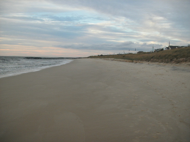
North Cape May, New Jersey — CDP — North Cape May shoreline, October 2009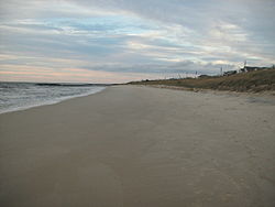 Map of North Cape May CDP in Cape May County
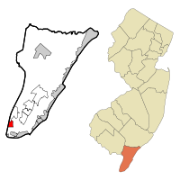
Coordinates: 38°58′47″N 74°57′6″W / 38.97972°N 74.95167°WCoordinates: 38°58′47″N 74°57′6″W / 38.97972°N 74.95167°W Country United States State New Jersey County Cape May Area – Total 1.5 sq mi (3.8 km2) – Land 1.4 sq mi (3.6 km2) – Water 0.1 sq mi (0.2 km2) Elevation 16 ft (5 m) Population (2000) – Total 3,618 – Density 2,583.4/sq mi (997.4/km2) Time zone Eastern (EST) (UTC-5) – Summer (DST) EDT (UTC-4) ZIP code 08204 Area code(s) 609 FIPS code 34-52650[1] GNIS feature ID 0878842[2] North Cape May is a census-designated place and unincorporated area located within Lower Township, in Cape May County, New Jersey, in the United States. It is part of the Ocean City Metropolitan Statistical Area. As of the 2000 census, the CDP population was 3,618. The Cape May-Lewes Ferry departs from here.
North Cape May had existed as an independent borough, formed by an Act of the New Jersey Legislature on March 19, 1928, from portions of Lower Township. The borough remained independent until April 30, 1945, when it was returned to Lower Township.[3]
Contents
Geography
North Cape May is located at 38°58′47″N 74°57′06″W / 38.979680°N 74.951643°W (38.979680, -74.951643).[4]
According to the United States Census Bureau, the CDP has a total area of 3.8 km2 (1.5 mi2). 3.6 km2 (1.4 mi2) of it is land and 0.2 km2 (0.1 mi2) of it (4.76%) is water.
Demographics
Historical populations Census Pop. %± 1990 3,574 — 2000 3,618 1.2% source: [5] As of the census[1] of 2000, there were 3,618 people, 1,544 households, and 1,008 families residing in the CDP. The population density was 997.8/km2 (2,583.4/mi2). There were 2,090 housing units at an average density of 576.4/km2 (1,492.3/mi2). The racial makeup of the CDP was 94.42% White, 2.79% African American, 0.44% Native American, 0.47% Asian, 0.75% from other races, and 1.13% from two or more races. Hispanic or Latino of any race were 2.16% of the population.
There were 1,544 households out of which 27.0% had children under the age of 18 living with them, 48.1% were married couples living together, 13.7% had a female householder with no husband present, and 34.7% were non-families. 29.6% of all households were made up of individuals and 15.5% had someone living alone who was 65 years of age or older. The average household size was 2.33 and the average family size was 2.88.
In the CDP the population was spread out with 22.8% under the age of 18, 6.0% from 18 to 24, 26.3% from 25 to 44, 24.2% from 45 to 64, and 20.7% who were 65 years of age or older. The median age was 42 years. For every 100 females there were 86.7 males. For every 100 females age 18 and over, there were 81.3 males.
The median income for a household in the CDP was $37,071, and the median income for a family was $42,161. Males had a median income of $33,036 versus $26,875 for females. The per capita income for the CDP was $18,420. About 1.0% of families and 4.1% of the population were below the poverty line, including 3.1% of those under age 18 and 3.0% of those age 65 or over.
North Cape May is mostly a residential community, with no hotels but many vacation homes. Many people come here after they retire.
References
- ^ a b "American FactFinder". United States Census Bureau. http://factfinder.census.gov. Retrieved 2008-01-31.
- ^ "US Board on Geographic Names". United States Geological Survey. 2007-10-25. http://geonames.usgs.gov. Retrieved 2008-01-31.
- ^ "The Story of New Jersey's Civil Boundaries: 1606-1968", John P. Snyder, Bureau of Geology and Topography; Trenton, New Jersey; 1969. p. 115.
- ^ "US Gazetteer files: 2010, 2000, and 1990". United States Census Bureau. 2011-02-12. http://www.census.gov/geo/www/gazetteer/gazette.html. Retrieved 2011-04-23.
- ^ "Population Finder: North Cape May CDP, New Jersey". U.S. Census Bureau. http://factfinder.census.gov/servlet/SAFFPopulation?_event=Search&geo_id=16000US3449440&_geoContext=01000US%7C04000US34%7C16000US3449440&_street=&_county=North+Cape+May&_cityTown=North+Cape+May&_state=04000US34&_zip=&_lang=en&_sse=on&ActiveGeoDiv=geoSelect&_useEV=&pctxt=fph&pgsl=160&_submenuId=population_0&ds_name=null&_ci_nbr=null&qr_name=null®=null%3Anull&_keyword=&_industry=. Retrieved 2007-03-19.
External links
Municipalities and communities of Cape May County, New Jersey Cities 
Boroughs Townships CDPs Cape May Court House | Diamond Beach | Erma | North Cape May | Strathmere | Rio Grande | Villas | Whitesboro-Burleigh
Communities Beesley's Point | Dennisville | Goshen | Green Creek | Marmora | Ocean View | South Dennis | Swainton | Tuckahoe
Categories:- Populated places in Cape May County, New Jersey
- Census-designated places in New Jersey
- Former boroughs in New Jersey


Wikimedia Foundation. 2010.