- New Jersey Route 147
-
Route 147
North Wildwood Boulevard
Spruce Avenue
Route information Maintained by NJDOT Length: 4.20 mi[1] (6.76 km) Existed: 1971 – present Major junctions West end: 
 US 9 / CR 618 in Middle Township
 G.S. Pkwy. in Middle Township

 CR 619 / Ocean Drive in Middle Township
East end:  CR 621 / Ocean Drive at New York Avenue in North Wildwood
Highway system New Jersey State Highway Routes
Interstate and US←  Route 143
Route 151  →
→Route 147 is a 4.20-mile (6.76 km) state highway located in Cape May County in New Jersey, United States. It is a short connector between U.S. Route 9 in Middle Township and North Wildwood at New York Avenue. West of U.S. Route 9, the road continues to Route 47 as County Route 618 (Indian Trail Road); this route along with Route 147 provides an alternate route to The Wildwoods from Route 47. East of New York Avenue, the route continues south through The Wildwoods as County Route 621 (New Jersey Avenue). The route passes through mostly marshland along its journey, intersecting the Garden State Parkway at a partial interchange and County Route 619 (Ocean Drive). The portion of the route east of the intersection with the latter forms a part of Ocean Drive. When the 500-series county routes were established in New Jersey in the 1950s, what is now Route 147 became a part of County Route 585, a route running from Lower Township north to Absecon. Route 147 was designated along County Route 585 between U.S. Route 9 and the North Wildwood border. The route was extended to its current location in North Wildwood by the 1990s.
Contents
Route description
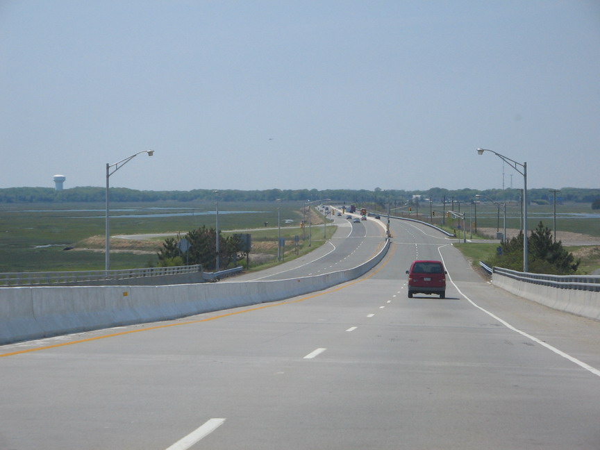
 Route 147 westbound through the wetlands near North Wildwood
Route 147 begins at an intersection with U.S. Route 9 in the Burleigh section of Middle Township, heading to the east of North Wildwood Boulevard, a two-lane undivided road.[1] The road continues to the west of U.S. Route 9 as County Route 618 (Indian Trail Road) to Route 47.[1][2] The road passes residences and businesses to the north and woodland to the south before coming to a partial cloverleaf interchange with the Garden State Parkway that has access to and from the northbound direction of the parkway.[2]
Past the Garden State Parkway, Route 147 becomes a four-lane divided highway that briefly passes more homes and commercial establishments before entering a delta-type series of marshy rivers and inlets. It turns to the southeast and comes to an intersection with County Route 665 before crossing the Grassy Sound on a bridge.[1][2] After the bridge, the route comes to an intersection with the southern terminus of County Route 619 (Ocean Drive).[1]
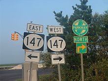 NJ 147 signage from CR 619
At this point, the Ocean Drive moniker merges onto Route 147 and the road crosses over the Beach Creek into the beach resort of North Wildwood. Here, the route turns south and becomes Spruce Avenue, which heads between marshland to the west and resort homes to the east. At the intersection with West Angelsea Drive, Route 147 becomes a four-lane undivided road that continues past more developments, turning to the southeast. Route 147 heads through a mix or residential and commercial establishments before ending at the intersection with New York Avenue.[1][2] From here, County Route 621 continues south along the roadway as New Jersey Avenue.[1] Route 147, along with County Route 618, provide an alternate route to The Wildwoods from Route 47.[3]
History
What is now Route 147 was an unimproved road back in 1927.[4] When the 500-series county routes were established in the 1950s, this road became a part of County Route 585, a route that ran from Route 109 (then a part of U.S. Route 9) in Lower Township north to U.S. Route 30 and Route 157 in Absecon.[5] In 1971, Route 147 was designated to replace the portion of County Route 585 between U.S. Route 9 in Burleigh and the North Wildwood border.[6] As a result of a bridge replacement over the Grassy Sound, Route 147 was realigned off its former drawbridge, and the former alignment became Cape May County Route 665.[7] The southern terminus of County Route 585 was eventually truncated its current location at Route 52 in Somers Point. By the 1990s, Route 147 was extended to its current terminus at New York Avenue in North Wildwood.[8]
Major intersections
The entire route is in Cape May County.
Location Mile[1] Destinations Notes Middle Township 0.00 US 9 / CR 618 west (Indian Trail Road)Western terminus 0.33 G.S. Pkwy. northGSP exit 6 2.13  CR 665 (Old North Wildwood Boulevard)
2.86 CR 619 / Ocean Drive northNorth Wildwood 4.20 CR 621 / Ocean Drive south (New Jersey Avenue)Eastern terminus 1.000 mi = 1.609 km; 1.000 km = 0.621 mi See also
 U.S. Roads portal
 New Jersey portal
References
- ^ a b c d e f g h "Route 147 straight line diagram". New Jersey Department of Transportation. http://www.state.nj.us/transportation/refdata/sldiag/00000147__-.pdf. Retrieved 2009-08-13.
- ^ a b c d Google, Inc. Google Maps – overview of New Jersey Route 147 (Map). Cartography by Google, Inc. http://maps.google.com/maps?f=d&source=s_d&saddr=S+Rte-9+%26+NJ-147,+Cape+May+Court+House,+Cape+May,+New+Jersey+08210&daddr=walnut+avenue+and+new+york+avenue+north+wildwood,+nj&hl=en&geocode=FdXKUwIdj9uJ-w%3B&mra=ls&sll=39.009922,-74.793345&sspn=0.003752,0.006899&ie=UTF8&t=h&z=13. Retrieved 2009-08-13.
- ^ Signage for CR 618/NJ 147 alternate route to Wildwoods on NJ 47 southbound (Highway sign). Middle Township, New Jersey: New Jersey Department of Transportation. http://commons.wikimedia.org/wiki/File:NJ_47_SB_approaching_Cape_May_CR_618.JPG.
- ^ Williams, Jimmy and Sharon. "1927 Tydol Trails Map - South". 1920s New Jersey Highways. http://www.jimmyandsharonwilliams.com/njroads/1920s/maps/1927tt2.jpg. Retrieved 2009-03-30.
- ^ Chevron Oil Company (1969). Map of New Jersey (Map). Cartography by H.M. Gousha.
- ^ State of New Jersey, Laws of 1971, Chapter 23, Section 1.
- ^ "Route 147 Straight Line Diagram". Ewing, New Jersey: New Jersey Department of Transportation. 2007. pp. 2. Archived from the original on 30 September 2007. http://web.archive.org/web/20070930192045/http://www.state.nj.us/transportation/refdata/sldiag/00000147__-.pdf. Retrieved 31 December 2009.
- ^ Rand McNally (1996). United States-Canada-Mexico Road Atlas (Map).
External links
Categories:- Intracoastal Waterway
- State highways in New Jersey
- Transportation in Cape May County, New Jersey


Wikimedia Foundation. 2010.