- National Register of Historic Places listings in Passaic County, New Jersey
-
List of the National Register of Historic Places listings in Passaic County, New Jersey
Contents: Counties in New Jersey Atlantic - Bergen - Burlington - Camden - Cape May - Cumberland - Essex - Gloucester - Hudson - Hunterdon - Mercer - Middlesex - Monmouth - Morris - Ocean - Passaic - Salem - Somerset - Sussex - Union - Warren This is intended to be a complete list of properties and districts listed on the National Register of Historic Places in Passaic County, New Jersey. The locations of National Register properties and districts (at least for all showing latitude and longitude coordinates below) may be seen in a Google map by clicking on "Map of all coordinates".[1]
-
- This National Park Service list is complete through NPS recent listings posted November 10, 2011.[2]
[3] Site name[4] Image Date listed Location[1] City or Town Summary 1 Ailsa Farms April 30, 1976 300 Pompton Rd.
40°56′37″N 74°11′50″W / 40.94361°N 74.19722°WWayne 2 Aycrigg Mansion April 29, 1982 Main Ave. and Temple Pl.
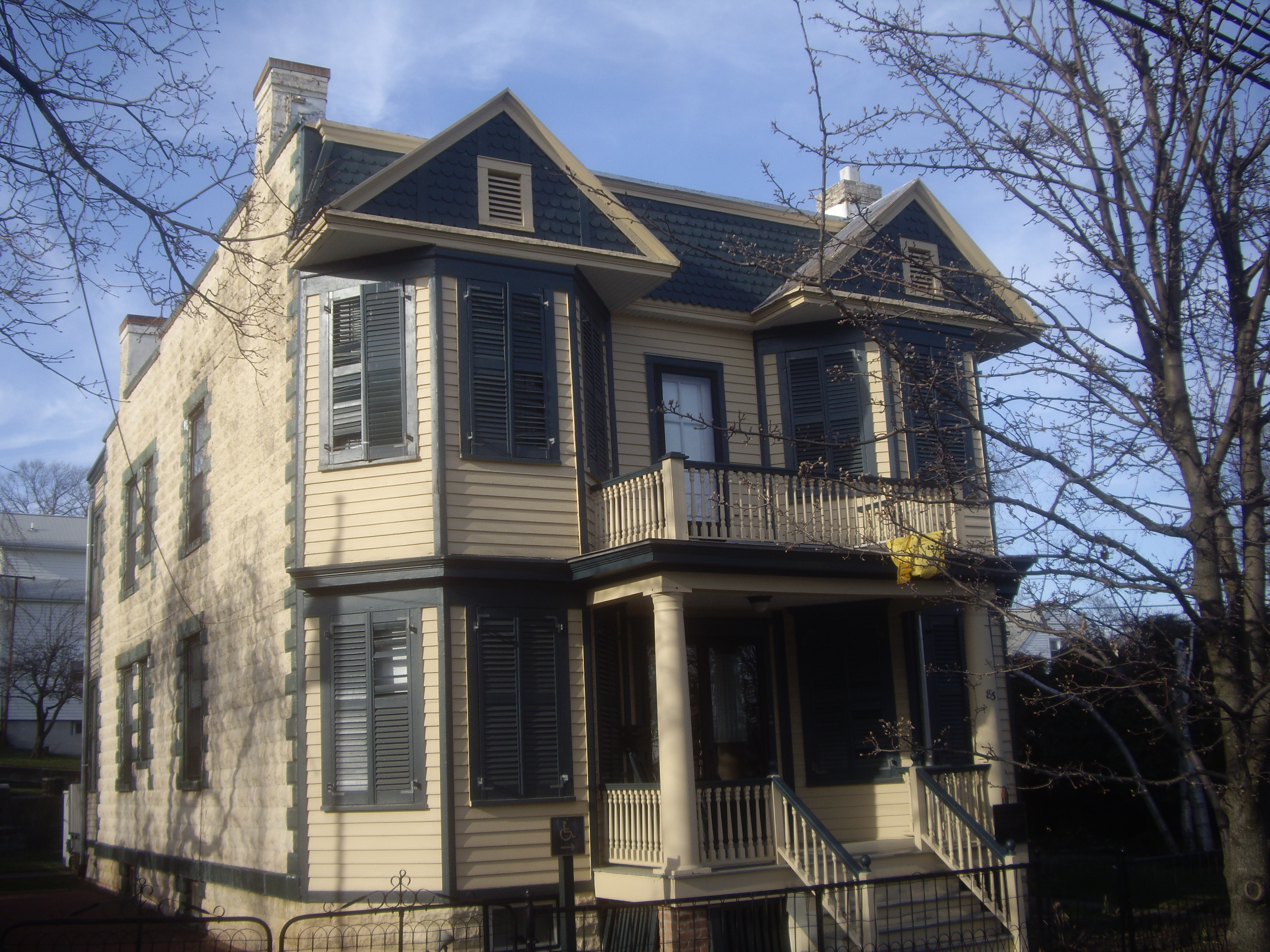
40°51′2″N 74°7′30″W / 40.85056°N 74.125°WPassaic 3 Belle Vista 
June 3, 1976 Valley Rd. in Garret Mountain Reservation
40°54′0″N 74°10′24″W / 40.9°N 74.17333°WPaterson 4 Botany Worsted Mills Historic District July 26, 1991 80-82 and 90 Dayton Ave. and 6-32 Mattimore St.
40°52′25″N 74°7′10″W / 40.87361°N 74.11944°WPassaic 5 Pietro Botto House 
July 30, 1974 83 Norwood St.
40°56′5″N 74°11′19″W / 40.93472°N 74.18861°WHaledon Also known as Pietro and Maria Botto House 6 Cathedral of St. John the Baptist December 16, 1977 Main and Grand Sts.
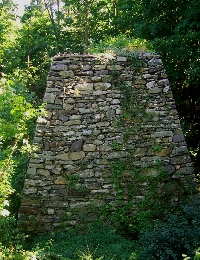
40°54′46″N 74°10′21″W / 40.91278°N 74.1725°WPaterson 7 Clinton Furnace 
June 18, 1976 Off NJ 23 at Clinton Reservoir
41°4′20″N 74°27′0″W / 41.07222°N 74.45°WNewfoundland 8 Frederick William Cooke Residence July 8, 1982 384 Broadway
40°55′6″N 74°9′31″W / 40.91833°N 74.15861°WPaterson Destroyed by fire in 1991.[5] 9 Danforth Memorial Library March 1, 1984 250 Broadway
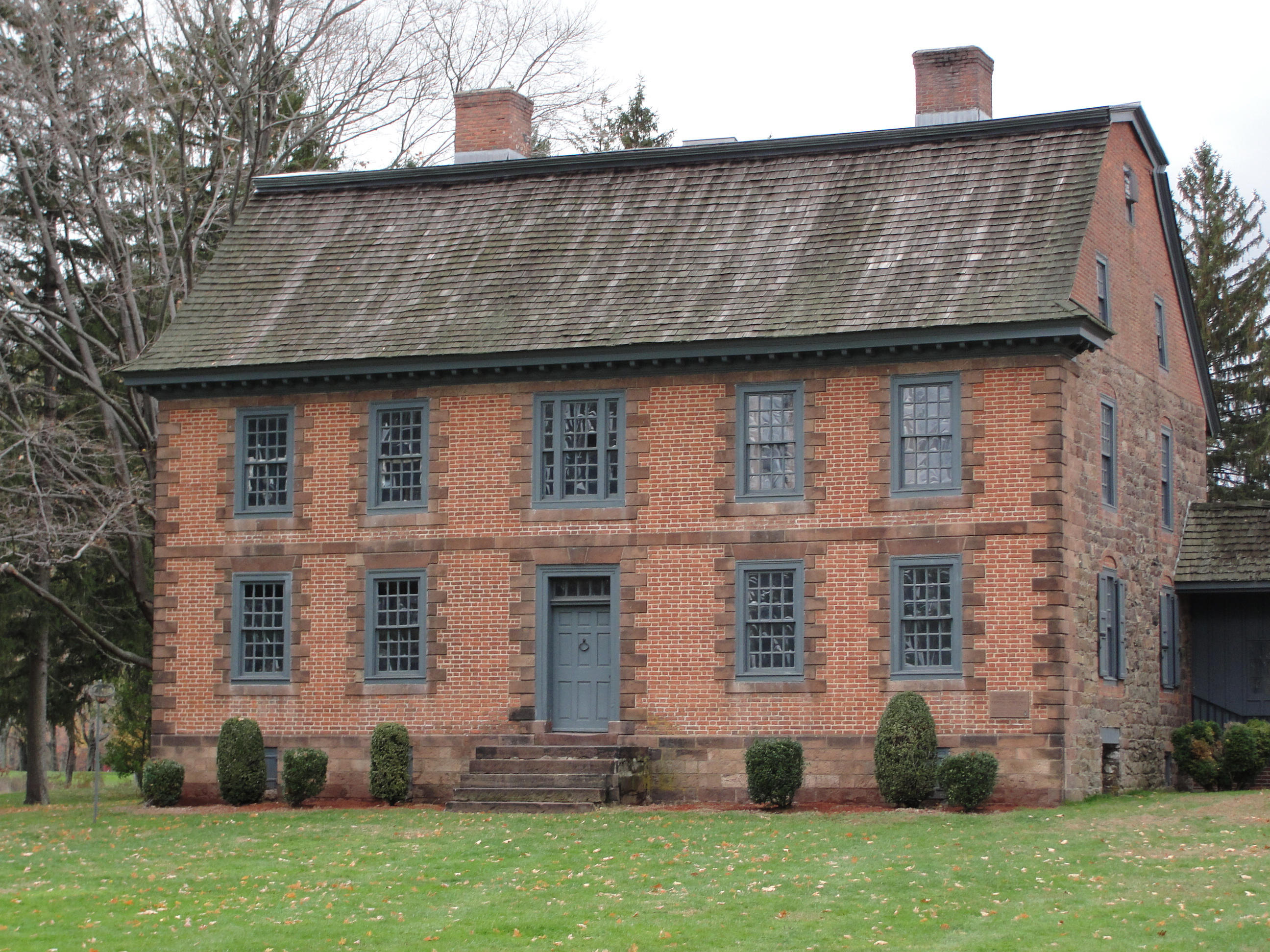
40°55′5″N 74°9′52″W / 40.91806°N 74.16444°WPaterson 10 Dey Mansion 
December 18, 1970 199 Totowa Rd.
40°54′56″N 74°14′0″W / 40.91556°N 74.233333°WWayne 11 Dundee Canal Industrial Historic District January 21, 1999 George St., N along Dundee Canal, approx. 1.2 mi. to headgates opposite E. Clifton Ave.
40°52′25″N 74°7′12″W / 40.87361°N 74.12°WPassaic 12 Eastside Park Historic District July 7, 2004 Roughly bounded by 20th, Vreeland, and 11th Aves., E. 33rd St. and Mclean Bvd.
40°54′52.9662″N 74°8′12.5334″W / 40.914712833°N 74.136814833°WPaterson 13 John W. Ferguson House May 23, 1980 421 12th Ave.
40°55′11″N 74°8′46″W / 40.91972°N 74.14611°WPaterson Demolished in 1988.[6] 14 Goffle Brook Park 
November 1, 2002 Goffle Rd., bet. Lafayette and MacFarlan Ave.
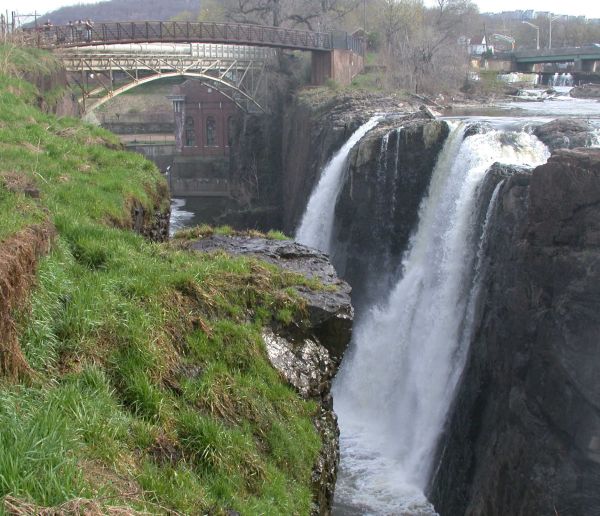
40°57′22″N 74°9′42″W / 40.95611°N 74.16167°WHawthorne 15 Great Falls of Paterson/S.U.M. Historic District 
April 17, 1970 At Passaic River
40°55′1.4304″N 74°10′51.819″W / 40.917064°N 74.18106083°WPaterson 16 Hinchliffe Stadium 
March 22, 2004 Maple and Liberty Sts., overlooking the Great Falls of the Passaic
40°55′13″N 74°10′53″W / 40.92028°N 74.18139°WPaterson 17 Kossuth Street School April 10, 1980 47 Kossuth St.
40°56′17″N 74°11′3″W / 40.93806°N 74.18417°WHaledon 18 Long Pond Ironworks 
January 11, 1974 NE of West Milford on NJ 511
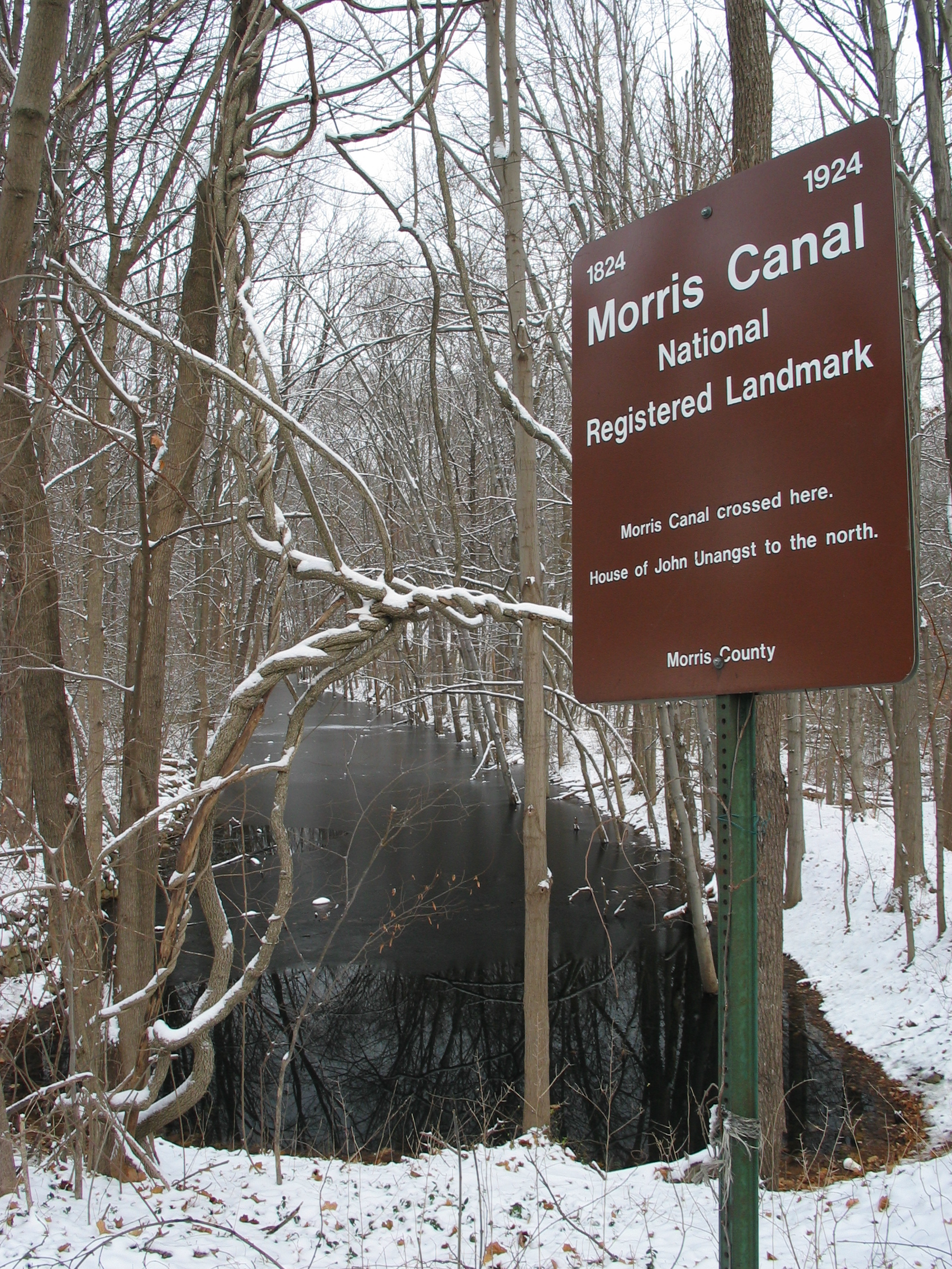
41°8′47″N 74°18′39″W / 41.14639°N 74.31083°WWest Milford 19 Morris Canal 
October 1, 1974 Irregular line beginning at Phillipsburg and ending at Jersey City
40°41′8″N 75°9′49″W / 40.68556°N 75.16361°WNot applicable 20 Passaic Elks Club December 28, 2005 29-31 Howe Ave.
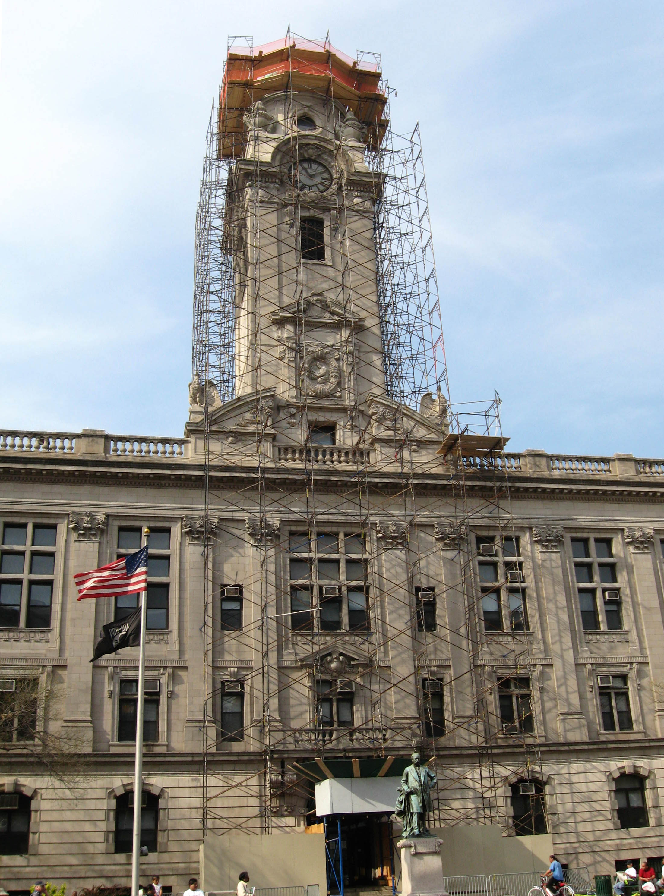
40°51′46″N 74°7′40″W / 40.86278°N 74.12778°WPassaic 21 Paterson City Hall 
March 10, 1995 155 Market St.
40°55′0″N 74°10′19″W / 40.916667°N 74.17194°WPaterson 22 Paterson Downtown Commercial Historic District February 12, 1999 Roughly bounded by Patterson, Ward and Gross Sts., and Hamilton Ave.
40°55′2″N 74°10′21″W / 40.91722°N 74.1725°WPaterson 23 Public School Number Two March 8, 1978 Mill and Passaic Sts.
40°54′55″N 74°10′38″W / 40.91528°N 74.17722°WPaterson 24 John W. Rea House September 17, 1999 675 Goffle Rd.
40°57′26″N 74°9′43″W / 40.95722°N 74.16194°WHawthorne 25 Reinhardt Mills May 9, 2003 283-297 21st Ave., 122-136 20th Ave., 46-72 Gray St., 45-67 State St.
40°54′28″N 74°9′43″W / 40.90778°N 74.16194°WPaterson 26 Ringwood Manor 
November 13, 1966 3 mi. E of Hewitt, Ringwood Manor State Park
41°8′40″N 74°15′10″W / 41.14444°N 74.25278°WRingwood 27 Schuyler-Colfax House 
April 3, 1973 2343 Paterson Hamburg Tpke.
40°59′15″N 74°16′47″W / 40.9875°N 74.27972°WWayne 28 Skylands 
September 28, 1990 Ringwood State Park
41°7′30″N 74°14′14″W / 41.125°N 74.23722°WRingwood 29 Reynier Speer House July 18, 1985 612 Upper Mountain Ave.
40°51′40″N 74°12′14″W / 40.86111°N 74.20389°WLittle Falls 30 St. John's Evangelical Lutheran Church May 7, 1982 140 Lexington Ave.
40°52′4″N 74°7′38″W / 40.86778°N 74.12722°WPassaic 31 St. Michael's Roman Catholic Church December 15, 1978 74 Cianci St.
40°54′53″N 74°10′30″W / 40.91472°N 74.175°WPaterson 32 St. Nicholas Roman Catholic Church May 14, 1979 Washington, State and Ann Sts.
40°51′43″N 74°7′24″W / 40.86194°N 74.12333°WPassaic 33 Daniel Thompson and John Ryle Houses July 30, 1981 8 and 9 Mill St.
40°54′59″N 74°10′42″W / 40.91639°N 74.17833°WPaterson 34 U.S. Animal Quarantine Station October 9, 1981 Clifton Ave.
40°52′5″N 74°9′43″W / 40.86806°N 74.16194°WClifton 35 Van Riper-Hopper House August 21, 1972 533 Berdan Ave.
40°58′50″N 74°14′50″W / 40.98056°N 74.24722°WWayne 36 John and Anna Vreeland House May 13, 1982 971 Valley Rd.
40°52′5″N 74°11′28″W / 40.86806°N 74.19111°WClifton 37 Westside Park March 7, 1973 114 Totowa Ave.
40°54′47″N 74°11′28″W / 40.91306°N 74.19111°WPaterson References
- ^ a b The latitude and longitude information provided in this table was derived originally from the National Register Information System, which has been found to be fairly accurate for about 99% of listings. For about 1% of NRIS original coordinates, experience has shown that one or both coordinates are typos or otherwise extremely far off; some corrections may have been made. A more subtle problem causes many locations to be off by up to 150 yards, depending on location in the country: most NRIS coordinates were derived from tracing out latitude and longitudes off of USGS topographical quadrant maps created under the North American Datum of 1927, which differs from the current, highly accurate WGS84 GPS system used by Google maps. Chicago is about right, but NRIS longitudes in Washington are higher by about 4.5 seconds, and are lower by about 2.0 seconds in Maine. Latitudes differ by about 1.0 second in Florida. Some locations in this table may have been corrected to current GPS standards.
- ^ "National Register of Historic Places: Weekly List Actions". National Park Service, United States Department of the Interior. Retrieved on November 10, 2011.
- ^ Numbers represent an ordering by significant words. Various colorings, defined here, differentiate National Historic Landmark sites, a [[National Historic Site (United States)|]], and several National Register of Historic Places Districts from other NRHP buildings, structures, sites or objects.
- ^ "National Register Information System". National Register of Historic Places. National Park Service. 2008-04-24. http://nrhp.focus.nps.gov/natreg/docs/All_Data.html.
- ^ http://www.state.nj.us/dep/hpo/1identify/lists/passaic.pdf Accessed June 29, 2010
- ^ http://www.state.nj.us/dep/hpo/1identify/lists/passaic.pdf Accessed June 29, 2010.
U.S. National Register of Historic Places Topics Lists by states Alabama • Alaska • Arizona • Arkansas • California • Colorado • Connecticut • Delaware • Florida • Georgia • Hawaii • Idaho • Illinois • Indiana • Iowa • Kansas • Kentucky • Louisiana • Maine • Maryland • Massachusetts • Michigan • Minnesota • Mississippi • Missouri • Montana • Nebraska • Nevada • New Hampshire • New Jersey • New Mexico • New York • North Carolina • North Dakota • Ohio • Oklahoma • Oregon • Pennsylvania • Rhode Island • South Carolina • South Dakota • Tennessee • Texas • Utah • Vermont • Virginia • Washington • West Virginia • Wisconsin • WyomingLists by territories Lists by associated states Other  State of New Jersey
Topics Regions - Atlantic Coastal Plain
- Central Jersey
- Delaware River Region
- Delaware Valley
- Gateway Region
- Gold Coast
- Highlands
- Jersey Shore
- Meadowlands
- New York metro area
- North Hudson
- North Jersey
- Pascack Valley
- Piedmont
- Pine Barrens
- Raritan Bayshore
- Ridge-and-Valley Appalachians
- Southern Shore Region
- Skylands Region
- South Jersey
- Tri‑State Region
- West Hudson
Counties Major cities Categories:- National Register of Historic Places in New Jersey
- Passaic County, New Jersey
-


Wikimedia Foundation. 2010.