- National Register of Historic Places listings in Hudson County, New Jersey
-
List of the National Register of Historic Places listings in Hudson County, New Jersey
Contents
Contents: Counties in New Jersey Atlantic - Bergen - Burlington - Camden - Cape May - Cumberland - Essex - Gloucester - Hudson - Hunterdon - Mercer - Middlesex - Monmouth - Morris - Ocean - Passaic - Salem - Somerset - Sussex - Union - Warren This is intended to be a complete list of properties and districts listed on the National Register of Historic Places in Hudson County, New Jersey. The locations of National Register properties and districts (at least for all showing latitude and longitude coordinates below) may be seen in a Google map by clicking on "Map of all coordinates".[1]
-
- This National Park Service list is complete through NPS recent listings posted November 10, 2011.[2]
[3] Site name[4] Image Date listed Location[1] City or Town Summary 1 Association of Exempt Firemen Building 
March 30, 1984 213 Bloomfield St.
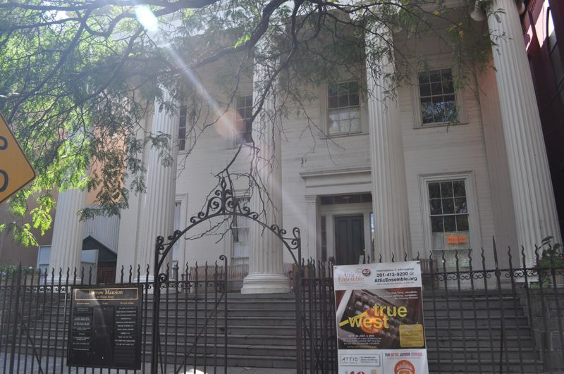
40°44′22″N 74°2′1″W / 40.73944°N 74.03361°WHoboken Hoboken Firefighters Museum 2 Dr. William Barrow Mansion 
May 2, 1977 83 Wayne St.
40°43′12″N 74°2′56″W / 40.72°N 74.04889°WJersey City 3 Bayonne Truck House No. 1 
January 2, 1976 12 W. 47th St.
40°40′51″N 74°6′18″W / 40.68083°N 74.105°WBayonne Bayonne Firefighters Museum 4 Bayonne Trust Company 
August 8, 2006 229-231 Broadway
40°39′25″N 74°7′35″W / 40.65694°N 74.12639°WBayonne 5 Buildings at 1200-1206 Washington Street 
March 9, 1987 1200-1206 Washington St.
40°44′57″N 74°1′38″W / 40.74917°N 74.02722°WHoboken 6 Church of Our Lady of Grace 
May 31, 1996 400 Willow Ave.
40°44′32″N 74°2′3″W / 40.74222°N 74.03417°WHoboken 7 Church of the Holy Innocents 
May 24, 1977 Willow Ave. and 6th St.
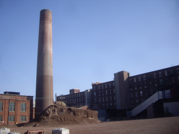
40°44′38″N 74°2′1″W / 40.74389°N 74.03361°WHoboken 8 Clark Thread Company Historic District 
June 2, 1978 900 Passaic Ave.
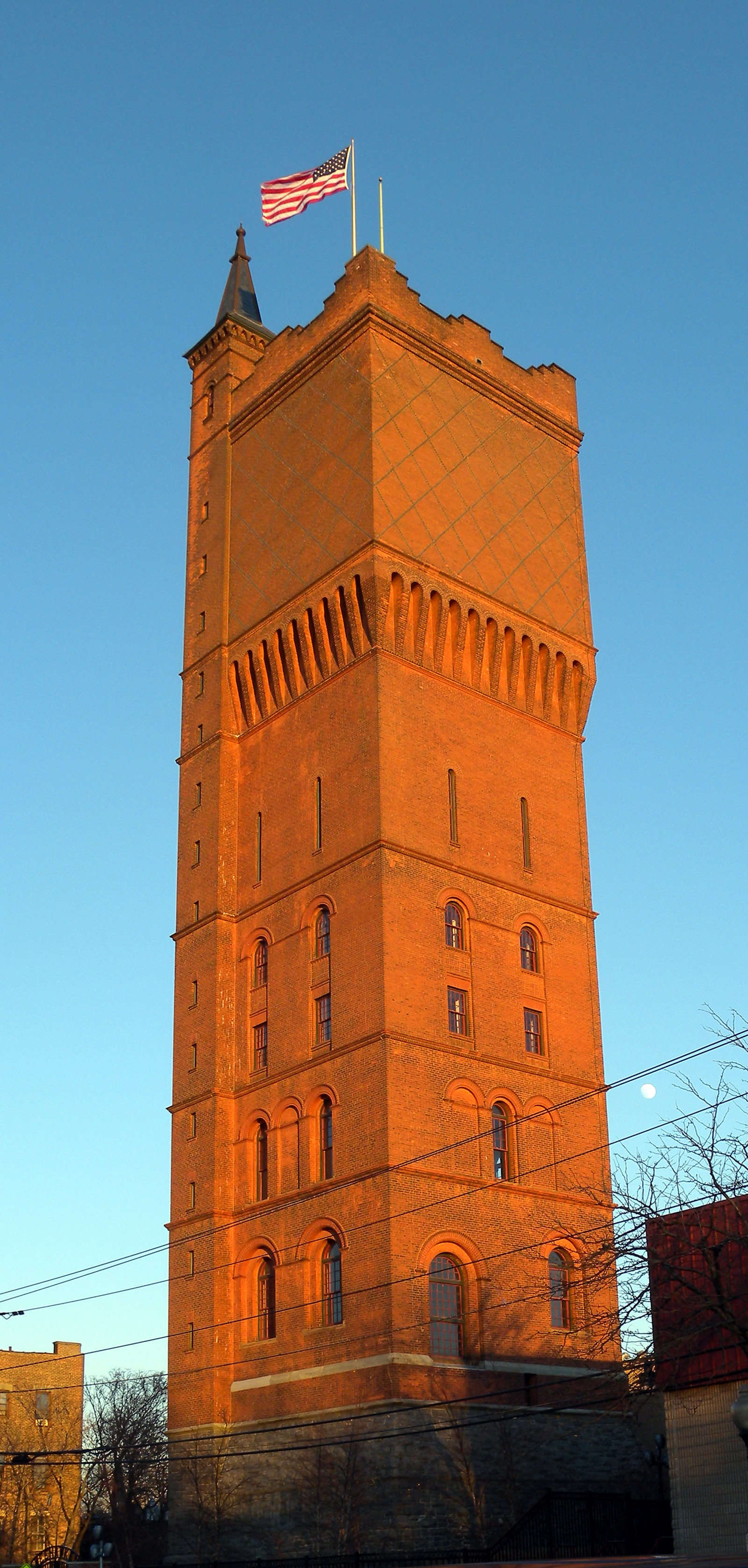
40°45′7″N 74°9′45″W / 40.75194°N 74.1625°WEast Newark 9 Engine Company No. 2 
March 30, 1984 1313 Washington St.
40°45′9″N 74°1′36″W / 40.7525°N 74.02667°WHoboken 10 Engine Company No. 3 
March 30, 1984 201 Jefferson St.
40°44′27″N 74°2′17″W / 40.74083°N 74.03806°WHoboken 11 Engine Company No. 4 
March 30, 1984 212 Park Ave.
40°44′23″N 74°2′1″W / 40.73972°N 74.03361°WHoboken 12 Engine Company No. 5 
March 30, 1984 412 Grand St.
40°44′33″N 74°2′10″W / 40.7425°N 74.03611°WHoboken 13 Engine Company No. 6 
March 30, 1984 801 Clinton St.
40°44′47″N 74°2′1″W / 40.74639°N 74.03361°WHoboken 14 Engine House No. 3, Truck No. 2 
March 30, 1984 501 Observer Hwy.
40°44′11″N 74°2′26″W / 40.73639°N 74.04056°WHoboken 15 Erie-Lackawanna Railroad Terminal at Hoboken 
July 24, 1973 On the Hudson River at the foot of Hudson Pl.
40°44′5″N 74°1′27″W / 40.73472°N 74.02417°WHoboken 16 Fairmount Apartments 
March 3, 1995 2595 Kennedy Blvd.
40°43′30″N 74°4′27″W / 40.725°N 74.07417°WJersey City 17 Ficken's Warehouse 
June 14, 1984 750-766 Grand St.
40°42′55″N 74°4′12″W / 40.71528°N 74.07°WJersey City 18 Firemen's Monument 
October 30, 1986 Church Square Pk.
40°44′31″N 74°1′56″W / 40.74194°N 74.03222°WHoboken 19 First Baptist Church 
February 1, 2006 901-907 Bloomfield St.
40°44′58″N 74°1′43″W / 40.74944°N 74.02861°WHoboken 20 First Reformed Dutch Church of Bergen Neck 
April 22, 1982 Avenue C and 33rd St.
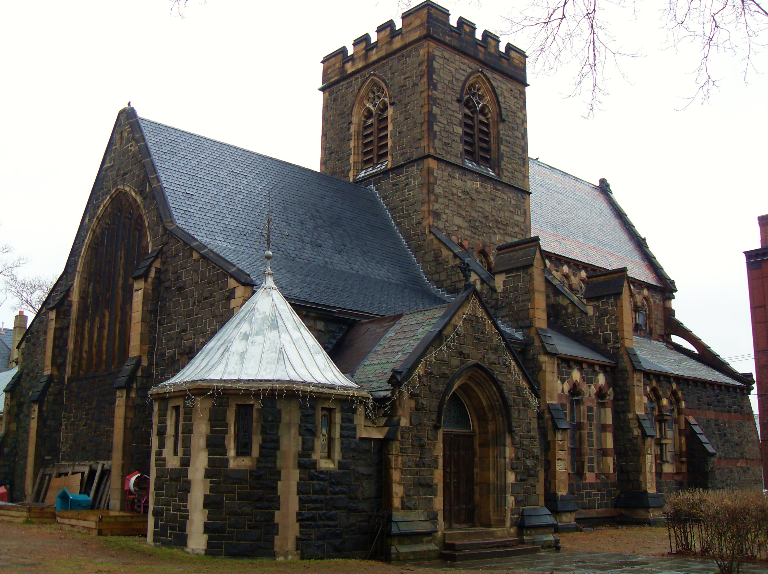
40°40′25″N 74°6′52″W / 40.67361°N 74.11444°WBayonne 21 Grace Church Van Vorst 
August 1, 1979 268 2nd St
40°43′21″N 74°2′42″W / 40.7225°N 74.045°WJersey City 22 Great Atlantic and Pacific Tea Company Warehouse 
June 2, 1978 Provost St. between 1st and Bay Sts.
40°43′16″N 74°2′25″W / 40.72111°N 74.04028°WJersey City 23 Hackensack Water Company Complex 
January 3, 1980 4100 Park Ave.
40°46′24″N 74°1′13″W / 40.77333°N 74.02028°WWeehawken 24 Hale-Whitney Mansion 
June 7, 1996 100 Broadway
40°38′56″N 74°7′42″W / 40.64889°N 74.12833°WBayonne 25 Hamilton Park Historic District 
January 25, 1979 Roughly bounded by Brunswick, Grove, 6th, and 9th Sts.
40°43′35″N 74°2′45″W / 40.72639°N 74.04583°WJersey City Boundary increase (added 1982-12-02): Jersey Ave. and 10th St. 26 Harsimus Cove Historic District 
December 9, 1987 Roughly bounded by Grove Dr., Bay & First Sts., Jersey Ave., Second, & Coles Sts.
40°43′24″N 74°2′41″W / 40.72333°N 74.04472°WJersey City 27 Highland Hose No. 4 
May 29, 1987 72-74 Halstead St.
40°45′45″N 74°9′3″W / 40.7625°N 74.15083°WKearny 28 Hoboken City Hall 
January 1, 1976 86-98 Washington St.
40°44′14″N 74°1′55″W / 40.73722°N 74.03194°WHoboken 29 Hoboken Land and Improvement Company Building 
July 3, 1979 1 Newark St.
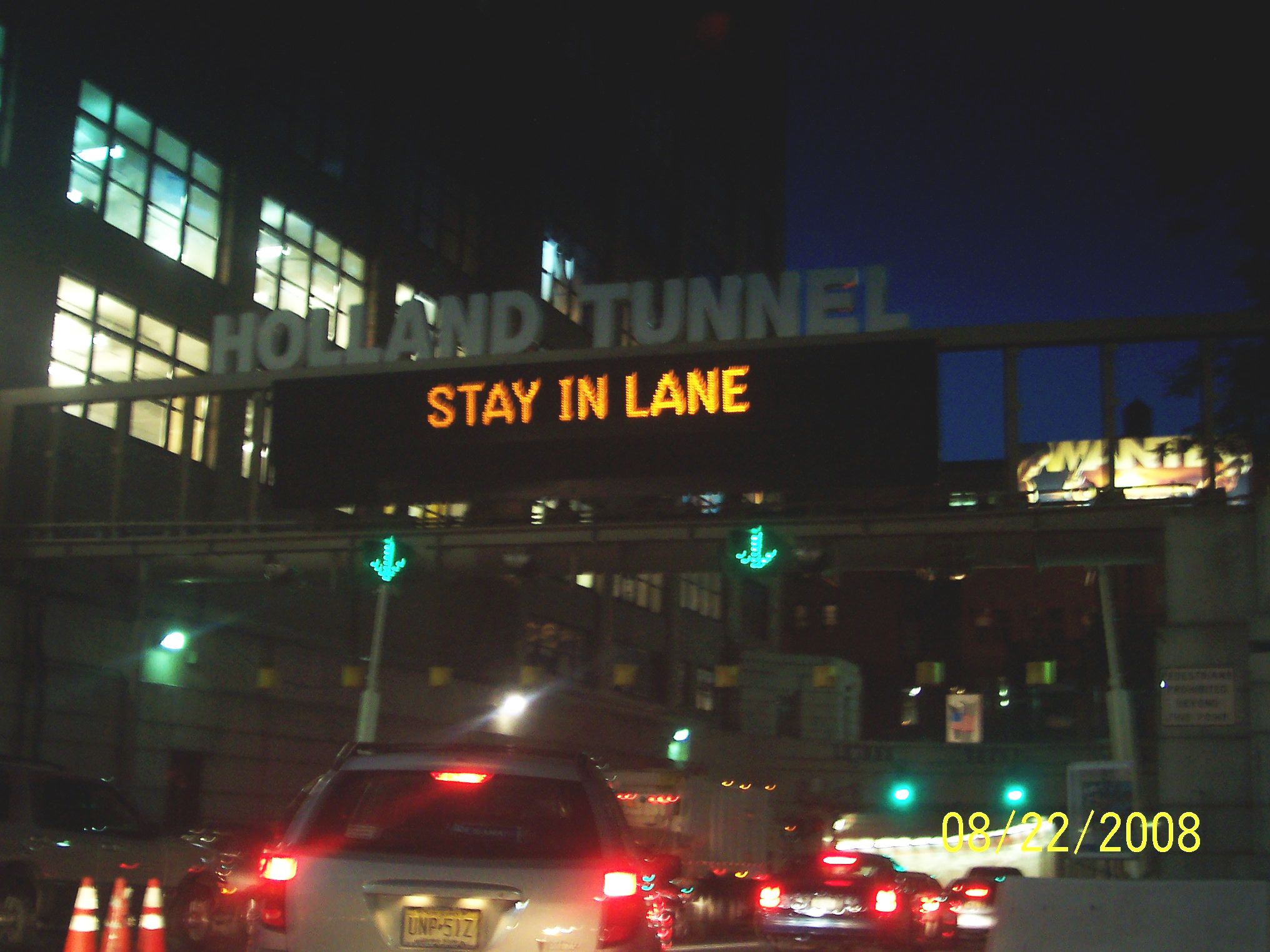
40°44′10″N 74°1′44″W / 40.73611°N 74.02889°WHoboken 30 Holland Tunnel 
November 4, 1993 Connecting Lower Manhattan and Jersey City, running under the Hudson R.
40°43′38″N 74°0′41″W / 40.72722°N 74.01139°WJersey City 31 Hudson and Manhattan Railroad Powerhouse 
November 23, 2001 60-84 Bay St., 344-56 Washington Blvd.
40°43′14″N 74°2′10″W / 40.72056°N 74.03611°WJersey City 32 Hudson County Courthouse 
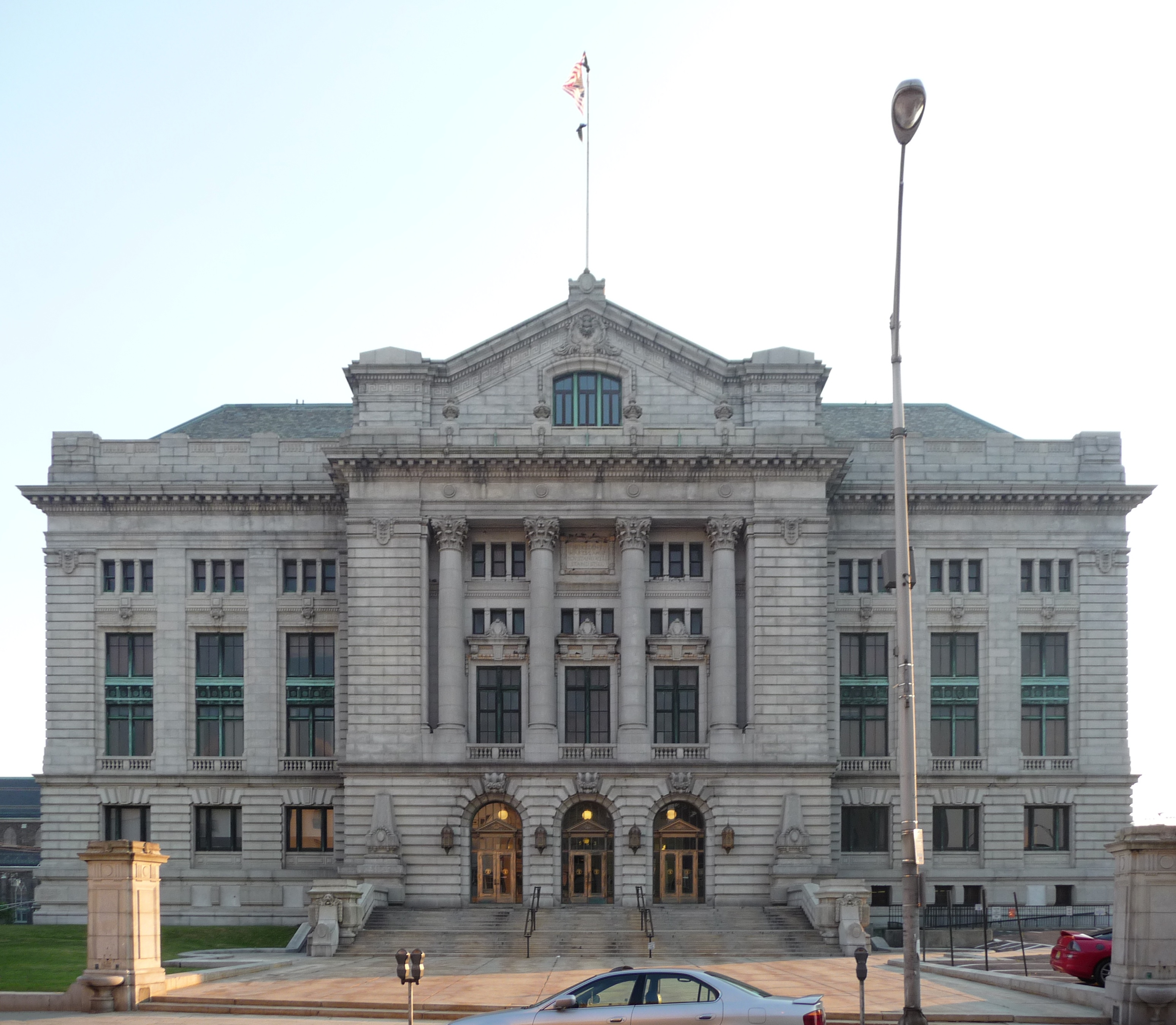
August 25, 1970 Newark and Baldwin Aves.
40°43′53″N 74°3′29″W / 40.73139°N 74.05806°WJersey City 33 Jefferson Trust Company 
February 13, 1986 313-315 First St.
40°44′15″N 74°2′9″W / 40.7375°N 74.03583°WHoboken 34 Jersey City Central Railroad Terminal 
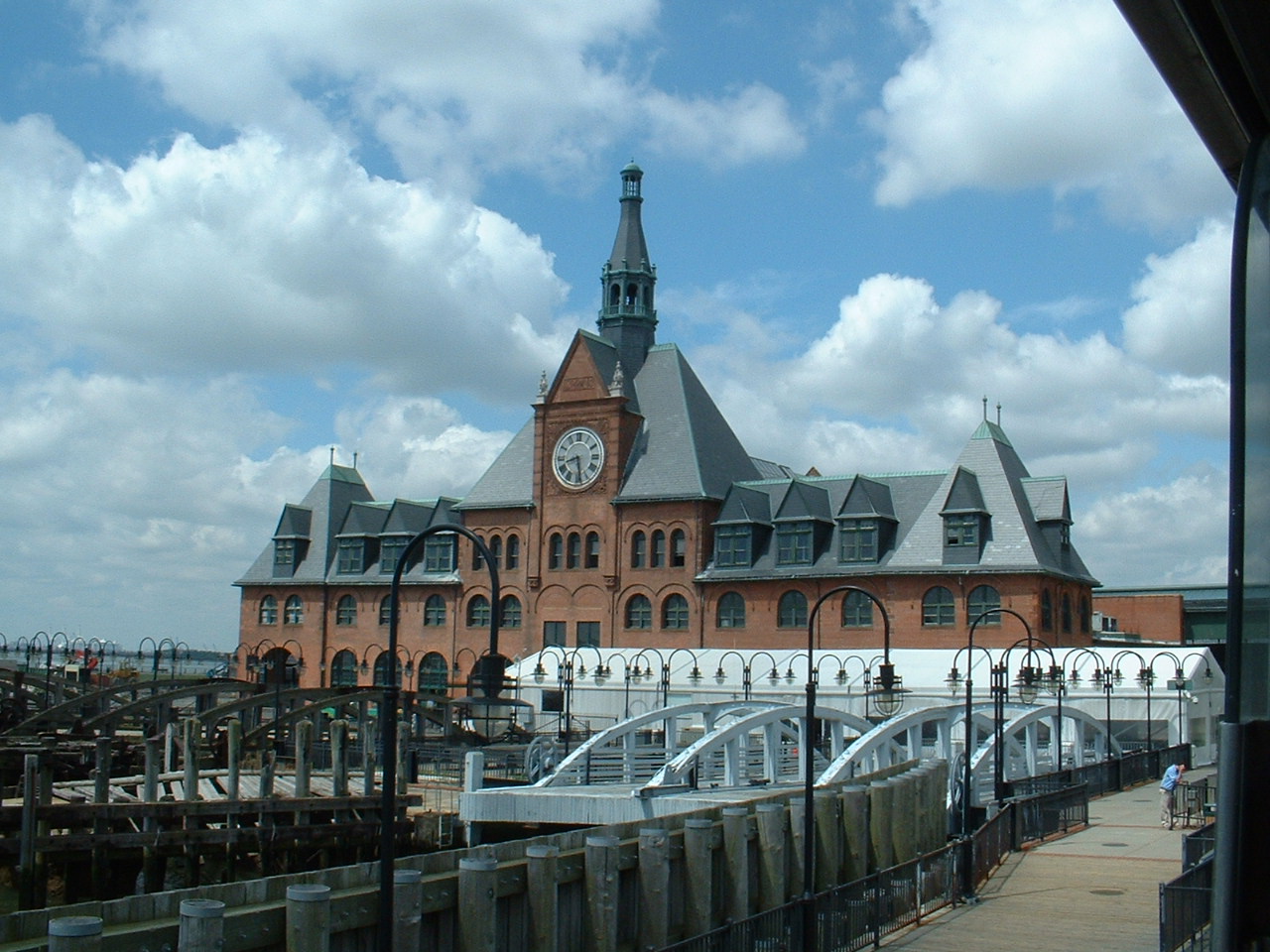
September 12, 1975 U.S. 78 N of Ellis Island
40°42′30″N 74°2′39″W / 40.70833°N 74.04417°WJersey City 35 Jersey City High School 
June 1, 1982 2 Palisade Ave.
40°43′48″N 74°3′16″W / 40.73°N 74.05444°WJersey City 36 Jersey City Medical Center 
November 27, 1985 Roughly bounded by Montgomery St., Cornelison Ave., Dupont St. and Clifton Pl., and Baldwin Ave.
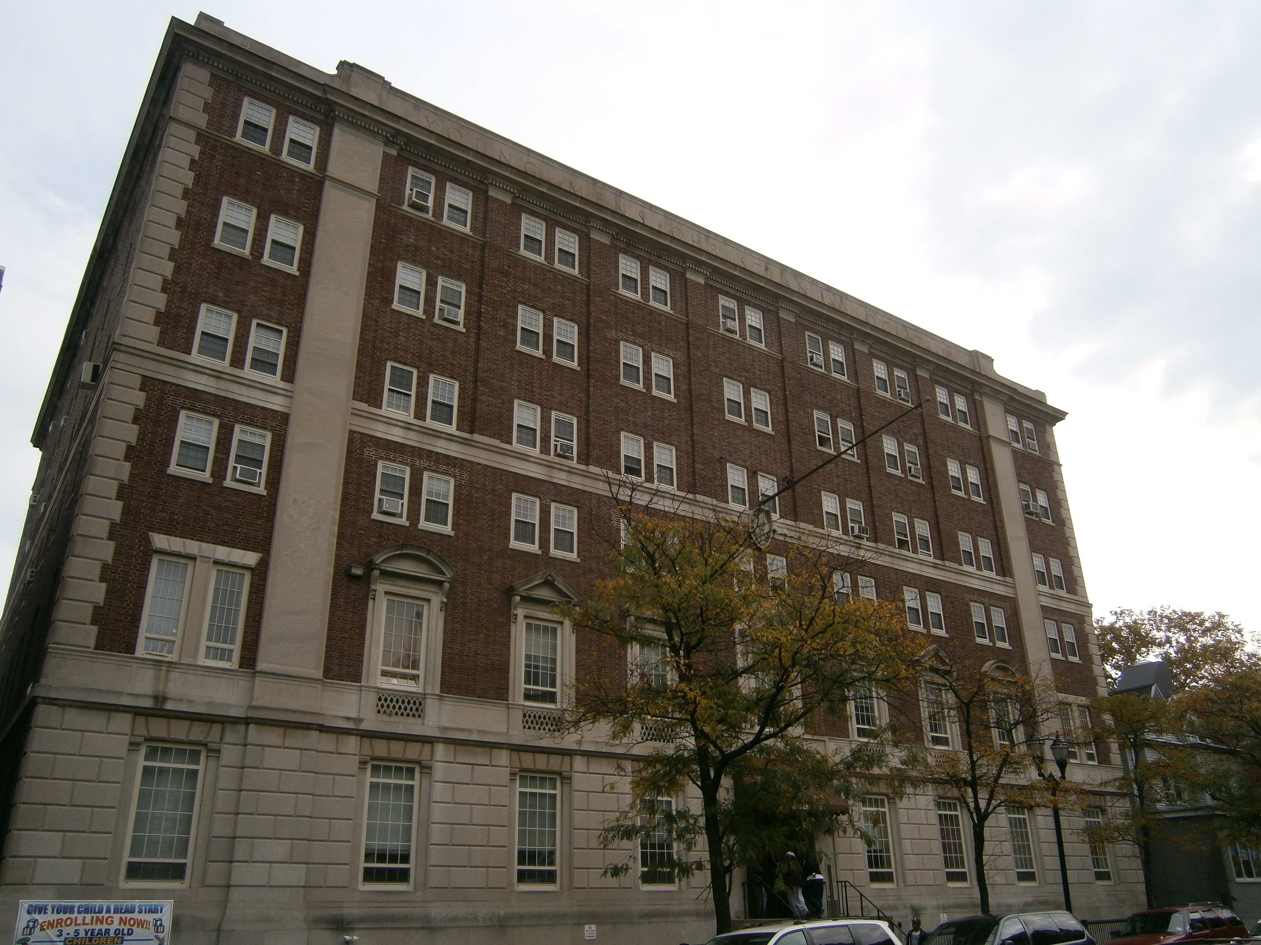
40°43′20″N 74°3′51″W / 40.72222°N 74.06417°WJersey City Renovation/restoration as residential/commercial neighborhood The Beacon 37 Jersey City YMCA 
November 12, 1999 654 Bergan Ave.
40°43′17″N 74°4′19″W / 40.72139°N 74.07194°WJersey City 38 KESTREL (steam yacht) August 12, 1977 S end of River Rd.
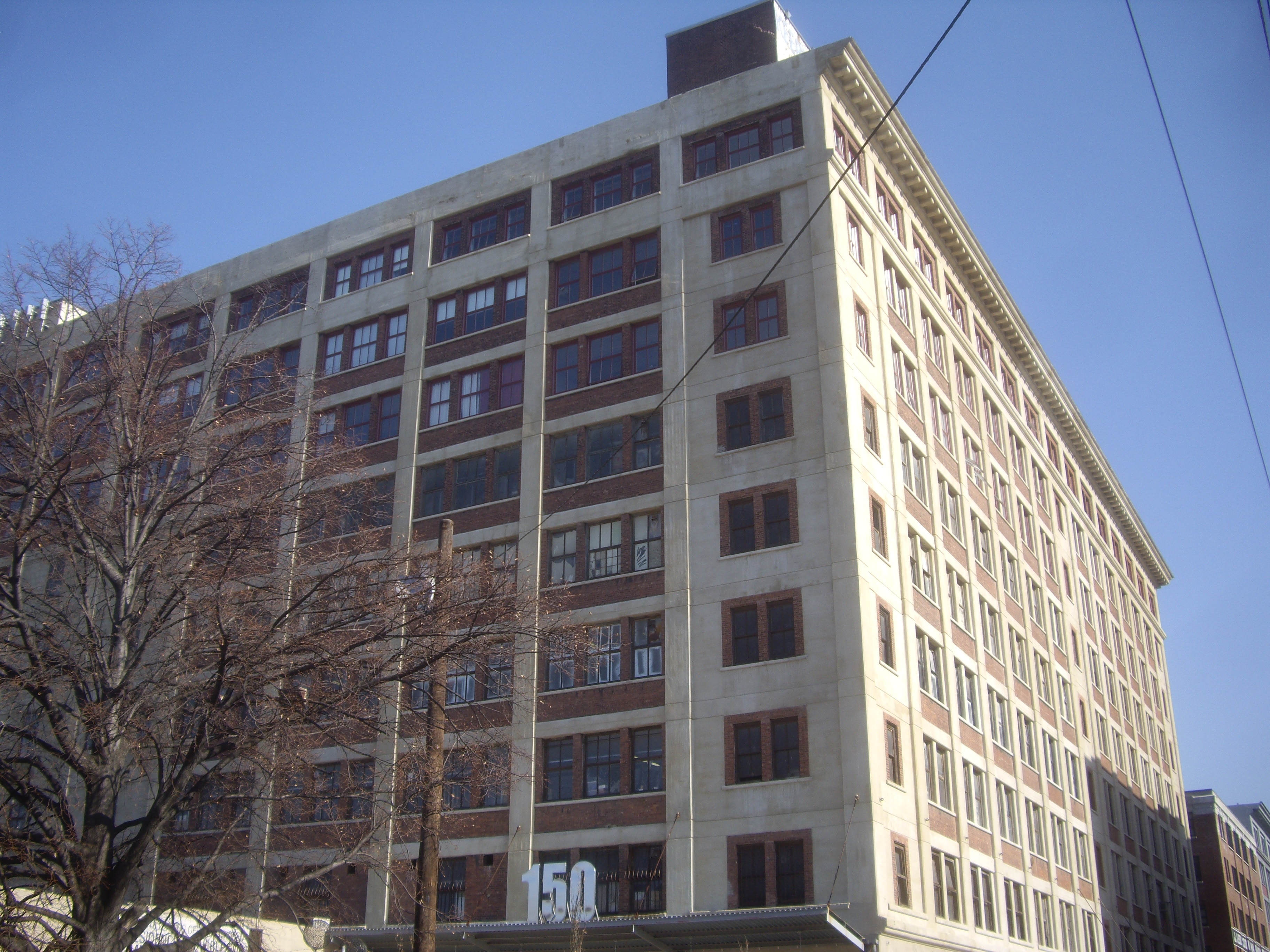
40°47′14″N 73°59′56″W / 40.78722°N 73.99889°WWest New York relocated to Staten Island 39 Keuffel and Esser Manufacturing Complex 
September 12, 1985 3rd, Grand & Adams St.
40°44′29″N 74°2′13″W / 40.74139°N 74.03694°WHoboken Now residences known as Clock Towers 40 Labor Bank Building 
June 14, 1984 26 Journal Sq.
40°43′49″N 74°3′50″W / 40.73028°N 74.06389°WJersey City 41 Lembeck and Betz Eagle Brewing Company District 
June 21, 1984 Bounded by 9th, 10th, Grove and Henderson StS.
40°43′42″N 74°2′29″W / 40.72833°N 74.04139°WJersey City The brewery buildings were demolished in 1997. 42 Monastery and Church of Saint Michael the Archangel 
March 6, 1986 2019 West St.
40°45′56″N 74°2′14″W / 40.76556°N 74.03722°WUnion City 43 Morris Canal 
October 1, 1974 Irregular line beginning at Phillipsburg and ending at Jersey City
40°41′8″N 75°9′49″W / 40.68556°N 75.16361°WNot applicable 44 Old Bergen Church 
August 14, 1973 Bergen and Highland Aves.
40°43′37″N 74°4′10″W / 40.72694°N 74.06944°WJersey City 45 Paulus Hook Historic District 
June 21, 1982 Greene, Washington, Grand, Sussex, Morris, Essex, Warren and York Sts.
40°42′55″N 74°2′21″W / 40.71528°N 74.03917°WJersey City Boundary increase (added 1985-05-13): Roughly bounded by York, Green, Essex and Henderson 46 Pohlmann's Hall 
September 5, 1985 154 Ogden Ave.
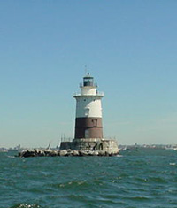
40°44′23″N 74°2′45″W / 40.73972°N 74.04583°WJersey City 47 Robbins Reef Light Station 
July 19, 2006 SW Upper New York Bay, 2.6 mi. SE of I-78 Interchange 14A
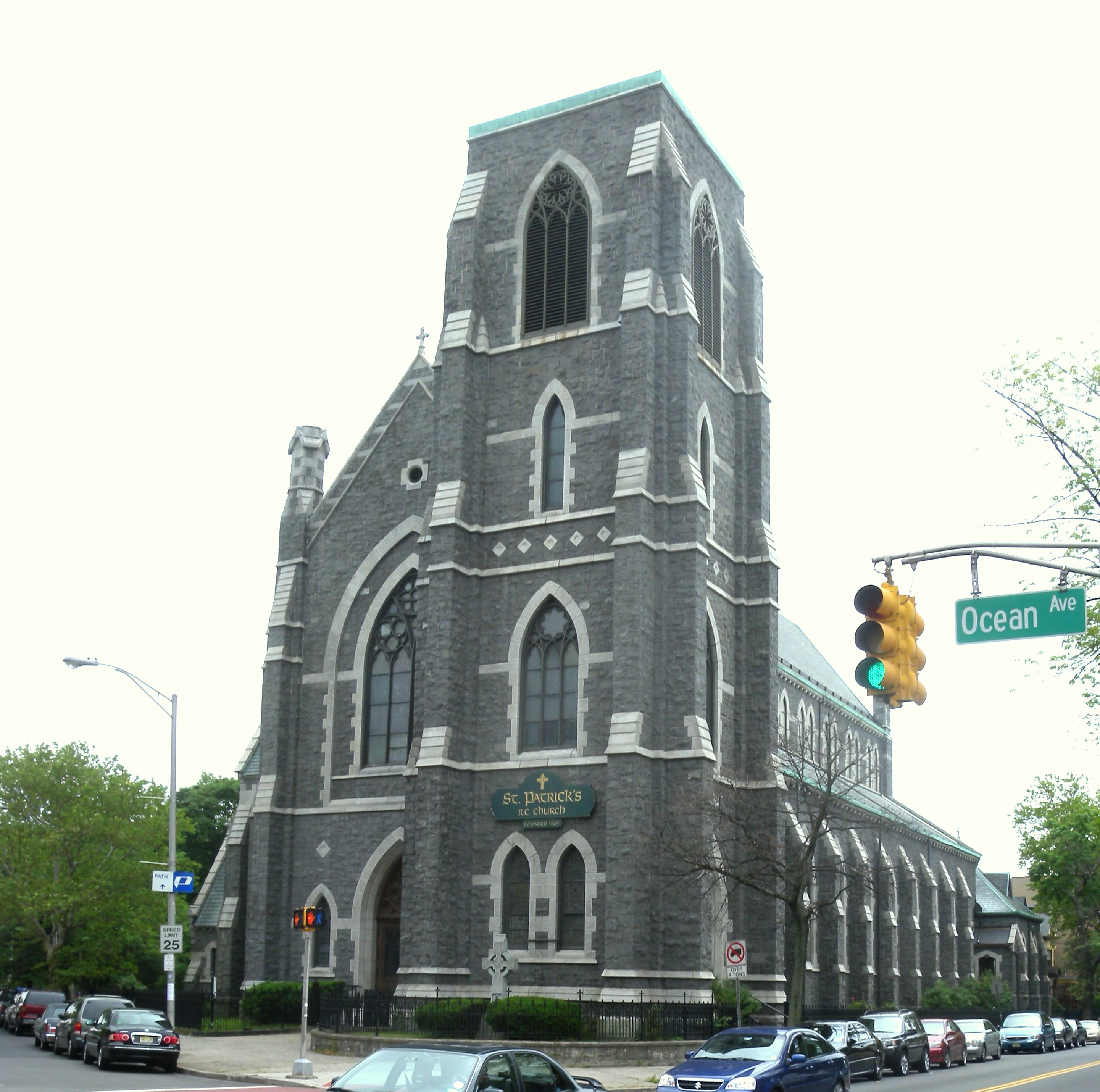
40°39′26″N 74°3′56″W / 40.65722°N 74.06556°WBayonne 48 St. Anthony of Padua Roman Catholic Church 
March 22, 2004 457 Monmouth St.
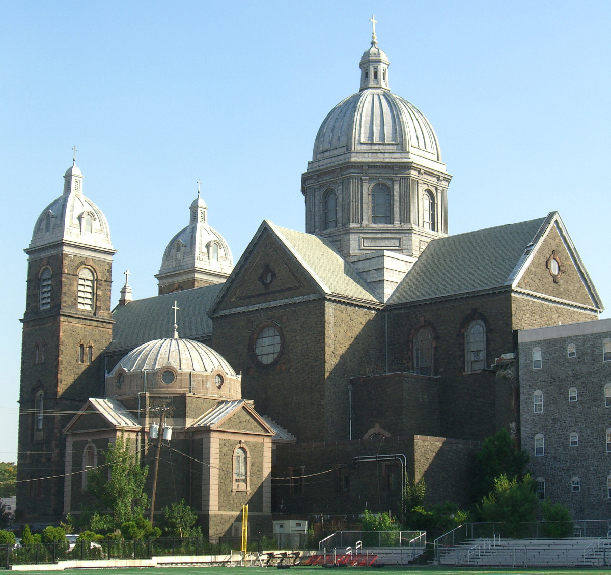
40°43′41″N 74°2′57″W / 40.72806°N 74.04917°WJersey City 49 St. Patrick's Parish and Buildings 
September 17, 1980 Grand St., Ocean and Bramhall Aves.
40°42′50″N 74°4′23″W / 40.71389°N 74.07306°WJersey City 50 St. Vincent de Paul Roman Catholic Church 
August 24, 2011 979 Ave. C
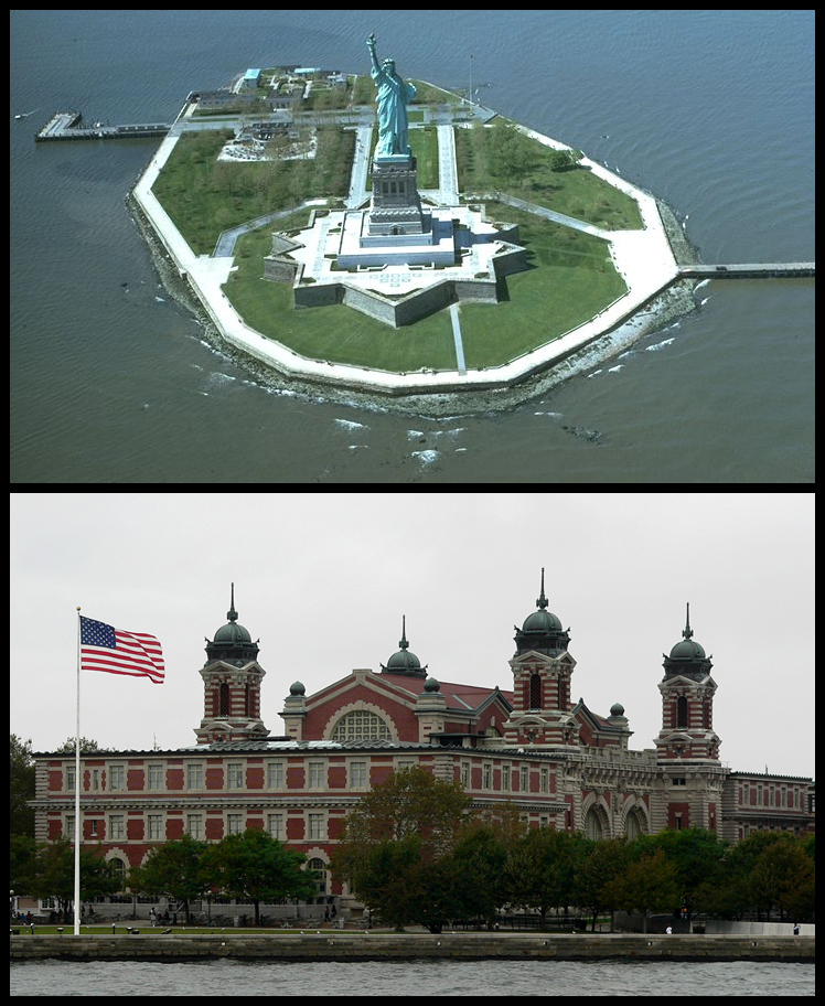
40°40′55″N 74°06′24″W / 40.68194°N 74.10667°WBayonne 51 Statue of Liberty National Monument, Ellis Island and Liberty Island 
October 15, 1966 Liberty Island, New York Harbor
40°41′38″N 74°2′37″W / 40.69389°N 74.04361°WJersey City 52 Edwin A. Stevens Hall 
February 4, 1994 Fifth St. between Hudson and River Sts.
40°44′32″N 74°1′41″W / 40.74222°N 74.02806°WHoboken 53 United Synagogue of Hoboken 
June 27, 2008 115-117 Park Ave
40°44′17.1738″N 74°2′0.585″W / 40.738103833°N 74.03349583°WHoboken 54 Van Vorst Park Historic District 
March 5, 1980 Roughly bounded by Railroad Ave., Henderson, Grand, Bright, and Monmouth Sts.
40°43′7″N 74°2′50″W / 40.71861°N 74.04722°WJersey City 55 Van Wagenen House 
August 16, 2006 298 Academy St.
40°43′55″N 74°3′59″W / 40.73194°N 74.06639°WJersey City References
- ^ a b The latitude and longitude information provided in this table was derived originally from the National Register Information System, which has been found to be fairly accurate for about 99% of listings. For about 1% of NRIS original coordinates, experience has shown that one or both coordinates are typos or otherwise extremely far off; some corrections may have been made. A more subtle problem causes many locations to be off by up to 150 yards, depending on location in the country: most NRIS coordinates were derived from tracing out latitude and longitudes off of USGS topographical quadrant maps created under the North American Datum of 1927, which differs from the current, highly accurate WGS84 GPS system used by Google maps. Chicago is about right, but NRIS longitudes in Washington are higher by about 4.5 seconds, and are lower by about 2.0 seconds in Maine. Latitudes differ by about 1.0 second in Florida. Some locations in this table may have been corrected to current GPS standards.
- ^ "National Register of Historic Places: Weekly List Actions". National Park Service, United States Department of the Interior. Retrieved on November 10, 2011.
- ^ Numbers represent an ordering by significant words. Various colorings, defined here, differentiate National Historic Landmark sites, a [[National Historic Site (United States)|]], and several National Register of Historic Places Districts from other NRHP buildings, structures, sites or objects.
- ^ "National Register Information System". National Register of Historic Places. National Park Service. 2008-04-24. http://nrhp.focus.nps.gov/natreg/docs/All_Data.html.
U.S. National Register of Historic Places Topics Lists by states Alabama • Alaska • Arizona • Arkansas • California • Colorado • Connecticut • Delaware • Florida • Georgia • Hawaii • Idaho • Illinois • Indiana • Iowa • Kansas • Kentucky • Louisiana • Maine • Maryland • Massachusetts • Michigan • Minnesota • Mississippi • Missouri • Montana • Nebraska • Nevada • New Hampshire • New Jersey • New Mexico • New York • North Carolina • North Dakota • Ohio • Oklahoma • Oregon • Pennsylvania • Rhode Island • South Carolina • South Dakota • Tennessee • Texas • Utah • Vermont • Virginia • Washington • West Virginia • Wisconsin • WyomingLists by territories Lists by associated states Other  State of New Jersey
Topics Regions - Atlantic Coastal Plain
- Central Jersey
- Delaware River Region
- Delaware Valley
- Gateway Region
- Gold Coast
- Highlands
- Jersey Shore
- Meadowlands
- New York metro area
- North Hudson
- North Jersey
- Pascack Valley
- Piedmont
- Pine Barrens
- Raritan Bayshore
- Ridge-and-Valley Appalachians
- Southern Shore Region
- Skylands Region
- South Jersey
- Tri‑State Region
- West Hudson
Counties Major cities Categories:- National Register of Historic Places in New Jersey
- Hudson County, New Jersey
- History of Jersey City, New Jersey
- Geography of Hudson County, New Jersey
- Culture of Jersey City, New Jersey
- Visitor attractions in Hudson County, New Jersey
-


Wikimedia Foundation. 2010.